
-
 11856 Hits
-
 74.92% Score
-
 5 Votes
|
|
Route |
|---|---|
|
|
44.14880°N / 71.6445°W |
|
|
Hiking |
|
|
Spring, Summer, Fall, Winter |
|
|
Half a day |
|
|
Walk-up |
|
|
Approach
See the Getting There section of the main page for directions to the trailhead.Route Description
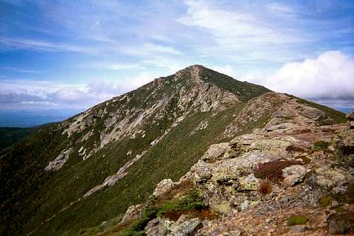
Please note that this page is not intended to describe the full Franconia Ridge Traverse but is meant to provide route info to Mount Lincoln. It just so happens that it is done via sections of the Franconia Ridge Traverse.
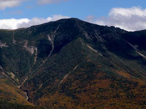
If you wish to access Lincoln from the north, take the Old Bridle Trail from the parking lot (it separates to the left at the junction with the Falling Waters Trail). It climbs Agony Ridge and can be scrambly in places but nothing too bad. It is 2.54 miles to Greenleaf Hut and another mile from there (follow signs at the Hut) past Eagle Lake and up to the summit of Lafayette. Follow the path on the ridge to the south for .96 miles to the summit of Lincoln. Elevation gain is about 3750 and it's 3.5 miles long.

If you wish to access Lincoln from the south, take the Falling Waters Trail at the above-mentioned junction. You'll pass Walker Brook and cross a bridge at .3 miles. In another half mile you come to Dry Brook. From there it is .1 mile to Stairs Falls, then another .1 mile to Swift Water Falls. Still another .4 miles on is Cloudland Falls. After that, it's .9 miles to Shining Rock Cliff and then another .5 miles to the summit of Little Haystack. From here, take the knife edge ridge that goes 1.67 miles north to the summit of Lincoln. Total length is 4.47 miles with same elevation gain.
You can descend either route as well and make the popular loop back to the parking lot.
 |  |