New Places to Snowshoe - Bishop to Mammoth

Regional discussion and conditions reports for the Golden State. Please post partners requests and trip plans in the California Climbing Partners forum.
User Avatar
Greg Enright

 
Posts: 556
Joined: Thu Sep 04, 2003 2:16 am
Thanked: 54 times in 38 posts

by Greg Enright » Thu Jan 28, 2010 7:05 am

MCGusto wrote:Is this the Hot Creek area you're talking about?

Image

Basically just following the road out along the creek, I'm assuming?

Also looking into the Dry, Deadman, and Glass Creeks areas. I'm guessing Dry Creek road isn't plowed during the winter?

Gusto


Yep that's the Hot Creek Gorge area. Just follow Hot Creek Hatchery Road as far as it is plowed, and start shoeing. There were quite a few cars parked out there before the storms, but I'm not sure where the plowing stops now. The Hot Creek Geyser is not where your map shows it, the Fish Hatchery is located at the geyser marker on the map. The geysers, just bubbling pools usually, are a couple of miles east in the gorge. Hot Creek is really exposed to the sun and wind. If it's windy, head for the trees, like the Obsidian Dome area.

The Obsidian Dome route on your map is a good one. The exact route heads up to the top of the dome a little further north than shown on your map, but you will see the path of the road to the top. That recommendation is a good one as it is cool to see the jagged lava poking up through the deep snow. The avy danger from the slope west of Obsidian Dome is minimal. In fact that hill is called Chicken Wing as it is often skied when White Wing has high avy danger. The parking for Obsidian Dome trails is at a large dirt lot at Glass Flow Road, just north of Deadman Summit.

Glass Creek Meadow is a little far to drag a sled, but it is a great place to tour in winter. I think 'Dry Creek Road' is the Mammoth Scenic Loop west of 395 and busy snowmobile trails east of 395.

no avatar
The Chief

 
Thanked: time in post

by The Chief » Thu Jan 28, 2010 1:15 pm

MCGusto wrote:
The Chief wrote:
- McGee Creek: As far as ya want to go.


How far up do they plow the McGee Creek road? Is there parking? My understanding was the road was closed because of avi danger.

Thanks again, everyone!

Gusto


It isn't plowed at all. You can park right off Crowley Lake Dr where McGee Creek Rd starts and head on up the road. Be careful on the weekends though as some folks like to skin this road as well.

Another very nice and quiet option is head east on Crowley Lake Dr towards Hilton Creek, turn off at the BLM Sign halfway between McGee Creek Rd and the Long Valley FD, turn off and park, and head on up Hilton Creek Jeep trail towards Nevahbe Ridge. My Wife, Kids and I do this little jaunt at least once a week as it is only 2 minutes from our home...
Image

User Avatar
MCGusto

 
Posts: 398
Joined: Tue Mar 29, 2005 7:18 pm
Thanked: 20 times in 10 posts

by MCGusto » Thu Jan 28, 2010 4:18 pm

Awesome!

Can't wait to try out these new places.

Thanks, everyone, for all the input. I'll try and post back with some pics.

Gusto

User Avatar
MCGusto

 
Posts: 398
Joined: Tue Mar 29, 2005 7:18 pm
Thanked: 20 times in 10 posts

by MCGusto » Wed Feb 17, 2010 4:59 am

Just wanted to follow up and say "Thanks!" for all the great ideas. Here are some of the highlights:

1. Saw a Bald Eagle while driving over near Pleasant Valley. He was munching on a trout.
Image

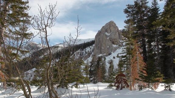
Went snowshoeing up near Obsidian Dome. Pretty awesome place once you get away from the road. Tried convincing wifey to go up through the trees and stay out of the sun, but she wanted to stay on the hard pack (illegal) snowmobile tracks.
Image

Later on Saturday took a drive up to June Lake. We stopped out around Silver Lake, I believe it was. Not too far from the trailhead.
Image

The following day (Sunday) we hiked on the trails near the Visitor's Center in Mammoth, which is also used for X Country skiing. Made for an easy walk, even without snowshoes.
Image

Then we decided to head up Old Mammoth Road where it's closed off for the winter. Awesome sledding down the road too!
Image

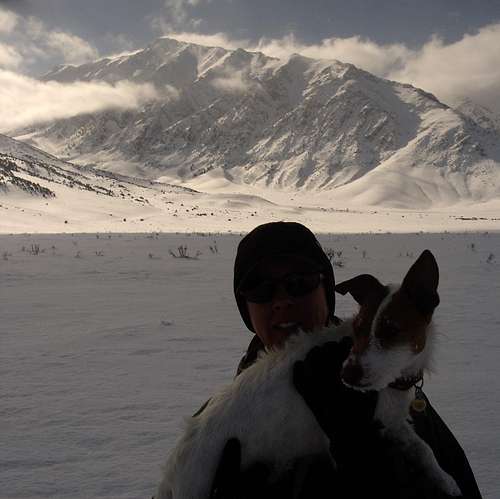
On our last day we went out to Hot Creek. Fantastic hike with views abound.
(Looking at Mt. Morrison and Laurel Mountain from our Hot Creek hike)
Image

The water at Hot Creek
Image

Just another sweet long weekend in the winter playground known as the High Sierra!
Image

Gusto

Previous

Return to California


  • Related topics
    Replies
    Views
    Last post

Who is online

Users browsing this forum: No registered users and 0 guests