SP Gathering-Round Top May 8th

-

Rinat Shagisultanov - Posts: 285
- Joined: Sat Sep 07, 2002 10:17 pm
- Thanked: 2 times in 2 posts
Planning to be there for CMC. How do we identify the SP group? I have not climbed with you guys, so need to have some help identifying who is who on TH. Any updates on the snowpack conditions?
-

jareds - Posts: 223
- Joined: Wed Jan 09, 2008 4:00 am
- Thanked: 15 times in 9 posts
hey so i'm stoked to get up in the snow, but i'm a noob to the sierra - is anyone skiing in the group or is it all snowshoers? If there are skiers and the game is not locked i'd love to come out. i can carpool from sf.
-
jareds - Posts: 223
- Joined: Wed Jan 09, 2008 4:00 am
- Thanked: 15 times in 9 posts
great! wait where's the meeting spot?
http://www.summitpost.org/mountain/rock/150503/round-top.html
where do i meet everyone? fyi I am coming from SF and have ski racks and space in my car if someone wants to carpool w/me[/url]
http://www.summitpost.org/mountain/rock/150503/round-top.html
To get to one trailhead from the Tahoe Area Travel south on CA State Route 89 (starting at its junction with U.S Highway 50) for approximately 11.5 to its junction with CA State Route 88 in Hope Valley. Turn right (west) onto S.R. 88 and drive for approximately 9 miles to the summit of Carson Pass. The parking area will be on the south side of the road with a small information building at the east end. The information hut is only manned during the summer months.
From the west the trail head / parking area is approximaetly 70 miles east of Jackson, CA on State Route 88.
The closer but lower one is at Woods Lake, elevation 8200 ft. Take highway 88 a few miles west of Carson Pass, then take the Woods Lake turn off on the south side. Proceed 2 miles to trailhead. From Jackson it is a couple of miles before you reach the summit.
where do i meet everyone? fyi I am coming from SF and have ski racks and space in my car if someone wants to carpool w/me[/url]

-

Marmaduke - Posts: 1541
- Joined: Tue Feb 02, 2010 1:08 am
- Thanked: 730 times in 563 posts
squishy wrote:A very eventful day...
Two parking violations, an pretty bad injury and I even had a spark plug unscrew itself and pop out on the way home...how does that even happen? Regardless, we all made it up the colouir, some on the right side some on the left. Thanks everyone for a fun day, and I hope everything works out for dragger she is a super trooper...
How about the SC, did you guys see them? etc?


-

Dragger - Posts: 2310
- Joined: Fri Aug 29, 2003 1:49 pm
- Thanked: 1 time in 1 post
Hi everyone, I'm ok! Except that I look like I was in a gangster fight with a 3 1/2 inch slice on the side of my face. Maybe everyone will run away, scared of me now?
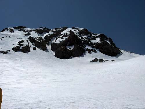
It was a beautiful day, quite windy on top. Kicked steps up the left side of the couloir, was really a lot of fun.
On the way back down, Rinat and Squishy glissaded down, I went down after them. Got going too fasy, flipped over to self arrest and accidentally took a slice out of the side of my face with the ax. I didn't even know anything was wrong until I got up and continued down. HUGE thank you to everyone with us who helped, especially Rinat and Lina (sp?). They did a fantastic job of patching me up enough to walk out. Went to Marshall Hospital in Placerville and they stitched me up. Evidently I nicked an artery in the face (I didn't even know there were arteries in the face!) and that's what caused all the blood.
So hopefully I won't end up looking like something out of a horror movie but thanks again, everyone, for you help.
Carolyn
-
Rinat Shagisultanov - Posts: 285
- Joined: Sat Sep 07, 2002 10:17 pm
- Thanked: 2 times in 2 posts
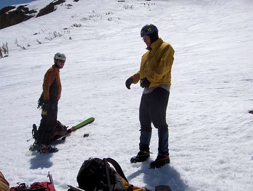
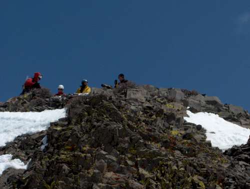
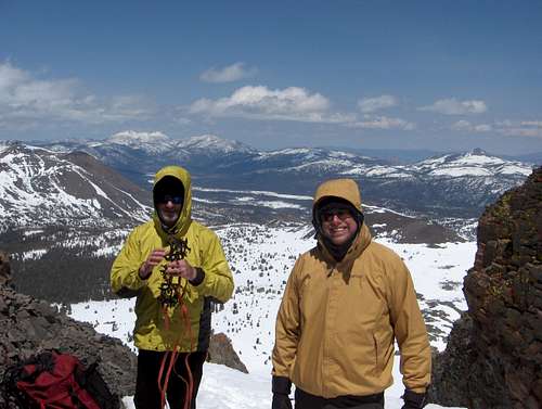
It was great climbing with all of you on Sat. Caroline, I am very sorry for the accident, but I am glad that they fixed the wound properly. I would like to post the pictures here, but really do not know how to do (shame on me  ). If somebody can PM me the link or a quick note, I shall post them really quickly.
-

rhyang - Posts: 8960
- Joined: Wed Apr 28, 2004 8:55 pm
- Thanked: 59 times in 38 posts
Rinat Shagisultanov wrote:I would like to post the pictures here, but really do not know how to do (shame on me
Step 1: host the pic on the web somewhere. Upload it to flickr or summitpost or picasa or facebook or where ever.
Step 2: get an URL for the pic. This usually has to end in '.jpg' -- if it's on SP then just click one of the pic sizes (eg. Large, Med, etc) and copy the URL.
Step 3: now the fun part, posting pic to a forum thread
- Code: Select all
[img]http://c0278592.cdn.cloudfiles.rackspacecloud.com/medium/502709.JPG[/img]

You can also type the [img] tags in manually.
-
- Related topics
- Replies
- Views
- Last post
-
- Climbing Nov 5th-8th
by rowantrollope » Mon Nov 02, 2009 4:30 am - 0 Replies
- 842 Views
- Last post by rowantrollope

Mon Nov 02, 2009 4:30 am
- Climbing Nov 5th-8th
-
- Snow pack at the top of the tram?
by Captain Beefheart » Wed Mar 24, 2010 10:22 pm - 1 Replies
- 796 Views
- Last post by KathyW
Wed Mar 24, 2010 11:17 pm
- Snow pack at the top of the tram?
-
- Joshua Tree Top Roping
by justumbo » Fri Feb 17, 2012 5:05 am - 8 Replies
- 15677 Views
- Last post by DukeJH
Tue Feb 21, 2012 10:10 pm
- Joshua Tree Top Roping
-
- Gear found on Round Top
by fruitflyman » Wed Apr 24, 2013 9:39 pm - 5 Replies
- 3280 Views
- Last post by Deb
Fri Apr 26, 2013 7:26 pm
- Gear found on Round Top
-
- Round top conditions or photo
by pjc30943 » Fri Jun 15, 2012 12:26 pm - 3 Replies
- 1777 Views
- Last post by pjc30943
Fri Jun 15, 2012 10:28 pm
- Round top conditions or photo
Who is online
Users browsing this forum: No registered users and 0 guests