
Comments
No comments posted yet.
|
|
Trip Report |
|---|---|
|
|
46.65340°N / 86.1108°W |
|
|
Sep 7, 2020 |
|
|
Hiking |
Pictured Rocks National Lake Shore preserves a portion of Lake Superior’s southern shoreline in the Upper Peninsula of Michigan. The park is so called because of cliffs that rise as much as 200 feet above the lake. “Pictured” refers to mineral stains on the surface of the rocks. A trail goes through the forest close to the edge of the cliffs providing you, at views points, with great views of Lake Superior and the cliffs. Sand dunes, waterfalls, beaches and forests are some of the other attractions of the park.
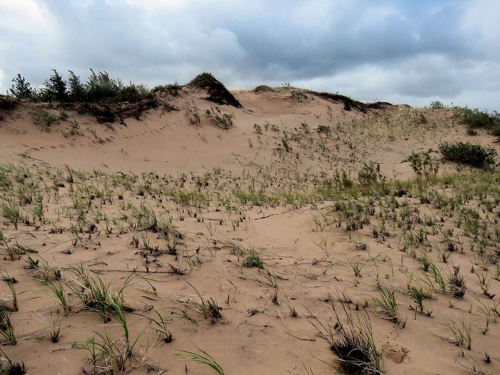
In the eastern end of the park, there is an area of sand dunes known as Grand Sable Dunes that rise as much as 300 vertical feet above the surface of Lake Superior. The park’s main trail, unfortunately, does not go over the sand dunes. By looking at satellite photos, I had seen a beaten path that went from Grand Sable Lake over the dunes to the shores of Lake Superior. I had come up with an 8.5 mile hiking plan to go from the dunes to Sable Falls. The day that I did my hike, turned out to be a very windy day. Sand whipped my face and went into my eyes forcing me to cut my plans short. Since I ended up with a lot of extra time, I did a number of other short hikes.
| Hike | Length | Ascent |
| Log Slide | 0.7 miles | 100 feet |
| Sand Dunes | 2.55 miles | 600 feet |
| Sable Falls | 0.8 miles | 180 feet |
| Au Sable Lighthouse | 3.45 miles | 180 feet |
| Beaver Creek & Beach | 3.9 miles | 275 feet |
| Total | 11.4 miles | 1335 feet |
Left the vacation rental house in Munising, Michigan after 6:30 a.m. and drove just below 50 miles on Michigan H-58 Road which went through a pretty forest to reach Log Slide parking area. I was happy to see no one at the trailhead unlike the huge crowds of the last two days. It was cloudy, windy and in mid 50s degrees F. Since I knew that I had a short hike, I did not take my backpack or camera. Took pictures with my phone.
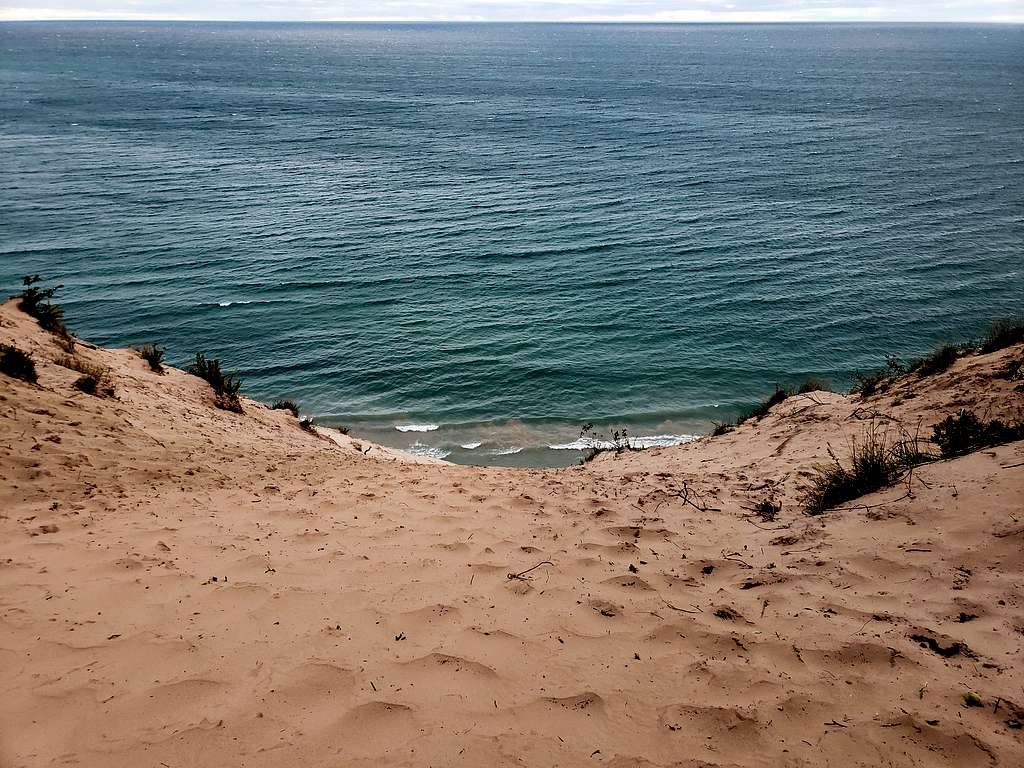
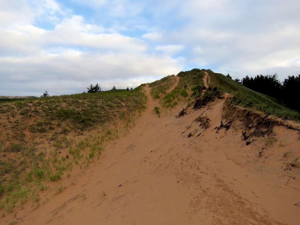
Started walking at 7:30 or so. The trail went a short distance in the forest until I suddenly found myself on top of sand dunes 300 vertical feet above the surface of Lake Superior (which sits at an elevation of 600 ft). In the old days, they used to slide timber down this slope to load onto ships, hence the name. It was quite an impressive site. The wind made it feel cold.
A sign warned about attempting to hike down to the lake saying every year people had to be rescued from the slope. Having looked at Google Earth, I had noted that the slopes appeared very steep with what looked like “sand cliffs” and landslides near the lake. I had no plans to hike down to the lake. The sign also said the walking distance to the lake was 500 ft (which meant a 60% slope, 37 degrees). I headed east on a short beaten path that traversed the slopes then returned to the car. There was still no other person there.
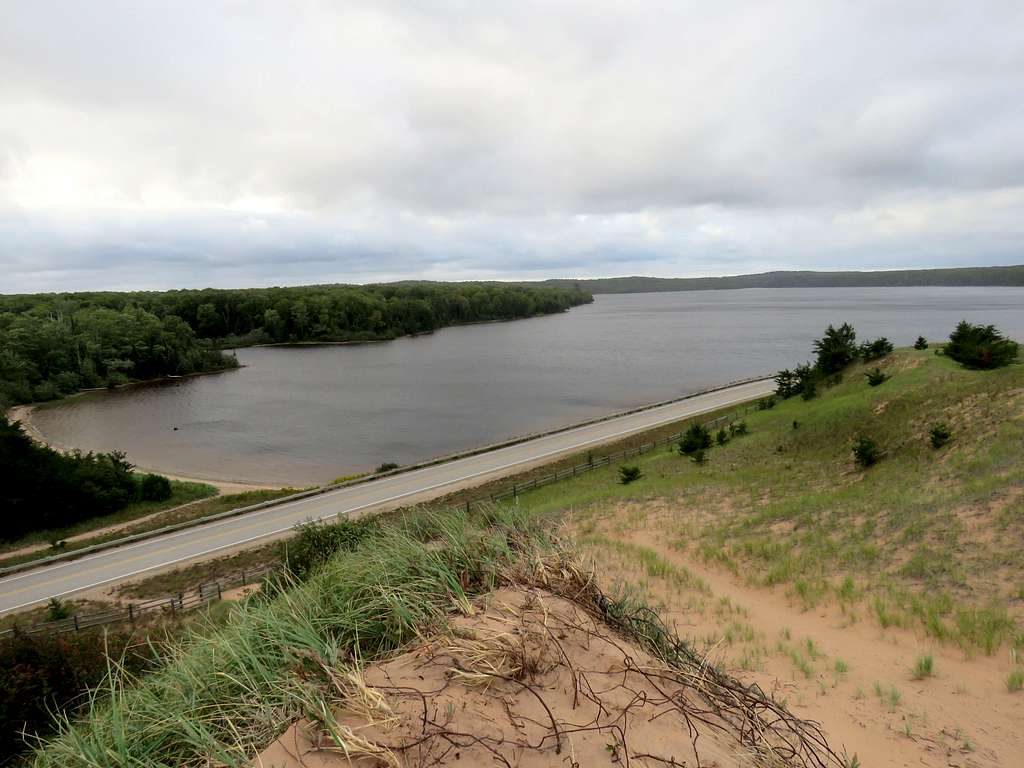
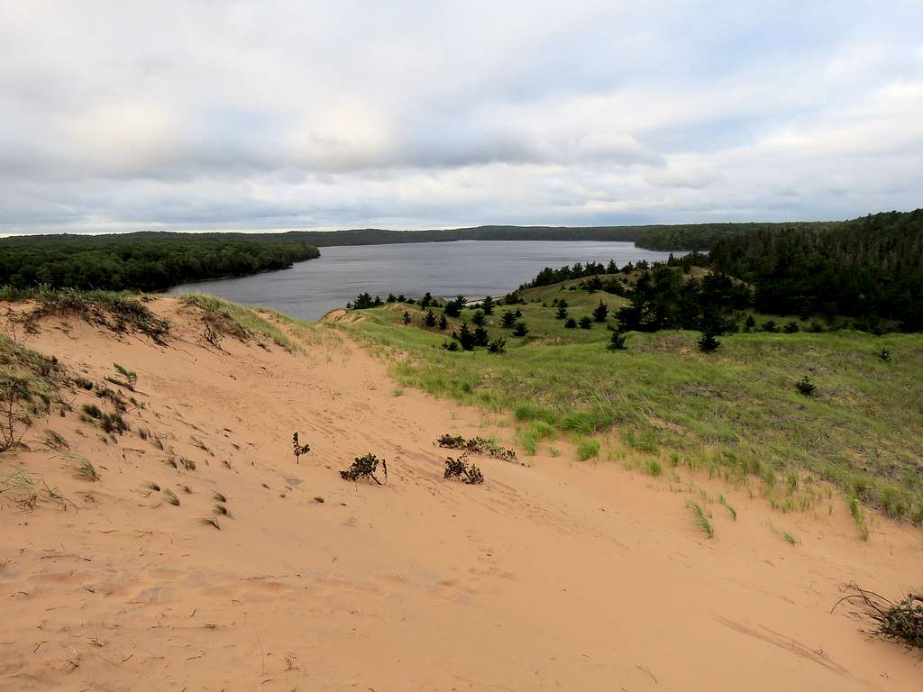
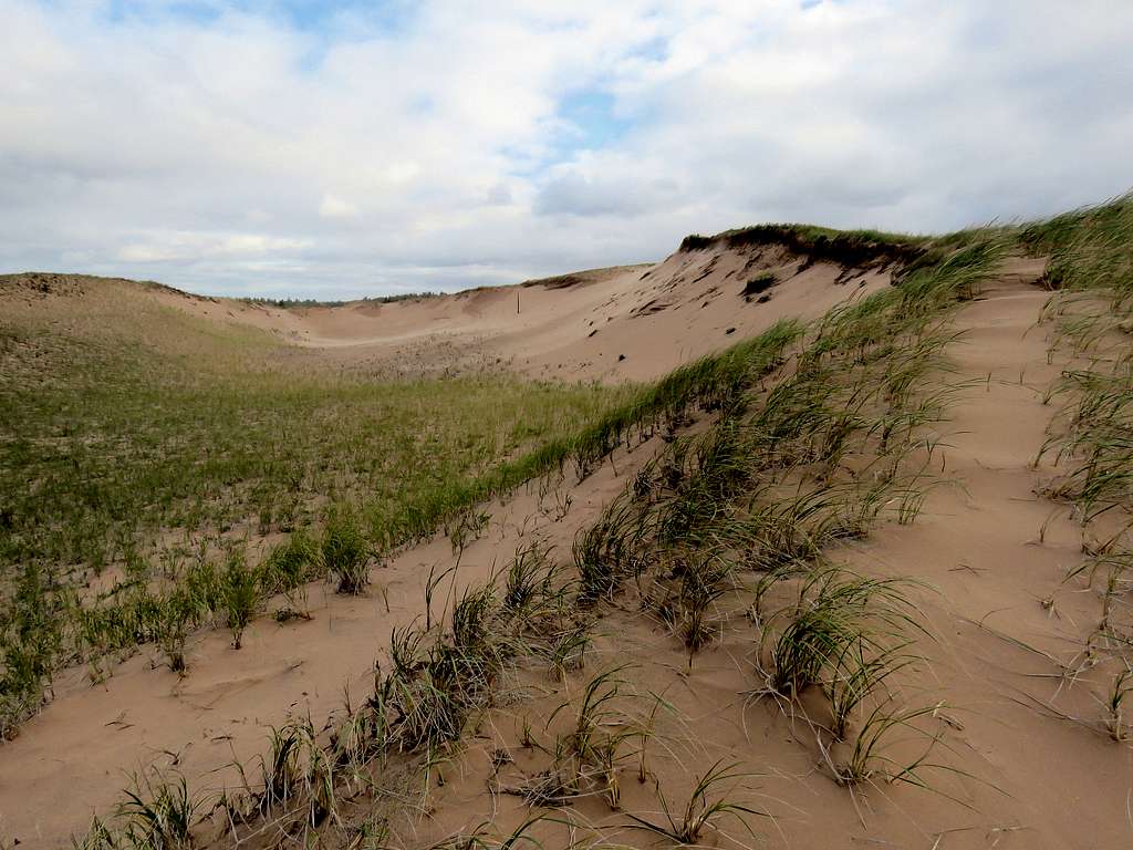
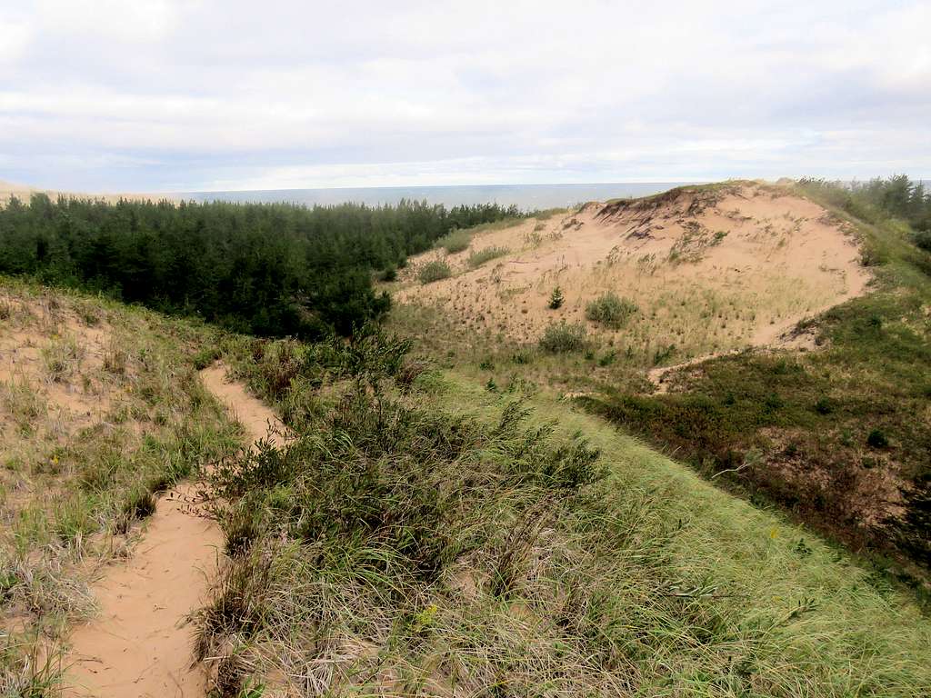
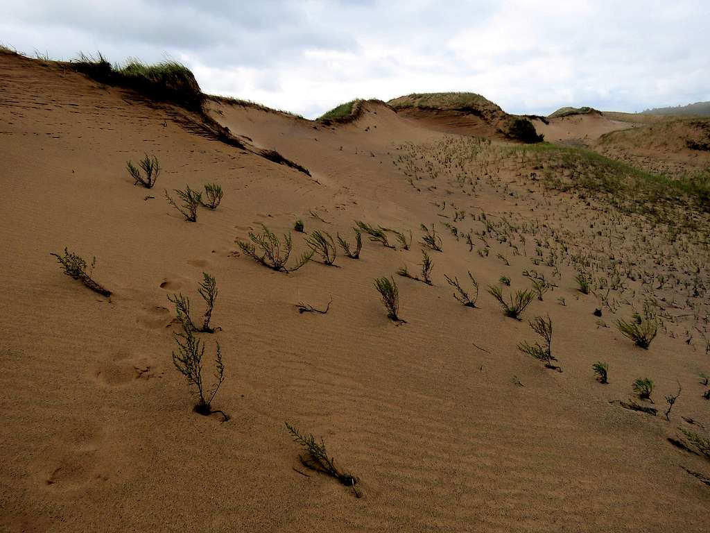
I then drove to a parking area near Grand Sable Lake. Wore my snow gaiters so that sand would not go into my boots. Started my hike at 8:20 a.m. Sand dunes that were mostly covered by grass sat on the north side of the road. There were no official signs for a trail but a well beaten path could be seen over the dunes. Went through a hikers opening in the fence and got on a steep slope that took me 90 vertical feet up to the top of a sand dune. View of Grand Sable Lake.
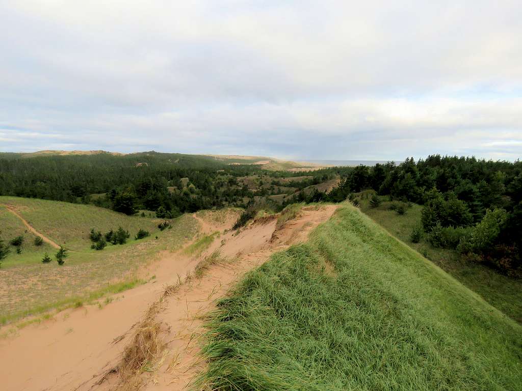
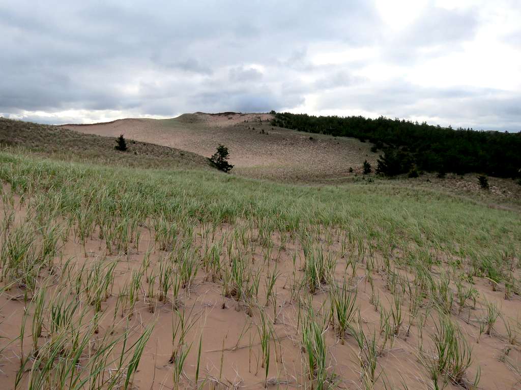
Continued the beaten path north up and down the dunes that had grass and even forest over them. It was very windy. I had my glasses on and my “granny nanny” big sun glasses over the regular glasses. Despite that, sand began to go into my eyes, in addition to my ears and nose.
As I went further north, the wind became stronger whipping my face with sand.
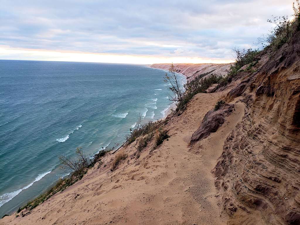
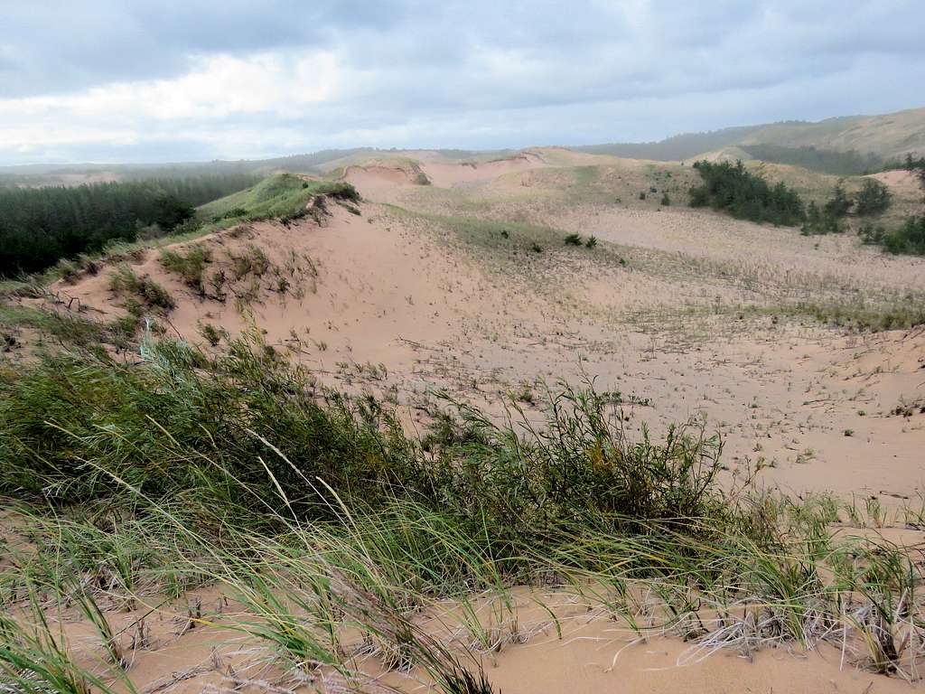
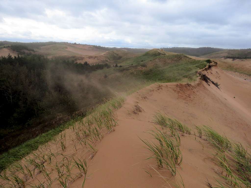
At 9:00 a.m., I reached the top of a slope 90 vertical feet above Lake Superior. I went a few steps down the slope but the wind was incredibly strong. Even when I had my back to the wind with my hat on, sand kept whipping the backs of my ears. I turned around and began to run away from the vicinity of the lake. Gave up on my plans to head west to the top of the taller dunes.
Began to walk back the way that I had come.
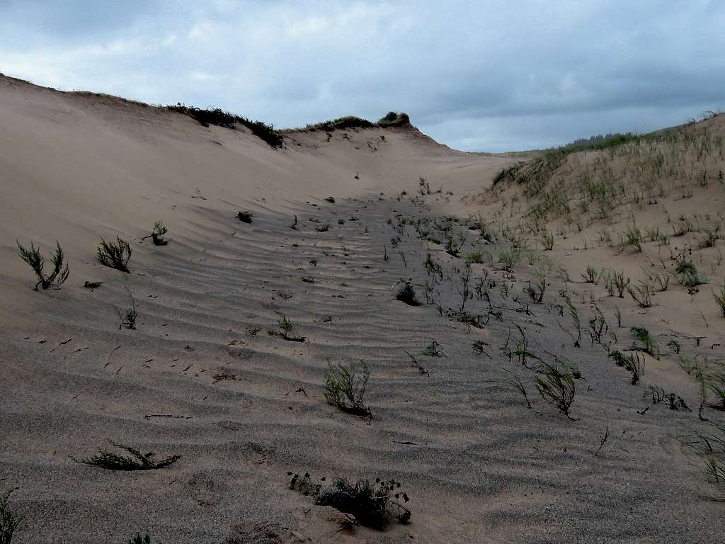
Wind blowing sand on the crest of the ridgetop.
Got paranoid thinking that having sand in eyes for long periods was bound to be bad for the eyes. Decided not to hike to Sable Falls and instead drive there so I went back to my car where I reached at 9:45 a.m.
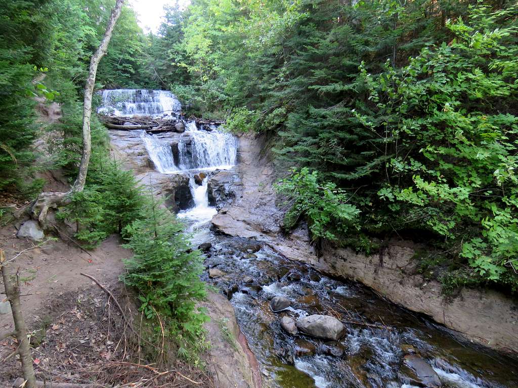
Next drove to Sable Falls Trailhead. A few people were there. A sign said 168 steps (and sloped trail) to Sable Falls. Went down the steps to reach the falls.
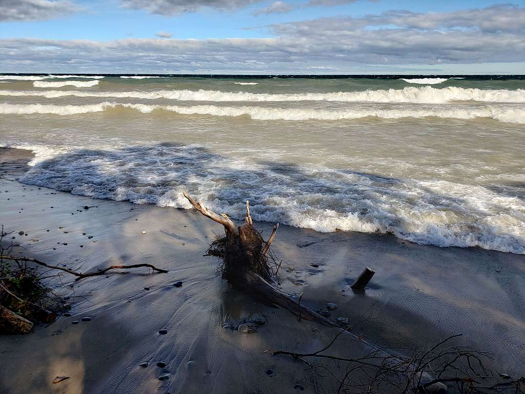
Continued on the trail to reach Lake Superior. Big waves flooded the narrow strip of beach every 30 seconds so did not step onto the beach.
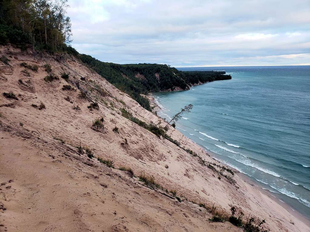
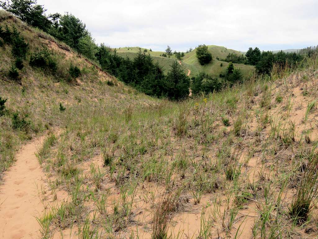
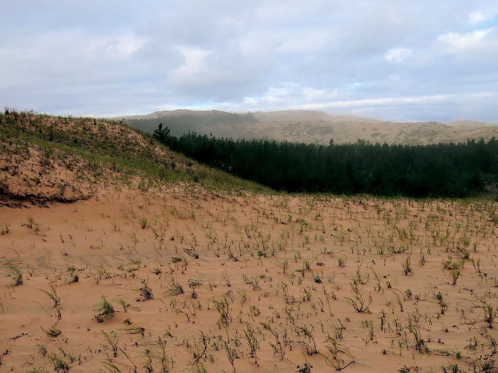
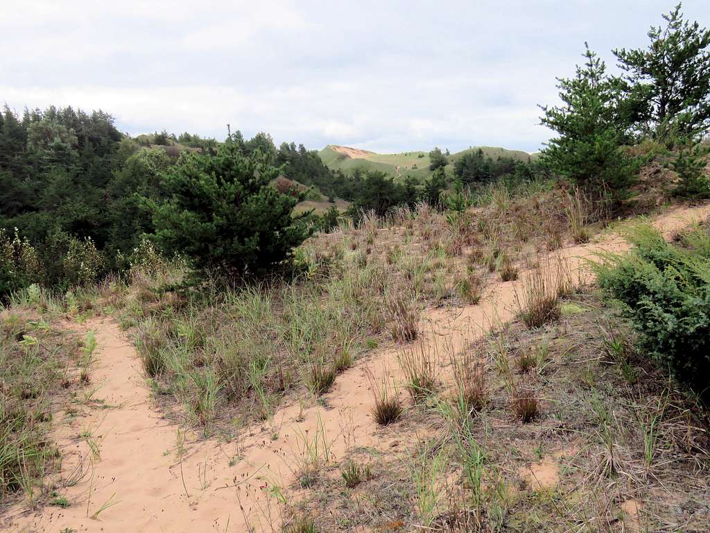
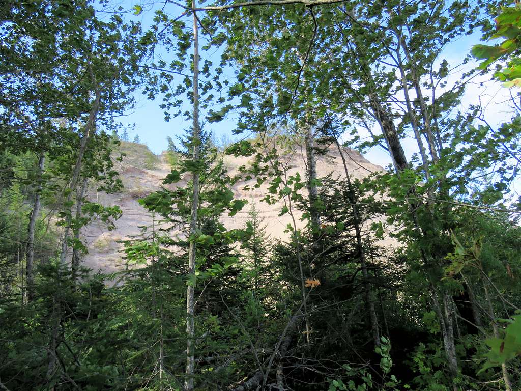
A big sand dune was visible through the forest across the creek.
Made it back to the car by 10:30 a.m. wondering where to go next.
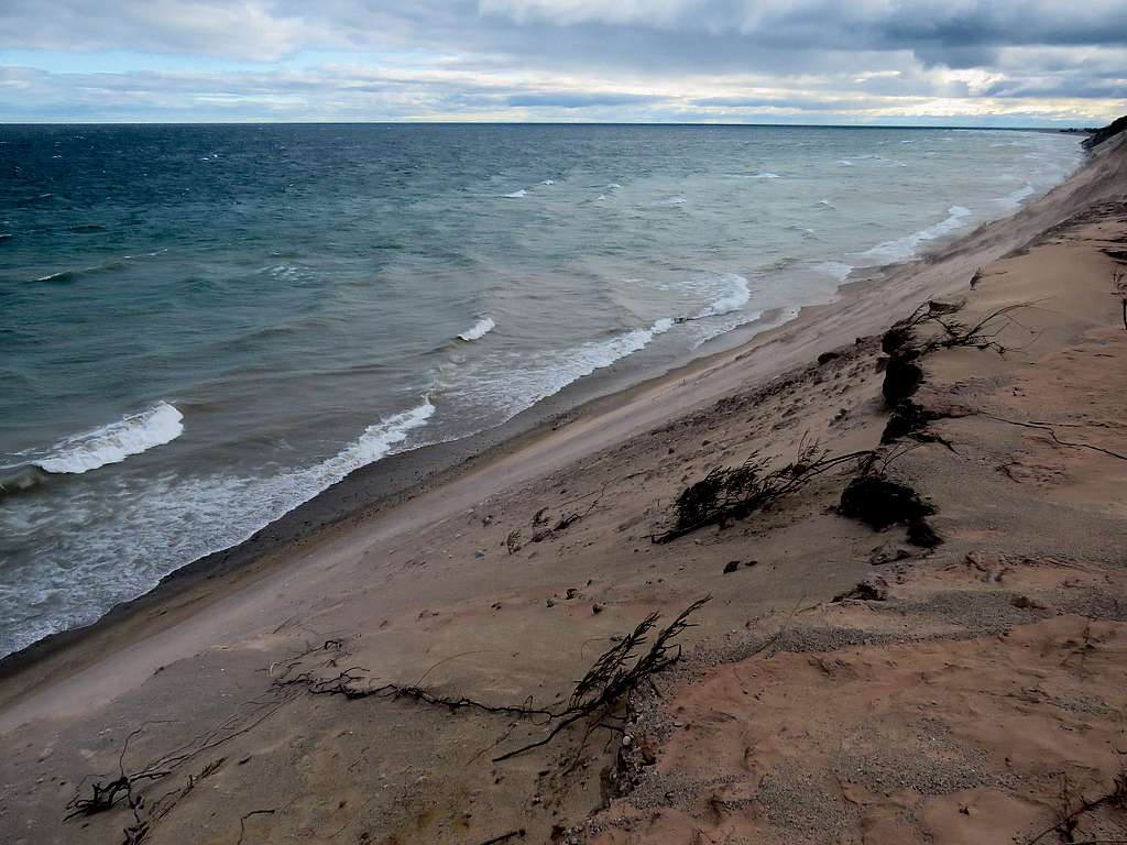
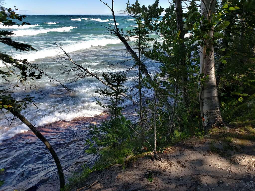
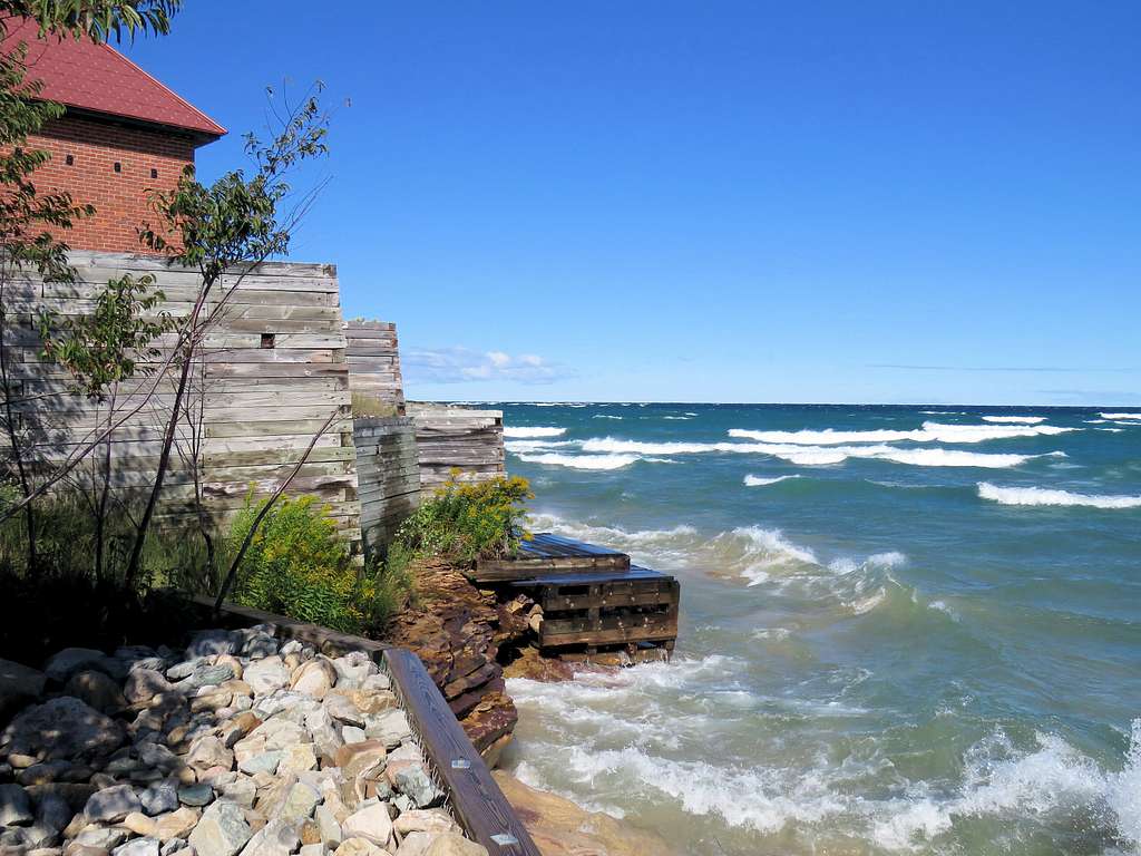
Drove back west to Hurricane River Trailhead. It had become sunny. Headed east 1.7 miles on a dirt road turned into a trail going to Au Sable Lighthouse. The trail, for the most part, was less that 50 ft away from Lake Superior. Strong winds made fierce waves that flooded the narrow strip of slickrock beach. In one place, there was a sign pointing to shipwreck remains on the beach but the beach was flooded so I did not get to go there.
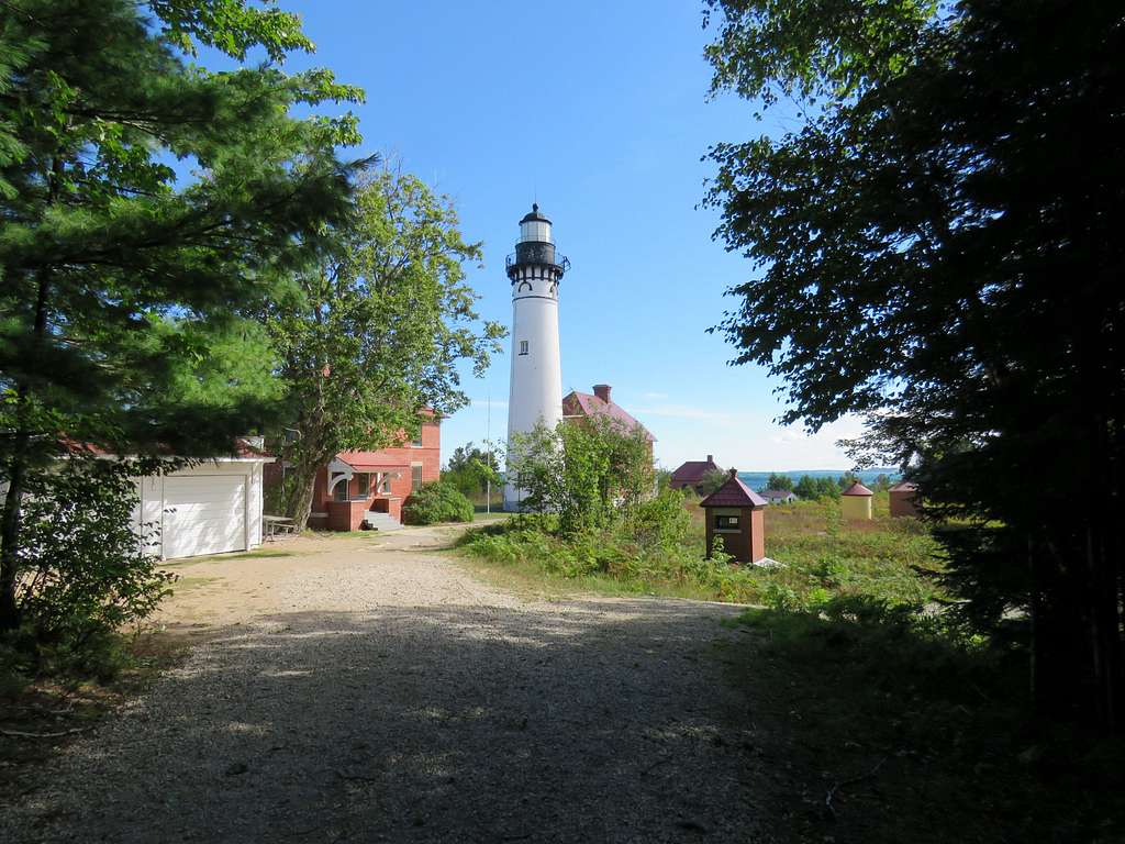
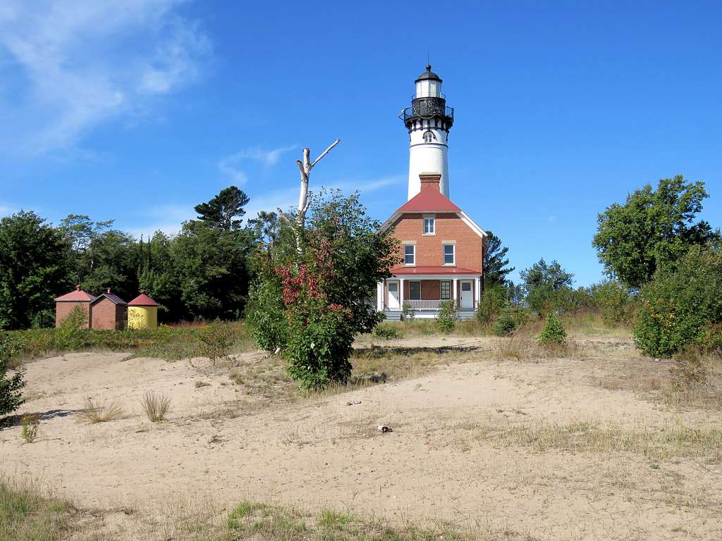
Au Sable Lighthouse.
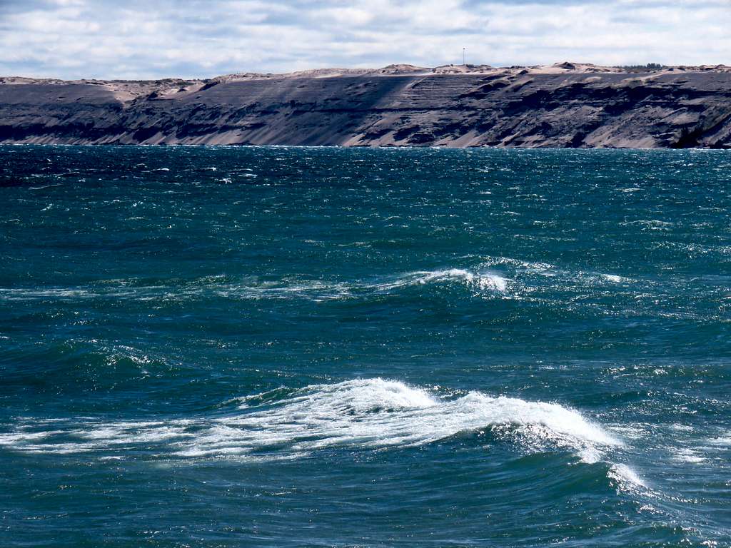
Zoomed view of Grand Sable Sand Dunes.
Was back to the car by 12:20 p.m.
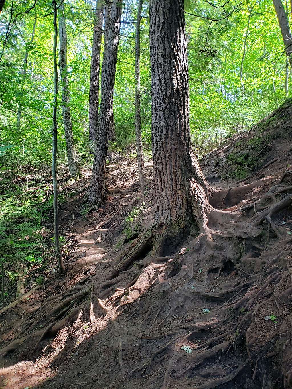
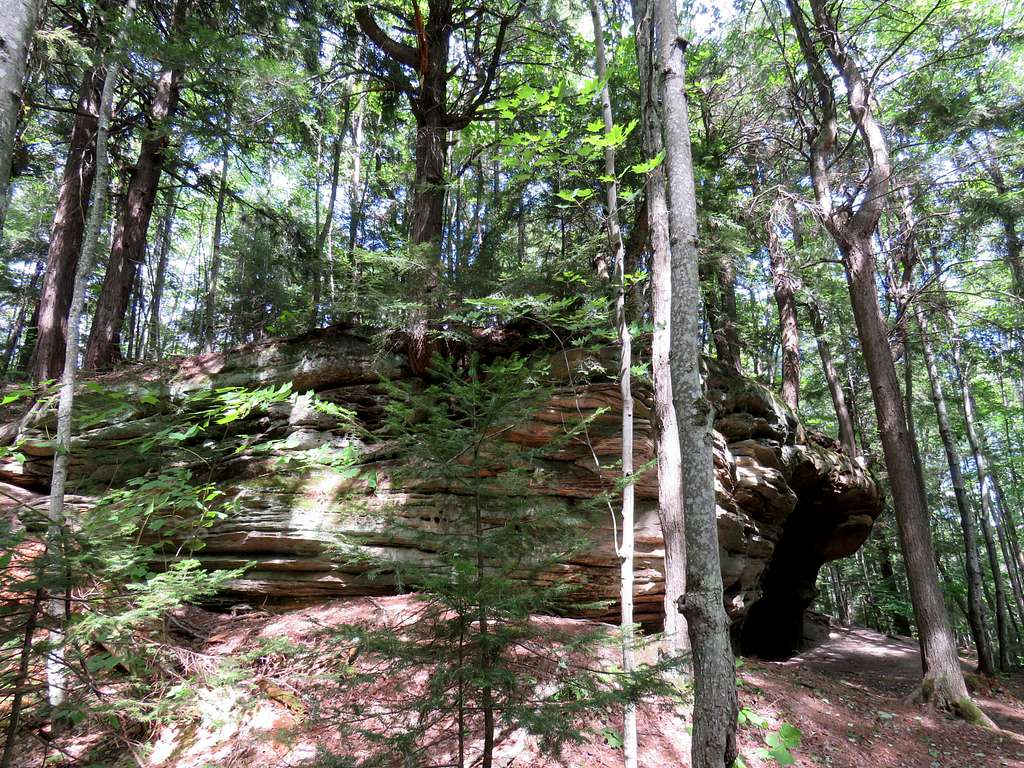
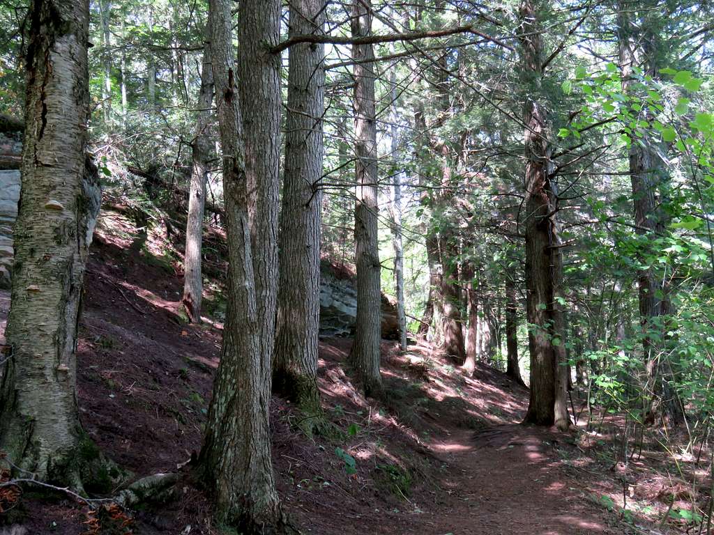
I wanted to walk on a sandy beach so I then drove to Beaver Creek Trailhead (which was a 1.5 mile hike away from Lake Superior) . Got on a trail that went into a beautiful forest going toward Twelve Mile Beach.
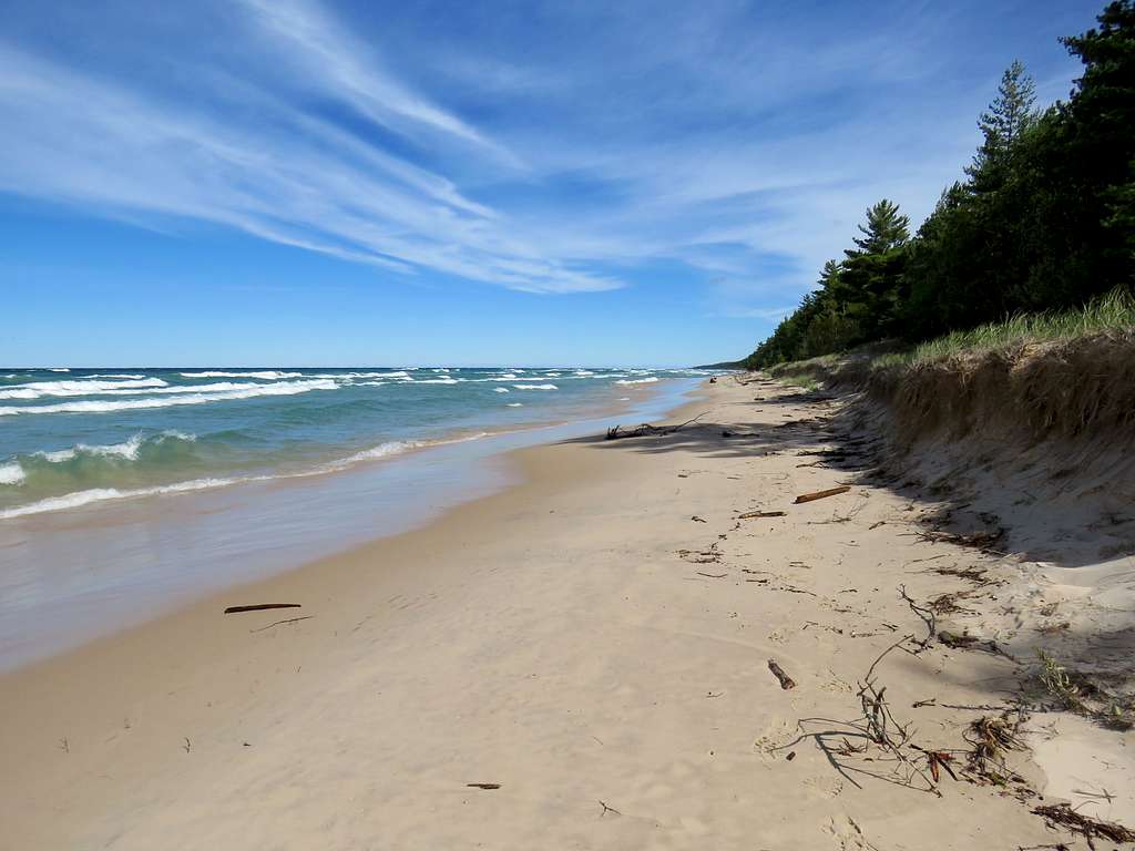
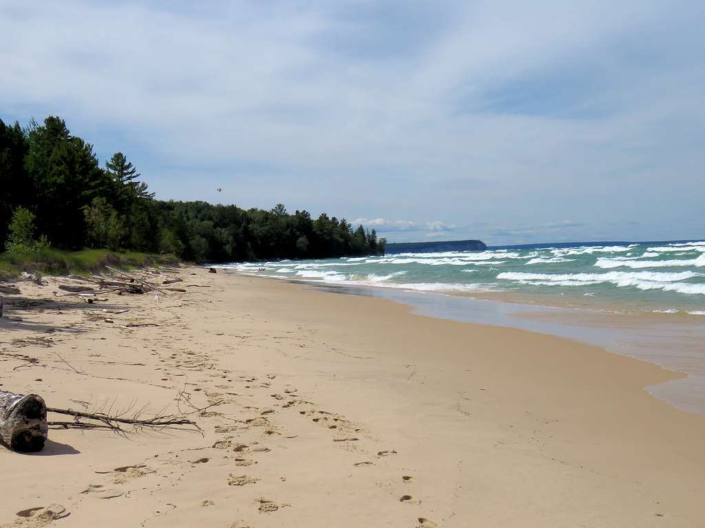
The trail went by Beaver Lake and then reached Twelve Mile Beach. Headed east and walked close to half a mile on the beach until I reached a fallen tree that had blocked the way. Sat there had lunch and then returned to my car by 3:10 p.m.