
-
 745 Hits
-
 76.66% Score
-
 7 Votes
|
|
Route |
|---|---|
|
|
46.40196°N / 13.80085°E |
|
|
Download GPX » View Route on Map |
|
|
Hiking |
|
|
Spring, Summer, Fall |
|
|
Most of a day |
|
|
Hiking: T2 |
|
|
Overview
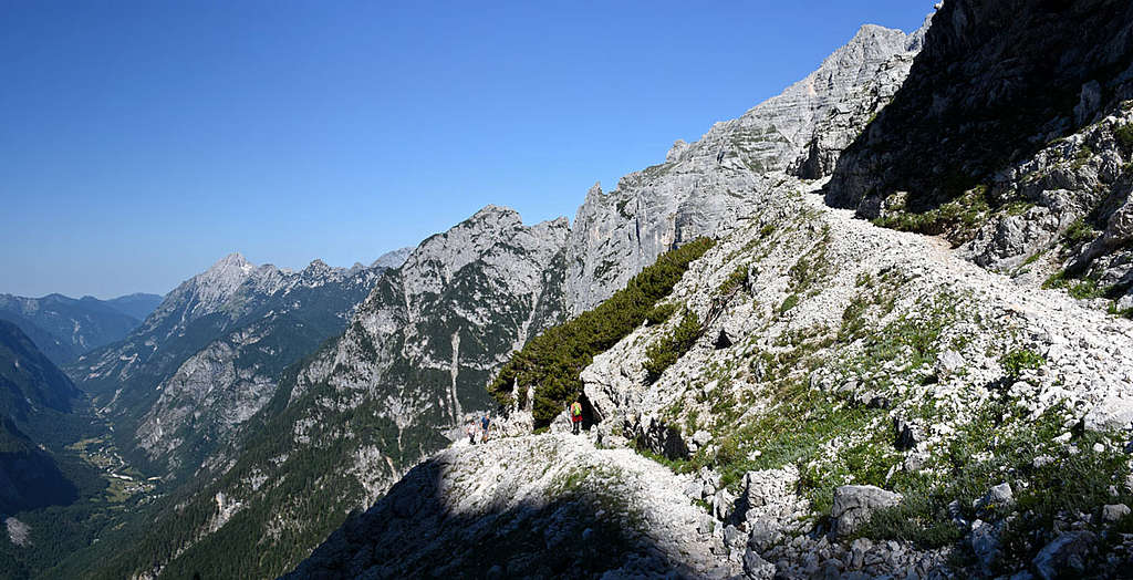
This is by far the easiest route to the Pogačnik hut and Kriški podi plateau. But it's also very long (some 8.5 km). The broad mule track ascends in endless hairpin bends up the valley, all the way broad and comfortable. There's only one a bit exposed place, but it's secured with a cable.
Getting There
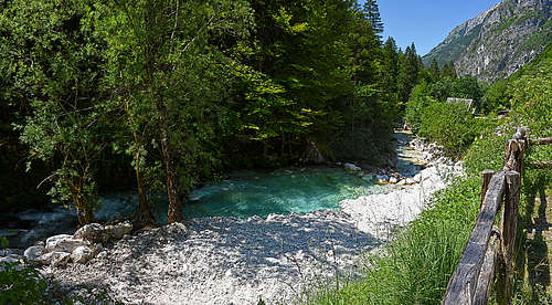
You start the tour in the valley mouth of Zadnjica, on 642 m. From the main road through the valley Trenta (towards Vršič pass) you deter eastwards just above the village of Na Logu. Parking is 300 m in the valley and is payable (5€/day): 46.38252443522542, 13.760795698339663.
General Data
|
Overall difficulty It's an easy hike of T2 grade (on the SAC scale). Only one short section is a bit exposed and secured by a cable. Gear Good sturdy shoes are needed and hiking poles are very recommended. For orientation have the online map on your phone, but be sure to have also an off-line version. Otherwise orientation is just simple - stick to the most beaten trail. The online version of my map is here. Altitude gain / Effort Altogether you gain some 1410 m of altitude, but you make also some 8.5 km of distance. The parking lot is on 642 m, the goal (hut) is on 2050 m. Time The first some 5% of distance (1.7 km) you do on a mountain road, reaching the lower station of material cable way on 797 m. The rest is the mule track. For an average hiker the time for ascent is a bit less than 4 h. |
Best season
You best do this tour in the times when the hut is open (mid June till end of September). Till the end of June the ascents on neighbouring summits may be demanding due to snow. But to the hut you can do this tour also before and after hut opening. Only avoid perhaps the hard winter, because in deep snow you'll never reach up there.
Best day time
Generally, the slopes are south oriented. So be early. Still, more than half of the route goes through nice woods, so it's not so desperately hot.
Route Description
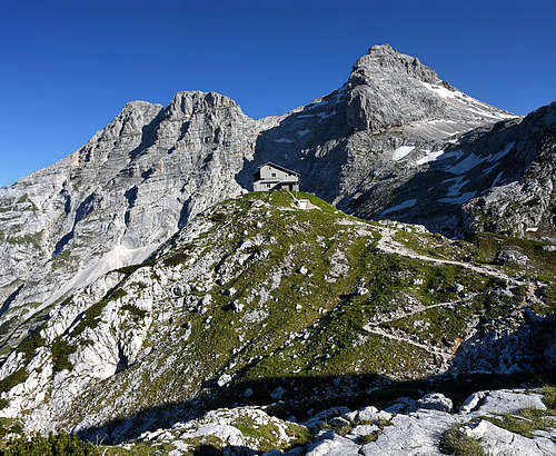
As said, from the parking place walk by the road (partly concrete, partly gravel) towards the valley-end, then left to the lower station of material cable way, 797 m. There a good ex mule track begins. It ascends by the W side of Beli potok (creek). On some 975 m it crosses the first ravine, coming down from Goličica. Immediately after the ravine, there's the short, exposed, secured section. Still, it's easy. Then the long ascent through the woods continues. On some 1200 m there's the second big ravine and on 1268 m the third one. After the second ravine the trail turns towards the E and after the third one it continues in that direction, through the woods again. Some bends on the trail are really long. On some 1500 m, above the nice lookout point, a weak trail deters to the left (actually continues straight, while the mail trail does a turn) - towards the nearby hunting hut (closed). So, we keep ascending up, more and more towards the NE. On some 1650 m we are reaching the upper timber line and the ascent becomes more and more panoramic. On 1886 m we reach the edge, where right below in a basin wee see the lowest lake (a bit below there's above the trail usually a water source). Don't miss to go the beautiful lake! From the crossing, there's still some 160 m of ascent towards the N - to the hut.
Spodnje Kriško jezero
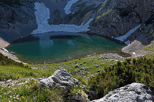
On Kriški podi (plateau) there are only three lakes (the fourth one is temporary). The Lower lake is the biggest and the first gets rid of snow cover. It lies in a bigger basin, on the altitude of 1800 m. It measures 120 m x 90 m and is 9.5 m deep. The N and E slopes of the basin are very steep. There snow rests remain long into a summer, taht's why the lake has usually enough water. On the SW side there's a low grassy step, formed of several bumps. In times of mountain spring they are covered with a colourful carpet of mountain flowers. Also the coast on that side is flat and gentle. On the S side, just above the lake, looms the sharp needle of Šplevta mountain, 2224 m.