
-
 147 Hits
-
 75.81% Score
-
 6 Votes
|
|
Mountain/Rock |
|---|---|
|
|
39.19322°N / 108.94914°W |
|
|
Hiking |
|
|
5723 ft / 1744 m |
|
|
Overview
Looking for some exercise on the last morning of my vacation, I found it hiking up Rabbits Ear Mesa between Moab Utah and Grand Junction Colorado. But it was much more than good exercise, it was a surprisingly scenic and far reaching tour of the nearby Colorado Plateau landscape. Uninterrupted views for most of the hike.
Getting There
You need to get to exit 2 off of I-70 in Colorado, just east of the Utah Border. This is about 27 miles west of Grand Junction and 75-80 miles northeast of Moab, Utah. Exit and make your way to the south side of the highway directly into the Rabbit Valley area of McInnis Canyon Conservation area. A sign will direct you east 4 miles to the well signed Rabbit’s Ear Mesa trailhead on the right (south) side of the road.
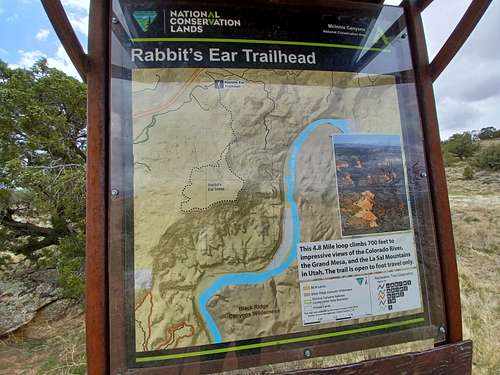
The 4.8 mile trail starts immediately southward through the scrub forest.
Route
The trail to the mesa top rolls up a series of small hills on very nice trails, interspersed with a few rocky sections. A mile plus of trail will bring you up to a loop along the edge of the mesa, and I recommend going clockwise as the scenery just gets better and better in that direction.
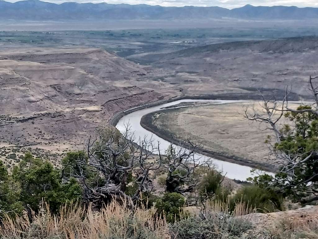
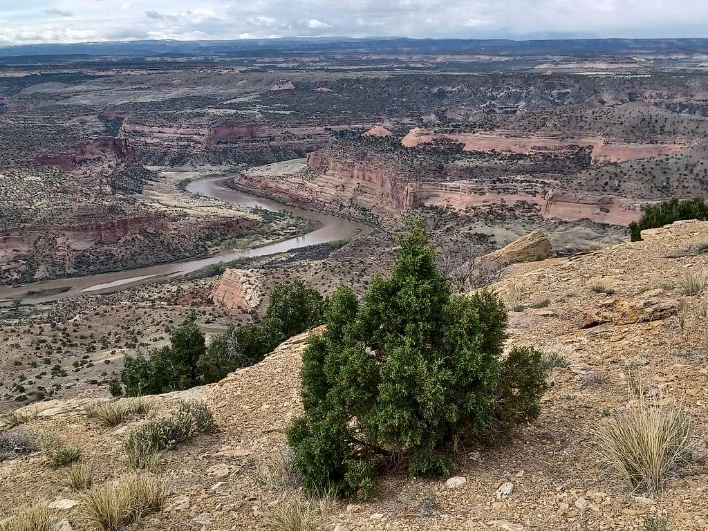
As you work your way up (mostly) and down the trail, the Colorado River will become more apparent on your left. Views all along the mesa top are unhindered and vast.
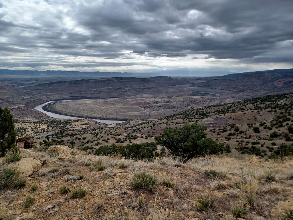
Not only a river winds its way to your left, but also a set of rails that I only noticed when a train made its way east and through a tunnel. Can you find them both?
As you move from the trail and loop along the east side of the mesa to the southern edge, more lovely views become available to enoy.
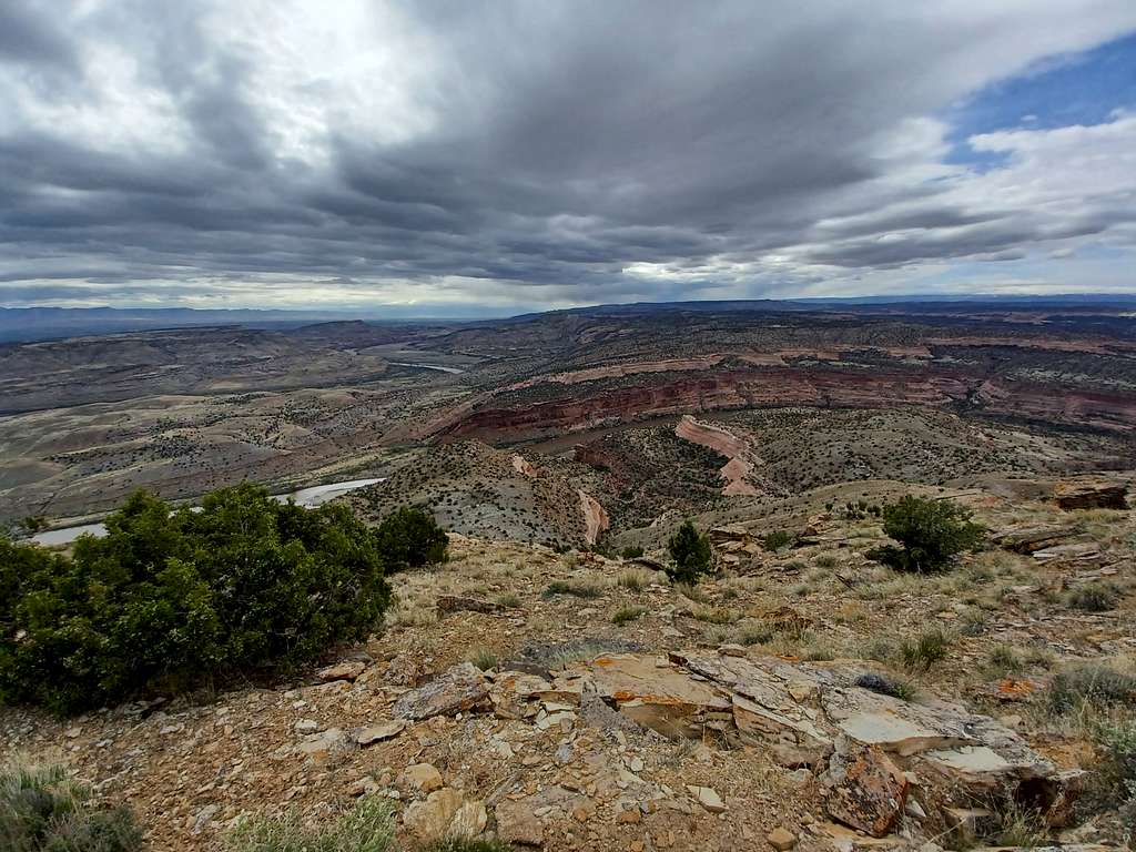
Soon Utah comes into view…southwest toward Moab.
And then deep into Utah. La Sals on the horizon at left?
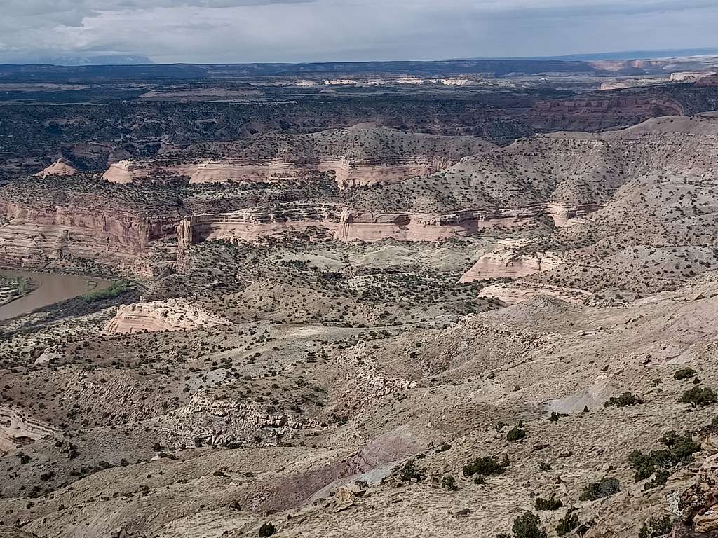
An unexpected bounty of views for 700 feet of elevation gain. Finish the loop and go back down to your car on the original trail.
Red Tape
None.
When to Climb
Spring I can state is great - not sure how mid-summer would be though.
Camping
There is camping in the Rabbit Valley area - apparantly it used to be free but will start having a fee soon.
External Links
McDonald Creek Canyon is nearby