
|
|
Route |
|---|---|
|
|
38.32630°N / 80.1542°W |
|
|
Hiking, Skiing |
|
|
Spring, Summer, Fall, Winter |
|
|
Less than two hours |
|
|
Class 1 |
|
|
I |
|
|
Overview
SummaryLength: 1.2 miles, one-way
Elevation Low/High: 4320/4703
Difficulty: Class 1 - easy, well marked trail
Time Required: 1-2 hours
Trail is marked with blue diamond blazes
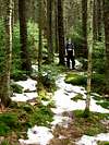
This 1.2 mile long trail leads to the top of the 9th highest point in West Virginia. The easy trail passes through red spruce forests, home to the endangered Virginia Flying Squirrel. At the top, the trail loops the summit, where the remains of an old fire tower can be found and a view of the surrounding mountains and valleys opens up.
Getting There
The trail can be accessed from the Red Spruce Knob Trailhead. Directions can be found on the trailhead's page or the Red Spruce Knob page.
Route Description
The route gently climbs to a ridge through a patch of red spruce. Once on the ridge, it stays on the ridge over level terrain. Near the summit, the trail loops around the top in another patch of red spruce. The trail circles the location of the former fire tower and the view is found on the southeastern end of the mountain.