
|
|
Route |
|---|---|
|
|
38.73690°N / 104.8806°W |
|
|
Difficult Hike |
|
|
Half a day |
|
|
Class 2+ |
|
|
Introduction
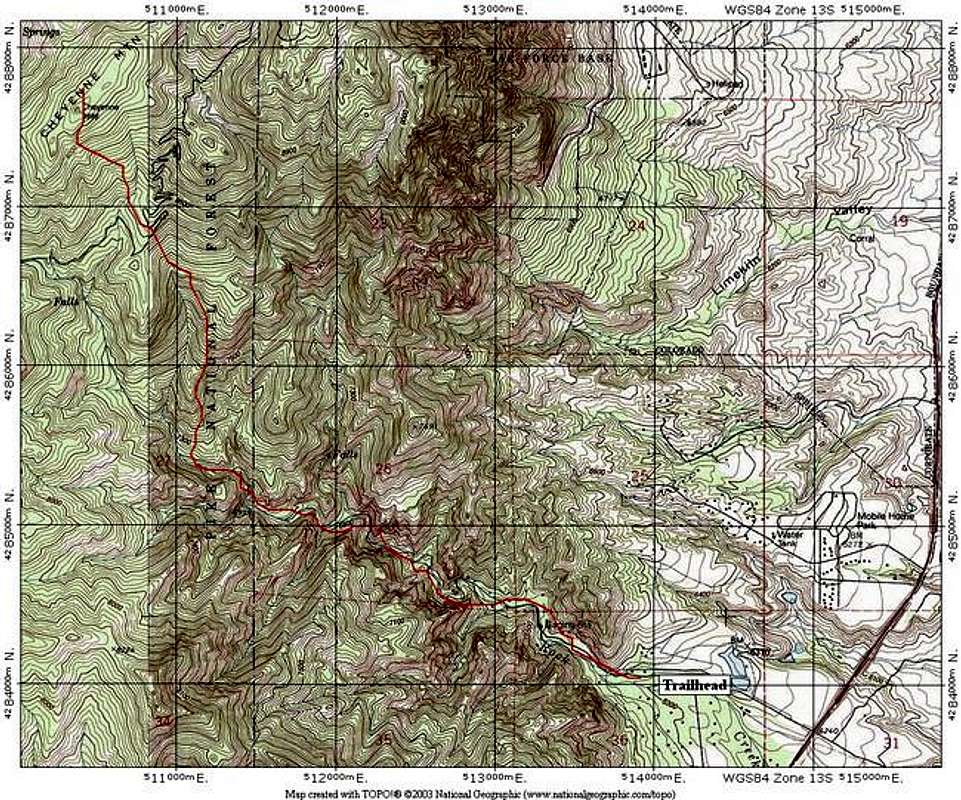
This steep route offers a tough way to ascend Cheyenne Mountain from the low plains to the East of the mountain. Rock Creek is a beautiful, but tough hike that will test your legs and your route finding skills. Ensure you study a map and have your navigational skills honed before trying this one. It's very easy to get lost if you enter the wrong creek drainage, and it's also heavily wooded in most areas, making navigation by landmark a little more difficult.
Getting There
Rock Creek Trailhead: Elevation 6,300 feet
Going South on Nevada Avenue (Rt. 115), pass the south end of Colorado Springs and head toward Fort Carson. Pass Ft. Carson Gate 2, and then set your odometer at Fort Carson Gate 1. Pass Gate 1 and drive 4.9 miles south on Rt. 115 and turn onto a dirt road. Park before a gated closure shortly up the road. Don't block the gate.
Route Description
From the gated closure, continue on the old road as it quickly turns into a trail. Enter the Rock Creek drainage. Follow this steep, rugged drainage as it climbs relentlessly up the eastern slopes. You will probably have to cross the creek several times to find the easiest path. The walls of this gorge can be tall and steep at times. Take your time and find the easiest path.
At 7,000 feet, leave the drainage as it begins to even out and find a large shoulder to the Northwest. Gain this shoulder on its western side and get on top of it. Follow this shoulder to 8,000 feet. There should be a faint trail to here. It's hard to follow, so don't worry if you lose it.
From 8,000 feet, head generally Northwest to the summit. Use your compass and map. The final slopes are steep. Descend your ascent route, taking care to enter the correct drainage on the way down. Ensure you take several mental pictures as you ascend.
Round Trip Mileage: 8.1 miles
Elevation Gain: 3,600 feet
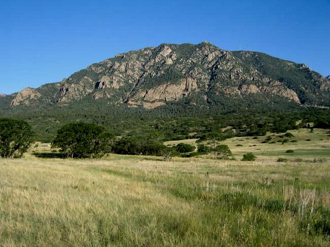
This photo shows the Eastern Slopes of Cheyenne Mountain. This route is to the left side of the mountain in one of the visible drainages. Photo credit to SP member mmoerk
Essential Gear
Good, sturdy boots and sturdy hiking gear. If you go in the Spring, waterproof boots will be appreciated.
Red Tape
As mmoerk alludes to on the front page of this mountain, private property is all over the place. This route does not go through private property as far as I know. On your descent, if you find yourself venturing toward NORAD, just turn around and try again. Do not try to go near NORAD. If you are near it, then you've taken a wrong turn anyway.
I did this route several times from 2000-2003, and never had any issues with trespassing. Please post here if you know differently.