


Andrej Mašera - Dec 17, 2006 8:28 pm - Hasn't voted
Thank youYou have discovered to us fine possibilities to study austrian mountains, as well, as other regions of your beautiful country. The digital technology has entered in the realm of dreams.

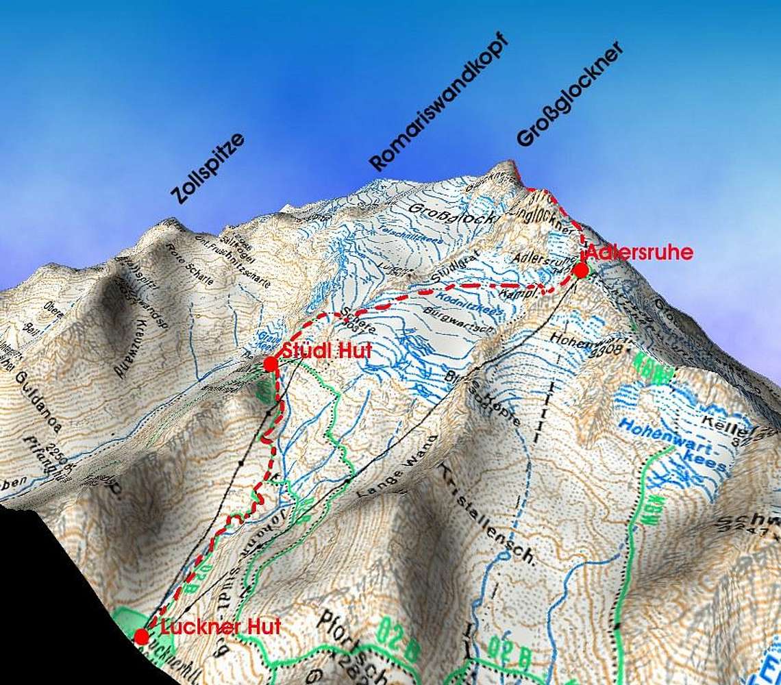
Mathias Zehring - Dec 25, 2006 9:09 pm - Hasn't voted
strange anglethis is a nice view but a strange angle. Probably you did the labelling and drawing of the route yourself. IMHO you mixed Grossglockner summit with Glocknerwand summit - look at Stuedlgrat ridge that should end on Grossglockner summit!

wuedesau - Dec 26, 2006 1:27 pm - Hasn't voted
Re: strange anglePlease keep in mind that the used DEM is based on a very rough grid (otherwise normal users couldn´t handle the data). The steep summit of Großglockner covers a very small area and the possibility to have a z-value for this point is naturally very small. Therefore the calculated topography can slightly differ from reality.
The 3d view is of course only intended to give an overall impression which is in my opinion quite good.

desainme - Dec 26, 2006 1:59 pm - Voted 10/10
Northward viewIf desiring a view more suggestive of the mountain's abruptness, one may go to the tilta version of Google Earth.


Comments
Post a Comment