
-
 3591 Hits
-
 83.69% Score
-
 17 Votes
|
|
Route |
|---|---|
|
|
49.15499°N / 20.02207°E |
|
|
Hiking, Mountaineering, Scrambling |
|
|
Spring, Summer, Fall, Winter |
|
|
Less than two hours |
|
|
I |
|
|
Overview
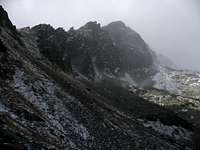 On hunters' trail to the saddle.
Ostrá veža (2129 m) easiest route is on its west face. It leads in strict natural reserve, so you have to sacrifice your respect before the law if you go there. It´s the only "hiking" route to the summit. You move in wall terrain, everywhere around you there are routes of II-III grade UIAA.
Getting There
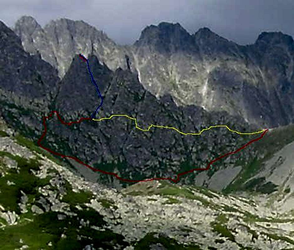
 Sedielková kopa on the left. 30 minutes are needed to get to the saddle on right via hunters' trail.
How to get to High Tatras to the near to Ostrá veža see "getting there" section of the page of Ostrá veža. When you are in Furkotská valley, go to the junction where marked hiking trails from the bottom of Furkotská valley meets trail from chalet under Solisko (you may spend a night there and start your trip there). Go up valley still following yellow trail, but only for 15 minutes, when you will see towards left hunters´ path to the saddle Sedielkový priechod (1950 m). It takes 30 - 45 minutes of walk-up from junction. Than follow to the other valley - and you have two possibilities:
1. The yellow route (on the picture) - through catwalk of Ostrá veža it takes 30 minutes of walk (0 UIAA) from the saddle to connect blue path. First, who traversed Ostrá veža this way, were Wlodzimierz Boldireff and Mieczyslaw Karlowicz (book about Karlowicz on that link) on 29th august 1907. Although the trail is on side of valley of Suchej vody - strict nature reserve, it is still a usual descend trail from Ostrá veža.
 In the first third of the catwalk - view back
2. Through valley. It was ever described, but intuitively it is possible to go through it especially on descend if the catwalk is too avalanchy. It longs about an hour. Note that the valley of Suchá vody is a strictly protected nature reserve, so do that only in very extreme situation.
You need to get to the place, where couloir falling from the saddle between the two summits enlarge itself. That is the beginning of the summit route. Note that the terrain at the catwalk is very complicated - don't follow any of short grassy-rocky pillars - you need to get to the entry of the couloir that is between two greater wally parts of the west wall.
Route Description
 Route description and of its variants - part higher than the saddle.