
|
|
Route |
|---|---|
|
|
46.64643°N / 8.31073°E |
|
|
Sport Climbing |
|
|
Spring, Summer, Fall |
|
|
Half a day |
|
|
5.7 (YDS) |
|
|
5a (5a obl.) |
|
|
10 |
|
|
Overview
The Südkante is very popular sport climbing route on the Mittagfluh. The routes in the Uri Alps are known for their good rock quality and perfectly re-bolted routes.The Südkante is route of moderate difficulty, max French 5a / 5.7 YDS. The 10 pitches are pretty homogeneous as for the difficulty. The route is re-bolted in 2000, which ensures solid bolts at all the belays and during the pitches. The distance between the bolts is pretty short (about 5 meters) and if you are able to tackle the difficulties easily you won't need any additional placements.
I can highly recommend the Südkante for beginners in the alpine round. Be aware of some rockfall when it is busy! A descent along the route is possible (rappel), but it is far more convenient to take the normal descent (see route description).
First ascent: Ernst Rufibach and Hans Streich, 1963
Re-bolted: Theo Maurer and Jürg von Känel, 2000

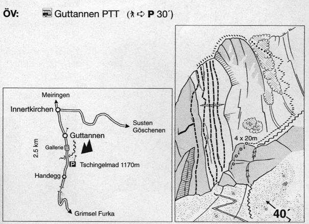
Getting There
To GuttannenGuttannen is located along the Grimselpas road (N6 between Innertkirchen and Gletsch). This road is a major connection between the Swiss Canton of Berne and Valais/Wallis. Therefore Guttannen can be easily reached by bus and car. Be aware of the fact that the Grimselpass road is closed in winter!
- See the website of the village of Guttannen for more detailed information of how to get there.
- See the website of the SBB if you're planning to travel by public transport.
To the south face
From Guttanen one has to drive in southern direction to Tschingelmad (1170 m). Here there is a good possibility to park your car (east side of the road). From the parking one can already see the south face of the Mittagfluh. There is good path to the base of the wall, which will take about 30 minutes. There is small online map available here.
Route Description
See this page for detailed topo of the route.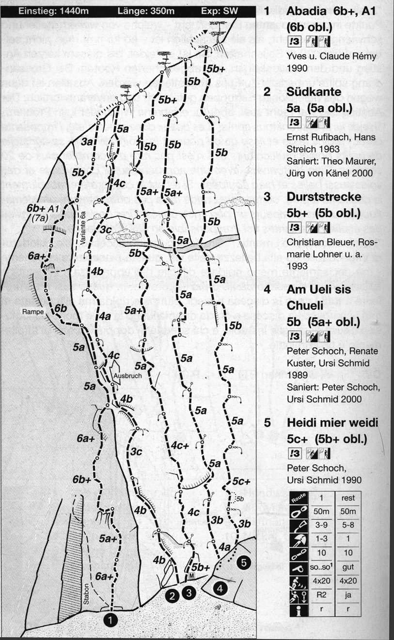
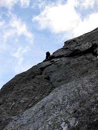 Climbing the Südkante.
Route Description
- First pitch, 4b: Start at a small corner and head left where you can see some bolts.
- Second pitch, 4b: Head straight up about 10 meters, head left and continue by climbing a crack.
- Third pitch, 3c: Easy pitch which basically runs up straight.
- Fourth pitch, 4b: Climb left towards the edge of the face.
- Fifth pitch, 4c: Climb left of the on the ridge by avoiding some loose rock (due to previous rock fall).
- Sixt pitch, 4a: Head up straight, a bit grassy.
- Seventh pitch, 4b: short pitch along the edge of the face.
- Eight pitch, 3c: a bit difficult to find because there are more possibilities. Easy, grassy and not very beautiful pitch.
- Ninth pitch, 4c: a very nice crack which is quite long, but very enjoyable.
- Tenth pitch, 5a: head either left or right after the belay (right is fine). The crux pitch which ends on a nice slab.
Descent: Reach the summitridge and follow this ridge in eastern direction. Just after the highest point of the summitridge (after the final pitch of Loris Boxenstop) one heads south on a small path. Follow this steep path down untill you reach the first rappel, which is close to a waterfall. Rappel three times (depending on your rope lenght) and walk towards the final two rappels. The last rappel brings you to the base of the south face routes where you can pick up your pack and head down.
Essential Gear, Maps and Guidebooks
Essential Gear: take your normal rock climbing gear like a helmet, a 50 meter rope (twins or double if you're planning to rappel down the route), maybe a small rack of nuts, about 10 quickdrawns and hiking shoes for the descent.Map 1:25 000:
- SAC Map: 1230 Guttannen
Map 1:50 000:
- SAC Map: 255 Sustenpas
Online Maps:
Guidebooks:
- Topoguide Band 1, Nicole Luzar & Volker Roth, ISBN 3-00-016204-6
- Schweiz Plaisir West, Filidor, ISBN 3-906087-19-0
To order SAC Maps: www.toposhop.ch
To order the Topoguide: www.topoguide.de
To order Schweiz Plaisir West: www.filidor.ch
External Links
Useful links:WSL Institute for Snow and Avalanche Research SLF - Avalance Bulletin
Weather Forecast - Detailed weather forecast by Meteoschweiz
Railroad information - Railroad schedule
Bus information - Postbus schedule
Guttannen - Tourist Office Guttannen
Alpenpasses - Information on the current road conditions on the Grimselpas road
Haslital - Tourist Office Haslital (Region of Meiringen)
steple - Mar 1, 2011 4:47 pm - Hasn't voted
RatingGreat (and correct) description. Except 5a is the French rating, not UIAA.
Jurgen - Mar 2, 2011 10:45 am - Hasn't voted
Re: RatingThanks, you're right. I've changed it now.