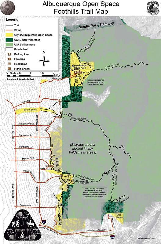
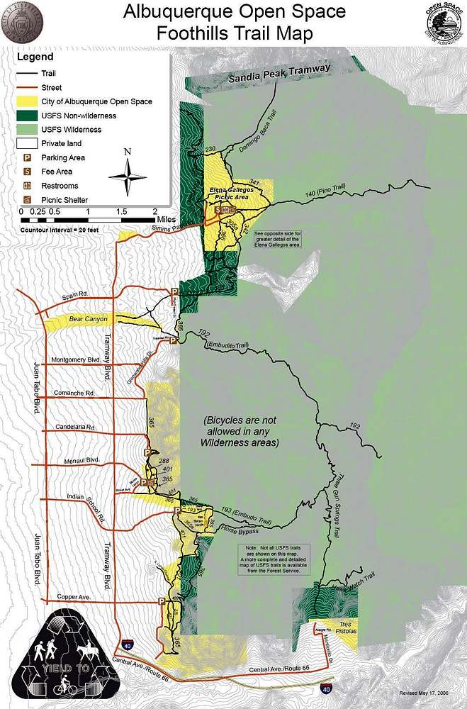
This map from the City of Albuquerque shows the various political boundries on the western side of the Sandia Mountians. In many places the Cibola National Forest and Sandia Mountain Wilderness overlap and this land covers most of the Sandia Mountains. The darker green is just Cibola National Forest, the lighter green is both National Forest and Wilderness, and the yellow is the city open space.


