


-
 27846 Hits
-
 81.18% Score
-
 13 Votes
|
|
Custom Object |
|---|---|
|
|
57.40946°N / 4.8999°W |
|
|
Collaborative playground |
THIS PAGE IS CURRENTLY UNDER COSTRUCTION. IF YOU WANT TO GET INVOLVED CHECK OUT THE FORUM DISCUSSION BELOW AND LET US KNOW
Back to discussionIntroduction
Into text. Might not be neededOverview
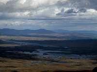
Overview text.The Ranges of the Northwest Highlands
As previously mentioned the Northwest Highlands are home to a variety of mountain environments, which can be further divided into a number of distinct sub-ranges. The sub-ranges are based on those of the SMC guidebooks, however, in places, definitions may vary. The divisions between the sub-ranges are not necessarily definitive, as some mountains may fit as easily into one sub-range as another, in such cases, the boundaries drawn on the map below may be considered 'fuzzy'. This section illustrates these divisions, containing photos and brief descriptions for each of the sub-ranges, as well as an interactive map to guide you through the area. For ease of use the sub-ranges have been grouped into three sections based on their geographical location – East, Central and West.| How to use this section The Map: The map is interactive and you can find out the name of the sub-range by hovering your mouse cursor over the highlighted areas. Click on a highlighted area to be taken to its description on this page. Tip: Look out for these  |
Southern Northwest Highlands
Obviously these bits need to be changed. Open to suggestions.Morvern
Ardnamurchan
Sunart & Moidart
Ardgour
Loch Eil to Loch Arkaig
Include south of Loch Morar.
Knoydart
Include strip north of Loch Morar. Puts Mallaig in this region for ferry to Inverie
Loch Lochy to Loch Quoich
Glenshiel
Southern side. Runs from Loch Quoich north to A87 road.
Central Northwest Highlands
Kintail
North of A87 road
Glens Affric & Cannich
Loch Affric to southern side of Loch Monar.
Glens Moriston & Urquhart
Loch Garry to roughly the top of the A831 road.
West Monar & Glen Carron
Everything north and west of Loch Monar until the A890 road between Achnasheen and Loch Carron.
Strathfarrar & Strathconon
Everything north and east of Loch Monar until A832 road between Achnasheen and Inverness.
Applecross
The Ben Damph & Coulin Forests
Torridon & The Flowerdale Forest
Torridon and everything north and to the west of Loch Maree and Loch Ewe
The Letterewe, Fisherfield & Dundonnel Forests
Loch Maree northeast to Loch Broom
The Fannaichs
Between the A832 at Achnasheen north to the A835 road
Northern Northwest Highlands
The Tollomuick & Rhidorrach Forests
East of Ullapool, from A835 to Strath Oykel. Includes Ben Wyvis, Beinn Dearg.
Easter Ross
North of Inverness to Strath Oykel.
West Sutherland
Everything west of A836 road.
East Sutherland
Everything east of A836 road.
This section could be broke down a bit more.
Summits of the Northwest Highlands
Obviously, for us here on SummitPost, the mountains themselves are the most important aspect of the Grampian Mountains. The area is home to many famous and iconic British peaks including such attractions as XXX, XXX and XXX, which have been the playground of many great climbers including Harold Raeburn, William Naismith, Robin Smith, Don Whillans and Joe Brown to name but a few. The UK seems to have as many definitions to what constitutes a mountain, as it does mountains themselves, and if this page were to list all the possible candidates it would become an unruly mass of names and numbers. Therefore only the two most popular lists, which are applicable solely to Scotland, have been included here - the Munros and the Corbetts, which incidentally compliment each other quite nicely since one carries on where the other leaves off. Furthermore, since there are so many Munros and Corbetts in the Grampian Mountains, so many in fact that listing them all here would cause the page to load at a snail like pace, the lists have been abridged to a Top 25 for each mountain type. For those wishing to see full lists, fear not; they are all illustrated on the maps below, and in addition, have been listed in a manageable form on their own specific list pages, which if you look below, accompany this one.| How to use this section The Maps: The maps are interactive and you can get name and height information for the mountains by hovering your mouse cursor over the red triangles. When a little 'hand symbol' appears over a triangle it means that there is a page on Summitpost for that mountain, just click on the triangle to be shown the relevant mountain/rock page. Tip: Look out for these The Tables: This is pretty simple, all you have to do is look at it. The key below explains what the different criteria mean. Key
|
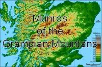
Munros of the Northwest Highlands Mountains
A Munro is a member of one of the world's most famous mountain lists, the Munros (obviously), and in Britain Munro Bagging has become a popular pastime for thousands of walkers and climbers. Basically a Munro is a Scottish mountain which exceeds 3,000 feet (914.4 metres) in height. They are named after Sir Hugh Munro (1856–1919), who in 1891 made the first attempt at an exhaustive catalogue of such hills, known as Munro's Tables. Since then they have undergone numerous revisions, with the most recent revision having taken place in 1997. The current version of the table lists 284 Munro’s and 227 Munro Tops (peaks above 3000ft that are not considered to be separate mountain).
MAP
Munros of the Grampian Mountains
Top 25 Munros:
TABLE
 | Since a top 25 list isn't exactly the best way to fairly represent the scope of what the Grampian Mountains have to offer, a sub-page has been created providing a full list of Munros in the Northwest Highlands. The page has sensibly been called Munros of the Northwest Highlands |
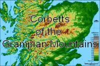
Corbetts of the Northwest Highlands
A Corbett is a Scottish hill between 2500 and 2999 feet high with a drop of at least 500 feet (152.4m) on all sides. The main difference between the Corbetts and the Munros is that the definition of a Corbett is much more clearly defined. Much of today’s definition of Munro’s lies with the opinion of the SMC secretary and members and they have refined the list many times, based upon what they think should and should not be a Munro. With Corbett’s however, the only reason for reclassifying a hill is through a more advanced height measurement.
The list was compiled in the 1920s by John Rooke Corbett, a Bristol-based climber and SMC member, and was published posthumously after it was passed to the SMC by his sister. There are 219 Corbetts, 92 of which are located within the Grampian Mountains area.
MAP
Corbetts of the Grampian Mountains
Top 25 Corbetts:
TABLE
 | Since a top 25 list isn't exactly the best way to fairly represent the scope of what the Northwest Highlands have to offer, a sub-page has been created providing a full list of Corbetts in the Grampian Mountains. The page has sensibly been called Corbetts of the Northwest Highlands |
Geology
Needs some changes but bits can be kept and/or incorpotated.
Simplified Geological Map of Scotland
The Grampian Mountains and their neighbours are the last remnants of what was once one of the world's greatest mountain ranges, and that’s not to say that they’re not great now, just one hell of a lot smaller. The geology of the area is characterised by the Dalradian Supergoup which was produced by intensive metamorphism and deformation arising from 'mountain building', caused by continental collision. Formed during the Precambrian and Cambrian periods between 700 and 600 million (and very possibly as recent as 500 million) years ago (ma), the Dalradian sediments and associated volcanics were originally laid down, or in the case of the volcanics erupted onto, the southern margin of a palaeo-continent known as Laurasia, which is represented today largely by the Precambrian basement rocks of North America, Greenland, the north of Ireland and, of course, the Scottish Highlands.
Laurasia sat on the northern margins of a vast sea known as the Iapetus Ocean, which was created in Late Proterozoic time (1.6 Ga to 0.6 Ga) by the rifting and pulling apart of a large supercontinent known as Rodinia. The opening started sometime around 650 Ma ago and by the beginning of Ordovician (490 to 443 ma), at 510 Ma, the ocean was at its widest, with a possible width of up to 5000 km. On the opposite side lay the supercontinent of Gondwana, consisting of the basements of South America, Africa, India, Australia, East Antarctica and Western Europe (including southern Ireland, England and Wales). A separate continent, Baltica (comprising of what is today Scandinavia and parts of Russia), lay to the north east of Gondwana, separated by an arm of the Iapetus Ocean known as the Tornquist Sea.
During the early Ordovician a micro-continent known as Avalonia (comprising of what today is largely England and Wales), broke away from Gondwana and drifted towards Laurentia. By the late Ordovician, the continental plates of Laurentia, Gondwana and Baltica had started to converge initiating a series of new tectonic and magmatic processes that marked the start of the Caledonian Orogeny. The Dalradian Supergroup underwent deformation and metamorphism as the continental landmasses collided, closing the Iapetus. Geological evidence suggests that Scotland lay on the margin of Laurentia, initially opposite Baltica, while England and Wales lay on the margin of Gondwana/Avalonia, opposite the Newfoundland sector of Laurentia. The terranes were then juxtaposed into their present relative positions by large sinistral (left-lateral) movements on the bounding faults during the later stages of the orogeny. The mid-Ordovician saw the climax of the Caledonian Orogeny in the Scottish Highlands. This ‘Grampian’ Event is particularly well defined in the NE of the Grampian Terrane, where the main deformation episodes and the peak of regional metamorphism are dated by major tholeiitic basic intrusions that were emplaced at around the late Llanvrin time(c. 470 Ma), towards the end of the event. In the central Grampian Highlands and the Northern Highlands Terrane, the comparable event may have been a little later (c. 455 Ma). This continental collision deformed and folded the various sedimentary rocks, which were also metamorphosed, with the recrystalisation of sandstones to quartzites and mudstones to slates. There was also the intrusion of granite magma, derived from the actual partial melting of rocks lower within the crust, where the heat and deformation caused by the continental collision was most intense.

During the early and mid-Silurian (443 to 417 ma) the Iapetus Ocean finally closed along most of its length, with a triangular remnant of oceanic crust around the Laurentia–Baltica–Eastern Avalonia triple junction. This finally disappeared completely by the early Devonian, with the continents welded together along the lines of the Iapetus and Tornquist sutures. The newly formed supercontinent was known as Laurussia. Both the Northern Highlands and the Grampian terranes underwent tectonic uplift during this period, with significant magmatic events occurring on the extreme ‘north-western’ edge of the Northern Highlands. Calc-alkaline magmatism, with subduction-zone characteristics became widespread and voluminous throughout the former Laurentian terranes throughout the Early Devonian period (417 to 354 ma) and large, essentially granitic, plutons (an intrusive igneous rock body that crystallized from a magma below the surface of the Earth) were emplaced at all crustal levels in the Scottish Highland and Eastern Shetland terranes from early Ludlow to early Lochkovian time.
Granitic plutons with lower crustal and mantle characteristics were emplaced at high crustal levels in the Midland Valley Terrane and in the NW part of the Southern Uplands Terrane. High-level granitic plutons and dyke-swarms were emplaced slightly later (Lochkovian to Pragian) in a broad zone that spans the projected position of the Iapetus Suture in the SE part of the Southern Uplands Terrane and in the Lakesman Terrane. Of these, the youngest are those immediately NW of the suture, in the zone in which the Southern Uplands thrust belt was underthrust by Avalonian crust.
The late granitic plutons were emplaced during and immediately following the rapid crustal uplift which produced the Caledonian mountain chain. High-level crustal extension led to local fault-bound intermontane basins in the Grampian Highland and Southern Uplands terranes and the larger basins of the Midland Valley Terrane. Rapid erosion of the newly formed mountains resulted in the deposition of great thicknesses of continental molasse sediments in these basins during the latest Silurian and Early Devonian (the ‘Old Red Sandstone’).

The Caledonian Orogeny
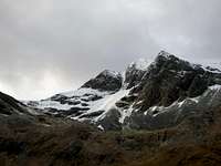
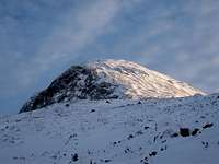
Since the creation of the range, it has been continually eroded by the forces of nature, with the most significant recent events manifesting themselves in the form of the Quaternary era (1.8 Ma – present day) ice ages. During the Late Devensian Glaciation (c. 126 Ka – 15 Ka) the mountains were completely covered by an ice sheet which exceeded 2,000m in height, and was centred over Rannoch Moor and radiated glaciers in all directions. The ice sheet helped carve the glens and lochs that surround the mountains today, affecting almost every aspect of the visual landscape. The sheer volume of water held as ice during this period meant that global sea levels were some 130 m lower than todays and the Scottish glaciers would have outflowed rapidly out over a vast tundra plain stretching far into what is now the Atlantic Ocean. A brief warm period known as the Windermere Interstadial (c. 15 ka – 13.5ka) saw the disappearance of the glaciers and the return of vegetation to the British Isles. Owing to the lingering effects of glacio-isostatic depression many of the glens would have been inundated by the sea, creating a landscape that may be comparable to the fjords of Norway we see today. Evidence for the type of vegetation that existed in northern and central Scotland during this period is slim, as it was not long before the area saw a return to cold conditions with the onset of the Loch Lomond Stadial, known internationally as the Younger Dryas (c. 12.8 to 11.5 ka). An ice sheet re-formed over much of central Scotland, although this time it would not be large enough to cover the summits of the mountains entirety. Valley glaciers occupied the major glens, and were funnelled around the major landmasses out to sea. Cirque glaciers occupied the higher corries, with glaciers forming in locations such as Coire Leis on Ben Nevis, Coire Ardair on Creag Meaghaidh and the Northern Corries of the Caringorms. The mountains bare the scars of these ice ages in their striated and polished rocks, morainal ridges, perched boulders, ‘U’ shaped valleys and weathered cliff faces which are so familiar to hikers and climbers today.
Climate
Needs some changes but bits can be kept and/or incorpotated.Even though the Grampian Mountains occupy a relativity small area in Alpine terms, the nature of the area's climate changes noticeably from west to east. To recognise this fact, the section below has been split between these two regions.
Western Grampians
Due to the stronger maritime influence bough by the prevailing winds blowing from the sea, the climate of the western Grampians is milder than that of the eastern Grampian's. In addition the Gulf stream has a strong influence on the area's temperatures, with annual temperatures in coastal areas in the 9.4 to 9.7 °C range. The annual mean temperature tends to fall towards the south and north parts of the region due to altitude, as well as inland where 8.0 to 9.3 °C is more typical.
The sea reaches its lowest temperature in February or early March so that on average February is the coldest month in most of coastal areas. In February the mean daily minimum temperature varies from about 1.6 °C in most of the islands, 0.7 to 1.6 °C in most of the lowland inland areas to the south, but less than -1.1 °C in parts of the highlands. Ben Nevis (1344 metres) the annual mean is just below 0 °C. Inland, where the influence of the sea is less, January is the coldest month with mean daily minimum temperatures between -3.4 and -0.9 °C.
July and August are the warmest months in the region with mean daily maxima ranging from less than 14.6 °C on the highest ground to more than 18.5 °C in the lowlands to the south. Instances of extreme high temperatures are rare and are associated with hot air brought from mainland Europe on south easterly winds, accompanied by strong sunshine.
December is the dullest month and May or June the sunniest.
Rainfall in the west tends to be associated with Atlantic depressions or with convection. The Atlantic depressions are more vigorous in autumn and winter and most of the rain which falls in those seasons is from this source. However, in autumn and winter the islands and western coastal areas are also prone to convective showers caused by the relatively warm sea. In spring and summer, convection caused by heating of the land can form showers inland in the region.
 Bad Weather! (mountainmanjohn) Bad Weather! (mountainmanjohn) |  Amazing weather! (Photo by daw37) Amazing weather! (Photo by daw37) |  ...it'll do (Photo by Nanuls) ...it'll do (Photo by Nanuls) |
A further factor which greatly affects the rainfall distribution is altitude. Moist air which is forced to ascend hills may be cooled below the dew point to produce cloud and rain. A map of average annual rainfall therefore looks very similar to a topographic map.
Rainfall is generally well-distributed throughout the year but there is a marked seasonal variation. The frequency of Atlantic depressions is normally greatest during the winter but, unlike other areas of the UK, Scotland tends to remain under their influence for much of the summer too. Autumn and early winter are the wettest seasons, especially from October to January, and spring and early summer is normally the driest part of the year, especially from April to June. In the highlands the average annual rainfall is over 4000 mm.
The occurrence of snow is linked closely with temperature, with falls rarely occurring if the temperature is higher than 4 °C. For snow to lie for any length of time then the temperature normally has to be lower than this. Over most of the area, snowfall is normally confined to the months from November to April, but upland areas often have brief falls in October and May. Snow rarely lies at lower levels outside the period December to March.
On average, the number of days with snow falling along the coast varies from less than 10 per winter in the south to 40 in the north, but over 100 days is typical over the highest ground. The number of days with snow lying has a similar distribution, with less than 5 on the coast but over 35 days over the higher ground. On the highest summits, such as Ben Nevis, snow cover typically persists for 6 or 7 months each year. The relatively plentiful supply of snow over the highest ground has led to the development of skiing areas such as Glencoe and the Nevis Range, both near Fort William.
Being close to the Atlantic, the western Grampians are one of the more exposed areas of the UK. The strongest winds are associated with the passage of deep depressions close to or across the UK. The frequency and strength of depressions is greatest in the winter half of the year and this is when mean speeds and gusts are strongest.


A measure of wind exposure is the number of days when gale force is reached. If the wind reaches a mean speed of 34 knots or more over any ten consecutive minutes, then that day is classed as having a gale. Over most inland, sheltered areas of the region the average is around 5 days per year but the coasts, islands and well exposed upland areas have more, with over 25 days with gale in the Hebrides in an average year. Wind speed is sensitive to local topographic effects and land use. Exposed places on coasts and hills will experience stronger wind speeds and more days of gale.
The direction of the wind is defined as the direction from which the wind is blowing. As Atlantic depressions pass by the UK the wind typically starts to blow from the south or south west, but later comes from the west or north-west as the depression moves away. The range of directions between south and north-west accounts for the majority of occasions and the strongest winds nearly always blow from this range of directions. Spring time also tends to have a maximum of winds from the north east, due to the build up of high pressure over Scandinavia at this time of year.
Eastern Grampians
In the east mean annual temperatures vary from about 9 °C close to the Firth of Forth to less than 6 °C over the higher ground of the Grampians. Within the region, significant variations in temperature arise from the combined effects of proximity to the coast, topography and, to a lesser extent, urban development. Temperature shows both a seasonal and a diurnal variation. Minimum temperatures usually occur around sunrise and maximum temperatures are normally 2 to 3 hours after midday.
January is the coldest month, with mean daily minimum temperatures varying from about 1.5 °C in north east coast, to less than -2 °C over the higher ground. Extreme minimum temperatures usually occur in January or February. Examples include the UK record low temperature of -27.2 °C at Braemar on 10 January 1982. This occurred during a severe cold spell across Scotland with some night minima below -15 °C and day maxima below -5 °C on several days. Conversely, to the lee of high ground temperatures can occasionally reach up to 15 °C in winter when a south or SW airstream warms up after crossing upland - an effect known as a fohn wind.
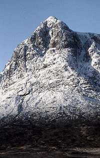
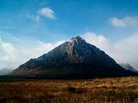 Buachaille Etive Mor (fraser5002) Buachaille Etive Mor (fraser5002) |  Carn Etchachan (Stuart Buchanan) Carn Etchachan (Stuart Buchanan) | 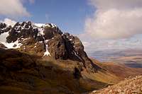 Ben Nevis (ZachStone) Ben Nevis (ZachStone) |
July is the warmest month, with mean daily maximum temperatures at low levels inland approaching 20 °C, the highest in Scotland. Elsewhere in Eastern Scotland the mean maxima are somewhat lower, and are less than 16 °C over the higher ground and along the coast. Extreme maximum temperatures can occur in July or August, and are usually associated with heat-waves.
In line with the western Grampians, December tends to be the dullest month while May or June are usually the sunniest.
Like the western Grampians, rainfall tends to be associated with Atlantic depressions or with convection. Much of Eastern Scotland is sheltered from the rain-bearing westerly winds. This shelter reaches its greatest potential along the coasts of East Lothian, Fife and the Moray Firth and these areas receive less than 700 mm of rainfall in an average year. In contrast, the wettest area is the southern Grampians where the average annual rainfall is over 1500 mm.
On average, the number of days with snow falling is about 20 per winter along the coast but over 100 days over the mountains. The number of days with snow lying has a similar distribution, with less than 10 along the East Lothian coast but over 60 days over the higher ground. The relatively plentiful supply of snow over the highest ground has led to the development of skiing areas such as Cairngorm, the Lecht and Glenshee.
The Eastern Grampians are one of the more windy parts of the UK, being relatively close to the track of Atlantic depressions. The strongest winds are associated with the passage of deep areas of low pressure close to or across the UK. Just as it is in the Western Grampians, the frequency and strength of these depressions is greatest in the winter half of the year, especially from December to February, and this is when mean speeds and gusts (short duration peak values) are high.
 Stob Coire nam Beithe (visentin) Stob Coire nam Beithe (visentin) |  Am Bodach (Tony Simpkins) Am Bodach (Tony Simpkins) |  Stob Coire nan Lochan (Photo by Boydie) Stob Coire nan Lochan (Photo by Boydie) |
Over most inland areas of the region the average number of days where gale force is reached is around 5, but places sheltered to the west experience fewer than this and well exposed upland areas have over 20 days with gale in an average year. The highest wind-recording station in the UK is on Cairngorm (1245 metres) which holds the record for the highest gust (150 knots on 20 March 1986).
Some useful links:
Mountain meteorology of Scotland - A very useful article right here on Summitpost.
Foehn Effect - Another Summitpost article, this time about the Foehn Effect.
Mountain Conditions - Up-to-date weather forecasts and other information for the Grampian Mountains.
Wildlife
Needs some changes but bits can be kept and/or incorpotated.Habitats
 The semi-permanent snow patches on Ben Nevis are an important ecological resource (Photo by daw37)
Due to the geographical morphology of the Grampian Mountains the range is blessed with a remarkable array of natural environments, with habitats extending from beneath the Atlantic into the coastal zone and on through a variety of grassland, bog and woodland types up onto mountain summits of rock, scree and montane heath.
The western part of the range experiences the brunt of the climate, sitting as it does, in the path of the Atlantic weather fronts which pass over the area with unrelenting regularity. This combination of high rainfall, moderate temperatures, and strong westerly's make the western seaboard one of the windiest places in Britain. Further east the oceans influence on climate reduces and the conditions become drier and more ‘continental’ allowing for a completely different set of habitats to exist. On the mountains snow fall is significant; for example snow lies above 800m on Ben Nevis for about five months of the year, and in sheltered north-facing corries and gullies it can last all year round.
The combination of the cool and wet conditions and the generally acidic geology has given rise to a predominance of peaty soils, and there are extensive areas of deep peat at places such as Kentra Moss, Sligachan and Inverasdale. Rannoch Moor is a particularly large and spectacular undulating plateau of deep peat studded with lochs and lochans. These areas support internationally important blanket bog vegetation, such as sphagnum mosses and the Rannoch rush – found only on Rannoch moor – and are home to rare birds such as the greenshank and dunlin.
 Rannoch Moor, Loch Ba and Loch Laidon (Photo by Boydie)
Moorland and upland habitats are widespread throughout the area; this is a mountain range after all. The sub-montane habitats, below about 700m, consist of heather moorland, rough grassland, bog and fern rich communities on some scree slopes. On the mountain summits these habitats merge into montane vegetation represented by low-growing, wind-clipped grasslands, heaths and willow scrub; bare rock and scree is a common feature and cliff ledges provide lush, ungrazed habitats.
The Grampian Mountains contain some of the most extensive patches of late lying snow in Britain and support a wide range of snow-bed plant communities, some of which are amongst the finest of their type, and encompass a number of rare mosses, liverworts, lichens and fungi which are only associated with snow beds. For example the arctic-alpine plant Diapensia lapponica and the montane lichen Nephroma arctica and liverwort Herbertus borealis occur on just one mountain summit each.
In addition to such rare plants and bryophytes, the high tops are also the haunt of rare and distinctive breeding birds such as dotterel, ptarmigan and snow bunting. Here too golden eagles hunt mountain hares, and merlin, red kite and peregrine falcon range extensively over the hill slopes.
A range of native woodland types occur within the area, but it is only a small remnant of the one-time forest cover that blanketed the area. The woods are dominated by birch, oak and Scots pine with alder, ash, hazel and rowan. In the west a number of the woods are particularly important examples of their type, such as the alder-ash wood at Carnach, the Leven Valley birch woods, the Sunart oak woods and the Scots pine at Beinn Eighe, Coille Phuiteachain, and Ardgour.
Uncommon tree-line Alpine willow scrub is well represented in Glencoe and on Ben Nevis and its neighbouring mountains. Associated with the woodlands, especially those of oak, hazel and ash, are internationally important communities of mosses, liverworts and lichens, many of which are affiliated with and/or confined to west Atlantic coasts.
 Rothiemurchus and the Cairngorm Mountains (Photo by Proterra)
In the east the ancient Caledonian pine forests of Strathspey and East Ross are also significant and beautiful components of the area’s biodiversity. They include some of the most important woods in Scotland: Abernethy, Rothiemurchus, Glen Affric and Strathfarrar. Some of Scotland's most well-known wildlife can be found here, including red deer, red squirrel, pine marten, capercaillie, black grouse, Scottish crossbill and a number of rare invertebrates including the chequered skipper butterfly, marsh fritillary butterfly and pearl-bordered fritillary butterfly.
At Creag Fhiaclach in the Cairngorms, the dwarfed 'Krumholtz' (German: bent/twisted) pines, grow to around 640 metres above sea level, and are regarded as Britain's highest natural tree line. In some areas, bog woods have developed; stunted pines, sedges and mosses, although no rare elsewhere in Europe, are common in these places.
The Grampian Mountains are a coastal range and is home to a number of varied coastal environments. In the west the coastline is dominated by rock, much of which is fairly sheltered, and this extends underwater to form extensive sub-marine rocky reefs. The area’s high rainfall creates much run-off which, in sheltered sea lochs, often floats on the surface of the sea water forming a brackish layer up to 12 m deep. The range of substrates in the sea lochs includes gravel, bedrock, sand and mud, creating an array of habitats which in turn support a rich variety of species such as sea pens, brittle stars, prawns, scallops, crabs and horse mussel beds.
In the east the coast is less rocky and more open to long sandy beaches, saltmarsh, machair, mud flats and sand dunes. The inner most part of the Moray Firth is internationally recognised for wintering and migrating waders and wildfowl. Bottlenose dolphins, one of only two resident populations in Britain (the other being in Cardigan Bay in Wales), can be readily seen from many points along the shore.
Coastal grasslands support rare invertebrates such as slender scotch burnet and the New Forest burnet moth, the latter being another species with its sole British population within West Highland Area. Here too otters are widespread, with particularly high densities inhabiting the sea lochs, and both common and grey seals can be seen, though the latter is relatively uncommon.
 Loch Linnhe, a large sea loch in the west of Scotland (Photo by johnloguk)
The sea lochs of the western Grampians harbour some of the deepest underwater cliffs in Scotland, with some plunging down over 100 metres below sea level. The tidal range is also large and at Lochs Duich, Long and Alsh for example, it is 6 metres, one of the largest such ranges in Scotland. The large volumes of water passing over the shallows sills in these, and other, sea lochs, creates the distinctive ‘tidal torrents’ habitat. The Sound of Arisaig is home to yet another unusual sub-tidal habitat: maerl beds. Maerl is a corral-like seaweed which is very slow growing and has a restricted European distribution as it has very specific ecological requirements, which include clear, unpolluted waters. Some of the most sheltered bays are home to a rare floating form of egg-wrack, a seaweed which normally grows attached to rock.
An important feature of the area’s marine environment is that it is at the meeting place of colder, northern currents and the warmer waters of Gulf Stream. Hence there is an interesting mixture of marine species, some of which are at their southern limit and others at their northern limit. As well as a rich and diverse benthic, or sea-bed fauna, the waters are important for fish, with the sea lochs and near shore waters being nursery areas for a number of commercial fish species such as saithe, cod, plaice, sprat and herring. More unusual marine vertebrates around the coast include basking sharks and leatherback turtles.
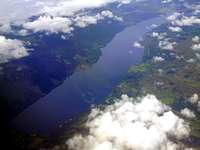 Loch Rannoch in the central Grampians (Photo by daveyboy)
The area’s inland lochs are an elegant and un-ignorable component of the area’s landscape, and are a key element of the area’s ecology. Loch Morar is the deepest freshwater body in Britain, with a maximum depth of 310 metres and an average depth of 87 metres, while Loch Lomond at 71 km2 is Britain’s largest lake in terms of surface area. Loch Ness’ 7.4km3 volume water exceeds that of the all of England and Wales’ inland waters combined. Most of the Area’s lochs are nutrient poor, with characteristic plants such as water lobelia, quill wort and shore weed. The rare pipewort grows in some shallow lochs and lochans and the semi-aquatic pigmy weed is found nowhere else in Britain. Important bird species dependent on the freshwater bodies include black and red-throated divers and common scoter. Arctic charr and brown trout are notable fish species found in these waters.
Much of the ground is frequently waterlogged and there are several thousands of kilometres of streams, rivers and burns. Many of these are high energy systems with steep gradients, small catchments and rapidly fluctuating water levels. In recent years, Atlantic salmon and sea trout numbers in Grampian rivers have decreased markedly. The lower reaches of the river plain benefit from rich soils, a benign climate and a long history of farming. This is arable and stock land. Its fields, woods, rivers, marshes and lochs, provide habitats for many animals and plants. The rivers Tay and Spey are the second and third longest rivers and Scotland, and are home to some of the area’s richest freshwater habitats. The high quality of the Spey water supports internationally important wildlife: freshwater pearl mussel, otter and the little-known sea-lamprey among them.
Fauna
This section lists the species that can be found within the Grampian Mountains area. The information is selected from data held by the National Biodiversity Network, which collates work from throughout the UK. The data is collected and verified by professional conservation officers and ecologists and is the most reliable source of species information in the country.
The absence of a species on any of these lists does not necessarily preclude its presence within the area, but could simply be a reflection of the difficulties posed when surveying in large and remote locations. Neither does the presence of a species on any of these lists necessarily mean that the species is a common or natural habitant of the area. Some migratory and transitional species may only visit the area once every few years and sitings of some species may represent rare events where an animal has somehow become displaced from its usual range.
Terrestrial Mammals
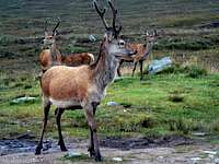
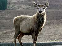
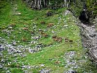
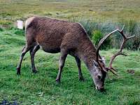
Although the area is home to many types of mammal, the most enigmatic of highland species’ are probably the members of the Cervidae family, and more specifically its red deer stags, often known as the 'Monarch of the Glen'. There’s an estimated 300,000 red deer in Scotland, with the Grampian Mountains housing one of the densest populations. While red deer are resident year round, they tend to spend the summer up in the hills and remote glens, and move down to lower levels in the winter, where food is more readily available. Arguably the best time to see (and hear) them is during the annual rut each autumn.
While the rest of the UK has seen its red squirrel population replaced by the invasive Eastern Grey Squirrel the Grampian Mountains have remained a stronghold for the country’s native species – the red squirrel. They are year round residents, but can be easier to spot in winter when trees are thinner and they seem a little tamer, prioritising the finding of food. The animals are also somewhat more playful in January and February, when courtship takes place.

Another British species now unique to Scotland is the wildcat. By appearance the wildcat resembles a very muscular domestic tabby, the coat is made up of well defined brown and black stripes and usually has a ruffled appearance due to its thickness. The Scottish form is the largest in the wildcat family with males typically between 6-9kg (13-17lb) and females 5-7kg (11-15lb), around 50% larger than the average domestic cat. Like most felines wildcats are solitary and largely nocturnal creatures; resting up in hidden thickets, dens or forests by day and patrolling and hunting up to 10km across open ground populated by prey at night. Males and females come together solely to mate in mid winter and for the rest of their lives the cats are alone. Sadly the animal is critically endangered with only 400 individuals remaining in the wild and barely a handful in the captive breeding population.
Among the area’s other present, but seldom seen mammals, are the members of Mustelidae (weasel) family which include the badger, otter, pine marten, stoat, American mink, polecat, feral ferret and, of course, the weasel itself. Owing to their nocturnal habits they are notoriously hard to spot, however these once widely persecuted animals are becoming increasingly widespread owing to a combination of successful conservation measures, public awareness and the decline of the fur trade.
| Recorded species: |
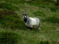
| American Mink (Mustela vison) Bank Vole (Clethrionomys glareolus) Black Rat (Rattus rattus) Brandt's Bat (Myotis brandtii) Brown Hare (Lepus europaeus) Brown Long-eared Bat (Plecotus auritus) Brown Rat (Rattus norvegicus) Chinese Muntjac (Muntiacus reevesi) Common Pipistrelle (Pipistrellus pipistrellus sensu stricto) Daubenton's Bat (Myotis daubentonii) Eastern Grey Squirrel (Sciurus carolinensis) Eurasian Badger (Meles meles) Eurasian Common Shrew (Sorex araneus) Eurasian Pygmy Shrew (Sorex minutus) Eurasian Red Squirrel (Sciurus vulgaris) Eurasian Water Shrew (Neomys fodiens) European Mole (Talpa europaea) European Otter (Lutra lutra) European Rabbit (Oryctolagus cuniculus) European Water Vole (Arvicola terrestris) Fallow Deer (Dama dama) Feral Cat (Felis catus) | Feral Ferret (Mustela furo) Feral Goat (Capra hircus) Feral Sheep (Ovis aries) Field Vole (Microtus agrestis) House Mouse (Mus musculus) Mountain Hare (Lepus timidus) Musk Rat (Ondatra zibethicus) Natterer's Bat (Myotis nattereri) Noctule Bat (Nyctalus noctula) Pine Marten (Martes martes) Polecat (Mustela putorius) Red Deer (Cervus elaphus) Red Fox (Vulpes vulpes) Reindeer (Rangifer tarandus) Roe Deer (Capreolus capreolus) Sika Deer (Cervus nippon) Soprano Pipistrelle (Pipistrellus pygmaeus) Stoat (Mustela erminea) Weasel (Mustela nivalis) West European Hedgehog (Erinaceus europaeus) Wildcat (Felis silvestris) Wood Mouse (Apodemus sylvaticus) |
Birds
Bird life is in abundance, with many orders of bird calling the Grampian Mountains, at the very least, a seasonal home; in Britain a number of which are unique to Scotland if not the Grampian Mountains themselves. The golden eagle is the area’s largest birds and is one of the worlds best known birds of prey with almost all breeding pairs in Britain found in Scotland. They prefer open, treeless areas down to sea level and will take any prey that is available, from small birds to snakes. In Scotland, they prefer hares and grouse, and sometimes rabbits. In coastal areas, they prefer fulmars to gulls. Some have even been spotted attempting to take deer calves.
Other birds of prey include the common buzzard, common kestrel, peregrine falcon, merlin, red kite and osprey. Ospreys an unmistakable large black and white bird, surprised wildlife experts when it returned to breed in Scotland of its own accord in the 1950s after decades of apparent absence. Since its re-established in the area their population has increased in range dramatically and can now be found from the Northwest Highlands to the Tweed Valley. Prime viewing locations include Loch Garten in the Cairngorms National Park. The population currently stands at around 200 pairs. In winter the bird migrates to western Africa and tends to arrive back at their nest sites in Scotland in April, just in time to lay their eggs. They remain here throughout late spring and summer, returning south to their wintering grounds in mid September.
The area is home to a number of grouse, none more distinctive than the Capercaillie. The birds spend a lot of time feeding on the ground, but may also be found in trees, feeding on shoots. They are a localised breeding species, unique to the Grampian Mountains, are found in Scottish native pinewood, a rare and vulnerable habitat, and in commercial conifer plantations. Unfortunately the UK population of capercaillie has declined so rapidly in recent years that it is at very real risk of extinction. In summer, is a mixture of grey, brown and black above with white bellies and wings. Because of their preference of thick woodland habitats the birds are rarely seen, however for an increased chance of spotting them, Abernethy Forest and Loch Garten reserves have hides which the birds occasionally frequent.


The ptarmigan is another distinctive member of the grouse family, and in Britain is also unique to Scotland. A plump little bird, in winter it becomes totally white except for its tail and eye-patch, which remain black. It breeds in the highest mountains of Scotland having a preference for the Arctic like landscapes that exist there. Birds are residents, seldom moving far from breeding sites. In severe cold weather, birds may move from the highest ground to the edge of forests. The Cairngorm Plateau and the glens that surround it are an ideal place to spot this little bird.
Due to the Grampian’s coastal locations sea birds enrich the areas otherwise largely land based bird communities. With its colourful and almost comical appearance the puffin is a particularly distinctive bird. Each year, nearly a million of these birds appear from the open ocean to take up residence in their burrows around the area’s coast. Feeding mainly on sandeels, puffins waste no time in laying their eggs and rearing their young before disappearing back to sea again. They start congregating in the waters around their breeding sites in April, and generally lay their eggs during May. Throughout June and early July, the birds are very active flying to and from their burrows with food for the chicks.
| Recorded species: |
| Arctic Skua (Stercorarius parasiticus) Arctic Tern (Sterna paradisaea) Atlantic Puffin (Fratercula arctica) Balearic Shearwater (Puffinus mauretanicus) Bar-headed Goose (Anser indicus) Bar-tailed Godwit (Limosa lapponica) Barn Owl (Tyto alba) Barn Swallow (Hirundo rustica) Barnacle Goose (Branta leucopsis) Barred Warbler (Sylvia nisoria) Bean Goose (Anser fabalis) Black Grouse (Tetrao tetrix) Black-billed Magpie (Pica pica) Black Guillemot (Cepphus grylle) Black-headed Gull (Larus ridibundus) Black Kite (Milvus migrans) Black-legged Kittiwake (Rissa tridactyla) Black Redstart (Phoenicurus ochruros) Black Stork (Ciconia nigra) Black Swan (Cygnus atratus) Black-tailed Godwit (Limosa limosa) Black Tern (Chlidonias niger) Black-throated Diver (Gavia arctica) Blackcap (Sylvia atricapilla) Blue Tit (Cyanistes caeruleus) Bluethroat (Luscinia svecica) Bohemian Waxwing (Bombycilla garrulus) Brambling (Fringilla montifringilla) Brent Goose (Branta bernicla) Carrion Crow (Corvus corone) Chaffinch (Fringilla coelebs) Coal Tit (Periparus ater) Common Blackbird (Turdus merula) Common Bullfinch (Pyrrhula pyrrhula) Common Buzzard (Buteo buteo) Common Chiffchaff (Phylloscopus collybita) Common Coot (Fulica atra) Common Crane (Grus grus) Common Crossbill (Loxia curvirostra) Common Cuckoo (Cuculus canorus) Common Eider (Somateria mollissima) Common Goldeneye (Bucephala clangula) Common Grasshopper Warbler (Locustella naevia) Common Greenshank (Tringa nebularia) Common Guillemot (Uria aalge) Common Kestrel (Falco tinnunculus) Common Kingfisher (Alcedo atthis) Common Linnet (Carduelis cannabina) Common Moorhen (Gallinula chloropus) Common Nightingale (Luscinia megarhynchos) Common Pheasant (Phasianus colchicus) Common Pochard (Aythya ferina) Common Quail (Coturnix coturnix) Common Raven (Corvus corax) Common Redpoll (Carduelis flammea) Common Redshank (Tringa totanus) Common Redstart (Phoenicurus phoenicurus) Common Rosefinch (Carpodacus erythrinus) Common Sandpiper (Actitis hypoleucos) Common Scoter (Melanitta nigra) Common Shelduck (Tadorna tadorna) Common Snipe (Gallinago gallinago) Common Starling (Sturnus vulgaris) Common Swift (Apus apus) Common Tern (Sterna hirundo) Common Whitethroat (Sylvia communis) Common Wood Pigeon (Columba palumbus) Corn Bunting (Emberiza calandra) Corn Crake (Crex crex) Cory's Shearwater (Calonectris diomedea) Crested Tit (Lophophanes cristatus) Curlew Sandpiper (Calidris ferruginea) Dark-bellied Brent Goose (Branta bernicla subsp. bernicla) Dunlin (Calidris alpina) Eurasian Collared Dove (Streptopelia decaocto) Eurasian Curlew (Numenius arquata) Eurasian Dotterel (Charadrius morinellus) Eurasian Jackdaw (Corvus monedula) Eurasian Jay (Garrulus glandarius) Eurasian Marsh Harrier (Circus aeruginosus) Eurasian Oystercatcher (Haematopus ostralegus) Eurasian Reed Warbler (Acrocephalus scirpaceus) Eurasian Siskin (Carduelis spinus) Eurasian Sparrowhawk (Accipiter nisus) Eurasian Teal (Anas crecca) Eurasian Tree Sparrow (Passer montanus) Eurasian Treecreeper (Certhia familiaris) Eurasian Wigeon (Anas penelope) Eurasian Woodcock (Scolopax rusticola) Eurasian Wryneck (Jynx torquilla) European Bee-eater (Merops apiaster) European Golden Plover (Pluvialis apricaria) European Goldfinch (Carduelis carduelis) European Greenfinch (Carduelis chloris) European Honey-buzzard (Pernis apivorus) European Nightjar (Caprimulgus europaeus) European Robin (Erithacus rubecula) European Shag (Phalacrocorax aristotelis) European Storm-petrel (Hydrobates pelagicus) European Turtle Dove (Streptopelia turtur) European White-fronted Goose (Anser albifrons subsp. albifrons) Fieldfare (Turdus pilaris) Gadwall (Anas strepera) Garden Warbler (Sylvia borin) Garganey (Anas querquedula) Glaucous Gull (Larus hyperboreus) Goldcrest (Regulus regulus) Golden Eagle (Aquila chrysaetos) Goosander (Mergus merganser) Great Bittern (Botaurus stellaris) Great Black-backed Gull (Larus marinus) Great Cormorant (Phalacrocorax carbo) Great Crested Grebe (Podiceps cristatus) Great Egret (Ardea alba) Great Grey Shrike (Lanius excubitor) Great Northern Diver (Gavia immer) Great Skua (Stercorarius skua) Great Spotted Woodpecker (Dendrocopos major) Great Tit (Parus major) Greater Canada Goose (Branta canadensis) Greater Scaup (Aythya marila) Greater White-fronted Goose (Anser albifrons) Green Sandpiper (Tringa ochropus) Green Woodpecker (Picus viridis) Green-winged Teal (Anas carolinensis) Greenland White-fronted Goose (Anser albifrons subsp. flavirostris) Grey Heron (Ardea cinerea) | Grey Partridge (Perdix perdix) Grey Phalarope (Phalaropus fulicarius) Grey Plover (Pluvialis squatarola) Grey Wagtail (Motacilla cinerea) Greylag Goose (Anser anser) Gull-billed Tern (Gelochelidon nilotica) Hawfinch (Coccothraustes coccothraustes) Hedge Accentor (Prunella modularis) Hen Harrier (Circus cyaneus) Herring Gull (Larus argentatus) Hooded Crow (Corvus cornix) Hoopoe (Upupa epops) Horned Lark (Eremophila alpestris) House Martin (Delichon urbicum) House Sparrow (Passer domesticus) Iceland Gull (Larus glaucoides) Icterine Warbler (Hippolais icterina) Jack Snipe (Lymnocryptes minimus) Lapland Longspur (Calcarius lapponicus) Leach's Storm-petrel (Oceanodroma leucorhoa) Lesser Black-backed Gull (Larus fuscus) Lesser Redpoll (Carduelis cabaret) Lesser Scaup (Aythya affinis) Lesser Whitethroat (Sylvia curruca) Little Auk (Alle alle) Little Grebe (Tachybaptus ruficollis) Little Gull (Larus minutus) Little Plover (Charadrius dubius) Little Stint (Calidris minuta) Little Tern (Sternula albifrons) Long-billed Dowitcher (Limnodromus scolopaceus) Long-eared Owl (Asio otus) Long-tailed Duck (Clangula hyemalis) Long-tailed Skua (Stercorarius longicaudus) Long-tailed Tit (Aegithalos caudatus) Mallard (Anas platyrhynchos) Mandarin Duck (Aix galericulata) Manx Shearwater (Puffinus puffinus) Meadow Pipit (Anthus pratensis) Mealy Redpoll (Carduelis flammea subsp. flammea) Merlin (Falco columbarius) Mew Gull (Larus canus) Mistle Thrush (Turdus viscivorus) Montagu's Harrier (Circus pygargus) Mute Swan (Cygnus olor) Northern Fulmar (Fulmarus glacialis) Northern Gannet (Morus bassanus) Northern Goshawk (Accipiter gentilis) Northern Lapwing (Vanellus vanellus) Northern Pintail (Anas acuta) Northern Shoveler (Anas clypeata) Northern Wheatear (Oenanthe oenanthe) Osprey (Pandion haliaetus) Paddyfield Warbler (Acrocephalus agricola) Pallas's Leaf Warbler (Phylloscopus proregulus) Parrot Crossbill (Loxia pytyopsittacus) Peregrine Falcon (Falco peregrinus) Pied Flycatcher (Ficedula hypoleuca) Pied Wagtail (Motacilla alba subsp. yarrellii) Pink-footed Goose (Anser brachyrhynchus) Pomarine Skua (Stercorarius pomarinus) Purple Sandpiper (Calidris maritima) Razorbill (Alca torda) Red Grouse (Lagopus lagopus) Red Kite (Milvus milvus) Red Knot (Calidris canutus) Red-breasted Merganser (Mergus serrator) Red-legged Partridge (Alectoris rufa) Red-necked Grebe (Podiceps grisegena) Red-throated Diver (Gavia stellata) Redwing (Turdus iliacus) Reed Bunting (Emberiza schoeniclus) Ring Ouzel (Turdus torquatus) Ring-billed Gull (Larus delawarensis) Ringed Plover (Charadrius hiaticula) Rock Pigeon (Columba livia) Rock Pipit (Anthus petrosus) Rock Ptarmigan (Lagopus muta) Rook (Corvus frugilegus) Rosy Starling (Sturnus roseus) Ruddy Duck (Oxyura jamaicensis) Ruddy Turnstone (Arenaria interpres) Ruff (Philomachus pugnax) Sabine's Gull (Larus sabini) Sand Martin (Riparia riparia) Sanderling (Calidris alba) Sandwich Tern (Sterna sandvicensis) Scottish Crossbill (Loxia scotica) Sedge Warbler (Acrocephalus schoenobaenus) Short-eared Owl (Asio flammeus) Sky Lark (Alauda arvensis) Slavonian Grebe (Podiceps auritus) Smew (Mergellus albellus) Snow Bunting (Plectrophenax nivalis) Snow Goose (Anser caerulescens) Snowy Owl (Bubo scandiaca) Song Thrush (Turdus philomelos) Sooty Shearwater (Puffinus griseus) Spotted Crake (Porzana porzana) Spotted Flycatcher (Muscicapa striata) Spotted Redshank (Tringa erythropus) Stock Pigeon (Columba oenas) Stonechat (Saxicola torquata) Surf Scoter (Melanitta perspicillata) Tawny Owl (Strix aluco) Tree Pipit (Anthus trivialis) Tufted Duck (Aythya fuligula) Twite (Carduelis flavirostris) Two-barred Crossbill (Loxia leucoptera) Velvet Scoter (Melanitta fusca) Water Rail (Rallus aquaticus) Western Capercaillie (Tetrao urogallus) Whimbrel (Numenius phaeopus) Whinchat (Saxicola rubetra) White Wagtail (Motacilla alba subsp. alba) White-tailed Eagle (Haliaeetus albicilla) White-throated Dipper (Cinclus cinclus) White/Pied Wagtail (Motacilla alba) Whooper Swan (Cygnus cygnus) Willow Ptarmigan (Lagopus lagopus) Willow Warbler (Phylloscopus trochilus) Winter Wren (Troglodytes troglodytes) Wood Sandpiper (Tringa glareola) Wood Warbler (Phylloscopus sibilatrix) Woodchat Shrike (Lanius senator) Yellow Wagtail (Motacilla flava) Yellow-billed Diver (Gavia adamsii) Yellowhammer (Emberiza citrinella) |
Reptiles
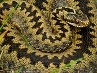 Adder (Vipera berus) (Photo by daveyboy)
Reptiles are quite rare in Scotland in general, the climate generally being unfavourable towards cold-blooded animals - Adder (Vipera berus), grass snake (Natrix natrix), common lizard (Zootoca vivipara) and slow-worm (Anguis fragilis) are the most widespread. Adders were once much more common that they are today but unfortunately, perhaps because of their venomous bite, they have been persecuted almost everywhere in Britain and their numbers are now much smaller. Nowadays adders are generally confined to the drier valley floors and coastal plain, however they can sometimes be found in peat bogs or on wet patches of sphagnum moss. Grass-snakes do better, their preference for damp, even watery habitats make them naturally suited to the region. Among the area’s more unusual visitors are leathery turtle (Dermochelys coriacea), loggerhead turtle (Caretta caretta), green turtle (Chelonia mydas) and Kemp's Ridley (Lepidochelys kempii) which have all been recorded along the western coast.
| Recorded species: |
| Adder (Vipera berus) Common Lizard (Zootoca vivipara) Grass Snake (Natrix natrix) Green Turtle (Chelonia mydas) | Kemp's Ridley (Lepidochelys kempii) Leathery Turtle (Dermochelys coriacea) Loggerhead Turtle (Caretta caretta) Slow-worm (Anguis fragilis) |
Amphibians
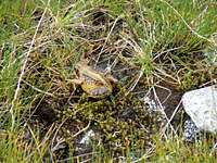 Common Frog (Rana temporaria) (Photo by Boydie)
Amphibians are relatively few with common frog (Rana temporaria), common toad (Bufo bufo) and palmate newt (Triturus helveticus) being the most common. The common frog can live at some surprisingly high altitudes, sometimes breeding in the highest ponds or peat bogs, even when snow is on the ground and the water partially iced-over. Because of the low temperatures and poor feeding environments some of these higher pools offer, tadpoles can be extremely slow to develop, sometimes taking a year to grow to the size of normal tadpoles. The common toad on the other had prefers the damp and shady ponds of the area’s valleys, and is rarely found on the high ground. Palmate newt is the only species of newt found throughout the area, although great crested newt (Triturus cristatus) and smooth newt (Triturus vulgaris) can be found locally.
| Recorded species: |
| Common Frog (Rana temporaria) Common Toad (Bufo bufo) Great Crested Newt (Triturus cristatus) | Palmate Newt (Lissotriton helveticus) Smooth Newt (Lissotriton vulgaris) |
Bony Fish
Scotland has long been known by anglers for its range of fish, and in particular its Atlantic Salmon, which are abundant in many of its rivers. The salmon begin their lives in fresh water as an egg, an alevin, a fry and finally a parr before making their way towards the ocean as a smolt where they will feed up and grow to full size. The young salmon may spend up to four years at sea before returning to the river where it hatched. However, for a variety of reasons many young salmon never make it back. Those that do return to the river require clean water and a gravel bed to ensure successful breeding, which can be found in such rivers as the Tay and Spey. The species is at its most spectacular when fighting its way upstream to spawn, leaping over both natural and man made obstacles. One of the best places to spot them is the specially constructed Pitlochry Fish Ladder in Perthshire, which allows the fish to continue to their ancient spawning grounds which would otherwise be blocked by the Pitlochry Hydro Electric Dam which was constructed in the 1940s.
| Recorded species: |
| Allis Shad (Alosa alosa) Anglerfish or Monkfish (Lophius piscatorius) Arctic Charr (Salvelinus alpinus) Atlantic Salmon (Salmo salar) Ballan wrasse (Labrus bergylta) Bib (Trisopterus luscus) Black goby (Gobius niger) Brill (Scophthalmus rhombus) Brook Charr (Salvelinus fontinalis) Brown Trout (Salmo trutta subsp. fario) Brown/Sea Trout (Salmo trutta) Bull rout (Myoxocephalus scorpius) Butterfish (Pholis gunnellus) Chub (Leuciscus cephalus) Coalfish (Pollachius virens) Cod (Gadus morhua) Common Bream (Abramis brama) Common Carp (Cyprinus carpio) Common dragonet (Callionymus lyra) Common Goby (Pomatoschistus microps) Common Sturgeon (Acipenser sturio) Conger eel (Conger conger) Corkwing (Crenilabrus melops) Crucian Carp (Carassius carassius) Cuckoo wrasse (Labrus mixtus) Dace (Leuciscus leuciscus) Eckstrom's Topknot (Zeugopterus regius) European Eel (Anguilla anguilla) | Fifteen-spined stickleback (Spinachia spinachia) Five-bearded rockling (Ciliata mustela) Flounder (Platichthys flesus) Fries's Goby (Lesueurigobius friesii) Goldsinny (Ctenolabrus rupestris) Grass Carp (Ctenopharyngodon idellus) Grayling (Thymallus thymallus) Greater pipefish (Syngnathus acus) Greater sand-eel (Hyperoplus lanceolatus) Grey gurnard (Eutrigla gurnardus) Grey Trigger-fish (Balistes carolinensis) Herring (Clupea harengus) Lesser Sand Eel (Ammodytes tobianus) Minnow (Phoxinus phoxinus) Orfe (Leuciscus idus) Perch (Perca fluviatilis) Pike (Esox lucius) Rainbow Trout (Oncorhynchus mykiss) Roach (Rutilus rutilus) Rudd (Scardinius erythrophthalmus) Sea Bass (Dicentrarchus labrax) Sea Trout (Salmo trutta subsp. trutta) Smelt (Osmerus eperlanus) Stone Loach (Barbatula barbatula) Tench (Tinca tinca) Thick-lipped Mullet (Chelon labrosus) Three-spined Stickleback (Gasterosteus aculeatus) |
 Minke Whale (Balaenoptera acutorostrata) - It's not a fish but we needed a picture of some sort of sea dwelling animal (Photo by munroitis)
Cartilaginous Fish
The waters and sea lochs around the Grampian coast are home to, and visited by, a number of cartilaginous fish i.e. jawed fish with paired fins, paired nostrils, scales, two-chambered hearts, and skeletons made of cartilage rather than bone. In the summer months basking sharks often frequent the area and are often seen close to land and enclosed bays, usually swimming slowly close to the surface with its huge fin (up to two metres high) breaking the water. The species is one of the world’s largest fish, second only to the whale shark, and will often grow as much as 11 metres in length and can weigh up to 7 tonnes. As it swims it opens its mouth, which is itself over one metre wide, allowing hundreds of litres of seawater to flow out through its widely-stretched gills, which are in turn used trap all kinds of plankton.
| Recorded species: |
| Basking Shark (Cetorhinus maximus) Catsharks (Scyliorhinidae) Dogfish (Scyliorhinus canicula) | Mackerel sharks (Lamnidae) Skate (Dipturus batis) Smooth Hound (Mustelus mustelus) |
Jawless Fish
Jawless fish are an unusual order and are not always considered to be true fish because of their vastly different morphology and physiology. In the Grampian Mountains lamprey are the most abundant with three species present in its rivers and lochs. Lamprey have toothed, funnel-like sucking mouth which are used by some species to bore into the flesh of other fish to suck their blood. The river lamprey is one such parasitic species and can be found only in western Europe, with a range from southern Norway to the western Mediterranean. It occurs in many UK rivers and although there is one landlocked population in Scotland it normally migrates between salt and fresh water, growing to maturity in estuaries and then moving into clean rivers and streams to spawn then die. The larvae spend several years in silt beds, feeding off mainly microorganisms, before metamorphosing and migrating downstream to estuaries where they spend a further 1-2 years feeding on a variety of estuarine fish, particularly herring, sprat and flounder. Although the river lamprey is a parasitic species there is no evidence that it is a threat to any fishery. Indeed, it is beneficial to the ecology of rivers, both in helping to stabilise and aerate silt beds and in providing food for a range of other wildlife, especially riverine birds and mammals.
| Recorded species: |
| Brook Lamprey (Lampetra planeri) Hagfish (Myxine glutinosa) | River Lamprey (Lampetra fluviatilis) Sea Lamprey (Petromyzon marinus) |
Marine Mammals

Grey Seal (Halichoerus grypus) (Photo by Nanuls)
The Moray Firth is also host to the most northerly population of bottlenose dolphin in the world, with between 100 and 250 individuals frequenting the Firth. It is one of only two resident populations in the UK (the other being Cardigan Bay in West Wales). Although bottlenose dolphins are numerous locally, the harbour porpoise is the most common cetacean in Scottish waters, and can be found almost everywhere along the coast. It may be found anywhere there are shallow seas but particularly around the Hebrides and Northern Isles.
A number of whales occasionally frequent the area, the most common being the minke whale. The whales are largely dark in colour with white or pinkish undersides and have pointed heads. Their body length averages 7 to 10 metres and they weigh in at up to 10 tonnes. They are one of the few whales still commercially hunted, though not in Scottish waters. One of the more unusual visitors to the area is the distinctively coloured orca, or killer whale, which are one of the most widespread mammals on Earth. Male orcas can grow between 7-8m and weigh over 5,000kg while females grow between 5-7m and weigh over 3,000kg. They have a huge dorsal fin - 1.8m (6ft) high. Orcas are the top predators in the ocean, with a hugely varied diet, and count the seals which swim off the Grampian coast among their prey. Like the other marine mammals they are highly social animals and live in groups called pods.
| Recorded species: |
| Atlantic White-sided Dolphin (Lagenorhynchus acutus) Bearded Seal (Erignathus barbatus) Bottle-nosed Dolphin (Tursiops truncatus) Common Dolphin (Delphinus delphis) Common Porpoise (Phocoena phocoena) Common Seal (Phoca vitulina) Grey Seal (Halichoerus grypus) Humpback Whale (Megaptera novaeangliae) | Killer Whale (Orcinus orca) Minke Whale (Balaenoptera acutorostrata) Risso's Dolphin (Grampus griseus) Sei Whale (Balaenoptera borealis) Sowerby's Beaked Whale (Mesoplodon bidens) Sperm Whale (Physeter catodon) White-beaked Dolphin (Lagenorhynchus albirostris) |
Invertebrates
I don’t know how many of the 14,000 or so species of invertebrate recorded in Scotland can be found in the Grampian Mountains and to attempt to list them all would seem somewhat foolhardy since the most of this page’s readers will be interested in climbing the area’s mountains, and not rummaging under its rocks and heather in search of insects and molluscs. So to keep things brief and manageable this section will only list those priority species with Action Plans (within the UK, their populations occur entirely or mostly in Scotland).


| Recorded species: |
| Hymenoptera (ants and bees) Scottish Wood Ant (Formica aquilonia) Narrow-headed wood ant (Formica exsecta) Great yellow bumblebee (Bombus distinguendus) The mason bee (Osmia inermis) The mason bee (Osmia uncinata) The northern Colletes (Colletes floralis) Lepidoptera (butterflies and moths) Chequered Skipper (Carterocephalus palaemon) Dark-bordered beauty (Epione parallelaria) Netted mountain moth (Semiothisa carbonaria) Sword-grass moth (Xylena exsoleta) Slender Scotch burnet (Zygaena loti scotica) New Forest burnet (Zygaena viciae argyllensis) | Diptera (flies) The hoverfly (Blera fallax) The hoverfly (Hammerschmidtia ferruginea) The cranefly(Lipsothrix ecucullata) The stiletto fly (Spiriverpa lunulata) Coleoptera (beetles) The reed beetle (Donacia aquatica) Plecoptera (stoneflies) The stonefly (Brachyptera putata) Mollusca (snails) Round-mouthed whorl snail (Vertigo genesii) |
Nature Conservation
Needs some changes but bits can be kept and/or incorpotated.The UK has a responsibility to ensure the conservation and enhancement of habitats and species in both a national and international context. One approach to achieving this is the establishment of a system of protected sites. The national suites of sites providing statutory protection for flora, fauna, or geological or physiographical features are Sites of Special Scientific Interest (SSSIs) (Areas of Special Scientific Interest (ASSIs) in Northern Ireland) and Marine Nature Reserves (MNRs). As well as underpinning other national designations (such as National Nature Reserves), this system also provides statutory protection for terrestrial and coastal sites which are important within Europe (Natura 2000 network) and globally (such as Wetlands of International Importance). Further designations exist for sites outside of the national suite (such as Local Nature Reserves), varying in the level of protection afforded. Apart from designations for sites with particular natural features, there are also landscape designations which aim to protect areas of either national (e.g. Areas of Outstanding Natural Beauty) or international (e.g. natural World Heritage Sites) significance in terms of their outstanding scenic importance.
Because the Grampian Mountains have such a rich natural heritage and wide variety of habitats much of its landscape is protected by both national and international legislation. There are over 500 Sites of Special Scientific Interest (SSSI) within, and in close proximity to, the area's boundary as defined on this page. An SSSI is a conservation designation denoting a protected area within the UK, and may be designated for a wide number of reasons based on their merits as areas of scientific interest. Sites may be notified due to their biological or geological interest and a minority of sites are notified for both. SSSIs are the basic 'building block' of nature conservation legislation and most other legal nature/geological conservation designations are based upon them, including National Nature Reserves, Ramsar Sites, Special Protection Areas, and Special Areas of Conservation.
The Grampian Mountains also has around 20 National Nature Reserves (NNR), which are in effect the next line of protection for nationally important environmental areas. NNRs are usually designated for their broader ecological value rather than for the presence of any rare species. There are however a number of sites which hold important numbers of scarce or rare species. A number of factors may contribute to the designation of a NNR. These may include; how fragile a site is, the size of the site, how 'natural' the site is and the presence of species rich communities. The NNR network represents almost every kind of vegetation type found in the UK.
There is also a large number of sites protected under international law. Special Areas of Conservation and Special Protection Areas are part of the Natura 2000 Networks of sites and are therefore strictly protected under European law. Special Areas of Conservation (SACs) are strictly protected sites designated under the EC Habitats Directive. Article 3 of the Habitats Directive requires the establishment of a European network of important high-quality conservation sites that will make a significant contribution to conserving the 189 habitat types and 788 species identified in Annexes I and II of the Directive (as amended). The listed habitat types and species are those considered to be most in need of conservation at a European level (excluding birds). Of the Annex I habitat types, 78 are believed to occur in the UK. Of the Annex II species, 43 are native to, and normally resident in, the UK.
Special Protection Areas (SPAs) are strictly protected sites classified in accordance with Article 4 of the EC Directive on the conservation of wild birds (79/409/EEC), also known as the Birds Directive, which came into force in April 1979. They are classified for rare and vulnerable birds, listed in Annex I to the Birds Directive, and for regularly occurring migratory species. In the UK, the first SPAs were identified and classified in the early to mid 1980s. Classification has since progressed and a regularly updated UK SPA Summary Table provides an overview of both the number of classified SPAs and those approved by Government that are currently in the process of being classified (these are known as potential SPAs, or pSPAs).

Lairig Ghru, Glen Geusachan and Bod an Deamhain (Devil's Point) (Photo by Nanuls)
Some of the Grampian Mountain's best examples of wetland areas have also been listed as Ramsar sites; a type of protection especially designed for wetlands of international importance designated under the Ramsar Convention. Sites proposed for selection are advised by the UK statutory nature conservation agencies, or the relevant administration in the case of Overseas Territories and Crown Dependencies, co-ordinated through the Joint Nature Conservation Committee (JNCC). In selecting sites, the relevant authorities are guided by the Criteria set out in the Convention. The UK also has a national Ramsar Committee composed of experts who provide further advice.
Special Areas of Conservation
There are XXX SACs in the Northwest Highlands, some of which cross over the boundary and into neighbouring regions. Combined they cover an area of XXX ha (just over XXX square km) and cover a variety of environments from marine mudflats to mountain summits.
MAP
Hover your mouse cursor over the map to highlight the Highland SACs
TABLE
Special Protection Areas
The Northwest Highlands have XXX SPAs which cover an area of XXX ha (nearly XXX square km).
MAP
Hover your mouse cursor over the map to highlight the Highland SPAs
TABLE
Ramsar Sites
Several of the Nighland's wetland sites (which also fall within SACs) are also of enough importance to be listed as Ramsar sites. The 16 sites cover a total area of XXX ha (over XXX square km).
MAP
Hover your mouse cursor over the map to highlight the highland Ramsar Sites
TABLE
Shooting Season
Needs some changes but bits can be kept and/or incorpotated.There are two main shooting seasons that take place in Scotland. These are the grouse and deer shooting seasons. Both are vital parts of the Scottish economy and it is important to ensure little or no disturbance to these events while you are on the hills.
Deer Stalking
Deer stalking is the term used in Scotland to describe deer hunting. Due to the large numbers of deer it is necessary to cull sections of the deer during the year in order to control their over population. This activity also ensures the preservation of certain plant life within Scotland and contributes to the local economies in the areas that this takes place.
The stag stalking season runs from the 1st of July until the 20th of October. The deer hind season runs from the 21st of October until the 15th of February. The majority of estates however, have the peak times of their stalking activities between the months of August and October.
When on the hills during these times walkers can help to avoid disturbing the deer by:
- Checking with the estate or appropriate Hillphone service.
- Find out about stalking activities before you go.
- On the day, follow any advice on locally posted signs about preferred routes.
- Keep to established tracks where they exist.
- On the hill, keep to the ridges and avoid cutting through corries especially when descending as this will disturb the deer less.
It should be noted that no deer stalking takes place on Sundays.
In order to enable hill walkers and climbers to plan routes that skirt around the main routes used for planned deer stalking activities, the following website provides detailed information and contact numbers; Hill Phones
The following links are from the Hill Phones website and cover the following areas and mountains;
Southern Northwest Highlands
1. Invercauld
The main peaks affected: Ben Avon and Beinn a’Bhuird
2. Callater & Clunie
The main peaks affected: Carn an t-Sagairt Mor and Carn an Tuirc
3. Balmoral / Lochnager and Glen Clova
The main peaks affected: Lochnagar, White Mounth, Broad Cairn and Tom Buidhe
4. Glen Shee
The main peaks affected: Carn a’Gheoidh and Creag Leacach
5. Fealar
The main peaks affected: Carn an Righ and Beinn Iutharn Mhor
6. Atholl & Lude
The main peaks affected: Beinn a’Ghlo and Beinn Dearg
Central Northwest Highlands
1. Corrour
The main peaks affected: Beinn na Lap, Sgor Gaibhre and Leum Uilleim
2. Glen Dochart/Glen Lochay
The main peaks affected: Meall Glas and Sgiath Chuil
3. Balquhidder
The main peaks affected: Beinn a’Chroin, Stob a’Choin and Beinn Chabhair
Northern Northwest Highlands
1. Grey Corries/Mamore
The main peaks affected: Sgurr Eilde Mor and Stob Coire Easain
2. Glen Fyne/Glen Falloch
The main peaks affected: Beinn Bhuidhe and Ben Vane
Grouse Shooting
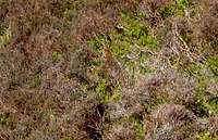 Can you spot him? (Photo by mountainmanjohn)
Every year on the 12th of August, or as it is more commonly known the 'Glorious Twelfth', the grouse shooting season kicks off and runs right through until the 10th of December. Shooters travel from all over the world to participate in this activity and it is estimated that this contributes to the estimated 240 million pounds that Grouse shooting brings to the Scottish economy. The grouse live naturally, in abundance, among the heather clad slopes of the Grampian mountains. It is not only grouse that can be shot, there is also the chance of shooting other wild birds such as ptarmigan or pheasants.
The British Association for Shooting and Conservation (BASC) provides detailed information on grouse shooting and all shooting related activities in the UK.
Basic Guide to Gaelic
Just change the photos and this section can be keptGaelic is a very rich language topographically, and this basic guide to some of its elements should hopefully provide useful information that will assist in understanding how/why the mountains in Scotland are derived and to enrich your knowledge of the local environment. It should be noted that in Gaelic a describing word would be placed at the end of a mountain name; i.e. Sgorr (peak) Dhearg (red), Sgorr Dhearg translated is Red Peak. This would read in English as Peak Red.
For a full detail of Gaelic mountain pronunciations I recommend the following book;
• Scottish Hill and Mountain Names by Peter Drummond.
Glossary
 Sgurr an lubhair (Photo by Nanuls) Sgurr an lubhair (Photo by Nanuls) Coire nan Lochan (Photo by Boydie) Coire nan Lochan (Photo by Boydie) Stob Coire nan Lochan (Photo by Jans Man) Stob Coire nan Lochan (Photo by Jans Man) Ben Nevis (Photo by markradford) Ben Nevis (Photo by markradford) Gully Number 3 Buttress (Photo by BigLee) Gully Number 3 Buttress (Photo by BigLee) Meall Corranaich (Photo by Boydie) Meall Corranaich (Photo by Boydie) Stob Coire Sgreamhach (Photo by Phil McLean) Stob Coire Sgreamhach (Photo by Phil McLean) |
|  Buachaille Etive Mor (Photo by isai) Buachaille Etive Mor (Photo by isai) Point Five Gulley (Photo by waldo) Point Five Gulley (Photo by waldo) Aladdin's Mirror (Photo by Dan Bailey) Aladdin's Mirror (Photo by Dan Bailey) The Cobbler (Photo by Boydie) The Cobbler (Photo by Boydie) An Steall (Photo by Nanuls) An Steall (Photo by Nanuls) Coire nan Lochan (Photo by Proterra) Coire nan Lochan (Photo by Proterra)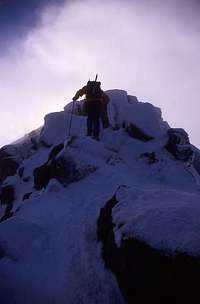 Ben Cruchan (Photo by marsco) Ben Cruchan (Photo by marsco) |
Mountain Conditions
Needs some changes but bits can be kept and/or incorpotated.Weather
This section displays the weather forecast for towns located in and around the margins of the mountains. Remember, most of these towns are between 0 and 300 metres above sea level while Ben Nevis reaches 1344 metres. Therefore, when looking at temperature the adiabatic lapse rate must be taken into account, which in Scotland is a drop in temperature of between 0.5 and 1°C per 100m gained in altitude. Exposure and wind speed can also have a significant affect in lowering temperatures.
| Aviemore Grid Reference - NH 895 127 |

| Braemar Grid Reference - NO 151 914 |
| Fort William Grid Reference - NN 107 742 |
| Callander Grid Reference - NN 632 077 |
| Crianlarich Grid Reference - NN 384 253 |
Avalanches
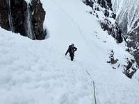
Avalanches can occur wherever and whenever there is snow lying on ground of a sufficient angle and this is as true in Scotland as anywhere else in the world. In recent years the growth in popularity of winter sports such as hill walking, ice climbing, mixed climbing, ski touring and off piste skiing has consequently meant an increase in the number of individuals at risk from such events; unfortunately each year adds to the list of injuries or fatalities. Although avalanches cause relatively few deaths in Scotland, avalanche hazard considerations should always be part of any winter hill goers daily plans. Many accidents could have been avoided, given greater care or knowledge, or if the victims had even paused to consider that avalanche hazard might be present.
As always, experience and training are your greatest tools for determining potential risks when on the mountain, and skills such as being able to correctly read the terrain and interpret the snowpack can prove invaluable. However, these skills are no substitute for simple avoidance, and reading the avalanche forecast before venturing onto the hills can pre-empt any potential hazards one may face.


Most youth hostels or mountain hotels will offer some form of daily avalanche forecast however, if this isn’t available, the Scottish Avalanche Information Service (SAIS) offer up-to-date online forecasts for five locations in the Grampian Mountains, as well as help and guidance about avalanche safety. Furthermore, the Scottish Mountaineering Club have published an excellent book, A Chance in a Million? - Scottish Avalanches, which contains clear, well-illustrated guidance for winter climbers and hill walkers of all abilities.
Resources
Some useful links on weather conditions:
Mountain Meteorology of Scotland - an article by Proterra on the Scottish climate and its weather
Metcheck - 7 day weather forecast
Abacus Mountaineering - Climbing conditions
A RECOMMENDATION:
The Scottish Mountain Weather Service offers detailed daily mountain weather forecasts for most of the Highlands.
West Highlands - The West Highlands area includes Ben Nevis and Creag Meagaidh and extends north to those hills accessible from Glenfinnan (Road to the Isles) and Glen Spean. In the east, it includes all the mountains from Ben Alder, south to Loch Lomond and Trossachs NP. The area also includes two islands - Arran and Mull.
East Highlands - The East Highlands area covers all the northeast Grampians north from Loch Lochy in the west, to the Cairngorm, Monadhliath, Cairnwell and Lochnagar areas in the east.
Some useful links on avalanche conditions:
The Mountaineering Council of Scotland - Information on avalanches
The Scottish Avalanche Information Service (SAIS) - Information and forecasts
The Scottish Avalanche Information Service also host a series of blogs run by members of their observer teams. This blogs act as a means for local SAIS observers to quickly pass on some of their local knowledge to mountain users. Currently there are four active blogs:
SAIS Lochaber
SAIS Northern Cairngorms
SAIS Southern Cairngorms
SAIS Creag Meagaidh
Web Cameras:
Webcams are an excellent way of getting up-to-date weather information for Scotland’s mountains. Currently there are only a few cameras located in the Grampian Mountains and even fewer which are actually reliable. The section below provides links to the very best. These feeds are hosted by external sites, so obviously we can’t be held responsible if a camera happens to be malfunctioning.
 | Ben Nevis, Lochaber View of Ben Nevis from Tomacharich, Fort William, courtesy of www.visit-fortwilliam.co.uk |
| | Ben Nevis, Lochaber View from Nevisport shop in Fort William, courtesy of Nevisport (obviously) |
 | Buachaille Etive Mor, Glencoe View of The Buachaille , courtesy of Kings House Hotel |
 | Cairngorm Summit Weather Station View of from the Cairngorm Summit Weather Station looking South-West over the Northern Corries, courtesy of the Department of Physics at Heriot-Watt University |
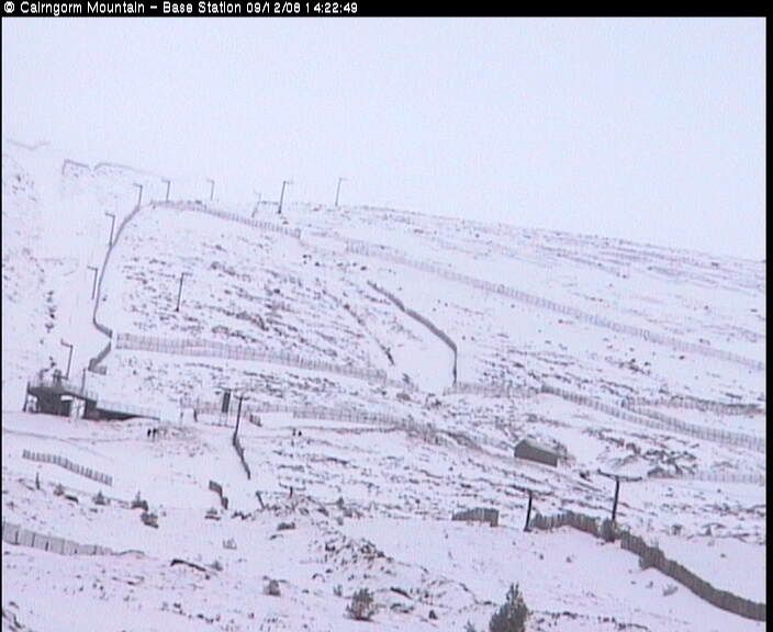 | Cairngorm Ski Area - Base Station View of the Cairngorm’s from the Ski Area Base Station, courtesy of www.cairngormmountain.com |
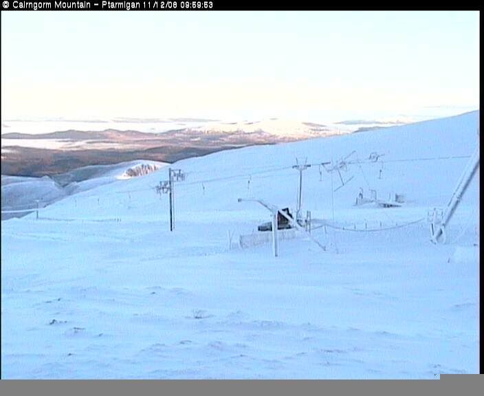 | Cairngorm Ski Area - Ptarmigan Building View of the Cairngorm’s from the Ptarmigan Building on the plateau, courtesy of www.cairngormmountain.com |
 | Knoydart View of Knoydart and the entrance to Loch Hourn taken from Sabhal Mòr Ostaig College on Skye, courtesy of the BBC. Knoydart isn't in the Grampians but the camera is worth checking anyway. |
Mountain Rescue
Needs some changes but bits can be kept and/or incorpotated.The Northwest Highlands are served by XXX mountain rescue teams which are distributed across the whole area:
For more information on Scottish mountain rescue teams take a look at the Mountain Rescue Committee of Scotland’s website - www.mrcofs.org
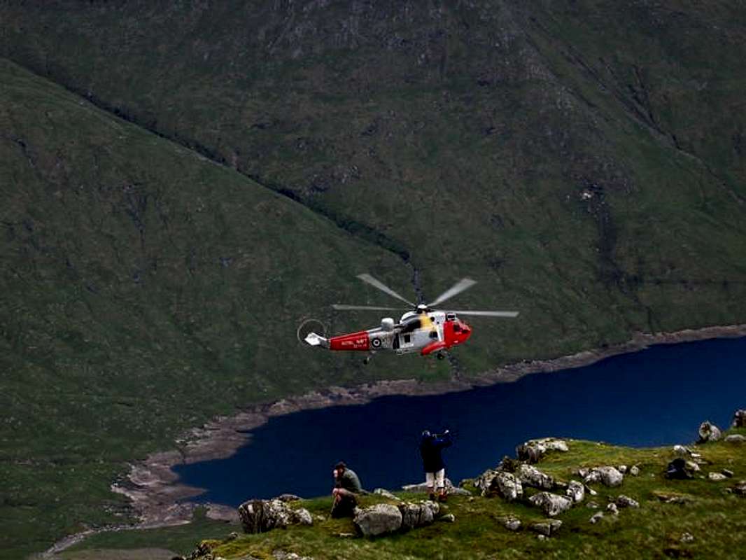 A mountain rescue on Ben Cruchan (Photo by munroitis) |  A mountain rescue on Ben Cruchan (Photo by munroitis) |
Teams should only be called out if you are in extreme difficulty and that your life, or the life of another, is under threat. As with all of the UK’s emergency services, to contact mountain rescue, phone 999 and ask for mountain rescue (obviously).
For Mountain Rescue Air lift:
- Secure all lose equipment and gear
- Clear an area for the helicopter to land or clear bystanders
- Signal the helicopter, by raising the arms above the head in a V
- Have a belay ready, but do not clip in the winchman until he says so.
- Field the winchman until he gets his bearings.
- Do not approach the helicopter until the pilot signals.
- Be aware of the main and tail rotors.
Transport and Logistics
Needs some changes but bits can be kept and/or incorpotated.Getting There
By Car
The Northwest Highlands are easy to reach by car. The area is huge so I'm not going to list every road route here; I would advise consulting Google Maps, or an equivalent for further information. There is no good or bad approach, but on occasions roads may be closed due to heavy snowfall.
View Larger Map
By Bus
Bus travel is widely available throughout the area, both in the form of coach travel and service buses. Service bus information can be obtained from CityLink the UK Bus Timetable Website Directory, while the National Express website has information on coach timetables. In more remote areas, the smaller villages and settlements are serviced by Postbuses run by the Post Office; timetables can be found on the Post Office’s website.
By Rail
There are two main lines servicing the Grampian region, the West Highland Line and the Highland Main Line. The West Highland Line runs from Glasgow in the south to Fort William in the North, with a branch of the line diverging at Crianlarich to service Oban in the west. The line stops at a number of remote stations, including the Rannoch and Corrour Stations, which give unrivalled access to some of the range’s least accessible areas. Be aware that if you are travelling to Glasgow by train, you will probably need to make your own way from Glasgow Central to Glasgow Queen Street Stations to make your connection.
The Highland Main Line runs from Edinburgh in the South to Inverness in the north and services much of the eastern portion of the Grampians. The line links some of the largest towns in central Scotland, but more importantly, it visits Aviemore, the self-proclaimed gateway to the Cairngorms.
Further information on timetables and tickets can be obtained from ScotRail or National Rain Enquiries.
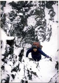 Aonach Eagach (Photo by Nigel Lewis) Aonach Eagach (Photo by Nigel Lewis) |  Eagle Ridge (Photo by grumpy monkey) Eagle Ridge (Photo by grumpy monkey) | 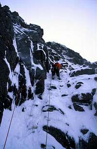 Route Major (Photo by Stuart Buchanan) Route Major (Photo by Stuart Buchanan) |  Hadrian's Wall (Photo by Ron Walker) Hadrian's Wall (Photo by Ron Walker) |
By Air
Dotted around the margins of the Grampian Mountains are a number of airports and airfields which are receive both domestic and international flights. For mountain access, Inverness Airport must be the best placed of all these, located as it is, only a short distance from the Cairngorm Mountains. Unfortunately the airport only receives domestic flights. An alternative to Inverness is BAA Aberdeen Airport, which is almost as convenient, and although it mostly deals in domestic flights, does receive some from Europe. In the south BAA Glasgow Airport, Glasgow Prestwick Airport and BAA Edinburgh Airport also offer easy access to the area, and have the benefit of receiving international flights.
Hub Towns
Throughout the Northwest Highlands there are numerous towns that are ideal for accommodation, food and drink, replenishing stocks, historical places and local annual events that might be of interest to the visitor.
Below is a selection of five 'Hub' towns that we feel are best placed for climbing/hiking in the Grampians. These towns give ease of access to numerous of the sub A&R's in the east, west and central Grampians.
Fort William
Fort William is the largest town on the Scottish west coast north of Helensburgh. It's location and proximity to the areas mountains make it the principal centre for the whole Western Highlands, an area of about 10,000 square kilometres (4,000 square miles). Fort William in particular serves the Lochaber area, which encompasses everything south to Ballachulish and Glencoe, east to Invergarry and Tulloch, north to Loch Cluanie, and west to Kinloch Hourn and Mallaig.
Because of its regional importance, one will find many more amenities and services here than in most other places of a similar population. Many of these facilities are aimed specifically at hill walkers and climbers making an ideal base for visiting the area’s mountains, which include Scotland’s highest, Ben Nevis.
An extensive online guide to the town and Lochaber area, which contains detailed tourist information and useful resources, can be found on www.visit-fortwilliam.co.uk
Mallaig
Kyle of Lochalsh
Inverness
Ullapool
  |

Stob Bàn's North East Face (Photo by JoeHarris)
Red Tape
Can be keptThere is no red tape in Scotland due to the Land Reform (Scotland) Act 2003 which incorporated the Scottish Outdoor Access Code. This code, which commenced on the 9th of February 2005, has established statutory rights of access to land and inland water for outdoor recreation.
There are however certain aspects that should be taken into account when in the Scottish countryside;
- Seek local advice in regard to deer stalking or grouse shooting activities (see previous section)
- Ensure that all gates are closed behind you
- During the lambing season (March to May) ensure that all dogs are kept on a lead
- Please refrain from feeding or annoying any animals
- Limited parking space is available at the start of many routes, please ensure that you are not blocking a road and/or entrance
- Parking is provided at the start of some routes by the local farmers, it is polite to ask if you can use this facility
- Try to refrain from crossing fields with animals and/or crops if an alternative route is available
- Ensure that you treat the local environment with care by leaving it as you found it and by taking any litter home with you
- Any camp fires should be carefully watched and only used away from dense forest areas
- Natural waste should be done in a hole and then buried when wild camping
The Land Reform(Scotland) Act 2003
Scottish Outdoor Access Code
Camping and Accommodation
Needs a lot changes but bits can be kept and/or incorpotated.There is a wide variety of camping and accommodation available throughout the whole of the Northwest Highlands. Contained within this section are places to stay in the major cities within the area and a small local selection of the different types of camping and accommodation available for the Southern, Central and Northern regions. On occasions the same venue is mentioned in two different sections. This is due to the proximity to bordering ranges and the fact that they can provide the best base for climbing in more than one place.
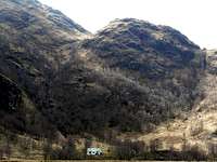

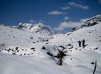
Some of the areas within the Northwest Highlands are extremely remote and as a result, accommodation is limited or non existent. As a result of this it may be necessary to stay out with the immediate area and travel a small distance to reach your destination. Another option that is available, is wild camping. This will probably be required for some of the peaks in areas such as; Knoydart, Strathfarrar, Glen Affric, Letterewe & Fisherfield & Dundonnel Forests and East & West Sutherland. Wild camping is totally legal in Scotland, again due to the Land Reform (Scotland) Act 2003 that was mentioned in the previous section. Here are some of the basic rules that should be adopted when wild camping;
- The larger the group, the harder it is to keep impacts to a minimum. Keep groups small.
- Camp as unobtrusively as possible.
- Remember that noise travels from tents disturbing wildlife as well as humans.
- Enjoy the freedom of wild camping without leaving a trace of your passage. Protect our country's outstanding scenery and wildlife as well as the wilderness experience.
- Camping on the same spot harms vegetation. Aim to move frequently and do not stay for any longer than 3 nights in the same place.
- Lighting fires poses a high fire risk on peaty soils and close to tinder dry grass. A high risk of fire can exist at any time of year, and not just in times of drought.
- Watercourses and loch sides are important sites for birds and animals. Take extra care when camping near burns and lochs, and try to avoid camping immediately beside them.
- Always find a spot at least 30 metres from fresh/running water when going to the toilet.
- Bury excrement in a small hole (not under boulders). A trowel or ice axe can be used to lift a flap of turf.
- Remove all litter (even other peoples!) Think ahead and only carry in what you are prepared to carry out.
The Mountaineering Council of Scotland provides an invaluable leaflet providing a full breakdown of the dos and don'ts of wild camping in Scotland. Wild Camping, A guide to good practice.
Southern Northwest Highlands
 Ben Nevis (Photo by daw37) Ben Nevis (Photo by daw37) | 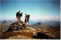 Beinn Dorian (Photo by mountainmanmark) Beinn Dorian (Photo by mountainmanmark) | 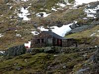 The CIC Hut on Ben Nevis (Photo by JoeHarris) The CIC Hut on Ben Nevis (Photo by JoeHarris) |
Hotels
B&B's
Lodges
Youth Hostels/Bunkhouses
Campsites
Central Northwest Highlands
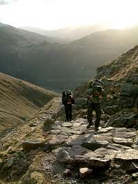 The Pony Track on Ben Nevis (Photo by roadmountain) The Pony Track on Ben Nevis (Photo by roadmountain) |  The Steall Hut in Glen Nevis (Photo by Nanuls) The Steall Hut in Glen Nevis (Photo by Nanuls) | 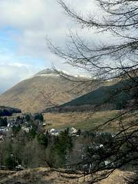 Tyndrum (Photo by Boydie) Tyndrum (Photo by Boydie) |  Stob Ban (Photo by Nanuls) Stob Ban (Photo by Nanuls) |
Hotels
Cluanie Inn - In the heart of Glen Shiel
Kintail Lodge Hotel - Former shooting lodge at the foot of the Five Sisters of Kintail
Tingle Creek Hotel - In the quiet hamlet of Erbusaig, Kyle of Lochalsh
The Torridon Hotel - Quality accommodation in the heart of Torridon & The Flowerdale Forest
Ledgowan Lodge Hotel - Located in Achnasheen and also provides bunkhouse and camping accommodation.
Poolewe Hotel - Quality hotel in Poolewe
Shieldaig Lodge Hotel - You've guessed it! A hotel In Shieldaig
The Old Mill Highlnd Lodge - After Kinlochewe by the shore of Loch Maree
B&B's
Gairloch View - B&B in Gairloch
The Ferroch Guest House - Guest house in Torridon on the shores of Upper Loch Torridon
Hill Haven B&B in Kinlachewe
Aurora - B&B in Shieldaig
Rockvilla - B&B in Lochcarron
Lodges
Youth Hostels/Bunkhouses
Toridon Youth Hostel - Torridon's Youth Hostel
Gairloch Youth Hostel - Gairloch Carn Dearg Youth Hostel
Campsites
Sands Wigwams - Wigwams and camping close to Torridon & The Flowerdale Forest
Gairloch Holiday Park - Camping & Caravan park close to Torridon & The Flowerdale Forest
Free campsites available at; Torridon, Taagan in Kinlochewe,
Northern Northwest Highlands
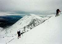 Stob Ghabbar (Photo by visentin) Stob Ghabbar (Photo by visentin) | 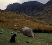 Glen Coe (Photo by johnloguk) Glen Coe (Photo by johnloguk) |  Meall na Dige (Photo by mountainmanmark) Meall na Dige (Photo by mountainmanmark) |
Hotels
The Royal Hotel- Located in the fishing town of Ullapool
Inchnadamph Hotel - In Inchnadamph, West Sutherland. Close to Conival & Ben More Assynt
Kylesku Hotel - In Kylesku, West Sutherland
Inver Lodge Hotel - In the fishing village of Lochinver, West Sutherland
Altnaharra Hotel - In Altnaharra, at the centre of the Sutherland district
Benloyal Hotel- In Tongue, at the northern end of Sutherland
Smoo Cave Hotel - A small family run hotel in Durness, Sutherland
Sutherland Inn - A family run hotel in Brora, East Sutherland
B&B's
Riverview - Quality B&B located in the town of Ullapool
Harbour Lights - Another guest house in the town of Ullapool
Rhian Guest House - 3 star B&B accommodation in Tongue, Sutherland
Old School Restaurant - Situated to the northwest of Sutherland by Kinlochbervie
Lodges
Youth Hostels/Bunkhouses
Campsites
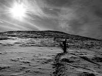
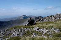

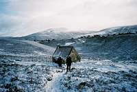
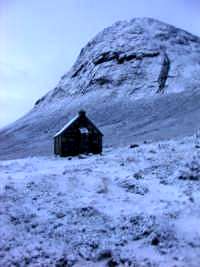
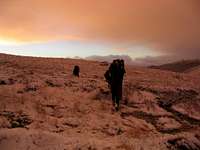
Maps
Needs a lot of changes but bits can be kept and/or incorpotated.| Ordnance Survey |
| Ordnance Survey Travel Map - Route Scale 1:625 000 (1 inch to 10 miles) Great Britain 2008 Ordnance Survey Travel Map - Tour Scale 1:500 000 (1 to 5 km, 1 inch to 8 miles) Sheet 12 - Scotland | Ordnance Survey Travel Map - Road Scale 1:250 000 (1 cm to 2.5 km, 1 inch to 4 miles) Sheet 1 - Northern Scotland, Orkney & Shetland Sheet 2 - Western Scotland & the Western Isles Sheet 3 - Southern Scotland & Northumberland |
| Ordnance Survey Landranger Map Scale 1:50 000 (2 cm to 1 km, 1¼ inches to 1 mile) |
| Ordnance Survey Explorer Map Scale 1:25 000 (4 cm to 1 km or 2½ inches to 1 mile) |
| Harvey Map Services |
| Harvey National Park Atlas Scale 1:40 000 Loch Lomond and The Trossachs National Park Atlas Harvey British Mountain Map Scale 1:40 000 Cairngorms & Lochnagar Ben Nevis Harvey Superwalker Map Scale 1: 25 000 Arrochar Alps Ben Avon Ben Lawers Ben Ledi & hills north of Callander Ben Lomond Ben Nevis Ben Venue, Loch Ard & Queen Elizabeth Forest Park Cairn Gorm Crianlarich Glen Coe Lochnagar and Glen Shee Ochil Hills | Harvey Summit Map Scale 1:12 000 Ben Nevis Harvey Cycling Map Scale 1:80 000 East Perthshire Harvey National Trail Map Great Glen Way Speyside Way West Highland Way Harvey Mountain Charts Munro and Corbett Chart Long Distance Path Chart Panorama of Central Scotland |
Guidebooks
Needs some changes but bits can be kept and/or incorpotated.
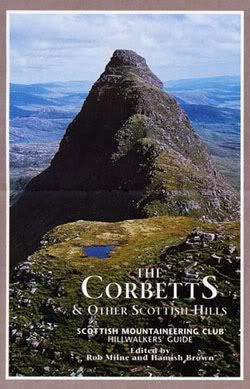
External Links
Needs some changes but bits can be kept and/or incorpotated.General
Scottish Mountaineering Club - Scotland's national mountaineering club
The Mountaineering Council of Scotland - Scotland's official mountaineering body
British Mountaineering Council - Britain's official mountaineering body
Climbers Club - British national climbing club
www.mrcofs.org - Mountain Rescue Committee of Scotland
Scottish Ski Club - home page of the Scottish Ski Club
Visit Scotland - website for the Scottish Tourist Board
Undiscovered Scotland - online guide to Scotland
Munro Magic - information of the Munros
The Highland Council - local authority home page
Scottish Natural Heritage - Scotland's statutory body for the protection of landscapes
Joint Nature Conservation Committee - Britain's statutory body for the protection of wildlife
Walk Highlands - Scottish walks and accommodation
The West Highland Way - Official website of Scotland's premier long distance route
Buachaille.com - Outdoor gear comparison website
Hill Phones - Information for hill walkers about stalking activities
Deer Stalking Scotland - A guide to deer stalking in Scotland
BASC - The British Association for Shooting and Conservation
Mountain Conditions
West Coast Mountain Guides - Avalanche information, climbing conditions and weather forecasts.
Abacus Mountaineering - Climbing conditions
The Scottish Avalanche Information Service (SAIS) - Avalanche information
Winternet-Scotland - Scottish mountaineering conditions
AccuWeather Mountain Forecast - AccuWeather Uk & Ireland mountain forecast
Weather
Mountain Weather Information Service (MWIS) - mountain weather forecast
Metcheck - 7 day weather forecast
Met Office - Weather from the Met Office
Weather Channel UK - Weather Channel weather
Travel
Lochaber Transport Forum - local public transport information
National Rail - UK Train Timetable
ScotRail - Scottish Train Timetables
Showbus - bus timetables for the UK
Citylink - Scottish bus timetables
Inverness Airport - home page of Inverness airport
BAA Glasgow Airport - homepage of Glasgow airport
Glasgow Prestwick Airport - home page of Glasgow Prestwick Airport
BAA Edinburgh Airport - home page of Edinburgh Airport
Caledonian MacBrayne Ferries - ferry information and timetables for the west of Scotland
Accommodation
The Mountain Bothies Association - information on bothies (mountain huts) in Scotland
Scottish Youth Hostel Association - home page of the SYHA
Scottish Independent Hostels - a directory of independent hostels in Scotland
Maps and Guidebooks
Ordnance Survey - Britain's national mapping agency
Harvey Map Services - an excellent selection of maps designed specifically for outdoor enthusiasts
Cicerone Guidebooks - guidebooks for people of all abilities
Climbers Club Guidebooks - guidebooks for climbers
Scottish Mountaineering Club - guidebooks and publications for and about Scottish mountains