Toggle navigation
Mountains
Routes
Images
Trip Reports
Forum
What's New
People
Areas & Ranges
Articles
Trailheads
Canyons
Huts & Campgrounds
Albums
Logistical Centers
Fact Sheets
Lists
Custom Objects
Gear
Plans & Partners
WELCOME TO SUMMITPOST
SIGN IN
REGISTER
Golden Hinde: SE Gullies
Additional Parents
Image
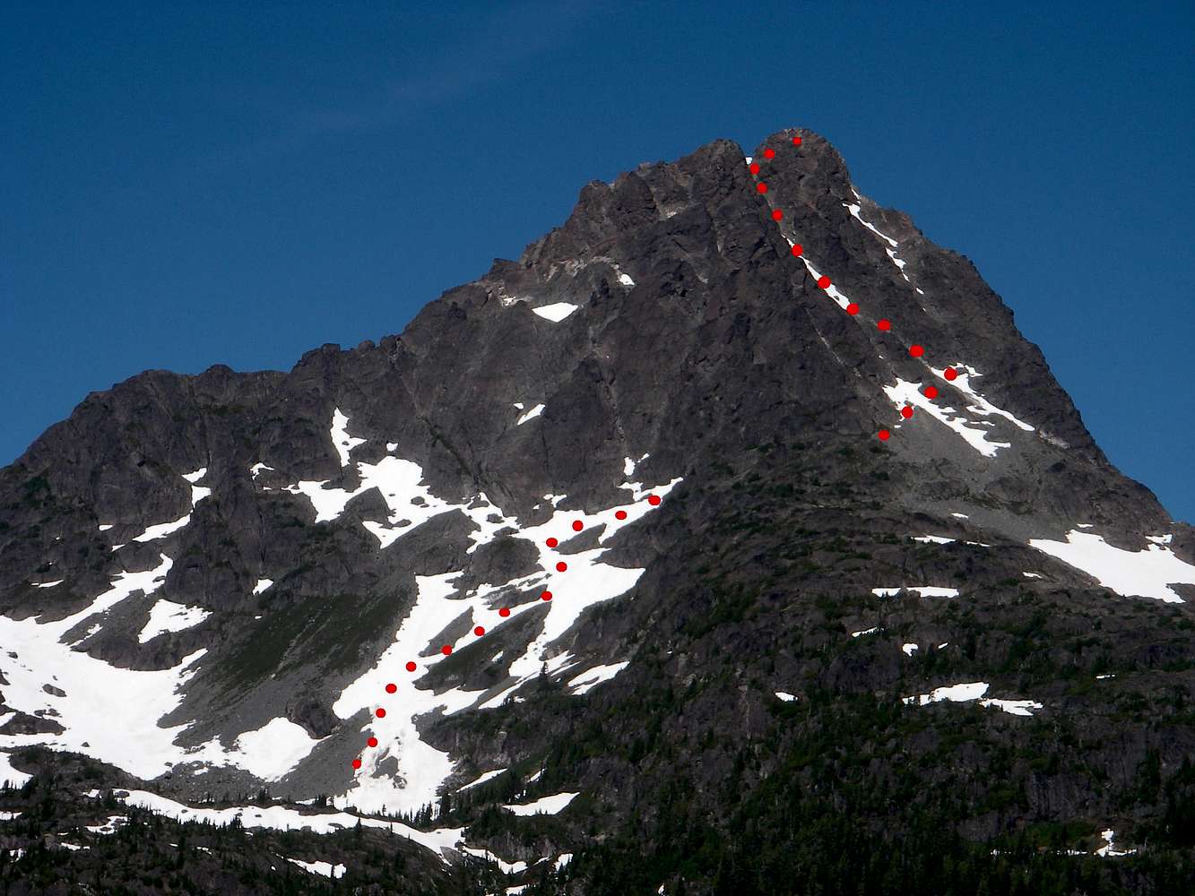
SE Gullies Route
View High-Resolution Image
SE Gullies Route
SE Gullies route map. Photo taken from the outflow of Schjelderup Lake. The break in the route indicates where the line goes out of shot as the route exits the South Bowl onto the lower SE face. Photo credit: Graham Bennett.
« PREV
NEXT »
vancouver islander
on
Nov 10, 2008 11:24 pm
Comments & voting
Other parents
Image ID:
462562
4785 Hits
74.92
% Score
5
Votes
Log in to vote
Comments
No comments posted yet.
to post!
Don't have an account?
Golden Hinde: SE Gullies
(Route)
« PREV
Viewing
#5 of 8
GALLERY
NEXT »
vancouver islander's Image Gallery
« PREV
Viewing
#508 of 1858
GALLERY
NEXT »
×
You need to login in order to vote!
User Name
Password
Remember me
Forgot your password?
Log me out when I close my browser.
Keep me logged in all the time.
sign in as a user
Don't have an account?
Register now for FREE
Rating available
Suggested routes for you
People who climb the same things as you
Comments Available
Create Albums
Register Here


