
|
|
Route |
|---|---|
|
|
40.69900°N / 110.902°W |
|
|
Hike |
|
|
Half a day |
|
|
Walk-up |
|
|
Getting There
To reach the Bald Mountain Trailhead, either drive east and north of Kamas along Highway 150 for 29 miles from Kamas; or south on Highway 150 49 miles south of Evanston. There is a sign that marks the trailhead.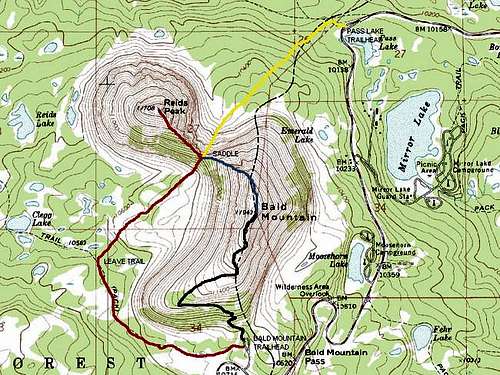 Black = Bald Mountain Trail.
Route Description
At the trailhead, there is a sign that points out the trail to the summit of Bald Mountain. The trail switchbacks up the slope and climbs 1250 feet in about 1.3 miles (the sign at the beginning of the trail states 2 miles-but this is in error). The trail is all up hill, but pretty easy, but it can be dangerous for the unprepared hiker before mid-July in most years due to snowbanks. Excellent views of countless lakes, basins, and peaks are your reward for reaching the summit.Experienced scramblers can combine the trip to Bald Mountain with Reids Peak. See the page on Reids Peak for details of the route.
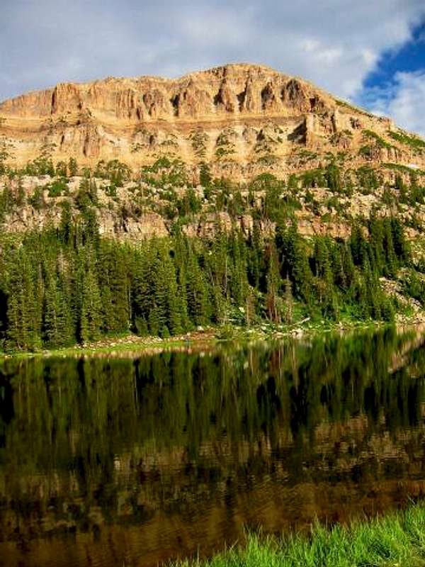 Bald Mountain from Moosehorn Lake.