Toggle navigation
Mountains
Routes
Images
Trip Reports
Forum
What's New
People
Areas & Ranges
Articles
Trailheads
Canyons
Huts & Campgrounds
Albums
Logistical Centers
Fact Sheets
Lists
Custom Objects
Gear
Plans & Partners
WELCOME TO SUMMITPOST
SIGN IN
REGISTER
Glacier of Aneto
Additional Parents
Image
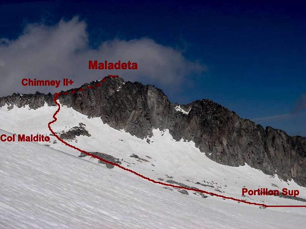
Sketch of route
View High-Resolution Image
Sketch of route
Sketch of route to
Maladeta
from the glacier of
Aneto
. I don't try this chimney for the moment but the skecth is based in a illustration of David Atela in his book "100 cumbres del Pirineo Aragonés" with great accurate. June 2004.
« PREV
NEXT »
Rafa Bartolome
on
May 1, 2006 12:04 pm
Comments & voting
Other parents
Lat/Lon:
42.74628°N / 0.64155°E
Image Type(s):
Alpine Climbing
,
Topo/Diagram
,
Informational
Image ID:
191376
3444 Hits
72.65
% Score
3
Votes
Log in to vote
Comments
No comments posted yet.
to post!
Don't have an account?
Glacier of Aneto
(Route)
You are at
the First
Image
Viewing
#1 of 1
GALLERY
You are at
the Last
Image
Rafa Bartolome's Image Gallery
« PREV
Viewing
#2476 of 6101
GALLERY
NEXT »
×
You need to login in order to vote!
User Name
Password
Remember me
Forgot your password?
Log me out when I close my browser.
Keep me logged in all the time.
sign in as a user
Don't have an account?
Register now for FREE
Rating available
Suggested routes for you
People who climb the same things as you
Comments Available
Create Albums
Register Here


