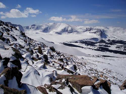
![Gilbert and Gunsight Peaks]() View of Gilbert and Gunsight Peaks from the north ridge of Mount Powell
View of Gilbert and Gunsight Peaks from the north ridge of Mount PowellStats
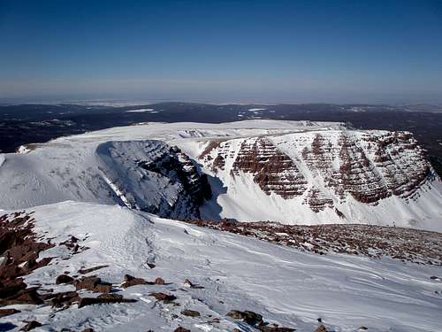
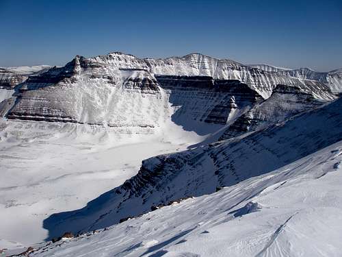
![Henrys Fork Peak]() Almost at the top, looking east southeast at Kings Peak et al.
Almost at the top, looking east southeast at Kings Peak et al.
What: One day ski trip to the summit of Mount Powell (13159')
Where: Uinta Mountains, Utah, 3.17 miles NW of Kings Peak
Length: 26.5 miles round trip
Distance above treeline: 10 miles round trip
Total elevation gain: 4300'
Start elevation: 9100'
Start location: near Henrys Fork Winter Parking (see map)
Date: March 8, 2012
Round trip time: 16 hours 6 min, 5:38am to 9:44pm
Time to summit: 9 hours 32 min
Summit to car: 6 hours 34 min
Participants: me
The Trip
I'd like to climb all of Utah's 13000 footers in the calendar winter. I'd also like to win the lottery. Realistically, I don't think either will happen, but at least I'm making some small progress on the 13000 footers. True winter ascents of Utah's 13000 footers are rare. Most of these peaks are over 10 miles from a summer trailhead. In the winter, with access roads being unplowed, the distances are even greater.
![Mount Powell]() Mount Powell as seen from the slopes of Gilbert
Mount Powell as seen from the slopes of Gilbert
Last winter I skied to Gilbert Peak and this winter I set my sights on Mount Powell (13159'). If you have climbed Kings Peak, Utah's highpoint, via the standard route up Henrys Fork Basin, then you have seen Mount Powell as it lines the basin's west side.
![Henrys Fork Peak and Mount Powell]() Mount Powell on the right, from Henrys Fork Basin
Mount Powell on the right, from Henrys Fork Basin
Gilbert was the easiest of the lot. Powell was going to be hard. It would be 26.5 miles round trip with a whopping 10 miles above treeline, hard to contemplate on a windy winter day. There was no chance of any of the route already being broken. There was no chance of finding someone to do it with.
Not being a fan of a heavy overnight pack, I was going for it in a day. I wasn't sure if I could break that much trail by myself so I had a contingency plan. I'd just break trail to treeline, and then come back a few days later and do the whole thing. If things went really well, however, then I'd push for the summit the first time.
Like many high Uinta peaks, Powell has a very long gentle north ridge which I would follow to the top. The sides of the ridge are steep, even cliffs in places, limiting practical access to only a few spots. One option was to go through Henrys Fork and gain the ridge in the vicinity of Elkhorn Crossing. I couldn't bear the thought. The usual ski route through Henrys Fork follows the stream bed, a cold sink of a maze with many twists, turns, downed trees, and open water. It's not so bad if someone else has already broken the trail so it is obvious which way to go but I didn't want to be looking at my GPS every 2 minutes in subzero weather. Perhaps part of this way would be broken, but it wasn't something I could count on.
![North ridge of Powell]() Mount Powell's broad north ridge
Mount Powell's broad north ridge
The other option was to take off from the plowed dirt road at a good spot before even reaching the Henrys Fork winter parking area. Which spot to pick was a compromise between the shortest distance and the easiest to ski. I had set waypoints for four possible starting points and on my drive the night before observed them all. The last of them, the closest one to Mount Powell, had the smallest snowbank and that was about all I could see in the dark so that's the one I picked. As the crow flies Mount Powell was just over 12 miles away.
The forecast had called for cloudy skies overnight with a slight chance of snow and light winds. It was completely clear with a beautiful full moon and completely still. I couldn't detect even the slightest movement in the highest treetops. On other trips it had been so windy that I could feel the car rock. If this kept up, I'd push for the summit.
I knew it was going to be cold but held out hope that the predicted low of 5F was overly pessimistic. I was heartened when the car thermometer rose for a short time from 9 to 12 before dropping back to 10. 10 wasn't so bad but by the next morning it had dropped to -3F.
One advantage of my route was that since I was going to be on the east side of a ridge or on top of the ridge itself, I would be in the sun as soon as it rose and would be a good 15-20 degrees warmer then if I was down in the dark Henrys Fork.
I spent the night a short distance away at a small campground, sleeping in the back of my trusty Subaru Legacy. The next morning I woke up at 4am, got ready and then drove back to the start. According to my GPS log it then took 40 min to put on my boots, do my last minute fiddling, and exit the car. What the heck had I been doing? I got such a late start, 5:38AM, that I would only have to ski about 30 minutes in the dark. I climbed up over the snowbank and entered the pitch black forest, not knowing what I'd find. I don't know if anyone else has ever climbed Powell solo in one day in the winter, but I'm pretty damn certain that if they did, they didn't go my way.
The snow initially had a crust so only minor trail breaking was necessary but it made me wonder what it would be like on the way down. The trees were spaced wide enough so there wasn't much contention with brush. I worked my way up to a dirt road that I would follow most of the way to the ridge. Another option had been to start skiing at the beginning of this road instead of taking the shortcut that I had.
As the slope aspect transitioned from east to north there was less and less crust. Sometimes I would float on top, sometimes I would find myself in calf deep sugar, but mostly it was like in the picture, about 4-6" or so to break through. It was a lot slower going than I'd have liked, but I made steady progress.
![Skiing to Mount Powell]() Typical terrain
Typical terrain
I was totally dismayed when 4 hours later I looked at my GPS and saw that I still hadn't made it to the point west of Alligator Lake far below in Henrys Fork. I had only gone 5.55 miles, totally pathetic. It looked like this would just be a trail breaking trip and I'd have to return another day. However, the weather was truly spectacular and if there was any way I could summit I was going to try. The day's forecast called for mostly sunny skies with 10 mph winds and a high of 24F at the summit. Well, they were wrong. It wasn't mostly sunny, it was just plain sunny. There wasn't a cloud in the sky, not even little baby ones on the horizon. As to the predicted wind speed of 10 mph, it was more like zero mph. There might never be a nicer winter day. I had to give it a shot.
![Treeline]() Treeline
Treeline
I made it to treeline at 11:20 with 8 miles behind me and 5.2 to go. The tips of all the peaks lining Henrys Fork Basin came into view. Initially the going was great. There was no more trail breaking with the snow consisting of a faint dusting on a solid crust. As long as I made it to the summit by 4 PM, I'd be able to make it back to treeline by dark. However, as soon as I reached the top of a small crest, it became painfully obvious that it wasn't the brilliant white expanse that I had hoped for. Rocks were everywhere. I carefully threaded my way through them and knew it would be slow going downhill.
![North ridge of Powell]() Typical rocky section
Typical rocky section![Thin cover]() A really bad rocky section
A really bad rocky section
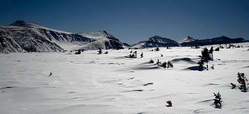
There were some occasional patches of solid snow and one really big one due west of Bear Lake, but mostly it required careful skiing through rocks. Powell was a mere speck on the horizon.
![North ridge of Powell]() Powell, still 3.6 miles away
Powell, still 3.6 miles away
After the big snowy patch there were rocks, rocks, and more rocks. It was time to ditch the skis and start walking. According to my GPS I still had almost 2 miles to go. Aaarrrg! The walking turned out to be easy, either staying on top of rocks, or stepping on hard snow. There was no trail breaking.
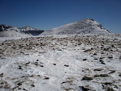
![Mount Powell]() One mile remaining, Mount Powell at right
One mile remaining, Mount Powell at right
If you've looked at the map, it should be apparent how technically easy most of this route is. A lot of it rises so gently that it appears to be flat. It is only the last 650' up that is at all steep. The snow was of the boiler plate variety and I was glad I had brought my ice axe, but mostly I was able to stay on rocks. I reached a false summit and the rest was a gentle incline on easy walking snow to the top.
![Mount Powell]() Last 650 vertical feet
Last 650 vertical feet![Mount Powell]() The summit
The summit
Whew, it took me 9 hrs and 32 minutes to reach that summit. The views were beautiful and there could not have been a nicer day.
![Henrys Fork Peak]() Looking southeast at Kings Peak et al.
Looking southeast at Kings Peak et al.![Red Castle]() Looking west at Red Castle
Looking west at Red Castle
It was 3:10PM and I had over 13 miles to go to get back to the car. I was not racing bad weather. Sure, it would be dark long before I got there, but it didn't really matter. I had brought two headlamps plus spare batteries.
![Gilbert Peak]() Cairn near Flat Top
Cairn near Flat Top
On the way back to treeline I took the time to visit the "summit" of Flat Top Mountain which isn't much of a summit since it is only a 40' bump on the map. My skis were stashed just a bit farther and then it was time to thread the rocks. I cringed every time I heard a little rock zing under my skis.
Treeline was striking on the way back as the terrain goes from wide open to dense forest abruptly. I looked back for one final view of the high peaks.
![Returning to treeline]() Approaching treeline
Approaching treeline![Sparkly treeline]() Last look back
Last look back
I returned to treeline about 5:30PM and instantly it went from bright sunshine to gloom and doom. The treed section of the ridge was so flat that it seemed like it was all uphill. I was striding almost the whole way. My headlamp went on shortly before 7PM. Mile after mile I skied in the dark. I kept seeing eerie flashes of bright orangish red to my right, at ground level. Was it a reflective sign in the middle of nowhere or someone's campfire? No, it was the brightest, reddest moon I had ever seen.
Finally, I began to loose elevation quickly and it was a joy to descend the north facing powder. Who knew that skiing in the dark could be so much fun? I reached the road portion that I had skied in the morning, signaling the end was near. It was a true delight now, as it was wide, straight, and very, very slick. If this kept up I'd be out in no time. But then I had to turn off the road and skiing hell began. It was very difficult to ski this portion in the dark. It took me 75 minutes to ski the final 1.7 miles back to the car, even though it was downhill. The snow was icy with a breakable crust, making it both hard to turn and hard to control my speed. And what the heck, where did all these damn little uphills come from? Up to this point I had felt great, but now I was so fatigued that when I fell once it seemed insurmountable to get back up. I was starving, but the one cliff bar I had left was particularly unappetizing. I was in danger of puking. I felt like crap. I thought about what I would do differently next time. I'd take the road the whole way instead of the short cut. (See map.) But who was I kidding, there would be no next time. I didn't feel like ever skiing again, ever.
I got back to the car at 9:44PM. I was toast. I spent another night at the campground and at 4:30AM it was time to get out of there. Every Tuesday and Friday I take my son x-country skiing after school. Today was Friday. Maybe he'd forget. Maybe he wouldn't have gotten his stuff ready without my being there to remind him. Please, please, please. I called home and reached him before he left for school and purposely didn't bring up the subject. I'm bad. I felt guilty. When I arrived home there was all his gear piled up neatly on a chair by the door. Aaaarrrg!
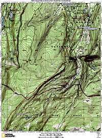
Maps
![Mount Powell topo 1]() Map 1
Map 1![Mount Powell topo 2]() Map 2
Map 2Equipment Used
I used cross country metal edged touring gear with fishscales.
skis: Atomic Selkirk with sidecut 78-60-70mm
bindings: NNN-BC
boots: Alpina BC-30
50mm kicker skins


Comments
Post a Comment