Advice
![Warning when entering Titlis Glacier]() Warning sign at the off piste route ascending to Titlis
Warning sign at the off piste route ascending to Titlis
When I was on the way to Klein Titlis and changing the cable car at middle station Trübsee, a Titlisbahn staff member spotted the ice axe on my backpack and asked, "What are you doing up there?" "some ski-touring" "No, don't do that! the condition is bad today! It's dangerous!"
It was not the first time I received this kind of warning. However, every single time, it will make you rethink and rethink whether I should continue.
This was a 3-day trip to Engelberg/Titlis from London. I successfully convinced my friend Yvonne to come with me to do some late season downhill skiing on Titlis glacier. Meanwhile, I also persuaded her to come with me to climb to Titlis summit. The plan was to spend one morning to do a short hike from Klein titlis (3020m) to Titlis (3238m). I would be on my backcountry ski while she could put on her snowshoes with her skis on my backpack. Therefore, we could ski down from the summit together.
However, a combination of Yvonne's health situation with slight high altitude effect and the bad weather with low visibility, it made us almost abandon the plan.
Waiting for the weather
Even a few days before the trip, the weather report already told that all the 3 days of our ski trip would be bad all through, raining/showering all the time in the valley. However, the only good news was that it meant there were constantly fresh snow around the high Titlis Glacier.
We arrived at
Zurich Friday night after work and slept at Zurich. Yvonne did not feel very well so that she told me to ski the first day by myself. I headed for
Engelberg alone
Saturday morning, leaving my bulk pack at the hotel, repacking to get my skis really. Then I headed up to Titlis. The weather was bad with no view whatsoever. Therefore, I just enjoy my down hill skiing and tried to polish my off piste skills (It's just my 2nd year of skiing and I am still very rusty at that). With this visibility and on my own, I decided it was not wise at all to go up to Titlis summit.
This was late-season skiing. It meant there were pretty few skiiers. Instead, we encountered loads of tourists, mainly from India and China(and I can converse with them in Chinese!) Sometimes it became a bit unpleasant when they did not let you go and kept you with your ski "armour" for taking photos with them.
Second day (Sunday), Yvonne joined me for downhill skiing. Once again, the visibility was quite low. I still had not ever seen Titlis summit even from Klein Titlis (3020m). Therefore, we enjoyed our downhill skiing again. Yvonne had not skiied for a long time and needed some time to pick up her downhill ski technique. Therefore, I went through the basics with her. During lunch, we stayed at Klein Titlis and she told me she felt a bit of high mountain syntoms. As far as she felt that she could still ski, I just told her to take it easy and I drank a beer to "match up" with her. Then in the afternoon, she did quite well on her skills improvement. However, with a combination of high mountain effect, tiredness and her good-will ambition, she unlunkily sprained her ankle. Fortunately, it was not very serious (and she could at least walk). Therefore, I was on my own again on the 3rd day.
![Engelberg overcast]() View at our balcony at Engelberg
View at our balcony at Engelberg![Titlis north face from Rotair cable car]() First sight of Titlis, from Rotair cable car
First sight of Titlis, from Rotair cable car, in the morning at 6:30am, we opened the french double doors of our hotel room, stepping out to the balcony and found that the whole sky was blue and clear, despite the latest weather forcast still suggested the weather would be really bad. Therefore, I could not believe what I saw. But then I hurried up for packing and breakfast. Yvonne parted with me to go back to Luzern and Zurich first because she could not ski and I headed for the Cable Car to go up to
Klein Titlis. By the time I arrived at the bottom station, the sky was already very cloudy, though the cloud did not seem as thick as the previous two days. It took 45 mins to go up to Klein Titlis. At the top I begin to barely see the summit Titlis. The sky was not comepletely clear, but at least offering some visibility. I decided I needed to give it a go, despite the warning from the Titlisbahn staff.
The Ascent
![Touristic Klein Titlis with no view of the summit]() On the day before the ascent, there was no view of the summit at all from Klein Titlis.
On the day before the ascent, there was no view of the summit at all from Klein Titlis.![Titlis from Klein Titlis]() Titlis from Klein Titlis station - The summit can be barely seen.
Titlis from Klein Titlis station - The summit can be barely seen.
After going down to an easy black run and up with the Ice Flyer ski lift to (visually) inspect the condition of the slope up to Titlis, I began to
decent 20m from Klein Titlis to a point beyond the pass, where I could ascent to Titlis.
At 10:30am, all by myself I put on the skins and began to skin up next to the West ridge, leaning on the glacier side.
![Titlis from the beginning of the skinning route]() Putting on the skins and looking up to Titlis
Putting on the skins and looking up to Titlis![On the ridge looking back to Klein Titlis]() At halfway looking back to Klein Titlis, and inspecting my lonesome skinning track
At halfway looking back to Klein Titlis, and inspecting my lonesome skinning track![Halfway up to Titlis]() Halfway
Halfway
Skinning up on that section is easy, although very tiring for me. The glacier surface was not too steep and fully covered in snow. The Titlis false summit can be clearly seen most of the time. One thing I worried about this ascent was the crevasses on the glacier. However, after carefully scrutiny, it seems there were no irregularity of snow pattern on the slope and if there were any crevasses, they were fully covered. (all in all, I still believe it is safer to ascent in a group other than alone) I kept near the west ridge to avoid getting lost and the danger of crevasses. The snow was still very thick and loose because of the constant fresh snowfalls. When the terrain got steeper, I skinned up zig-zag and I ocassionally found it difficult to keep on track, ski slightly slipping sideway and downhill.
![Looking at Titlis from the false summit]() Titlis from false summit
Titlis from false summit![Leave the skis and walk to Titlis]() Titlis from false summit - Here I left my skis.
Titlis from false summit - Here I left my skis. Although I carefully looked at the google map of Titlis before(it was difficult to find a comprehensive map including both Titlis and Engelberg area), I did not realise that true summit Titlis actually is at the south across a little ridge from the false summit. Therefore, noticing this short ridge and a bit of scrambling terrain towards Titlis, I left my ski, walked across the flat bit and the ridge with my Scarpa ski-mounteering boot and took out my ice axe for protection. The snow was pretty deep, at least to my knee. It was a bit scary on the ridge. One cannot see the bottom of the shear drops on both sides of the ridge. After the short ridge was a 10m scrambling to take me
to the summit at 11:30am, although it was proven a bit slippery to scramble with my ski boots without crampons, which were in my bag and I was too lazy to take them out.
Summit Titlis
![On Titlis (3238m)]() Summit-proving photo - Titlis 3238m
Summit-proving photo - Titlis 3238mThe summit was still full of snow, covering almost all the panaramic picture boards. I managed to set up my camera on my backpack to take a summit-proving photo. The weather was still quite clear with strong sunshine on my head, though I could just barely see Klein Titlis station because of the clouds. I sat down and called Yvonne (the reception was excellent!), who still had pain in her knee and stayed at Engelberg, to tell her my sucess of getting to the summit. Then I took my time, eating lunch and enjoying an alpine sunbath.
![From Titlis looking back to the path]() Looking back to the false summit & Klein Titlis - my walking track on the right
Looking back to the false summit & Klein Titlis - my walking track on the right![From Titlis looking back to Klein Titlis]() From Titlis looking back to Klein Titlis
From Titlis looking back to Klein Titlis![Looking SWW]() From Titlis looking SWW
From Titlis looking SWW![Looking S]() From Titlis looking S
From Titlis looking SThe Descent
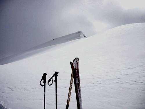
After all, I did not want to stay too long there amid the closing in of clouds. I quickly scrambled (and slipped a bit) down, walking across the ridge and the flat bit. By the time I picked up my skis, the visibility dropped to 30m and continued to drop. I then tried to ski down the mountain as quick as I could because I did not want to trap myself in a wipeout condition. Now the best I could do was to stay a bit lower than my ascent track, which was just below the ridge. Given that it was only my second year of skiing, I was still a bit nervous about falling (and particularly about the possibility of falling into covered crevasses!), but the slope was gentle enough and the snow was very deep that I could keep a steady speed, despite the visibility already dropped to 10m.
It turned out that skiing downhill is always a quick job. Very soon after my fear and struggling, a couple of piste poles suddenly appeared. Making sure this was the ski piste no.1, I rejoiced in my heart. And at this very moment, the most embarrassing thing happened - I fell... Though I ate much snow and felt stupid, I quickly stood up again and ran back to the piste.
![Klein Titlis in VERY misty environment]() Klein Titlis piste exit at the worsened weather after the excursion
Klein Titlis piste exit at the worsened weather after the excursion
Looking at other alpine skiiers passing through, I prouded myself finishing another little adventure. Also, Titlis summit was all for me that day while I did not see anyone else at all in this small round trip. Thanks God that it was another safe and fun excursion.
I went on to do downhill skiing on the glacier in the afternoon. However, the visibility was worsening to a point that I could not see more than 2 poles on the piste, but who cared about the weather now. So I just finished early at 2:50pm, taking the cable car to go back to Engelberg, then to Zurich Airport.
Comments
No comments posted yet.