|
|
Mountain/Rock |
|---|---|
|
|
44.16779°N / 73.79516°W |
|
|
Hiking |
|
|
Spring, Summer, Fall, Winter |
|
|
2362 ft / 720 m |
|
|
Overview
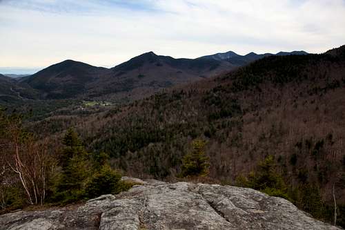
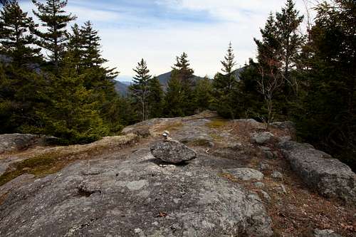
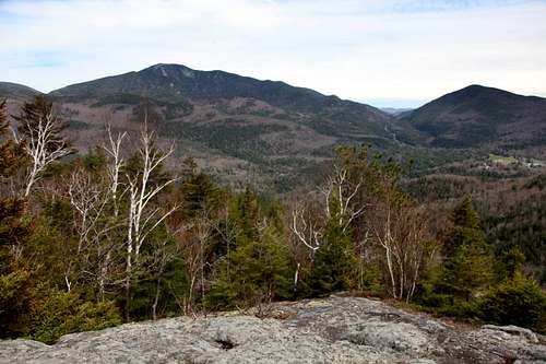
A minor peak at the northeast end of the Great Range, Snow Mountain offers fairly good views for little effort. As such it makes a good hike for children, and can easily be combined in a mostly-loop hike with nearby Rooster Comb.
It is an "alternate" peak on the Adirondack 29er Challenge list, which collects lesser-known day-hikes with good views (originally, 29 peaks outside the High Peaks region).

Getting There
Located at the northeastern end of the Great Range in the High Peaks region of the Adirondacks, Snow Mountain is most easily approached from NY route 73.
From Albany, NY, take interstate 87 north about a hundred miles to exit 30. Follow signs for Keene: 2 miles on U.S. route 9 north, then bear left onto NY route 73 north, eight miles to Ausable Rd in St. Huberts. From here there are three main choices for trailheads, south to north:
A southern approach starts at the Ausable Club. From route 73, take 86A (Ausable Club Road) southwest half a mile to the golf club. (I'm not sure where you are supposed to park, but there is an extensive trail system starting here, so there must be something...) Start walking southwest on Lake Rd and immediately look for a trailhead on your right.
The trailhead nearest the peak, known as the Snow Mountain Trailhead, is off Route 73 at Deer Brook 0.6 miles north of Ausable Rd, St. Huberts. This provides the most direct approach, from the east.
A northerly choice is the Rooster Comb Trailhead, off Route 73 in Keene Valley, 1.5 miles north of the Snow Mountain Trailhead.

Routes
(in order from shortest to longest)
Note on trail names: the only place I could find these was on OpenStreetMap.org. Trail names do not appear on trail signs nor on most maps. Luckily all hiking trails in this area are well-blazed (with color-coded plastic discs) and all intersections are well-marked (with destination e.g. peak name or trailhead name, and mileage).
The most direct route from the Snow Mountain Trailhead starts on the Deer Brook trail, which follows its eponymous brook west then diverges northward to join the Snow Mountain Trail. 1.4 miles one-way, about 1,250 feet of elevation gain.
You can also make a narrow loop using the Snow-Deer Brook Link Trail which runs south from the Deer Brook Trail to hit the Snow Mountain Trail at a more southerly point, and/or use Deer Brook Way, a road that runs from the Deer Brook Trail near the Link intersection to route 73, within spitting distance of the Snow Mountain trailhead.
From the Ausable Club, start walking southwest on Lake Rd and immediately look for a trailhead on your right. Start out northwest on the West River Trail, crossing the East Branch of the AuSable river on a bridge. Immediately after the bridge, head north on the W.A. White trail. When this curves westerly, you will find the south end of the Snow Mountain trail. Follow that to Snow Mountain. Two miles one-way, about 1,250 feet of elevation gain.
Starting from the Rooster Comb Trailhead, the shortest route starts on the Rooster Comb trail, which heads west, turns southwest, and then forks. The westerly fork keeps the name Rooster Comb trail and goes to Rooster Comb via the col with Hedgehog, where it intersects with the Hedgehog Trail. The easterly fork is the Flume Brook Trail, which takes a roundabout route to the same intersection at the Hedgehog-RoosterComb col, but first passes the Snow-Flume Brook Crossover Trail. Follow the Crossover Trail to the Snow Mountain Trail, then turn east to the peak. 2.3 miles one-way, about 1,300 feet of elevation gain.
A natural loop from this trailhead takes in both Rooster Comb and Snow Mountain.

Red Tape
No fee to park at the rte 73 trailheads.
Eastern High Peak area: no fires. Various restrictions on camping, group size, etc. Notably, campers must use bear cans (except in winter)
When to Climb
Year-Round. Snowshoes or skis *mandatory* when there is at least eight inches of snow. Full DEC Regulations
Camping
Eastern High Peak area: no fires. Various restrictions on camping, group size, etc. Notably, campers must use bear cans (except in winter).
- No camping above 4000 feet at any time.
- Camping between 3500 and 4000 feet is limited to designated sites.
- Below 3500 feet, camping is allowed at designated sites or at locations at least 150 feet (46 m) from any road, trail, or water source. (In the Eastern High Peaks, to protect the resource, DEC strongly recommends camping only at designated sites or lean-tos.)

