Toggle navigation
Mountains
Routes
Images
Trip Reports
Forum
What's New
People
Areas & Ranges
Articles
Trailheads
Canyons
Huts & Campgrounds
Albums
Logistical Centers
Fact Sheets
Lists
Custom Objects
Gear
Plans & Partners
WELCOME TO SUMMITPOST
SIGN IN
REGISTER
Sonora Peak
Additional Parents
South Ridge via PCT
Saint Marys Pass
Image
Sonora Peak Routes
View High-Resolution Image
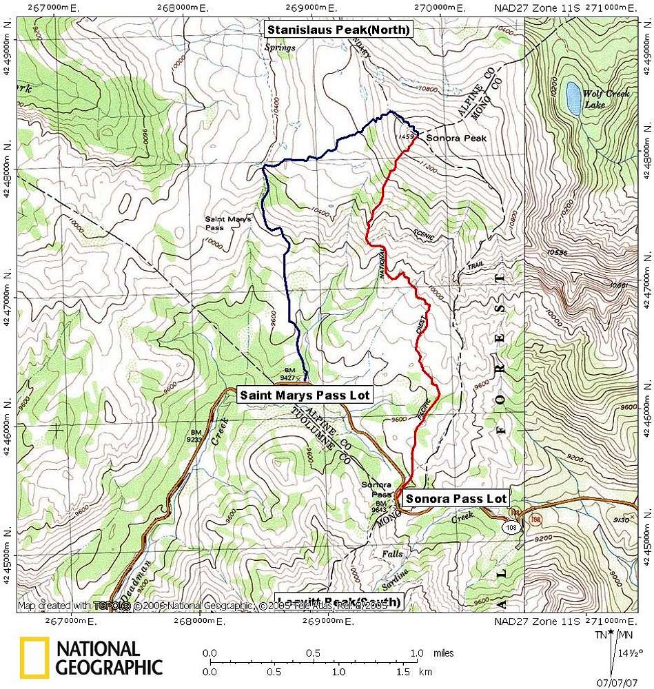
Sonora Peak Routes
The two main routes up Sonora Peak. The blue is the Saint Marys Pass route, while the red outlines the South ridge route via the PCT.
« PREV
NEXT »
thebeave7
on
Jul 7, 2007 12:49 pm
Comments & voting
Other parents
Lat/Lon:
38.35380°N / 119.6355°W
Image Type(s):
Hiking
Image ID:
308770
3934 Hits
71.06
% Score
1
Votes
Log in to vote
Comments
No comments posted yet.
to post!
Don't have an account?
Sonora Peak
(Mountain/Rock)
You are at
the First
Image
Viewing
#1 of 1
GALLERY
You are at
the Last
Image
thebeave7's Image Gallery
« PREV
Viewing
#326 of 376
GALLERY
NEXT »
South Ridge via PCT
(Route)
Loading....
Saint Marys Pass
(Route)
Loading....
×
You need to login in order to vote!
User Name
Password
Remember me
Forgot your password?
Log me out when I close my browser.
Keep me logged in all the time.
sign in as a user
Don't have an account?
Register now for FREE
Rating available
Suggested routes for you
People who climb the same things as you
Comments Available
Create Albums
Register Here


