Comments
No comments posted yet.
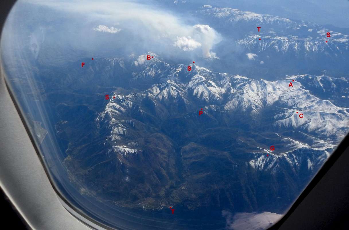
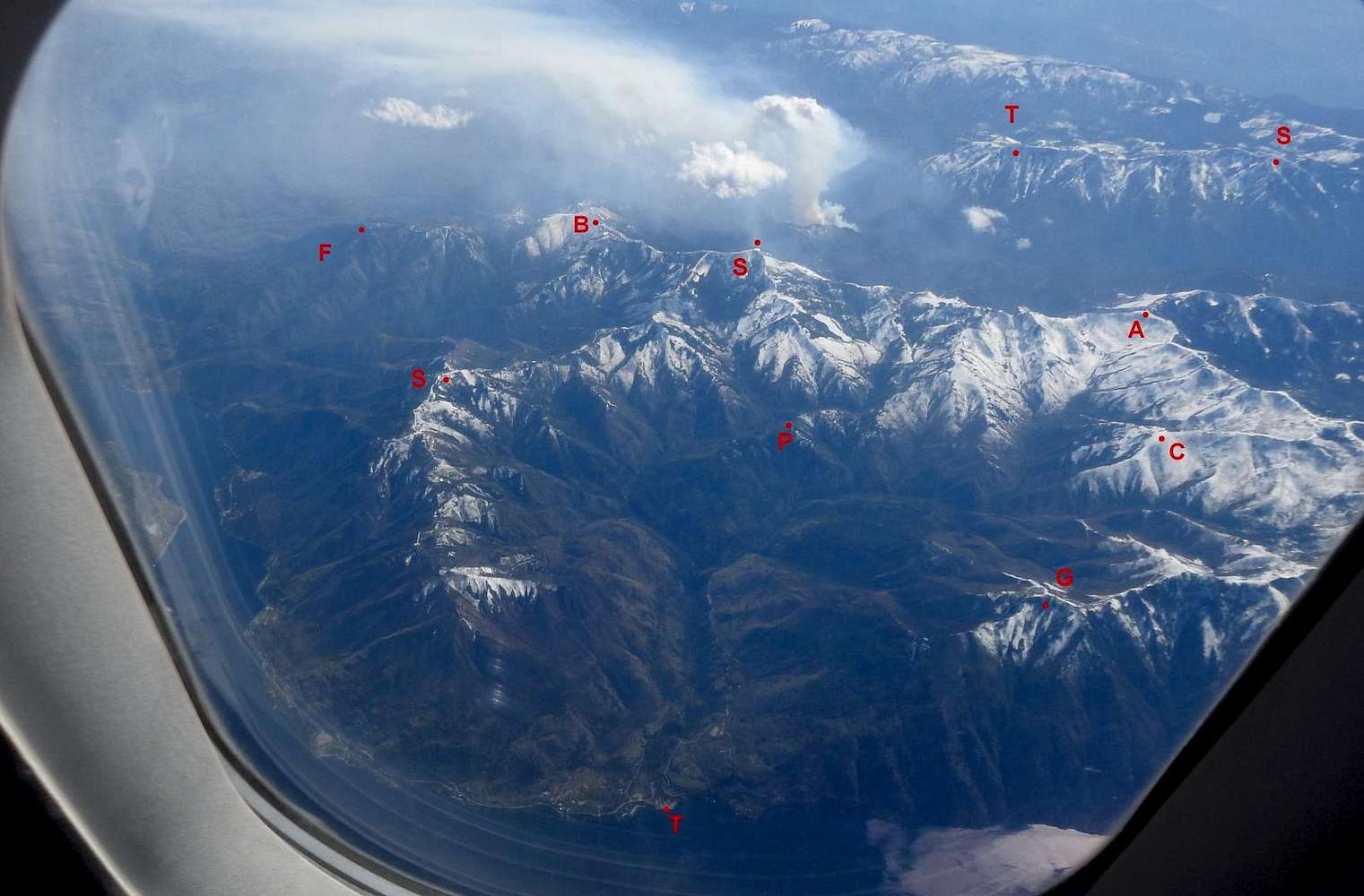
Southern end of the Chelan Mountains, taken from airliner 5/2/18 4PM. From left to right: F Forrest Mtn 5253ft, S Slide Peak 5580, B Baldy Mtn 6411, T Twenty Five Mile Creek State Park on Lake Chelan, S Stormy Mtn 7187, Pot Peak 4696, T Tyee Mtn 6662, G Grouse Mtn 5572, A Angle Peak 6735, C Crescent Hill 6748, S Signal Peak 6930.
According to Wikipedia, the Chelan Mountains are north of the Entiat River, which means Tyee and Signal are in the Entiat Mountains.
Note: the Chelans and Entiats should probably be areas withing the N Cascades, or something similar, but I couldn't see how to do that and don't have the knowledge to properly subdivide the Cascades.


