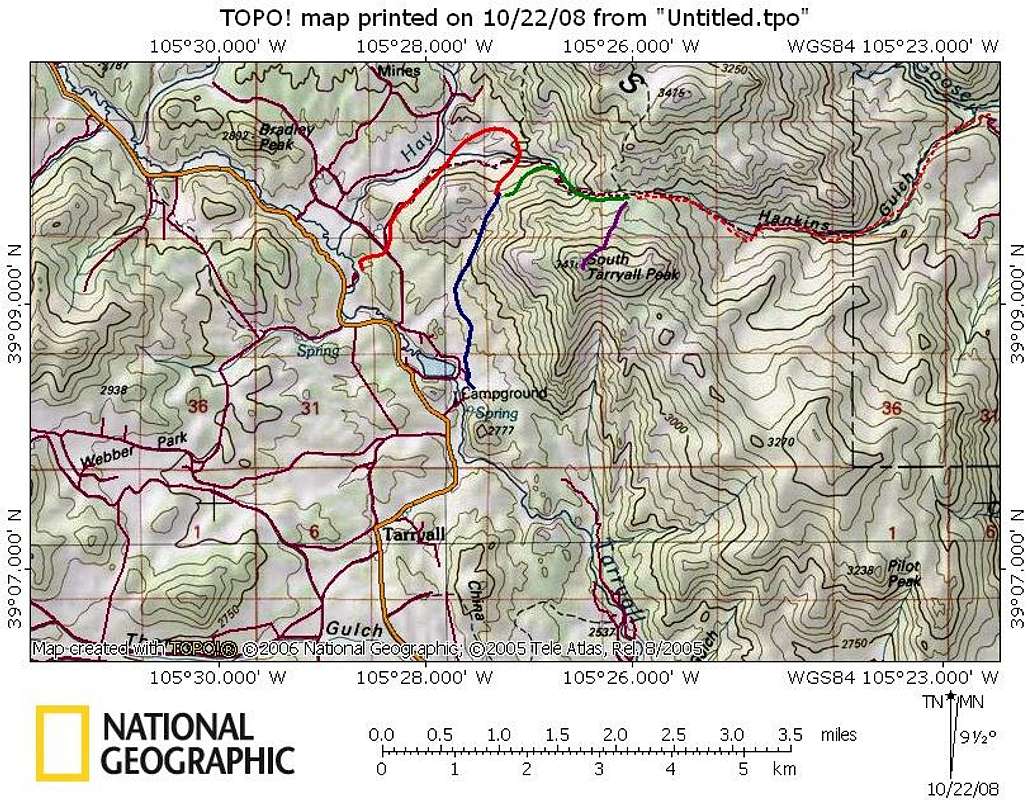
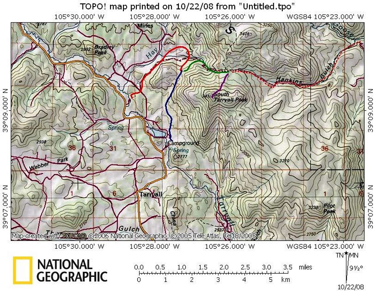
A route overview map for South Tarryall Peak. The solid blue line indicates the Spruce Grove/Lizard Rock route. The solid red line indicates the Twin Eagles/Brookside-McCurdy route. The green line is where the Spruce Grove and Twin Eagles routes converge toward Hankins Pass. The dotted red line represents the Goose Creek route up Hankins Gulch. Finally, the purple line is where all routes leave Hankins Pass for the final three-quarter mile push through dense timber to the summit.


