
-
 14002 Hits
-
 80.56% Score
-
 13 Votes
|
|
Route |
|---|---|
|
|
37.79910°N / 107.8284°W |
|
|
Hiking, Mountaineering, Scrambling, Skiing |
|
|
Spring, Summer, Fall, Winter |
|
|
A long day |
|
|
Class 2+ |
|
|
Approach
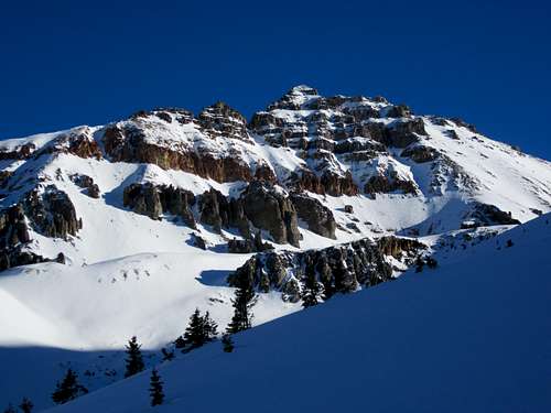
The approach for this route starts at the South Mineral Creek Trailhead which is accessed from Silverton, Colorado. Take US Highway 550 north towards Red Mountain Pass from from the US 550-110 intersection. After only 2 miles, you will take the turnoff for the South Mineral Campground on the left side of the road. Follow this good quality dirt road for 3.5 miles until you arrive at the South Mineral Campground where you can park on the right side of the road. The approach hike can be shortened by taking a right off of the South Mineral Road towards Clear Lake and park at the first switchback (room for only a few cars). A very short unmarked trail goes west to intersect the Ice Lakes Trail passing right through a small waterfall which is quite exposed and may be difficult at times. This approach shaves 1.8 miles and 540 vertical feet off the round-trip distance and elevation gain. When dry, this shortcut can be accessed with tough passenger cars with decent ground clearance. Whichever starting point you choose, hike the scenic trail into Ice Lakes Basin to about 12,600 feet at Fuller Lake. There is an old mining shed here and this is where the climb begins. Although this approach is pretty short, it is a great place to spend the night as it is perhaps one of the most beautiful alpine basins in Colorado.
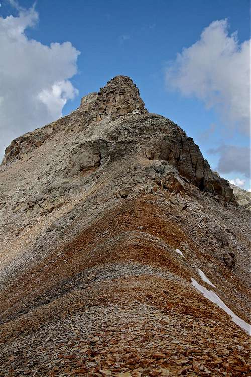
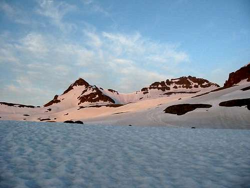 Sunrise on Fuller Peak - the Fuller/Vermilion saddle clearly seen in the center | 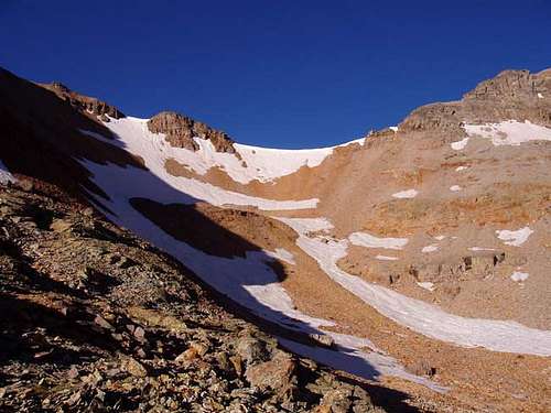 Photo of the slope leading to the Fuller/Vermilion saddle |
Route Description
From 12,600 feet at Fuller Lake, hike southwest towards the east face of Vermilion Peak and up the high basin above the lake. Climb southwest up a moderate slope which is often snow covered to the Vermillion-Fuller saddle at 13,500 feet. From the saddle, hike northwest on a climbers trail initially on the ridge then dropping to the south (left) side. Follow this trail around a couple towers on the ridge to the notch above the Vermilion Dollar Couloir. Just past this notch locate a loose gully and climb the gully for about 60 feet. At this point you can see the summit above you. Scramble up loose rocks to the narrow, exposed summit area and walk across a short catwalk to the summit (Class 2+). Enjoy the views as they are fantastic with the Wilson Group just to the west and all of the Sneffels Range in clear view.
RT Distance:
From lower trailhead at the South Mineral Campground - 10 miles
From the upper trailhead - 8.25 miles
RT Elevation Gain:
From lower trailhead at the South Mineral Campground - 4,100 feet
From the upper trailhead - 3,500 feet
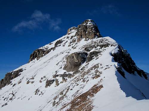 Vermillion Peak Southeast Ridge from the saddle | 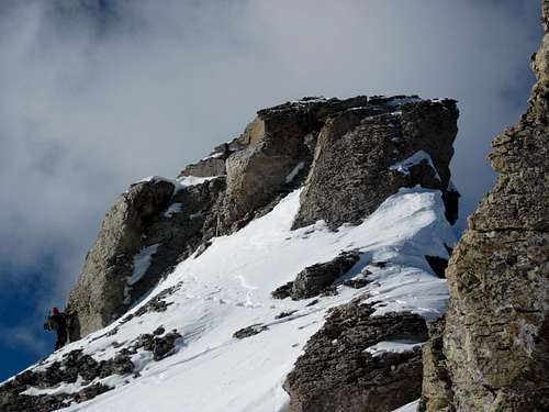 Traversing one of the false summits along the Southeast Ridge | 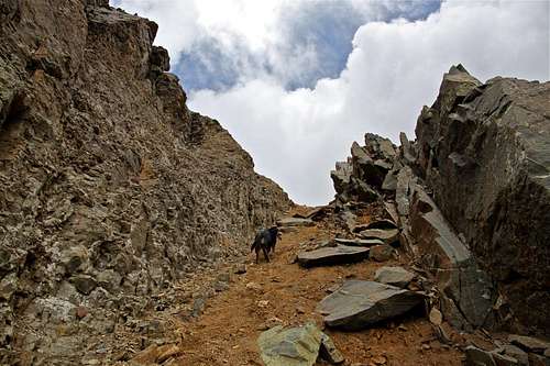 Climbing the loose gully just below the summit |
 Vermilion Peak from the saddle | 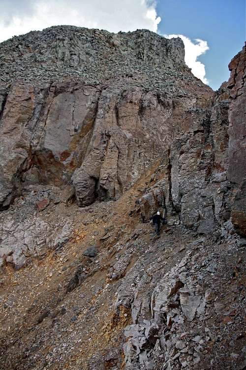 Final scramble to the summit...the loose gully is just behind the person heading up to the right |
Essential Gear
An ice axe is great to have due to the amount of snow usually in the basin and it can be fun to glissade down from the Vermillion-Fuller saddle when the conditions are right. Waterproof clothes and crampons will also help.Map
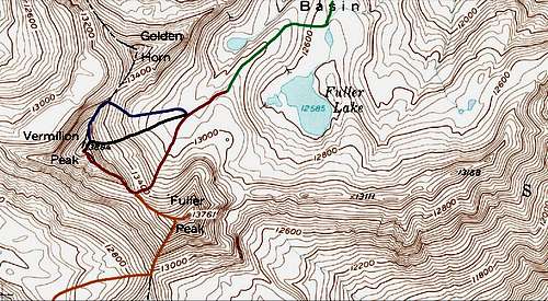
Map provided by Brian Kalet
RED: Vermilion Peak SE ridge - Class 2+
PURPLE: Vermilion Peak NE ridge - Class 2+
YELLOW: Fuller Peak NW Ridge - Class 2
BLACK: Vermilion Dollar Couloir - Class 2+ and Steep Snow
External Links
Vermilion Peak in winter
Great trip report of the ridge in winter
More Ice Lakes Basin Info
Silverton Chamber of Commerce
Town of Silverton
South Mineral Campground
San Juan National Forest Campgrounds