-
 27026 Hits
-
 81.18% Score
-
 13 Votes
|
|
Area/Range |
|---|---|
|
|
42.04966°N / 73.48729°W |
|
|
Hiking |
|
|
Spring, Summer, Fall, Winter |
|
|
2608 ft / 795 m |
|
|
Overview
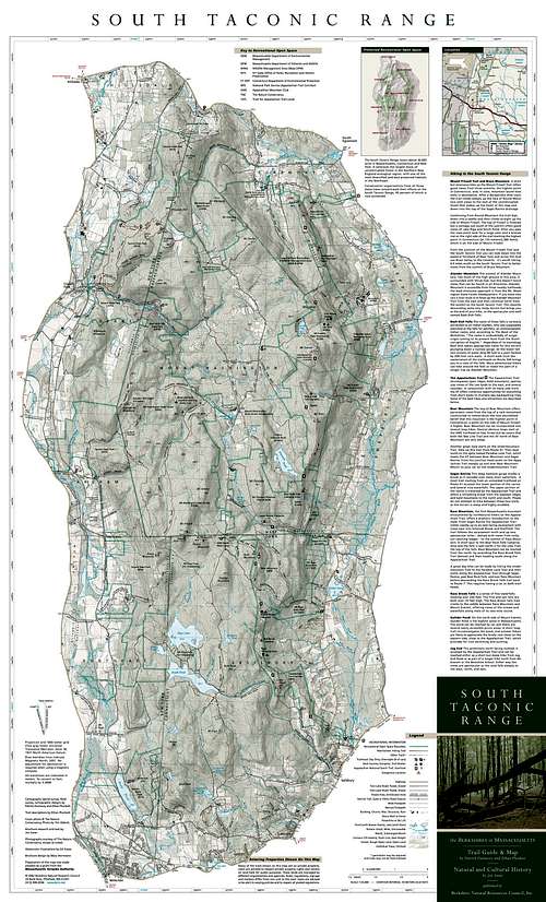
The oval shaped peaks in the Southern Taconic Range, rising from 2200 to 2600 foot levels, are certainly small by worldly standards. These peaks, however, combine with high areas of stunted vegetation rarely seen in the East, frequent drop-offs and ledges, dark watery ravines full of waterfalls, and amazing bio-diversity to make a spectacular landscape.The landscape has as its core one of the largest, healthiest, and most diverse remaining blocks of forest in southern New England. Roaming mammals, such as black bear, mink, fisher, deer and bobcat still find sufficient territory in this forest, and migratory songbirds make their homes in the canopy above.The unfragmented mountainous forest, through an interlaced network of underground water and high-energy streams, supplies alkaline, or "sweet" water to some of the highest quality calcareous wetlands in the world in the valleys below; many thousands of citizens also rely on this for exceptionally pristine drinking water.The entire landscape system is home to more than 150 rare and endangered species - one of the highest concentrations in New England.The many thousands of people who live in the landscape have a strong rural tradition that focuses on maintaining and relating to the land; until recent years, the 120,000-acre landscape had managed to remain relatively undisturbed, despite the fact that it is nestled in the heart of the urban Northeast. But today, the Berkshire Taconic Landscape faces ever-increasing development pressures that threaten to degrade both its ecological and cultural heritage. As a result many individuals and organizations are taking actions to protect the most precious elements of the landscape.Physical Features of the Area
Geology
Believe it or not, mile-high glaciers, oceans, beaches, huge swampy forests, and 20,000-foot high peaks are all part of the geologic history of the Berkshire Taconic Landscape.It took more than a billion years of geologic time to create the Berkshire Taconic Landscape. Phrases like "old as the hills" make it seem like our mountains have been here forever. Yet these rounded peaks and gravel-lined valleys are far less enduring than they might appear. In fact, these familiar mountains are mere remnants of the far older mountain ranges that once rose more than four miles above sea level. Those earlier ranges were originally formed by the collision of continental plates when the entire region was located south of the equator. At times covered by shallow oceans, and recently buried under nearly a mile of glacial ice, the Berkshire Taconic Landscape that we see today bears evidence of all of these forces and events.The layout of the Southern Taconic Range is best understood by considering that it is comprised of two parallel smaller north-south ranges, cradling a peak studded high plateau. The plateau is referred to as Mount Riga in Connecticut and Mount Washington in Massachusetts, although there are no peaks named as such there. The area, although under some pressure, continues to be thinly settled.The western ridge parallels closely the New York border, with Brace and Alander Mountains, its largest mountains, standing guard. This western range also contains the Southern Taconic Trail running within it. The eastern ridge, containing a bit of the famed Appalachian Trail, features a longer and generally higher area than the western ridge.
Hydrology
Throughout the Berkshire Taconic Landscape, healthy and active hydrological systems are laced above and below the ground surface. This network forms a seamless system that carries water from the ridges of the mountains to the great rivers of the region, and, ultimately, the sea, providing drinking water for thousands of local residents in the process. The fresh water that flows through limestone bedrock and gravel also produces alkaline (also called "sweet" water), which creates living conditions that support many rare and endangered species.
Mountains, Trails, & Camping
Mountains (south to north)
Bird PeakThorpe Mountain
Lion's Head
Bald Peak
Gridley Mountain (2215 ft)
Bear Mountain (2323 ft)
Brace Mountain (2323 ft)
Mount Frissell (2451 ft)
Round Mountain (2293 ft)
Mount Ashley (2382 ft)
Mount Plantain
Mount Race (2372 ft)
Mount Everett (2608 ft)
Alander Mountain (2240 ft)
Washburn Mountain
Mount Undine
Mount Bushnell
Mount Darby
Bash Bish Mountain
Cedar Mountain
Mount Ethel
Dugway Hill
Sunset Rock
Prospect Hill
Mount Whitbeck
Mount Sterling
Mount Fray
Major Thru-Trails
Appalachian TrailSouth Taconic Trail
Shelters & Camping (south to north)
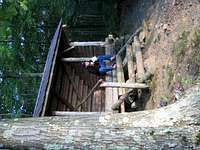
Riga Camping Area & Lean-ToBall Brook Campsite
Brassie Brook Campsite & Lean-To
Sages Ravine Campsite
Bear Rock Falls Camping Area
Race Brook Trail Campsite
Hemlock Lean-To
Glen Brook Lean-To
***BOLD = Summitpost page link***
Helpful Links
Taconic State Park - Copake Falls AreaDepartment of Conservation and Recreation - Jug End Reservation & WMA
Department of Conservation and Recreation - Bash Bish Falls State Park
Department of Conservation and Recreation - Mount Everett
Department of Conservation and Recreation - Mount Washington State Forest
The Nature Conservancy - Berkshire Taconic Landscape
Berkshire Hiking
Appalachian Mountain Club
Appalachian Trail Conservancy


