Springtime in the Rockies!
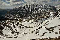
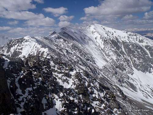
![Wheeler Mountain]() Much of our route is visible in this image
Much of our route is visible in this image
This phrase is usually summoned for the purpose of dry sarcasm for events such as:
- Mother's Day getting soaked in cold snowshowers.
- Your garden getting frozen solid the first week of June.
- Memorial Day flight cancellations due to snow storms.
- Freezing your hiney off in alpine winter conditions despite the calendar telling you summer is just around the corner.
This day, however, the weather gods delivered something fine in the form of sunny blue skies with puffy blue clouds floating past and relatively warm temperatures. About the only thing this day didn't serve up was ample snow to attempt one of the more ambitious snowlines on the southern slopes. No need to have regrets, though, as this was one fun, beautiful day!
Roundtrip Distance: 8.5 miles (approximate, from Magnolia Mine)
Elevation Gain: 2,850 feet
Initial Approach via Wheeler Lake Jeep Road
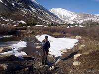
![The begining]() The beginning | SenadR
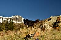
The beginning | SenadR![Meet Kodi]() Kodi on the move | SenadR
Kodi on the move | SenadR![Westbound on the road]() Westbound on the road
Westbound on the road![Up Platte Gulch]() Looking up Platte Gulch
Looking up Platte Gulch
What's to say about the approach via Wheeler Lake Jeep Road? Unless you've got a modified 4x4 rig to ride it, it's not going to be the most exciting part of your day.
"We're here for the hike, not for the drive."
With an almost stock Rubicon, I was no match for the challenges of Wheeler Lake Jeep Road, so we parked near Mangnolia Mine. (We did not, however, park before I got to enjoy the first road obstacle to the background noise of: "No, you're not driving up
that, are you?")
The walk along the jeep road makes for a nice warm-up. It's a good time to chat and catch up with friends; To tell stupid jokes and re-live stories only other climbers can appreciate. It's a time to wish you hadn't had that third shot of Jägermeister last night and opted instead to relish another hour or two of sleep, or hope you don't regret forgetting to put your footbeds in your Scarpas (which I still regret...)
The beginning of the jeep road was dry and rocky. We surmounted several areas that were challenging enough by foot, let alone on four wheels. The road soon turned to a combination of snow drifts, mud soup and stream bed and we occasionally opted for a willow bash to avoid the bog.
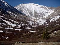
Into the Wheeler Lake Basin
![Heading into the basin]() Heading into the basin
Heading into the basin![Nestled into the basin]() Nestled into the basin
Nestled into the basin
After the long haul in and out of the rutted, mushy roadbed, it's quite a relief and a joy to turn right and head into the Wheeler Lake Basin.
What a place of beauty!
And here, with snow still packing the road in spots, we enjoyed the peace and quiet of this basin that can be enjoyed when it's accessible via foot traffic only. From the foot of the basin, we were able to gaze up at our goal, the rugged Wheeler Mountain. The weather was divine and the south slopes looked purely inviting. This was going to be a very, very good day.
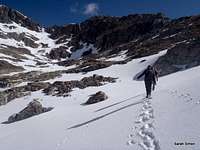
Leaving the Lakes to Gain the Ridge
![Above the second lake]() Above the second lake Above the second lake | ![Ridge....first step toward summit.]() Finally on the ridge | SenadR Finally on the ridge | SenadR |
![Steep grass!]() Steep grass! Steep grass! |
|
![Southwest toward Bartlett Mountain]() Southwest toward Bartlett Mountain
Southwest toward Bartlett Mountain![Along the southwest ridge]() Along the Southwest Ridge
Along the Southwest Ridge![Southwest along the ridge]() Southwest along the ridge
Southwest along the ridge![Gaining the ridge]() Gaining the ridge | SenadR
Gaining the ridge | SenadR
The lakes are a destination for many summer visitors, but a lovely waypoint en route to the top of Wheeler Mountain for us. Both the larger, lower lake and the upper lake were covered mostly in white ice and snow, but with an alluring rim of aqua near their outer edges.
We were kicking steps through a few inches of fresh snow on top of who-knows-how-much firm, older snowpack. We noticed a set of solo footprints and an axe impression, possibly from yesterday but more than likely this morning, indicating someone was ahead of us.
We worked our way first around the western shore of Wheeler Lake (elevation 12,168 feet | 3,709 meters), then wriggled up onto a shelf above the eastern shore of the upper, smaller lake. It was around this point that I noticed the glean of an ice axe on the ridge above us and...a pair of bright yellow climbing pants. Indeed, we
were following someone, and this someone had curious taste in climbing attire.
We ascended some pleasant, easy snowslopes to a plateau and found ourselves standing at the base of the Southwest Ridge. Time to go!
Ascending dreadfully steep tundra, following a slight users' trail, brought us to the rocky crest of the saddle between Wheeler Mountain and the long northern ridge of Clinton Peak.
The ridge before us leading to the summit of Wheeler Mountain certainly looked fun and interesting, but made it clear it was not going to yield too easily. A voice in my head reminded me that if this was easy, half of Denver would be up here today. Instead we had this mountain to ourselves (and
Mr. Yellow Pants).
Let the fun begin!
Southwest Ridge of Wheeler Mountain
![Looking back southward]() Back southward along ridge
Back southward along ridge
Early on in our journey along the ridge, we ran into
Mr. Yellowpants, who turned out to be a very nice man named Mark. He gave us a few pointers on the route-finding to the summit, and we notified him that one of our party had opted to hang out below the ridge and not attempt the summit.
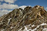
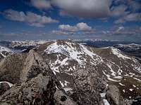
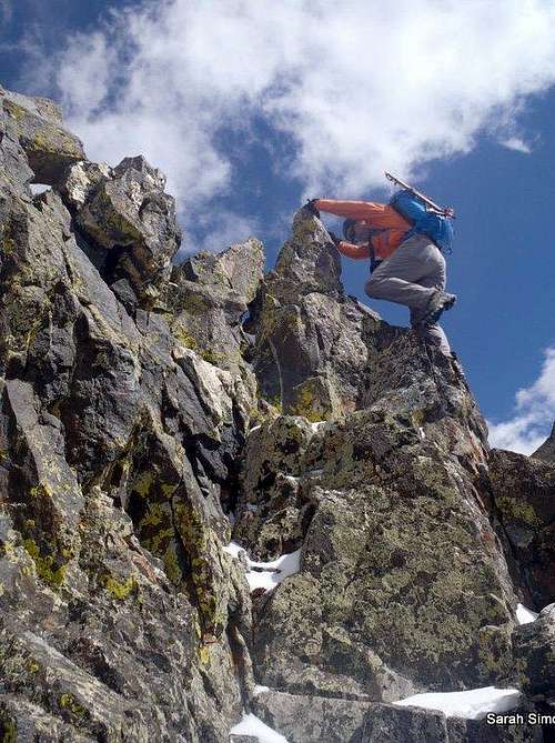
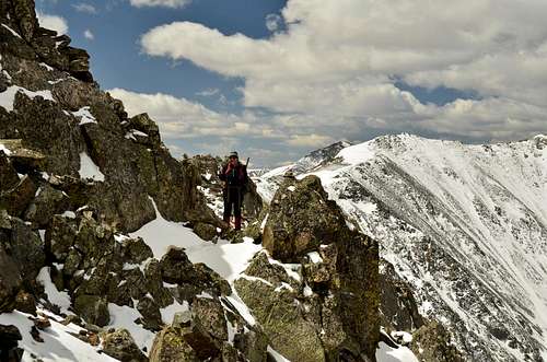
The Southwest Ridge of Wheeler Mountain is a place both beautiful and delightfully thrilling! The views of surrounding high peaks are non-stop, yet the terrain and routefinding are bound to keep your attention.
This ridge is relaxed enough that you can stop and savor the views, but requires attentive route-finding, scrambling on solid rock, trusting not-so-solid talus-upon-scree and negotiating a few slick, downsloping areas a bit less cozy due to recent light snowfall.
There's no reason to rush this ridge!
The weather seemed to be holding, with only moderate clouds building, and the views of surrounding mountains and ranges are worth stopping to catch your breath and scan the horizon for familiar summits.
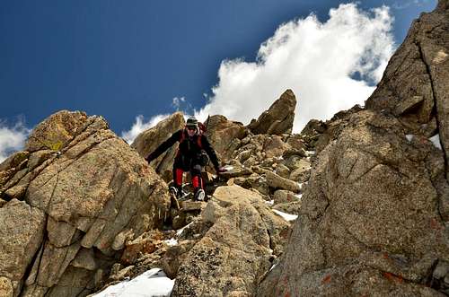
![Ridge is the fun]() The real fun is about to begin! The real fun is about to begin! | This is me in easy terrain along the lower, early reaches of the Southwest Ridge of Wheeler Mountain. Clinton Peak rises in the background. |
![Views, views....]() The views from the ridge are nothing short of amazing The views from the ridge are nothing short of amazing | Are these views not amazing? I nearly slipped off the ridge on slick snow or unstable rock a few times because I was busy taking in the scenery. |
The Summit!
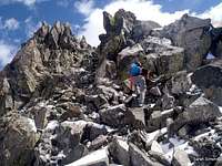
![Almost to the top]() SenadR working the last fun move to the summit
SenadR working the last fun move to the summit
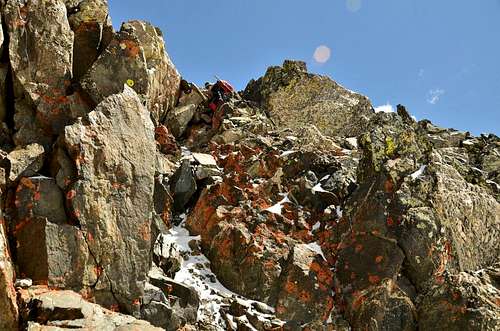
We were weaving our way along the Southwest Ridge, mostly sticking to the western aspect, but sometimes clinging to the ridge proper. Several humps must be overcome and gullies ascended and woven together. But soon we got that summit fever...all roads seemed to lead to Rome and we had to be nearing the top!
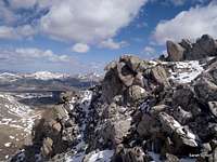
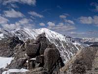
A nice, steep Class 3 move up a horn brought us to the broken, jagged rocks that make up the final last steps to the summit.
The apex of Wheeler Mountain is petite and exhilarating! There is not a whole lot of room for just two people to move around to take photos, enjoy the views and grab some lunch. The world seems to drop away all around you (I guess, really, it does!) making this a summit you won't soon forget.
After celebrating, we snapped photos like rabid paparazzi, grabbed a quick bite to eat, then wistfully began our descent.
Descending the Ridge
It's on the way down that you are reminded parts of this mountain are not really attached. Most of our return down the route was basic retracing of our steps and solid downclimbing, but at least two rubble chutes got our attention as we paid close care to every footfall and downclimbed "single file" to avoid having anyone in the other's fall-line.
Returning to the rock outcrop that marks the end of the ridgeline fun was quite the let-down, but it was time to outhike and head home.
Descending Southern Slopes Into Basin
The upper southern slopes were pleasant and the snow had held firm (firm enough that I almost slipped on my keister. It was as we dropped down near the lakes, however, that the trouble began.
The dreaded postholing.
Lucky for us, safely stationed on dry, high ground, Deb & Mark were on standby to laugh at us as we flailed across the warm early afternoon snow. That, I guess, is what friends are for.
Outhike and Epilogue
Once past the lake, it was back to the Wheeler Lake Jeep Trail. Under the warm afternoon sun, the roadbed had turned into a streambed in places. We charged on, eager to get back to the parking area, kick out of our boots and relax.
What would we do without days like this in the mountains?
![Kodi, Mark & Deb]() Kodi, Mark & Deb with Mount Lincoln (14293 ft | 4357 m) in the background
Kodi, Mark & Deb with Mount Lincoln (14293 ft | 4357 m) in the background
Comments
No comments posted yet.


 Above the second lake
 Finally on the ridge | SenadR
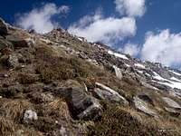 Steep grass!
 The real fun is about to begin!
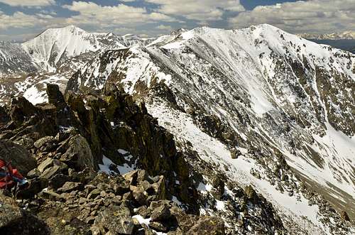 The views from the ridge are nothing short of amazing