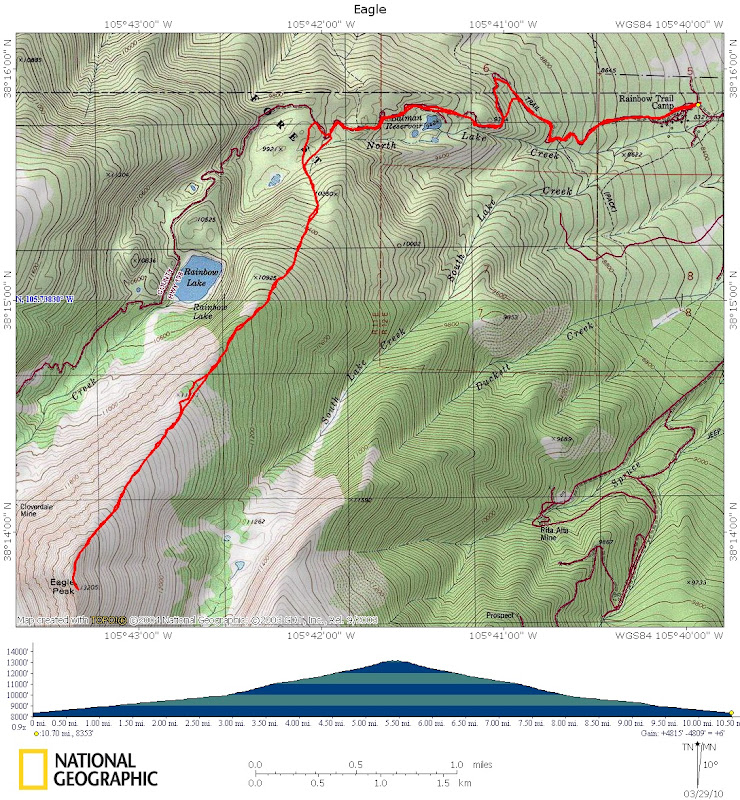
Intro/Stats
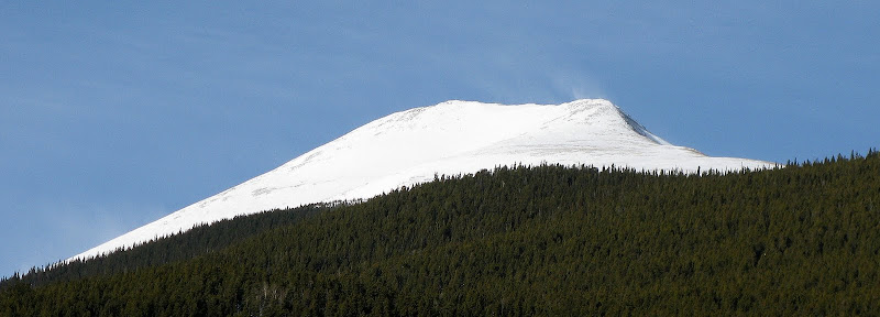
Eagle Peak (13205')
Northern Sangres
10.7 miles RT, 4900' gain
From Rainbow Trail Lutheran Camp on CR-198(8360')
March 29. 2010
Participants: Darin Baker and Kevin Baker
Slideshow
Darin was looking to get some altitude in since he's been mostly into ice climbing this winter, so a new 13er was in order! I suggested the Rosalie group near Evans, but decided to head for the Sangres when I saw 45mph wind gusts in the forecast for Rosalie. The forecast didn't end up being much better in the Sangres, but much of the route on Eagle is in the trees.
Eagle is a seldom climbed, overlooked 13er that offers a nice, mellow, avy safe ridge run to the summit. It's a perfect outing for winter or spring since it's kind of out there on an island all by itself. As expected, County Road 198 was plowed all the way to the Lutheran camp and we found a suitable parking spot just below it. We set out at 7:15am and it was a balmy 25 degrees. Not sure when the last time was when I started an alpine hike with such a warm start. Break out the shorts, baby!
Spring Snow is Here!
Our plan was to hike the road until we were closest to the nose of the northeast ridge at around 9800'. We went without snowshoes for all of about 10 minutes, and quickly donned them when the postholing started above the camp. The snow in the Sangres tends to set up sooner in the spring than the rest of the state due to the huge temp swings during the day, and the trailbreaking was minimal along the road.
We took our direct line to the ridge and left the road just past the prominent switchback at 9800'. I was worried there would be a bit of wallowing on north slopes to get to the ridge, but we were only breaking about a foot of powder on top of a solid base.
We got some fleeting views of the ridge on Eagle and it looked like the banshees were waiting for us. They must be looking for Darin since he hasn't paid the piper recently!
We made good time breaking trail to the ridge and the effort was "easy" enough to even carry on a conversation! As the trees began to thin out, the wind started howling through the trees, but luckily it's only 1500 vertical from treeline to the summit. That's the benefit of climbing these low 13ers! We took one final break before pushing for the summit, donning full body armor for the wind. It was pretty warm though (upper 30's), so frostbite wouldn't be a concern today.
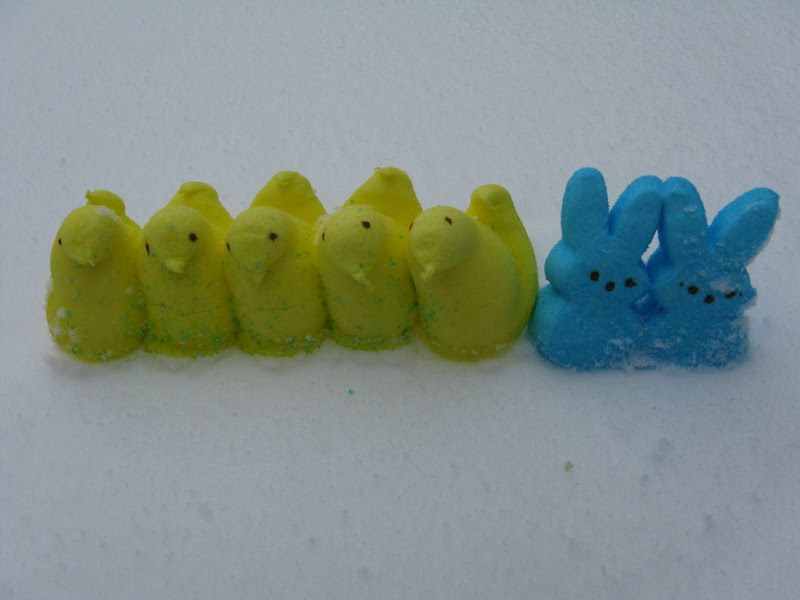
I was pleased to see that Darin brought me some Peeps in honor of Easter, we we downed a few of those for the summit push:
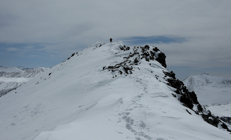
The banshees were not as tormenting as I'd feared, maybe because they didn't have as much of a bite. We stayed slightly below the crest of the ridge weaving around or going across snowfields that were for the most part firm. I don't think the gusts were any higher than 30mph today. The ridge is very mellow until a short, steep section of talus that brings you to the final traverse on a mostly flat ridge to the summit. The snow was pretty hard in the talus section, but it wasn't that steep and we were able to kick steps when necessary.
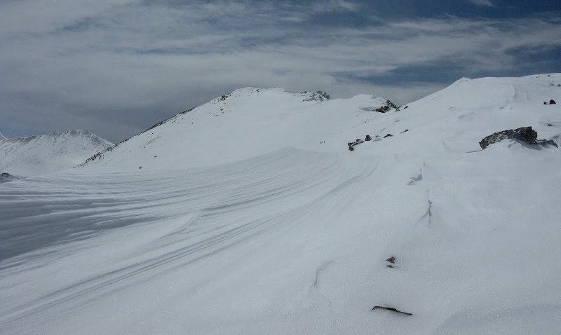
We had to plow through quite a bit of snow on the last few hundred feet across a very photogenic ridge crest. Luckily there were no cornices to deal with, but we made sure we were on terra firma at all times.
Spindrift was blowing up the northwest face, but it wasn't too much of an issue by staying slightly below the crest. We topped out at around 1:05 and enjoyed a balmy break on the leeward side in the sun.
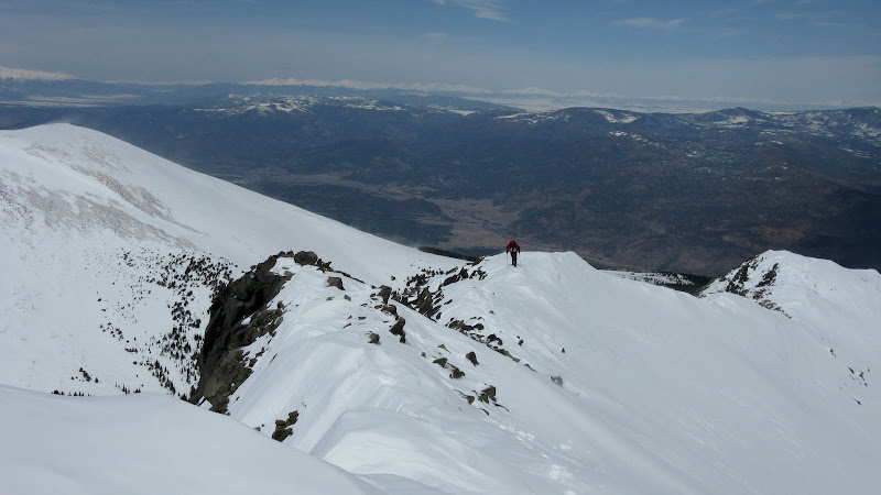
Darin nears the summit:
Even though this was an "easy" 13er, it had quite the rugged appeal to it in early spring. Here's a video of the final few steps to the summit in the deep snow. It's about a 1 min 30 sec video since I go very slow in deep snow at altitude trying to hike while shooting a video!
Summit ridge video
After a pleasant stay, we headed back down the cool ridge, happy to now have the wind at our backs. It only took us 35 minutes to descend back to our snowshoe cache at treeline as the wind pushed us down the slopes, seemingly picking up the further down we got. We timed this hike just right because a couple hours later there was spindrift swirling all over the mountain!
Darin heading down:
The wind had obliterated our track in a few open areas, but we soon picked it back up and enjoyed the fruits of our labor following our trench back to the road. On the way down, we were able to cut a few switchbacks on the road to save some distance and were back at the truck at 4:19. We were actually glad the sun wasn't out all day so that the snow remained firm enough to avoid any significant postholing! Another fine day in the Sangres!
GPS track:


Comments
Post a Comment