Toggle navigation
Mountains
Routes
Images
Trip Reports
Forum
What's New
People
Areas & Ranges
Articles
Trailheads
Canyons
Huts & Campgrounds
Albums
Logistical Centers
Fact Sheets
Lists
Custom Objects
Gear
Plans & Partners
WELCOME TO SUMMITPOST
SIGN IN
REGISTER
Rabbit Ears Peak
Additional Parents
Image
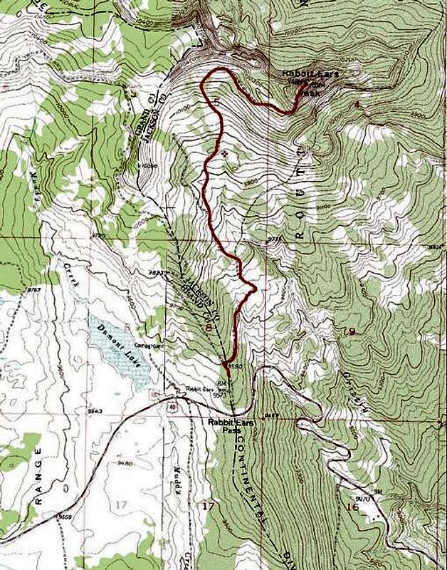
Standard Approach route to...
View High-Resolution Image
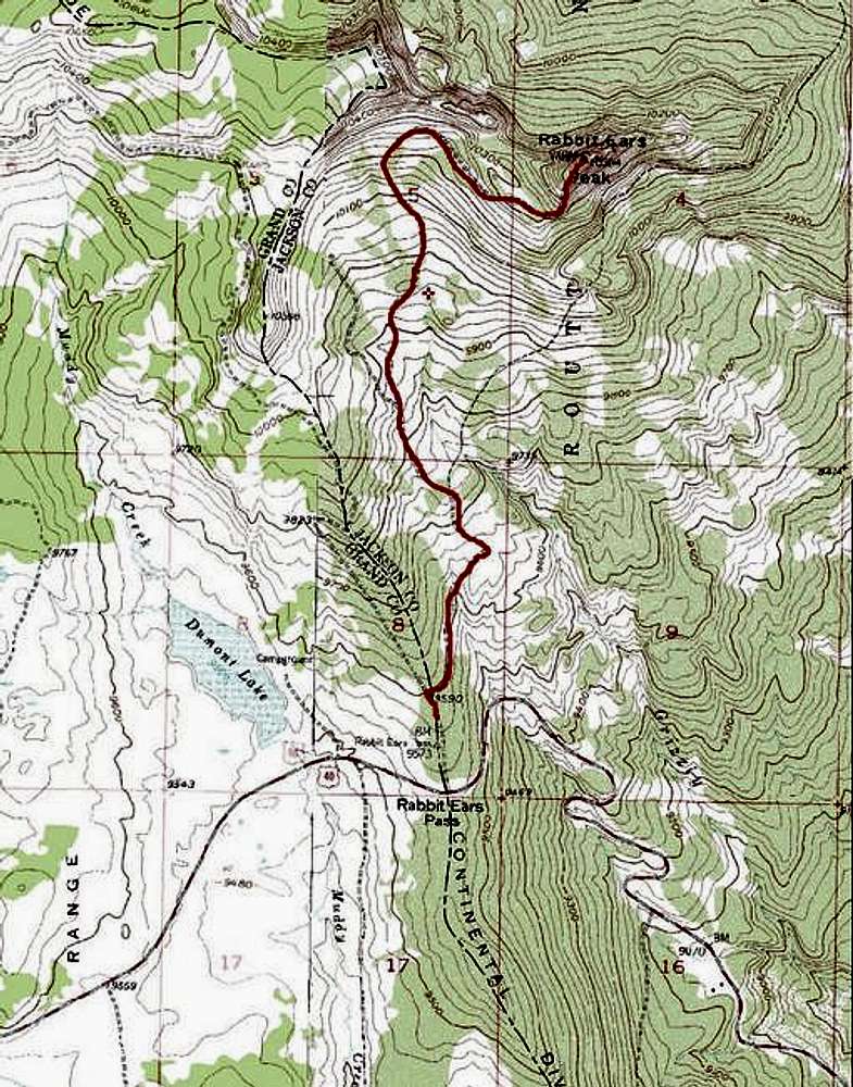
Standard Approach route to...
Standard Approach route to Rabbit Ears Peak. The topo is incorrect regrading the roads in the area. There is a road that goes from US 40 past Dumont Lake, past Dumont Lake Campground and connects to the road where the trail (RED) starts.
« PREV
NEXT »
vanny37
on
Jul 27, 2005 5:16 pm
Comments & voting
Other parents
Lat/Lon:
40.42700°N / 106.6111°W
Image ID:
117033
4682 Hits
72.08
% Score
2
Votes
Log in to vote
Comments
No comments posted yet.
to post!
Don't have an account?
Rabbit Ears Peak
(Mountain/Rock)
« PREV
Viewing
#15 of 18
GALLERY
NEXT »
vanny37's Image Gallery
« PREV
Viewing
#98 of 132
GALLERY
NEXT »
Standard Approach
(Route)
Loading....
×
You need to login in order to vote!
User Name
Password
Remember me
Forgot your password?
Log me out when I close my browser.
Keep me logged in all the time.
sign in as a user
Don't have an account?
Register now for FREE
Rating available
Suggested routes for you
People who climb the same things as you
Comments Available
Create Albums
Register Here


