
-
 436 Hits
-
 81.18% Score
-
 13 Votes
|
|
Mountain/Rock |
|---|---|
|
|
61.57220°N / 8.11771°E |
|
|
Innlandet |
|
|
Mountaineering, Trad Climbing, Scrambling |
|
|
Summer |
|
|
7244 ft / 2208 m |
|
|
Overview
Store Smørstabbtinden 2208 m
The Jotunheimen range is located inside Jotunheimen National Park, 350 km North to Oslo, in the middle of Southern Norway, between the counties of Innlandet and Vestland. In Norwegian Jotunheimen means "Giants Home" and the reason of this nickname is that the highest mountains in Norway lie in this area. It’s the most well-known and the largest mountain range in the country; valley level is about 1400 m and there are quite a number of glaciers in the area and above numerous snowcapped peaks.
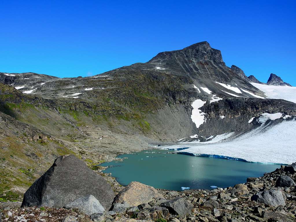
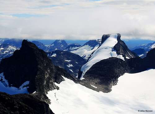
Called "the pyramid of Sognefjellsvegen" due to its appearance, Store Smørstabbtinden is a magnificent mountain surrounded by majestic glaciers on all sides. It's the second highest mountain among the Smørstabbtindene and it's located in Lom municipality, Innlandet county. The peak is 2208 m and has a vertical separation of 200 metres.
Getting There
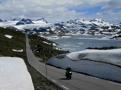
The place to park and start the climb is at Krossbu Mountain lodge 1267 m, hut located along the Sognefjellsveien Road (Highway 55) joining Turtagro and Lom. Obviously it can be reached both from Turtagrø and Lom. There is no international airports in this part of Norway, so getting here from Oslo is as good as any options. The fastest possibility is to drive from Gardermoen airport against Lillehammer and then follow Gudbrandsdalen valley ontop the little town "Otta". Then take left and follow the road against the town Lom. After Lom the road will get higher and higher before it crosses the wild "Sognefjellet" Mountain pass which at 1440 meters is the highest driveable mountainpass in Norway.
Store Smørstabbtinden standard route
Store Smørstabbtinden standard route report
Summit altitude: 2208 m
Difficulty: scramble
Vertical gain: 990 m
Exposure: various
Starting point: Krossbu Mountain Lodge
The route doesn't involve to cross a glacier. It's various and interesting, with a last part a little bit steep. The reward that meets you at the peak makes it worth it! Please note that you should bring proper footwear and clothing for mountaineering, as the weather can change quite quickly in the mountains.
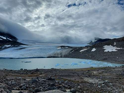
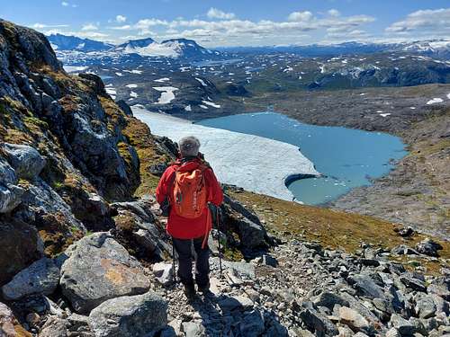
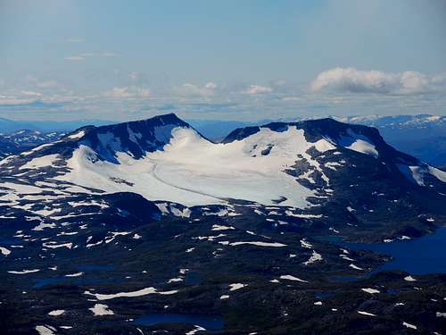
From the car park near the refuge cross a bridge and take the track that goes up along the left side of the Leira stream. The tracks are actually two parallel, the most convenient is the one closest to the river shore. You climb up to a glacial lake with several small icebergs where the Leirbrean glacier ends.
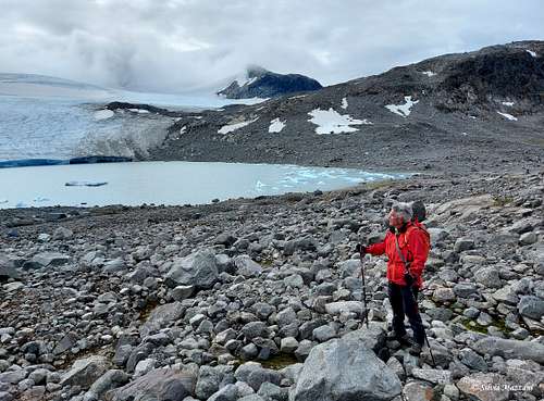
Continue to the left until you find a valley which you cross and return to the right towards a steep slope of rocks and grass. Climb it (cairns), reaching the top of a moraine hill, beyond which a second lake appears, the Leirvtnet. Follow the edge of the morainic hill to the right in the direction of the mountain, first uphill, then downhill.
At the end of the descent you cross a small stream and then start climbing slightly to the right following the cairns.
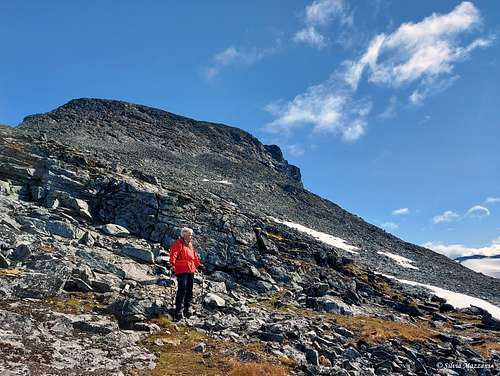
Following a serpentine trail, you return to the left, reaching a large basin of large boulders which you cross in the direction of the left crest of the mountain. Once you reach the crest, continue climbing following the cairns and returning to the right to overcome the steepest section of the climb between rocks and blocks which require a bit of scrambling to overcome.
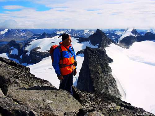
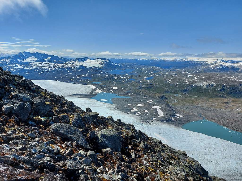
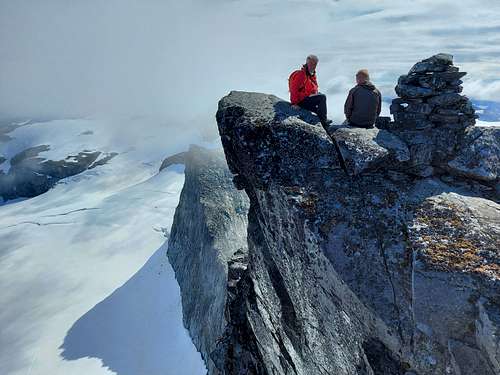
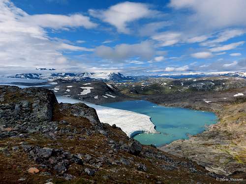
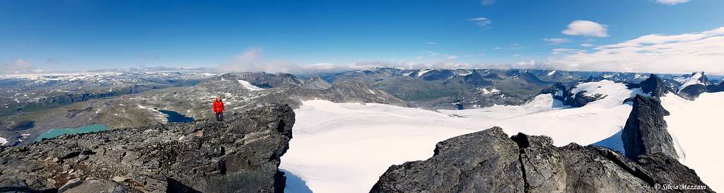
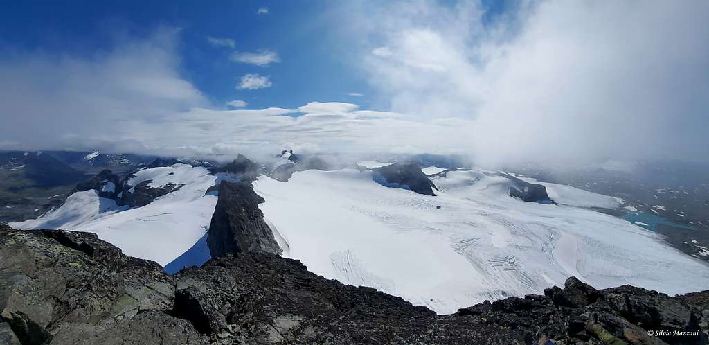
On slightly less steep terrain we reach the upper basin from where some short hairpins lead us to the incredibly aerial summit. The mountain is surrounded by glaciers on almost all sides and from the tiny summit there is a truly impressive vertical drop overlooking the glacier.
The 360° panorama is absolutely incredible: wide views of Jotunheimen and Hurrungane and towards the North West on the Jostedalbrean.
Descent: reversing the same itinerary
Red Tape
Store Smørstabbtinden is placed in the superb Jotunheimen National Park, established in 1980, covering an area of 1140 km² and including the 27 highest peaks in Norway. Jotunheimen is located between Innlandet and Vestland counties and it's bordered by the great lake called Vågåvatnet, the valleys of Bøverdalen and Leirdalen and the road N. 55 (the mytical Sognefjellveg) to the N and NW, by the Road 51 to the East, by Bygdin, Tyin and Årdal to the South and by the mountain road between Årdal and Turtagrø to the West. There are no particular restrictions in climbing and hiking. Its purpose is to preserve the environment. There are no particular restrictions in climbing and hiking, however act as careful as possible and make no impact on the vegetation and wildlife.
Please visit "Forskrift om Jotunheimen nasjonalpark, Lom, Vågå, Vang, Luster og Årdal kommunar, Oppland og Sogn og Fjordane" (in Norwegian).
When to Climb
Summer is the best season
Accomodation and Camping
Meteo
Public transport
- Fjord1: operate busses from Otta to Lom - http://www.fjord1.no/en/default.asp?page=1577
- Nor-Way: Norwegian long distance bus operator (for a bus from Gardemoen to Otta/Lom) - http://www.nor-way.no/?lang=en_GB.
- NSB: Norwegian national rail company (for a train from Gardemoen to Otta) -http://www.nsb.no/?lang=en_US
Guidebooks and maps
Guidebooks
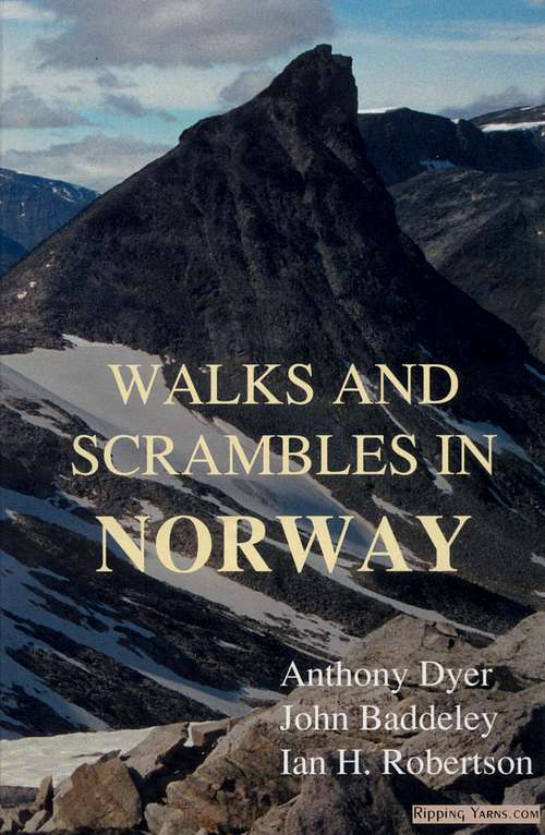 |
Walks and scrambles in Norway
Anthony Dyer - John Baddeley - Ian H. Robertson
Hiking, Scrambling and Mountaineering in Norway, an English guidebook covering Jotuheimen and several other areas in the Scandes
Ripping Yarns 2006
|
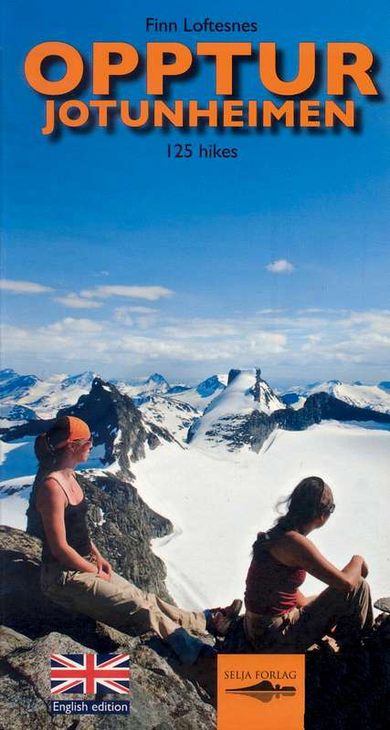 |
Opptur Jotunheimen
Finn Loftesnes
125 selected itinerary on Jotunheimen
Selja Forlag 2009
|