T2W Tahoe to Mt. Whitney 2015 hike
“The mountains are calling and I must go.”
John Muir, co-founder and first president of the Sierra Club
Answering the call of the wild, I boarded Southwest Airlines on July 1 for the Sierra Nevada Mountains in California. 400 miles long and approximately 70 miles wide, the majestic Sierras span 3 national parks, 20 wilderness areas and 2 national monuments. A backpacker’s paradise. Determining where to hike is problematic; beauty abounds everywhere. I’ve always dreamed of hiking the John Muir Trail (JMT), a 211-mile route that follows the rugged backbone of the Sierra Nevada Mountains from the Happy Isles Trailhead in Yosemite Valley to Mount Whitney’s summit, the highest mountain in the contiguous United States. John Amorosano’s and Landmark Adventure’s YouTube videos provide valuable beta for planning a JMT hike. People come from around the world to hike the JMT. The National Park Service (NPS) sets a maximum daily quota ensuring a pristine wilderness experience for the lucky individuals snaring a permit. The NPS begins issuing permits 26 weeks in advance and the permits go like hot cakes! Hikers on the Pacific Crest Trail (PCT) are allowed to pass through Yosemite, Kings Canyon, and Sequoia with their PCT permits and aren’t required to purchase JMT permits. Unable to secure a JMT permit, I got a PCT permit instead and began my backpacking trek at Lake Tahoe, 160 miles north of Yosemite. What’s an extra 160 miles?
Arriving at the Echo Summit trailhead, I experienced hesitation realizing I was embarking on a 400-mile journey requiring 32 days. Leaving at 5:45 p.m., several hours later than I originally anticipated, I didn’t make it to Showers Lake 6 miles away. Establishing camp near a mountain brook just 3 miles from the trailhead, I awoke with the sun the following day and pounded miles making up for yesterday’s late start. California was experiencing their worst drought ever, but rain, sleet, hail, and lightning were daily occurrences from Lake Tahoe to Yosemite. What’s a hiker to do when it begins to rain, sleet, and hail? Put on your rain gear and keep going. Hunkering down under a tree waiting for the storm to pass results in only getting wet, cold, and depressed. You’re still under that tree hours later after you’re drenched and finally decide to get moving. Lightning storms are a totally different story. Get off the mountain passes and exposed areas ASAP when hammer-wielding Thor throws angry bolts of lightning and thunder echoes across the mountains.
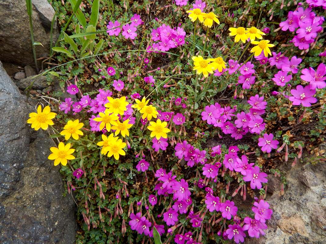
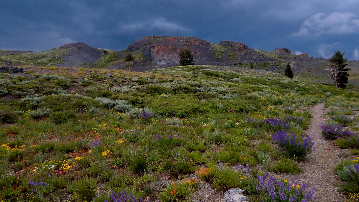
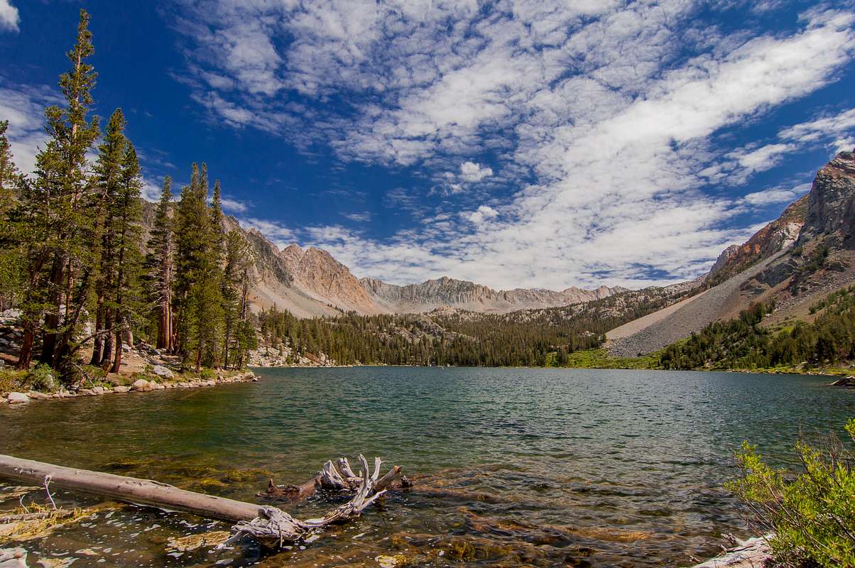
Coffee colored clouds brewed overhead in stark contrast to blossoming wildflowers blanketing the meadows. An early spring melted the winter’s snow providing sufficient moisture encouraging a dazzling explosion of wildflowers in a kaleidoscope of colors. The hills were alive, not with the sound of music, with countless hues of blue to purple lupines, reddish-orange Indian paintbrush, and wildflowers possessing every imaginable color as far as the eye could see. The Fourth of July fireworks’ finale back in Lake Tahoe surely paled in comparison to Mother Nature’s wildflower display. The loop trail from Carson Pass to Winnemucca Lake returning via Woods Lake is one of the premier wildflower walks in the Mokelumne Wilderness.
![Pretty flowers along the PCT]() Pretty flowers along the PCT
Pretty flowers along the PCT![Pretty flowers along the PCT]() Pretty flowers along the PCT
Pretty flowers along the PCT
![Stormy clouds and beautiful flowers]() Stormy clouds and beautiful flowers
Stormy clouds and beautiful flowers
Thor was becoming angry and preparing for battle as ominous storm clouds now filled the sky and thunder rumbled in the distance. No sign of lightning from my vantage point of 9,000’ elevation near the Winnemucca Lake junction. Hastily, I hiked across the vast barren landscape over Forestdale Divide to Lost Lakes. I found Lost Lakes easily and established camp on the western shore of the closest lake. Surprisingly, no other backpackers sought refuge at Lost Lakes nestled amongst the pines between two long barren stretches lacking water sources. Perhaps Lost Lakes are aptly named after all?
Although I haven’t seen Sasquatch on the trail (yet), I prayed a ‘trail angel’ would miraculously appear at Ebbetts Pass. Leprechauns may be fictional; but trail angels are as real as you and I. Trail angels are good Samaritans conjuring up ‘trail magic’ for weary hungry backpackers. Trail magic is an unexpected act of kindness from complete strangers. Magic includes burgers, cookies, ice cream, fresh fruit, cold beverages, transportation to or from town, and hot showers or warm beds in their private residences. Think of trail magic as feeding a lost cat trying to find its way home. Trail angels like the majority of PCT/JMT hikers have ‘trail names’. Meadow Mary regularly stocks an ice chest with magic at Ebbetts Pass. Unfortunately, the magic disappeared prior to my arrival transforming the magic box into a trash receptacle. Rather than enjoying a cold refreshing beverage or fresh fruit, the ice chest contained only empty bottles and candy wrappers.
My first resupply was Kennedy Meadows, a privately owned pack station located 7 miles west of Sonora Pass on Hwy 108. I arrived at Sonora Pass as five backpackers were cramming themselves and their gear in the camper shell of a pickup truck. There goes my ride! My disappointment quickly turned to joy as the next approaching vehicle stopped. Arriving at Kennedy Meadows, the pickup driver expressed sorrow he couldn’t drive all of us to Kennedy Meadows. Upon learning I was spending the night, Charlie agreed to drive me back to Sonora Pass the next morning.
Back on the trail, I continued southward like a migrating monarch butterfly flying over the high ridges heading for the safety of Kennedy Canyon. I established camp adjacent to a nice mountain stream at PCT mile marker 1004. Several northbound PCT hikers camped nearby. They planned on bypassing Kennedy Meadows going directly to their next resupply at Lake Tahoe. I jumped at the chance to lessen my pack’s weight by offering these backpackers some of my food I picked up at Kennedy Meadows. Camaraderie among backpackers is unparalleled. Need food, fuel, or first aid supplies? There’s a backpacker willing to share.
A lone deer greeted me on July 8, as I entered Yosemite National Park via the park’s northern boundary over Dorothy Lake Pass. Occasionally, I encountered northbound PCT hikers or people hiking Yosemite’s remote northern section. The weather conditions were still unfavorable with occasional periods of rain, sleet, hail, and lightning. Putting on and removing rain gear several times every day became frustrating. It stopped raining whenever I put it on and started raining again whenever I stored it away. The scenery; however, changed drastically. Nor more red volcanic rock; just sparkling white granite everywhere.
![Deer at Dorothy Pass]()
Deer near Dorothy Lake Pass![Raining at Dorothy Lake]()
Raining at Wilma Lake
“The world is a big place and I want to have a good look before it gets dark.”
John Muir
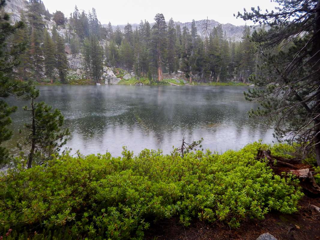
Yosemite offers over 800 miles of hiking trails ranging from easy short day hikes to strenuous multi-day backcountry treks requiring scrambling and route-finding abilities. There’s something here for everyone. The California Conservation Corps, CCC, the oldest and largest conservation corps in the world, performs trail work in Yosemite. Every spring, crewmembers trade the comforts of civilization and toil 5 months in the backcountry performing trail maintenance. Vegetation along the trails must be pruned back or trails in thickly vegetated areas soon become impassable. Where trees have fallen across the trail, sections of the trunk must be removed. Erosion measures include channeling rain and snowmelt off trails dispersing the run-off. Enormous rock boulders are split by drilling holes and driving steel ‘wedges and feathers’ into the drilled holes stressing the rock past its tensile strength. Crewmembers move these smaller boulders often weighing 500 pounds with crowbars, building stone steps or retaining walls. The Wilderness Act of 1964 prohibits electrical generators, power tools, explosives, and chainsaws in wilderness areas requiring crewmembers to use two-man logging saws, sledgehammers, picks, and shovels. Hard manual work, indeed. Yet many individuals return year after year performing this back-breaking labor in our country’s most beautiful wildernesses. I encountered my first trail crew after crossing over Seavey Pass and descending towards Benson Lake. The light drizzle intensified as we chatted prompting everyone to run for cover. Concealing their tools among the vegetation, we tried out running the approaching thunderstorm as we hurried to Benson Lake still three miles away. Arriving at Benson Lake, I hunkered down on the leeward side of a large pine tree seeking shelter from the rain. The CCC workers had arrived earlier and weren’t anywhere to be seen. Rather than pitching my tent in the rain (I hate setting up or breaking camp in the rain), I ventured out searching for them. Secluded at the far end of the lake, their camp consisted of several large canvas tents and shelters. Accepting their invitation for supper, we swapped stories as rain pounded the canvas roof like a drum. Each crew has a full time cook who prepares breakfast, sack lunches for the trail, and supper. Sitting under a canvas tarp next to a fire filling my belly with hot chili sure beats hunkering down under a tree. Crewmembers are a diverse group from all ‘walks of life’ united by their love of the outdoors. Surprisingly, females composed a third of the crew. Several hours later, the rain stopped. I thanked them for their hospitality and quickly established camp on the lake’s sandy shore. Snuggled in my sleeping bag with a belly of chili, sleep came quickly.
![Benson Lake]() Benson Lake
Benson Lake
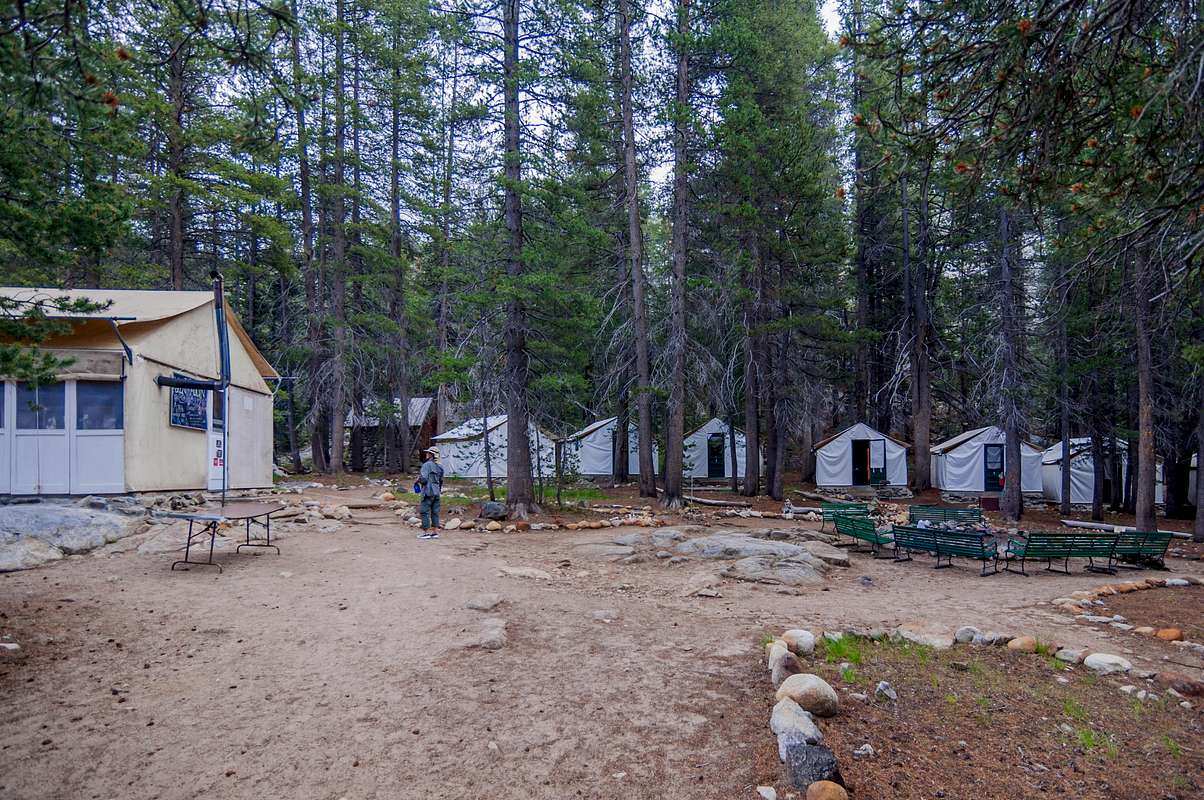
On July 11, I arrived at Glen Aulin High Sierra Camp located near a nice swimming spot at the base of White Cascades Falls on the Tuolumne River. Glen Aulin is one of five high sierra camps conveniently located approximately 6-10 miles apart along a loop trail throughout Yosemite. Four of these camps are in the heart of Yosemite. Glen Aulin, on the other hand, is north of Tuolumne Meadows. Non-backpackers can experience Yosemite’s backcountry without a heavy pack easily hiking from one camp to another completing the circuit or electing to stay several days at a particular camp. Paying guests are pampered with prepared meals, beverages, showers with hot water, flush toilets, and warm beds in tent cabins. An annual on-line lottery determines who receives a permit and like the JMT permits, they disappear fast. Backpackers spending the night at high sierra camps are interned in the backpackers’ area, aren’t allowed to dine in the cafeteria, aren’t permitted to use the showers, and must use pit-style toilets. They sure know how to make us feel welcomed. I’m sure us smelly dirty backpackers have just as much fun (or possibly more) than the ‘city-slickers’ living the high life in their furnished cabins.
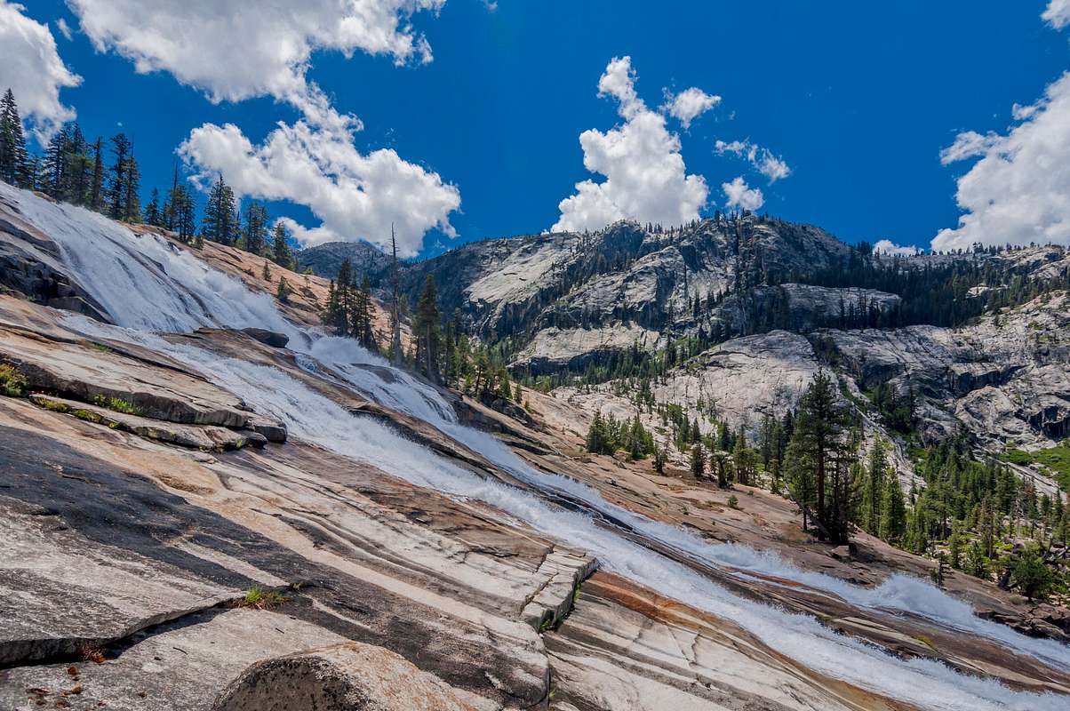
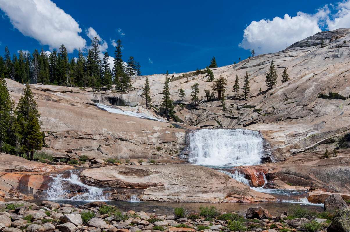
On Sunday, July 12, I spent an additional day at Glen Aulin since the post office at Tuolumne Meadows wasn’t open and I wouldn’t be able to pick up my resupply package until the following day. Waking up to bluebird skies with puffy marshmallow clouds, I day hiked down the Grand Canyon of the Tuolumne River past California Falls, LeConte Falls, Waterwheel Falls, and countless smaller waterfalls cascading over sparkling white granite. Swimming holes everywhere. The Tuolumne River flows into the infamous Hetch Hetchy Reservoir, once a mirror image to world-renowned picturesque Yosemite Valley prior to building the O’Shaughnessy Dam. After the massive 1906 San Francisco earthquake and subsequent fires that practically burnt the city to the ground, James R. Garfield, the United States’ Secretary of the Interior, granted San Francisco the rights to dam the untamed Tuolumne River forever flooding this beautiful valley.
![Tuolumne River cascading towards Hetch Hetchy Reservior]()
Tuolumne River cascading towards Hetch Hetchy Reservior![Tuolumne River in the Grand Canyon of the Tuolumne]()
Tuolumne River in the Grand Canyon of the Tuolumne
“Dam Hetch Hetchy! As well dam for water-tanks the people’s cathedral and churches, for no holier temple has ever been consecrated by the heart of man.”
John Muir
Several attempts at funding feasibility studies for demolishing the O’Shaughnessy Dam and allowing Mother Nature to reclaim Hetch Hetchy has proved futile.
I returned to Glen Aulin as the paying guests were enjoying steak for supper. Banished to the camp’s outer limits with the other riff-raff backpackers, I fired up my backpacking stove and prepared Mountain House beef stroganoff with noodles. Mountain House advertises their meals as 2.5 servings. This may satisfy two normal people; a hungry hiker can easily consume the entire entrée. A 4-ounce serving of Idahoan bacon and cheddar mashed potatoes and hot chocolate completed the meal.
![Glen Aulin]() Glen Aulin
Glen Aulin![Glen Aulin cafeteria]() Glen Aulin cafeteria
Glen Aulin cafeteria
Hiking the remaining 6 miles to Tuolumne Meadows, I arrived at our country’s smallest busiest post office. The 12’ x 12’ post office is literally stacked floor to ceiling with several hundred resupply boxes awaiting pickup. I enjoyed breakfast burritos in the adjacent Tuolumne Meadows Grill while a postal worker retrieved my package amongst the over-stocked room. It resembled Christmas as dozens of backpackers eagerly opened their resupply boxes on the wooden picnic tables nestled under the large pine trees. Having adequate food again is reassuring, but increasing my pack’s weight 10-14 pounds is frustrating. Backpackers in Yosemite, Kings Canyon, and Sequoia National Parks are required to store their food and toiletries in bear resistant canisters, another 3 pounds to carry. I struggled cramming my food in the bear canister and decided to mail a few needless items home. Items tossed in your pack at the last moment “just in case” are better left behind. Gone were the second cooking pot, coffee mug, an extra long sleeved shirt, and solar charger.
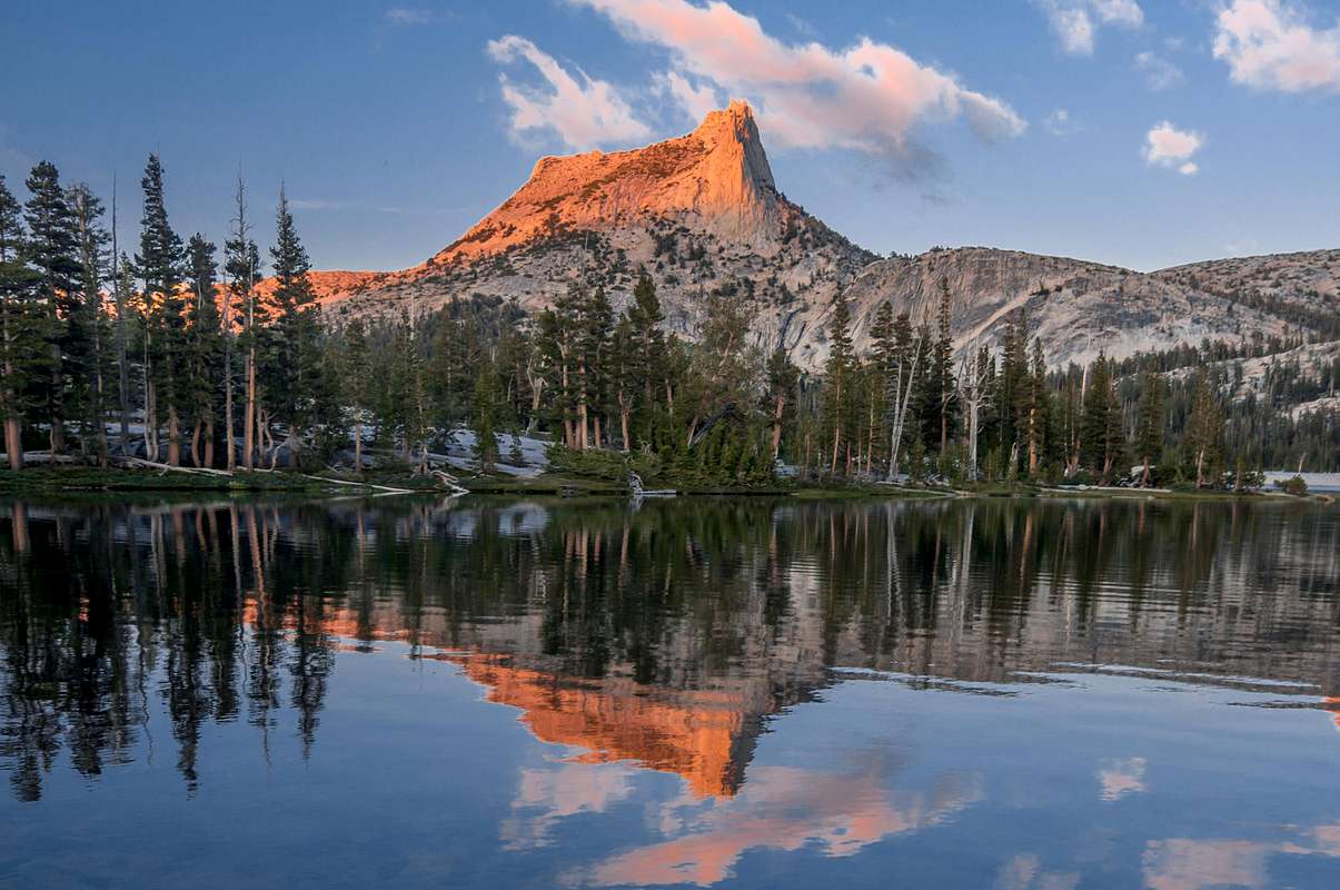
After chatting with several backpackers I met at Kennedy Meadows, I began hiking the John Muir Trail towards Yosemite Valley. Due to the close proximity to Tuolumne Meadows Campground, I met numerous day hikers stretching their legs and a few ambitious ones returning from Cathedral Lakes, tonight’s destination. Multiple parallel paths nearly touching one another scar this fragile meadow due to the trail’s popularity. Litter is also a problem near congested campgrounds. I saw empty water bottles, candy wrappers, and several articles of clothing including a pair of underwear along the trail. I understand how someone can leave sunglasses on a fallen tree trunk or forget a removed article of clothing; but how does someone lose their underwear? Other ‘lost’ items I saw along the PCT/JMT trail included sandals, hats, tents, and tent poles. Items strapped on a pack’s exterior can become ‘lost’ if a strap breaks. I lost my ball cap and another backpacker returned it upon my arrival at Muir Trail Ranch. Practically all PCT/JMT hikers, whether they’re northbound or southbound, stop at Muir Trail Ranch, a resupply point. I normally leave lost items along the trail for I have no idea of the hiker’s direction or whether they’ll retrace their steps looking for it. Finding a nice campsite on the lake’s west shore, I pitched my Big Agnes FlyCreek2 tent and prepared supper. Bloodthirsty mosquitoes chased me around lower Cathedral Lake as I enjoyed the spectacular alpenglow on Cathedral Peak.
![Cathedral Peak]() Cathedral Peak
Cathedral Peak
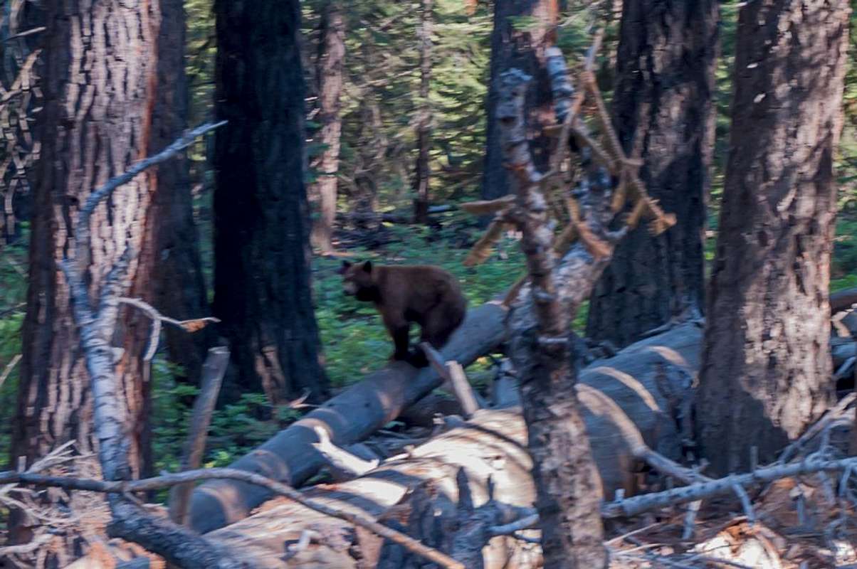
On July 14, I hiked past the Sunrise High Sierra Camp and left the John Muir Trail to ascend Clouds Rest. The weather was perfect; otherwise, I would have remained on the JMT continuing on to Little Yosemite Valley. My second time atop Clouds Rest was just as memorable as my first summit. Rising over 9900 feet, Clouds Rest offers Yosemite’s best 360-degree panoramic views. Notable landmarks visible from the summit include Half Dome, North Dome, Basket Dome, Sentinel Dome, and Tenaya Lake. I encountered a mature black bear as I neared my campsite at the spur trail to Half Dome. Thank god, I had a bear canister. I might be mauled to death; but at least my food was safe! The fact you’re reading this signifies I survived my encounter with Mr. Bear. Every year, people perish or mysteriously disappear in Yosemite’s backcountry and this year wasn’t an exception. Two teenage boys were killed when a tree limb crashed onto their tent during the night in Upper Pines Campground during August. Three men - each hiking solo - have mysteriously died within Yosemite Park also during August. As of today, the NPS hasn’t released the cause of death of any of these solitary hikers. This is very unusual. Sasquatch? Alien abductions? A crazed murderer? Normally, the cause of death (e.g. swept over waterfall, fall, climbing accident, natural causes, bear attack, etc.) is very apparent and listed in the news release.
![Little Yosemite Valley]() Little Yosemite Valley
Little Yosemite Valley
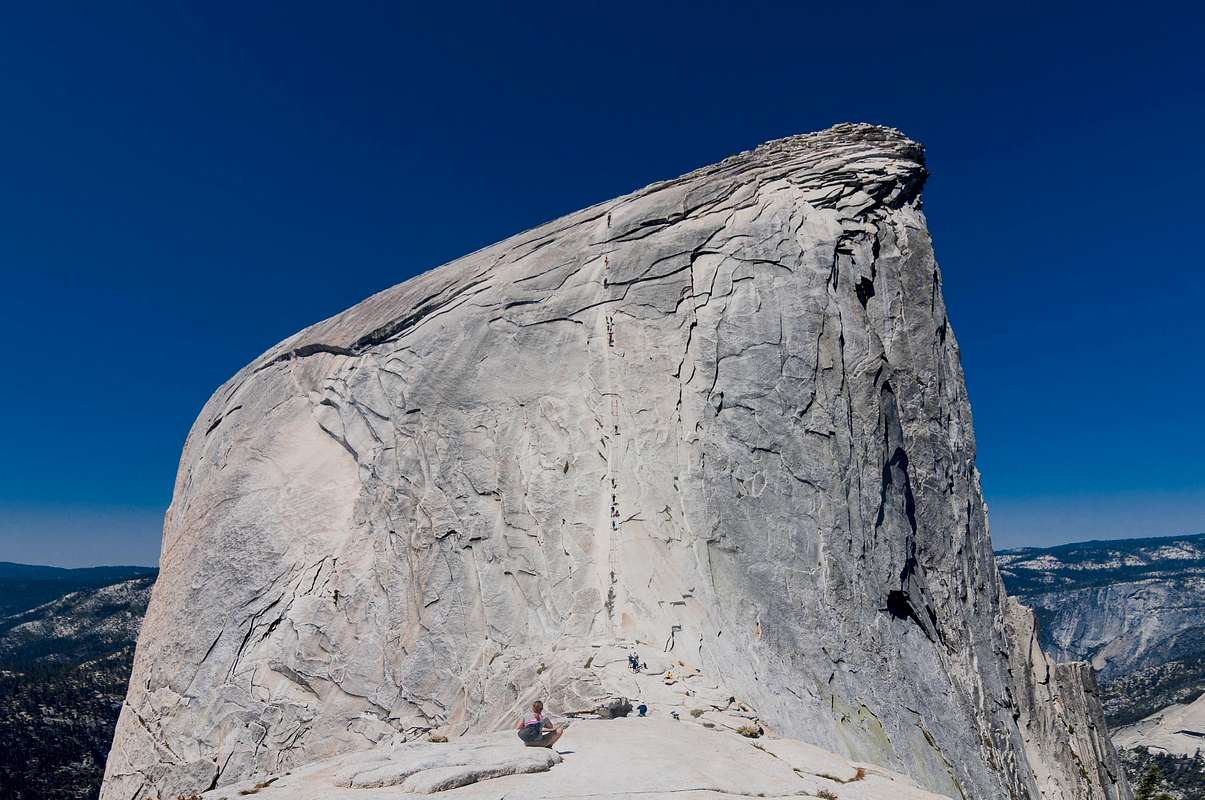
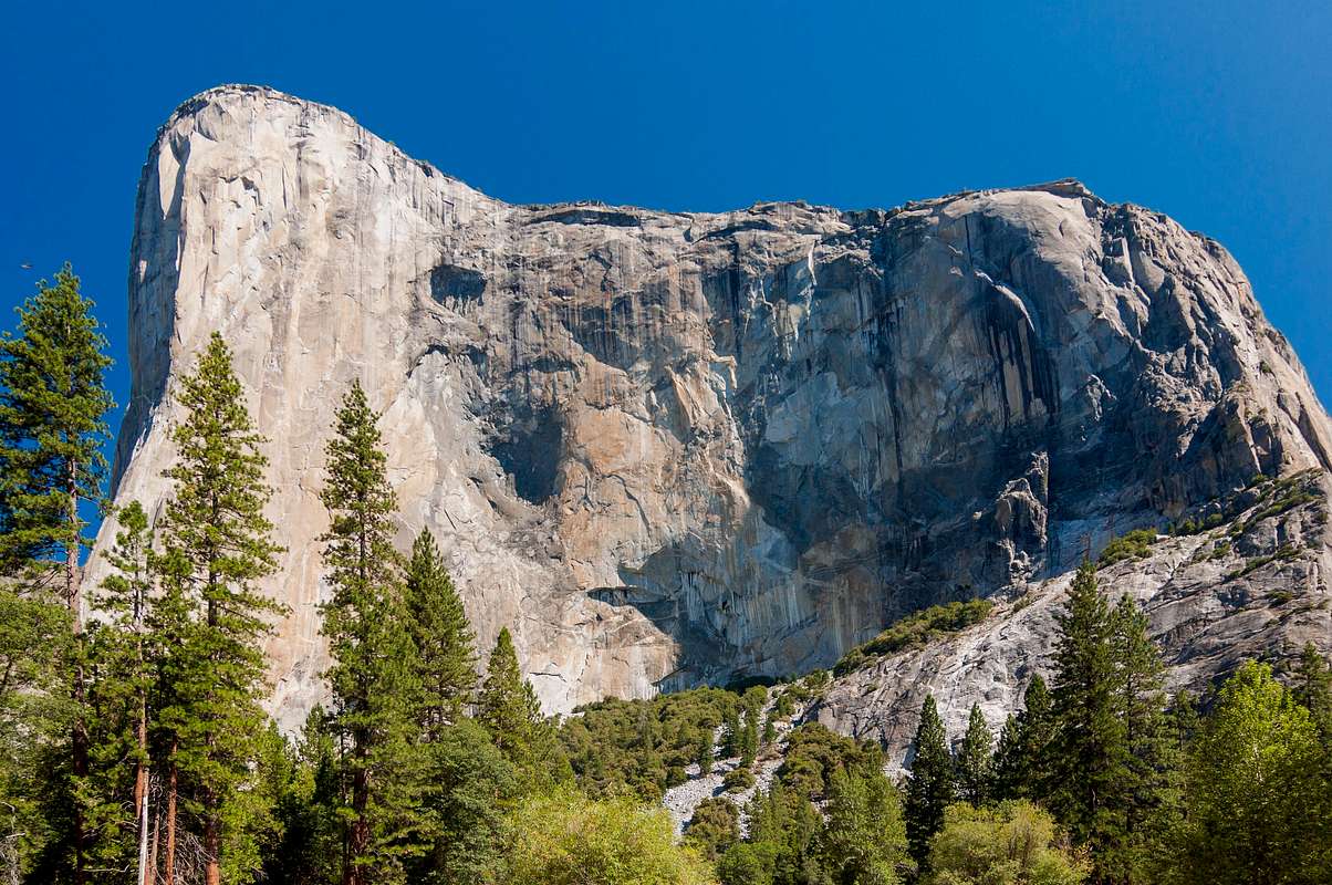
Spent the night at Camp 4, where Royal Robbins, Tom Frost, Yvon Chouinard, and other notable climbers congregated, often illegally, during the ‘60’s. Camp 4 is listed on the National Register of Historic Places for “its significant association with the growth and development of rock climbing in the Yosemite Valley during the ‘golden years’ of pioneer mountaineering.” Arriving too late to secure a tent permit at Camp 4, a NPS ranger permitted me to crash with established campers. (I’m guessing the ranger had sympathy for this weary, scruffy-looking backpacker. At least that’s the image I tried to portray.) My newest best friends and I swapped stories over a roaring fire as day transformed into night. They were surprised I was hiking the John Muir Trail after already hiking 160 miles from Lake Tahoe. Spent the following 1 ½ days walking throughout the valley. Viewed Cathedral Rocks, the Leaning Tower, El Capitan, and Yosemite Falls, the highest waterfall in the United States. I silently wondered how many cars would be permitted into the valley before the NPS restricts vehicular traffic similar to Zion National Park? Every lodge and campground was filled to capacity! People everywhere all desperately trying to “get away from it all.” The second night I retreated to the backpackers’ secluded campground near the horse stables. The foul smelling stench wafting through the evening air was either horse manure or smelly backpackers. I couldn’t tell.
![Half Dome]() Half Dome
Half Dome![Half-Dome]() Half-Dome
Half-Dome
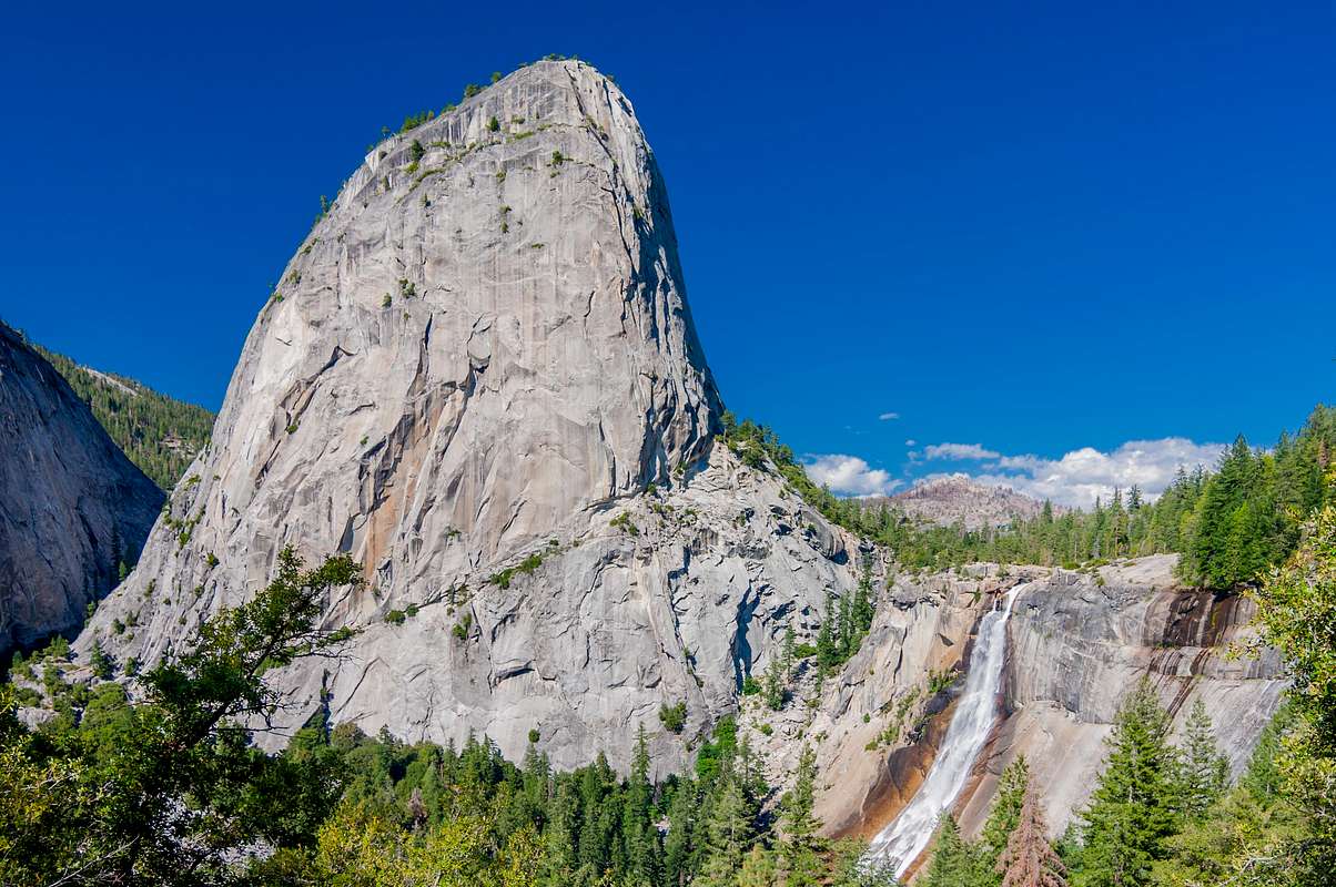
![Liberty Cap and Nevada Falls]() Liberty Cap and Nevada Falls
Liberty Cap and Nevada Falls![El Capitan]() El Capitan
El Capitan
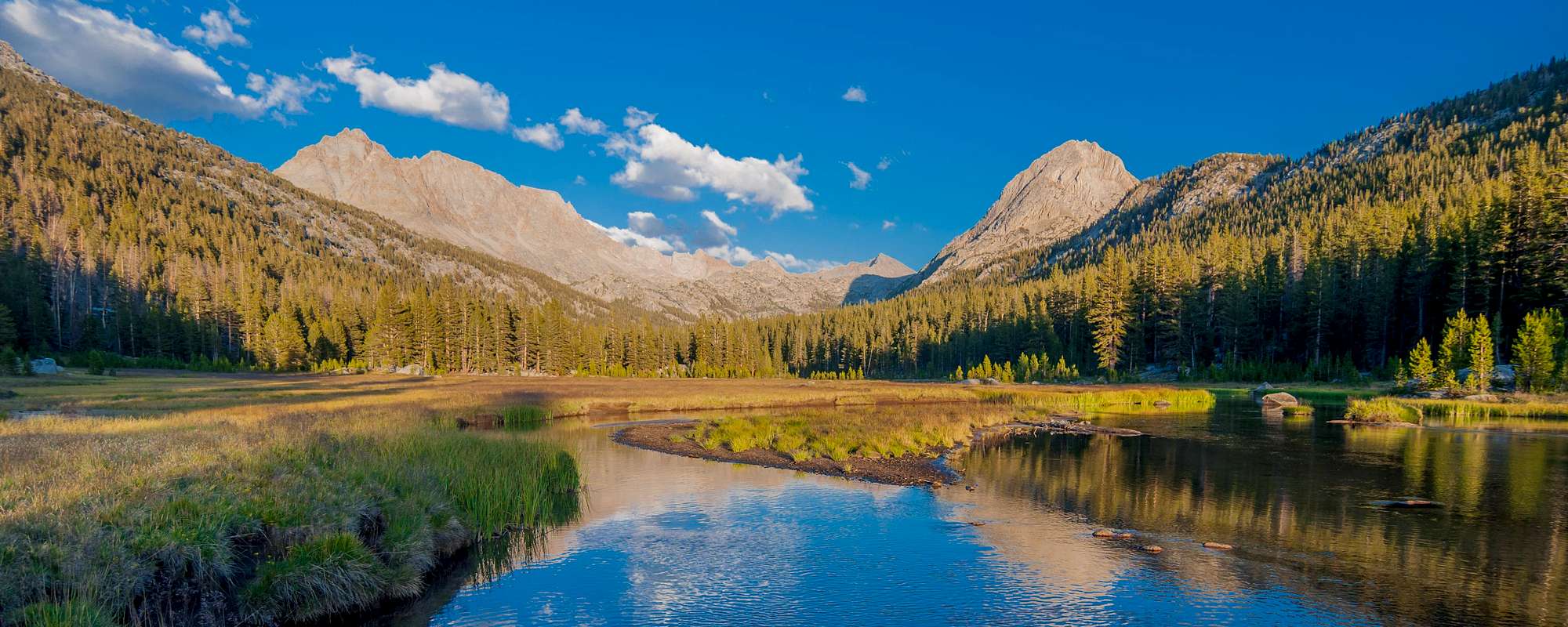
Back at Tuolumne Meadows, I rejoined the JMT/PCT and began hiking up Lyell Canyon, a classic textbook example of a glacier U-shaped valley with characteristic steep vertical sides and a broad relatively flat floor. The first 8 miles from Tuolumne Meadows is practically flat as the meandering Lyell Creek flows leisurely towards Tuolumne River. Deer grazed in the lush meadows. Mr. Bear was nowhere to be seen. Possibly, he ventured into the Valley and began breaking into vehicles in search of food or making plans to steal some hapless day hiker’s picnic basket. Food and all toiletries must be removed from vehicles and stored in bear resistant bear boxes, bear canisters, or within a hard-sided structure. Rangers regularly issue tickets for non-compliance. I could have easily crossed Donahue Pass that day, but the surrounding beauty begs you to slow down and enjoy the scenery. The majestic Kuna Crest rises several thousand feet above the valley’s floor on the east. Trails leading southwest follow drainages to Vogelsang High Sierra Camp. Donahue Pass is the first of 9 mountain passes over 10,000’ I’ll climb on my southward trek to Mt. Whitney. The others are Island Pass, 10,205’; Silver Pass, 10,895’; Selden Pass, 10,880’; Muir Pass, 11,955’; Mather Pass, 12,100’; Pinchot Pass, 12,130’; Glen Pass, 11,978’; and formidable Forester Pass, 13,200’. I established camp in the upper reaches of Lyell Canyon within striking distance of Donahue Pass. Most backpackers prefer crossing mountain passes in the morning, not late afternoon after hiking all day. Worst is crossing a mountain pass after sunset with only the stars, moon, or a headlight illuminating the way.
![Lyell Canyon]() Lyell Canyon
Lyell Canyon
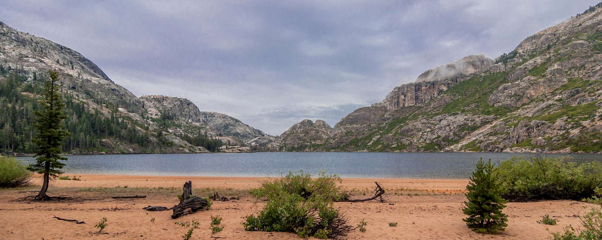
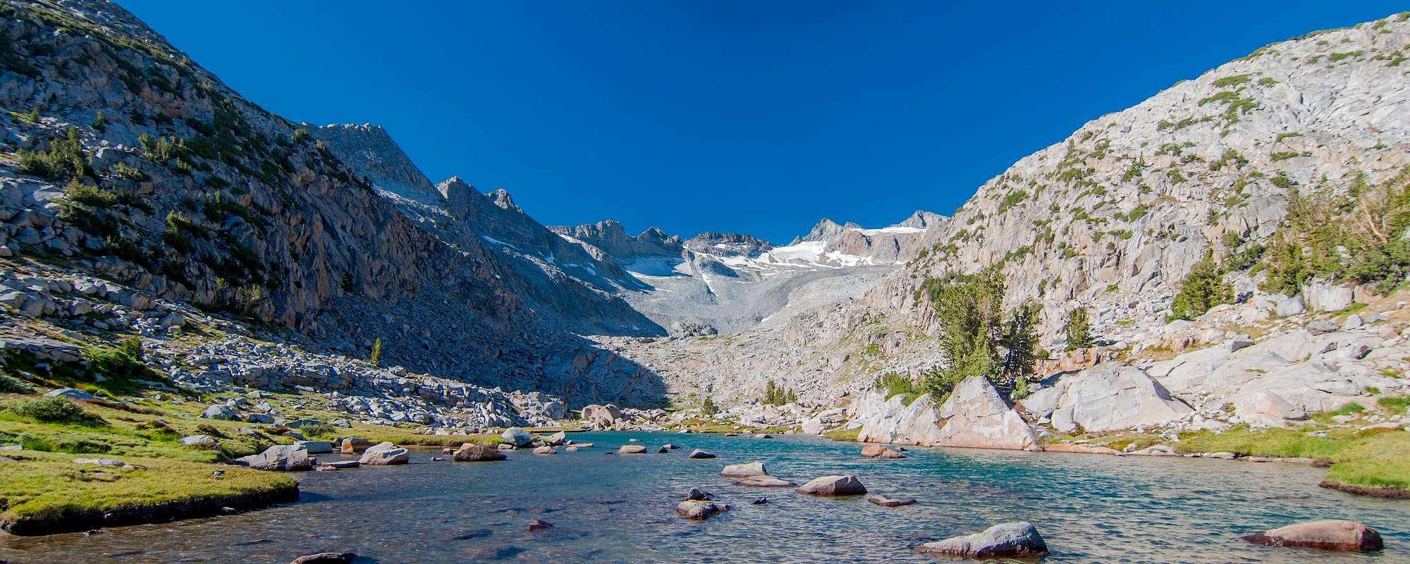
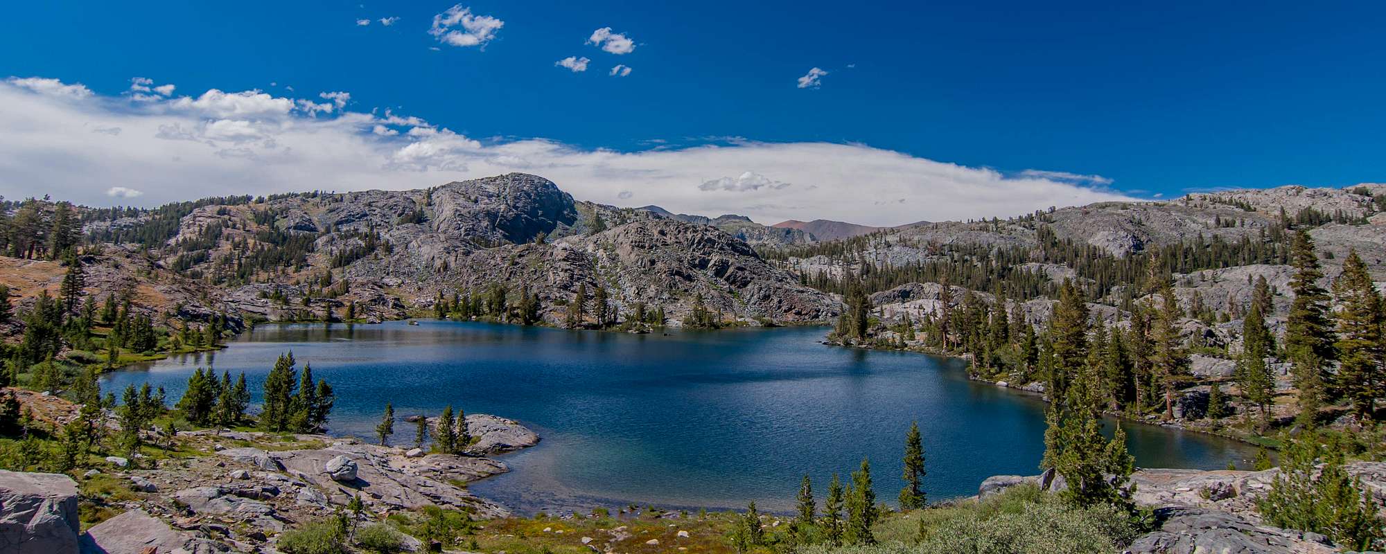
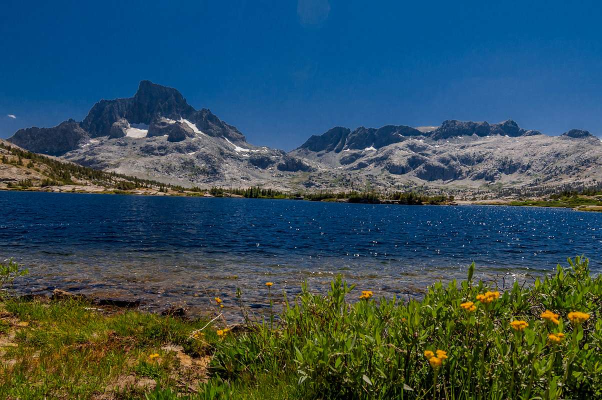
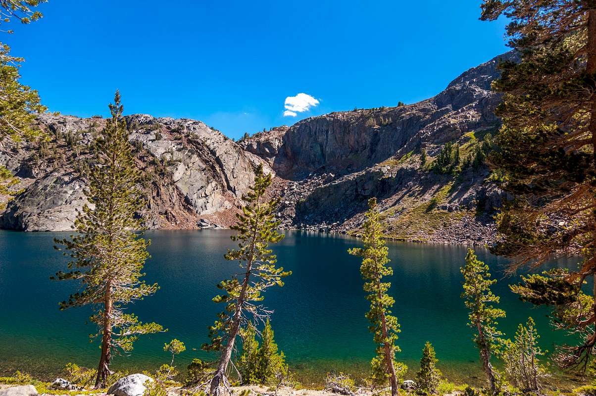
Crossed over snow free Donahue Pass into Ansel Adams Wilderness early the next morning. Ansel Adams Wilderness may lack Yosemite’s wonderful waterfalls but offers some of the most beautiful alpine lakes in the Sierra Nevada Mountain Range. Thousand Island, Emerald, Ruby, Garnet Lake, and Shadow Lake are on the JMT, whereas Waugh, Gem, Sullivan, and Clark Lakes are within a few miles. Each worthy of a visit. The trail drops nearly 1500’ before ascending Island Pass. Thousand Island Lake, one of the prettiest places on the John Muir Trail, glistened in the distance. Banner Peak and Ritter Peak reflected in the lake’s still waters. Postcard perfect. Several hikers arrived and departed before I could pull myself away. Does Thousand Island Lake have 1000 islands? I doubt it. Nevertheless, there are more islands than I cared to count. I wished I could have spent the night at Thousand Island Lake, but I ventured onward to Garnet Lake 2.6 miles farther south. The sunset was spectacular as the reddish-orange sun glistened on Garnet Lake and orange saturated clouds floated effortlessly above the horizon. Definitely a Kodak moment.
![Emerald Lake]() Emerald Lake
Emerald Lake![Thousand Island Lake]() Thousand Island Lake
Thousand Island Lake
The Pacific Crest and the John Muir Trails split at Thousand Island Lake. The PCT takes a higher route bypassing Garnet, Shadow, Rosalie, and Glady’s Lakes. I remained loyal to the John Muir Trail until the two trails rejoined at Devils Postpile National Monument. Devils Postpile is a unique geological formation of columnar basalt. Hundreds of tourists daily visit this ancient volcanic area where lava from deep within the earth rose forming pentagon-shaped columns of solidified lava. Since I visited Devils Postpile during 2006, I skipped this touristy area and continued onward to Reds Meadow Resort, my third resupply location. Reds Meadow Resort has the Mule House Café, a well-stocked general store, rental cabins, hot showers, and horseback rides into the backcountry. Something for everyone. Other than bathing and washing clothes in mountain streams, Reds offered my second opportunity to shower and shave since leaving Lake Tahoe over 20 days ago. Arriving in time for supper, I ordered the cheeseburger platter and a milkshake. The ‘Cheeseburger in Paradise’ at Jimmy Buffet’s Margaritaville is surely delicious; however, my cheeseburger here at Reds Meadow tasted just as delicious. The backpackers’ campground is located near the over-flowing trash dumpsters. Mr. Bear or his friends wouldn’t have any difficulty finding discarded food here. At least we had restrooms with flush toilets. Hooray!
![Ruby Lake]() Ruby Lake
Ruby Lake![Sunset over Garnet Lake]() Sunset over Garnet Lake
Sunset over Garnet Lake
The next morning I rode the shuttle bus to Mammoth Lakes to retrieve my resupply box at the post office. Once again, I tried cramming all my food into the bear canister. It wouldn’t all fit regardless how I tried to position the individual items or how hard I squeezed the contents. What to do? Realizing my next resupply was 10 days away at Onion Valley (I didn’t send a resupply box to Muir Trail Ranch since MTR charges a $75.00 service fee in addition to the post office’s $20.00 shipping fee), I placed the odorous items in the canister and stored the remainder in my pack. Technically, I wasn’t in Yosemite, Kings, or Sequoia National Parks.
The shuttle bus returned to Reds Meadows by 1:30 p.m. South of Reds, the forest is recovering from the lightning induced Rainbow Fire, a 1992 wild fire named after nearby Rainbow Falls. A fire rainbow, on the other hand, is a rare weather phenomenon resulting in visible light being refracted through a cloud’s ice crystals, much like a prism. More enjoyable than miles upon miles of burnt forest. Spent the night at Deer Creek, aptly named for the deer frequenting the area. I saw several deer that evening and the following morning. With today’s trip to the post office, I only hiked 6 miles today. I planned to camp at Purple Lake another 8 miles away; however, Deer Creek is the last water source for nearly 6 miles and the sun was already racing towards the horizon. Other backpackers at Deer Creek shared my sentiments for they had already pitched their colorful tents amongst the tall timber. Joining my neighbors for supper, I feasted on StarKist hickory smoked tuna on flour tortillas. Another backpacker caught two pan-sized golden trout in Deer Creek, gutted them, and roasted his prized catch over the roaring fire. His dinner was burnt black on one side and looked raw on the other side. He said it tasted delicious. I guess if you’re hungry enough, an old leather shoe tastes good.
With water bottles topped off, I left early the next morning hoping to pound out some miles. A few puffy clouds drifted lazily across the sky as I hiked towards Purple Lake. These cumulus clouds were consolidating and turning darker as I approached Lake Virginia. Thor was getting angry again. Afternoon showers are common in the Sierras. It was afternoon. I was in the Sierras. Time to don the rain gear. It rained ‘cats and dogs’ as I descended into Tully Hole. No, I didn’t actual see cats and dogs fall from the heavens. Instead of hunkering down seeking shelter under a tree, I sang Landmark’s song as I hiked through the pouring rain towards Squaw Lake.
Boom, boom, boom…in the afternoon
Boom, boom, boom...where the dummies hike
Boom, boom, boom...and a flash, flash, flash
Lord, I need a drink
![Purple Lake]() Purple Lake
Purple Lake![Squaw Lake]() Squaw Lake
Squaw Lake
Rain continued falling as I arrived at Squaw Lake. I briefly pondered continuing up and over Silver Pass and traveling an additional 5 miles to the Mott Lake trail junction. Thor was on the warpath as I pitched my tent in record time seeking refuge from the rain. A backpacker with an umbrella continued onward as I secured the tent’s guy-lines to nearby boulders. Fierce winds tried blowing my tent away like an un-tethered kite as I placed boulders inside my tent for ballast. My clothes were partially dry, but my boots and socks were saturated from hiking in the rain all afternoon. Others backpackers arrived, pitched their tents in the pouring rain, and we rode the storm out together. The entire tribe was here as Warrior Lake, Papoose Lake, Chief Lake, and Lake of the Lone Indian were nearby.
Eager to put Squaw Lake in the rearview mirror, I swallowed a Cliff Bar for breakfast and ran like a rabbit towards Silver Pass. After ascending Silver Pass at 10,895’, the trail descended 3,000’ to Quail Meadows at the upper end of Lake Thomas A. Edison. The Mono Creek Trail leads to the Vermillion Valley Resort, (VVR), or backpackers can spend $14.00 each way on the water taxi to VVR. VVR entices backpackers to detour from the JMT and take a ‘zero day’ relaxing at VVR by offering a free beverage and one night’s free lodging in the backpackers’ tent cabin. I skipped VVR and continued traveling south like that migrating monarch ascending nearly 2,000’ on countless switchbacks up Bear Ridge and down Bear Creek drainage to the Lake Italy trail junction. Established camp adjacent to Bear Creek. A pizza sure would have satisfied my hunger, but I settled for Mountain House lasagna instead. For some reason, I felt safer at Deer Creek than here at Bear Creek. These places are named for a reason. Since my food didn’t all fit within the bear canister, I hung the remainder from a leaning tree. Tossing paracord over the trunk, I hoisted my food bag nearly 12’ above the ground. I always hang my food and place my bear canister several hundred feet from my tent ensuring Mr. Bear wouldn’t be dining at Marlin's residence tonight.
“Of all the paths you take in life, make sure a few of them are dirt.”
John Muir
![Marie Lake]() Marie Lake
Marie LakeOn July 23, I crossed Selden Pass, 10,880’ above sea level, en-route to Muir Trail Ranch. The views atop Selden Pass were spectacular! Marie Lake to the north; the Sallie Keyes Lakes to the south. Racing against the clock, I covered the 7 miles and 3,000’ of elevation loss from Selden Pass towards Muir Trail Ranch. MTR, a privately owned guest ranch open from 7:00 a.m. to 5:00 p.m. daily, is situated along the south fork of the San Joaquin River. MTR, like Reds Meadows, offers paying guests prepared meals, cabin accommodations, horseback riding, trout fishing, and an opportunity to escape the hustle and bustle of modern life. Just kick back and let your mind roam while soaking in one of MTR’s private natural hot springs. Backpackers must ford the river to their hot springs (some having murky water). Locating a nice clear pool of warm water, I enjoyed a nice relaxing soak in Blayney Meadows as deer grazed nearby.
Refreshed and relaxed, I forded the San Joaquin River returning to my campsite along the river’s shore. Backpackers often leave excess food and other supplies in hiker buckets at MTR. Approximately 20 buckets each labeled with their contents are placed under a canvas shelter. Granola, oatmeal, snacks, trail maps, batteries, toiletries, first aid supplies, and other essentials are free for the taking. Someone donated a regular sized can opener. Who brings can goods on a backcountry trek? Helping myself to several Cliff bars, trail mix, 4 fresh AA batteries, and candy bars, I left MTR the following morning for Evolution Valley.
3.3 miles from MTR, I crossed the hikers’ bridge spanning Piute Creek entering Kings Canyon National Park. The 3.5 miles along this stretch of the San Joaquin River in Kings Canyon is surreal. My vocabulary lacks the words to describe this beautiful place. Spectacular, magnificent, amazing, astounding, stunning, wonderful, and beautiful all fail at defining Evolution Valley. No wonder the JMT permits go like hot cakes every year. Beauty abounds everywhere. I established camp near McClure Meadow among the tall pines where others have camped previously. It’s best to camp within the trees than trample fragile meadow grasses. Several backpackers and I cooked dinner over a campfire as we chatted about our trail experiences. Mountain House dehydrated meals are simple to prepare. Just pour 2 cups of boiling water into the foil package, reseal, and wait 15-20 minutes. Nothing to it. Two vegan backpackers (Russian, I think) starting cooking before I established camp and were still adding spices to their seven bean soup hours later. I began wondering if they were preparing supper or breakfast. Their cooking pot? Black as coal from repeated use over wood fires. The following day I stopped for lunch at Evolution Lake but ended up spending the night there. Once gain, words fail me for describing Evolution Lake. Rather than settling on lake front property, I found a nice spot at the outlet of Evolution Lake offering majestic views of Evolution Valley and the surrounding peaks. My little tent may lack indoor plumbing and electricity, but the million dollar views were more than worth the inconvenience. One of the nicest camping spots along the entire JMT. Mount Darwin, Mount Mendel, and Mount Spencer, named after famous scientists Charles Darwin, Gregor Mendel, and Herbert Spencer for their pioneering work in the theory of evolution, rise majestically above the crystal clear waters. The setting sun glowed like a fireball as it slowly disappeared below the horizon. The view at night? More stars than I’ve ever seen.
![Footbridge into Kings Canyon]() Footbridge into Kings Canyon
Footbridge into Kings Canyon![Evolution Valley]() Evolution Valley
Evolution Valley
“In every walk with Nature, one receives far more than he seeks.”
John Muir
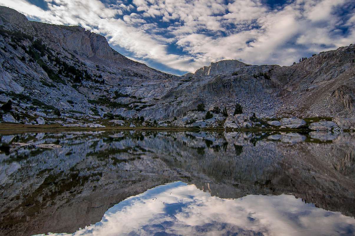
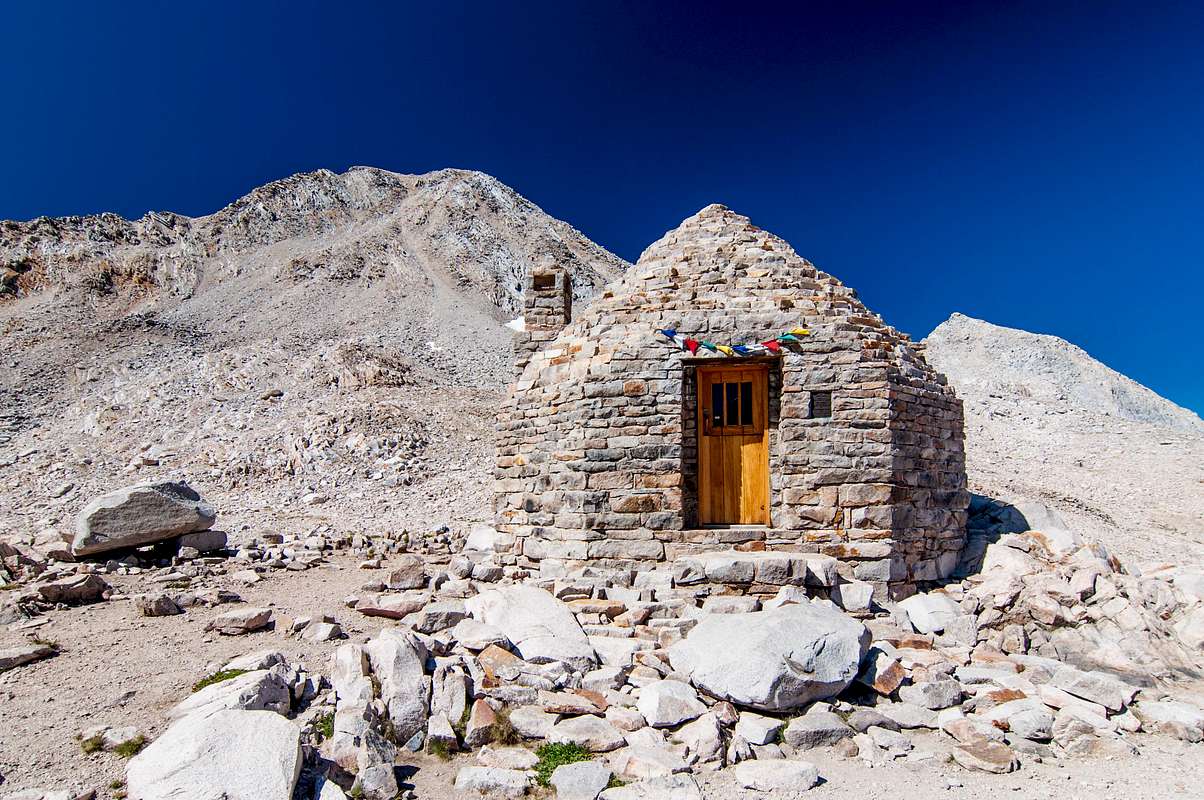
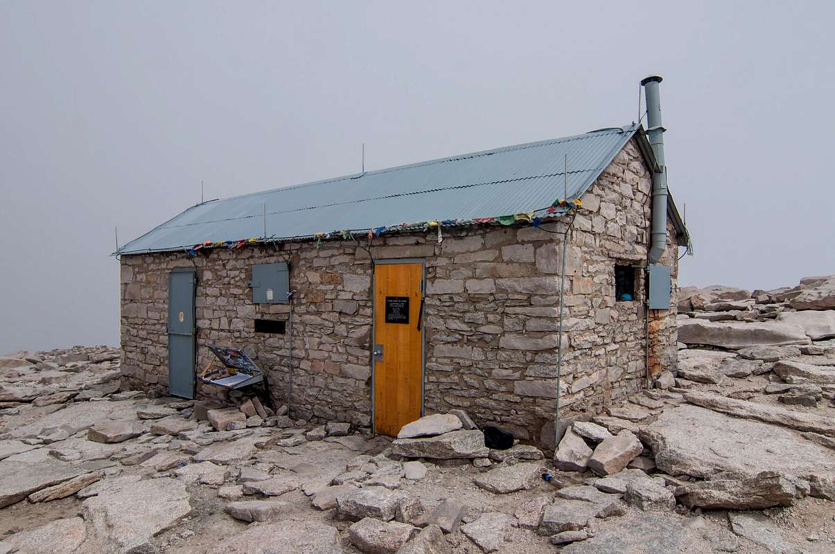
The following morning I left Evolution Lake nestled among the jagged mountainous cliffs passing Sapphire Lake, Wanda Lake, and Lake McDermand gaining elevation as the trail climbed towards Muir Pass. Not a tree within miles. A lunar landscape. Finally, the stone hut honoring John Muir, co-founder and first president of the Sierra Club, atop Muir Pass came into view. A yellow-bellied marmot greeted me to his rocky home as I reached the pass. Muir Pass, 11,955’, is the highest mountain pass encountered so far on my southward trek to Mt. Whitney. Higher passes are yet to come. I ventured inside and enjoyed a mid-morning snack as other backpackers arrived. Years ago, pack animals hauled firewood up to Muir Hut for the hut’s fireplace. Today, the fireplace is mortared shut preventing marmots from entering via the chimney. A plaque honoring John Muir and a stone mantle cluttered with hikers’ memobralia are above the fireplace. Wooden benches line the hut’s interior. Muir Hut makes a wonderful refuge from fierce winds, but I wouldn’t recommend seeking refuge here during thunderstorms due to the structure’s lack of lightning arrest protection. Wet rock is an excellent conductor of electricity! Alix and Joe whom I leap-frogged several times over the previous week soon arrived and quickly departed. I find it extremely difficult leaving these mountain passes. The views are spectacular! Wanda Lake, north of Muir Pass, and Helen Pass to the south are named after John Muir’s two daughters.
![Muir Pass]()
Looking north from Muir Pass![Muir Hut]()
Muir Hut
“Fear not, therefore, to try the mountain passes. They will kill care, save you from deadly apathy, set you free, and call forth every faculty into vigorous, enthusiastic action. Even the sick should try these so-called dangerous passes, because for every unfortunate soul they kill, they cure a thousand.”
John Muir
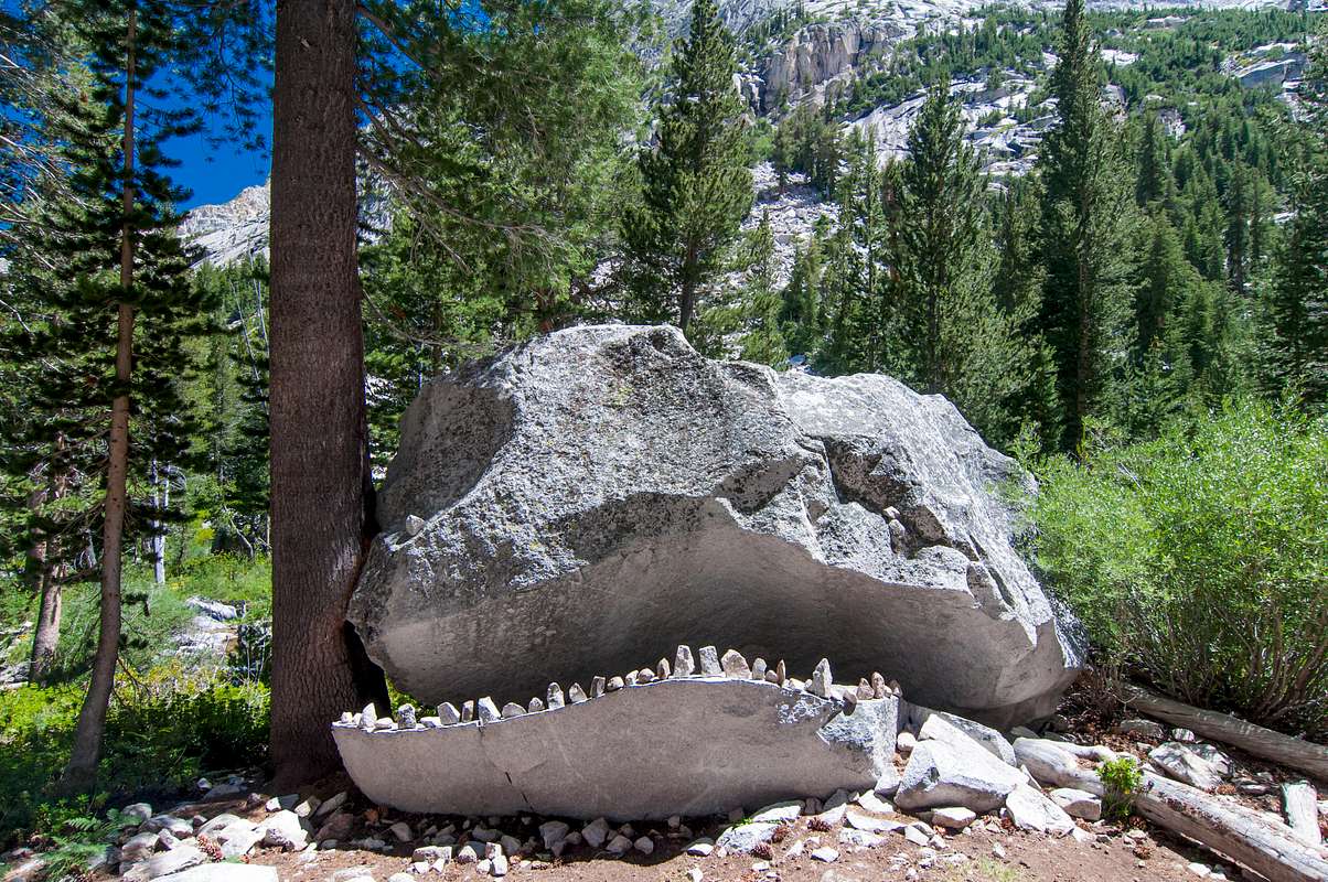
Leaving Muir Pass, I passed pristine Helen Lake and encountered the infamous Rock Monster lurking within the forested drainage prior to Big Pete Meadow. Resembling Jabba the Hutt from Star Wars, this haunting rock formation has an insatiable appetite. Hikers are forewarned from getting too close. Bears certainly aren’t the only worry along the JMT. Established camp north of the hikers’ bridge over Dusy Branch, a few hundred yards south of the LeConte Ranger Station. Adam, a backpacker whom I leap-frogged several times during the previous week, arrived earlier and was doing laundry in the stream. Soon Cassie and Dan arrived and we shared our trail experiences over a campfire. Although I always hiked solo, I became acquainted with other southbound hikers and sometimes we shared a campsite together.
![Helen Lake]() Helen Lake
Helen Lake![Rock Monster]() Rock Monster
Rock Monster
Crossing rivers and streams are everyday occurrences on the JMT. I’ve forded streams and rivers in sandals, hiking boots, or barefoot; jumped from one strategically placed boulder to another using hiking poles for additional balance; walked across on wooden planks or hewn-sawed logs; or casually strolled across on engineered bridges of structural steel designed to withstand the torrid spring floods. Never a problem for me. A cowboy on his horse tethering a pack mule traveling southbound encountered an embarrassing problem crossing the hikers’ bridge over Dusy Branch. Mules are stubborn animals and this one was no exception. This mule wouldn’t cross the wooden bridge over Dusy Branch. Upon seeing the unfamiliar bridge, the mule stopped dead in his tracks. The cowboy dismounted and tried walking the mule across to no avail. Re-tethered to the horse, the horse lacked the horsepower to pull the stubborn animal across the bridge. That mule decided he wasn’t crossing that bridge! Nothing seemed to work. The cowboy dismounted again, removed his bandana, and placed it over the mule’s eyes. Maybe if the mule couldn’t see the bridge, everything will be O.K. Nope, this didn’t work either. The mule remembered the bridge and was determined not to go across! I almost shouted, “Spin the mule around several times to confuse him”, but I didn’t want this frustrated cowpoke thinking a ‘city-slicker’ knew how to out-smart this stubborn animal. Finally, the cowboy admitted defeat and returned the way he came. When asked how he intended on getting the mule across, he stated he’s returning to base camp for additional mules (accustomed to crossing this bridge) and this additional ‘mule-power’ would drag the stubborn animal across that bridge tomorrow. I guess the mule didn’t want “to get to the other side” like that chicken. I sometimes wonder if that mule ever crossed the bridge.
As the cowboy struggled with the mule the following day, I continued southward like a migrating monarch butterfly. Leaving the Middle Fork of the Kings River, I turned left following Palisade Creek towards Mather Pass. The Golden Staircase, the last completed section of the John Muir Trail, must be mastered prior to reaching Palisade Lakes. Trail workers were performing maintenance work on the Golden Staircase as I ascended. Bypassed lower Palisade Lake and made camp next to a nice stream flowing into upper Palisade Lake. Saw the largest rabbit I’ve ever seen hopping around camp that evening. This rabbit was huge! Rabbit stew sounded delicious. Bugs Bunny is welcomed in my camp any day; Yogi Bear isn’t.
On July 28, I crossed over Mather Pass and descended through Upper Basin along the South Fork of the Kings River towards Pinchot Pass. Traveled only 11 miles today. Lake Marjorie offered such beautiful scenery I spent the night along the lake’s shore rather than pass over Pinchot. The Pinchot Pass area has reddish cliffs strikingly very different from the Range of Light’s usual sparkling white granite.
![Upper Palisade Lake]() Upper Palisade Lake
Upper Palisade Lake![A pleasant surprise in the Range of Light]() A pleasant surprise in the Range of Light
A pleasant surprise in the Range of Light
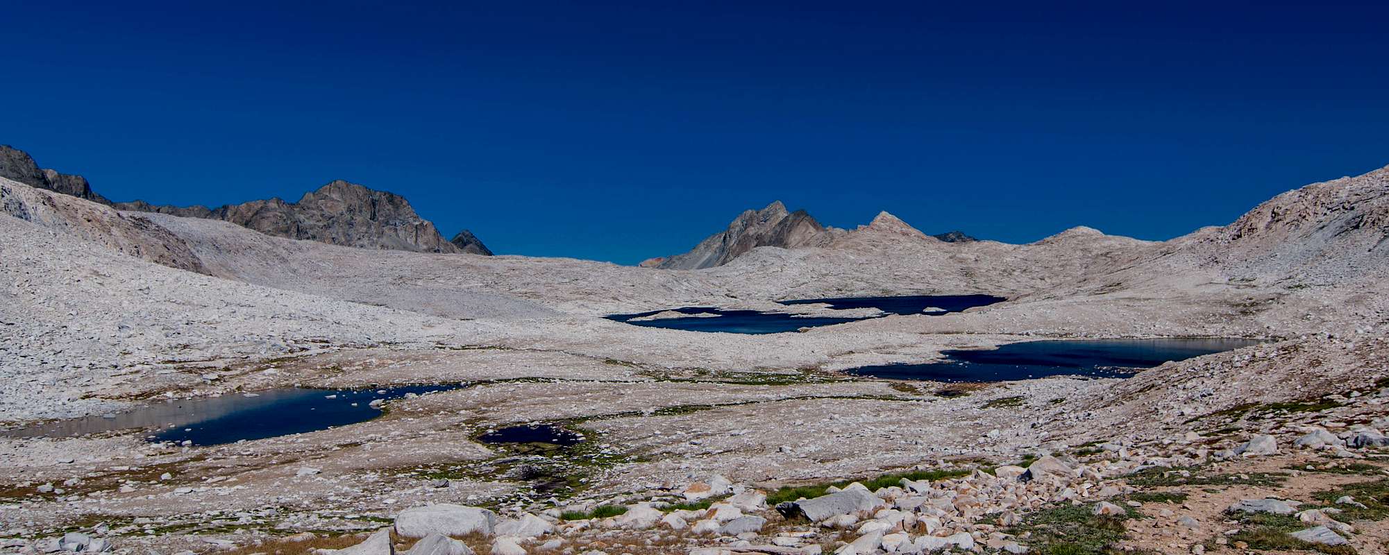
The following morning I ascended 1000’ in approximately 1.5 miles reaching Pinchot Pass before 7:00 a.m. No time to dally at the pass, I intended on pounding out 16 miles today. From Pinchot Pass to the suspension bridge over Woods Creek, the trail drops 3600’ in 7.6 miles. Woods Creek offers hundreds of swimming holes along this section. While having a mid-morning snack, lunch, or an afternoon break, it’s always a good idea to soak and dry your feet and change into dry socks. On rainy days, I continued wearing wet socks. Why get both pairs wet? On sunny days, I always rinsed out my socks in streams or lakes and donned a dry pair. As Lieutenant Dan told Forrest Gump, “Take good care of your feet.” This is very important! Hiking with sore feet is like trying to drive a car without wheels; you’re not going anywhere! Surprisingly, I developed only one small ‘hot spot’ during my 400-mile trek from Lake Tahoe to Mt. Whitney. The key is good hiking boots and darn tough socks. I mean Darn Tough socks, knitted from genuine Merino wool in the Green Mountains of Vermont. Each pair comes with an unconditional lifetime guarantee. No strings attached unless your socks disappear in the dryer or are stolen. “If you can wear these socks out, we’ll replace them. Free of charge. No questions asked. For life.” Ric Cabot, President & CEO
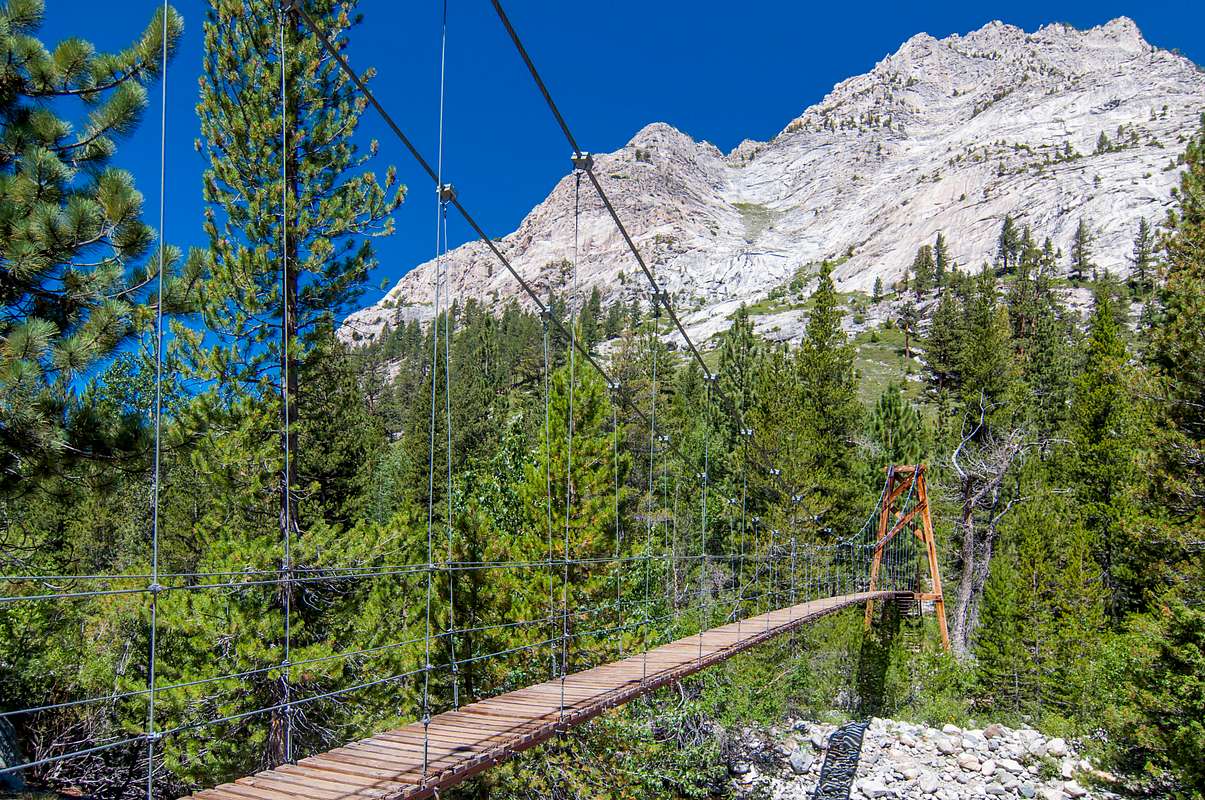
The wood suspension bridge spanning Woods Creek looks safe upon arrival. Steel cables strung between tall wooden towers supports the wooden planks. Signs posted on both sides of the bridge state, “One Person At A Time On Bridge.” During late July, I could have waded across Woods Creek bypassing this rickety thing. If I could survive encounters with Mr. Bear and the Rock Monster, I could surely survive crossing this wobbly wooden bridge. It reminded me of the rickety-rackety bridge to the Dragon’s Keep in the movie, Shrek. The bridge squeaked and bounced all over the place as I crossed and some of the boards were missing! “Okay, don’t look down…..Don’t look down….. Don’t look down…..Keep on moving.” One misstep and I’d fall into the fiery boiling lake of lava below! (I meant raging waters below.) Safely on the other side, I met up with Alix and Joe again. I first met this couple in Lyell Canyon 12 days ago. After catching up on the latest ‘trail talk’, I began the 2000’ ascent to Middle Rae Lake. Climbing out of Woods Creek drainage was tiresome; it was already mid-afternoon and the sun shone high overhead. The JMT is always uphill or downhill. The elevation profile of the John Muir Trail resembles a roller coaster. Over 84,000’ of vertical elevation changes; that’s nearly 16 miles. Up, and then down. Down, and then up again. For 211 miles. Very seldom is the JMT as flat as a pancake.
Established camp at Middle Rae Lake exactly where I camped in 2009. Surprisingly, Middle Rae Lake was sparsely occupied. An Australian posted a note on the metal bear box alerting everyone he lost his iPhone here several days prior and was offering a reward for its return. I made several trips to the lake’s shore for water but failed to find the phone. Fin Dome reflected on the lake’s peaceful waters as the Painted Lady gazed over Rae Lakes. Exactly as I remembered it. One of the prettiest places along the JMT. My wilderness trek would be over in 3 short days. I began developing wilderness withdrawal symptoms. I didn’t want it to end.
![Painted Lady]() Painted Lady
Painted Lady![Suspension Bridge over Woods Creek]() Suspension Bridge over Woods Creek
Suspension Bridge over Woods Creek
On the morning of July 30, I crossed over Glen Pass, 11,978’. Bears were so problematic during 2009, the NPS erected a solar-powered electrical fence around the Ranger Station at Charlotte Lake. Numerous bear boxes are located from the suspension bridge over Woods Creek to Forester Pass, a good indication of bear activity. Bear tracks and scat are better indicators. Become ‘bear aware’ whenever venturing into the wilderness. Bears are most active in the evening, throughout the night, and early morning. The fact you’re not seeing bears doesn’t mean they’re not lurking amongst the deadfall. Bears ‘blend in’ very well.
Rather than exiting over Kearsarge Pass to pick up my last resupply at the post office in Independence, I remained loyal to the JMT. I began rationing my food several days prior, conserving enough for the remaining two days. The 14-mile roundtrip to the Onion Valley trailhead requires crossing Kearsarge Pass, nearly 12,000’, twice, and hitching a ride to and back from Independence, CA. My bear canister still contained ample food until I reached Whitney Portal so I skipped my last supply in Independence. The detour to Onion Valley and the 12-mile hitch to and back to the trailhead would require a full day or possibly more. I couldn’t count on trail angels for a hitch to town and back on this dead end road. Three deer each sporting massive antlers greeted me at the spur trail to Charlotte Lake. Unfazed by my presence, they continued grazing on the lush meadow grasses as I quietly passed. The jagged Kearsarge Pinnacles rose in glory to the east as the trail followed Bubbs Creek up the drainage towards Forester Pass. Due to rain, I stopped ½ mile short of reaching my previous campsite north of Forester Pass.
The following morning, I departed for Forester Pass, the highest mountain pass on the PCT/JMT at 13,200’ above sea level. A thousand feet higher than any previous pass. Cold blistery weather chased me up the narrow winding trail to the pass. Luckily, my pack weighed a lot less than 2009. Backpacking gear has improved drastically and is much lighter since I began backpacking 15 years ago. I capitalized on these innovations and purchased lighter gear reducing my base weight considerably. Happy feet are one ingredient for a successful hike; a light pack is the other. Only carry the essentials. Some ultra-light hikers forgo a tent and ‘cowboy camp’ under the stars or sleep under a light weight shelter strung between trees or hiking poles. My Big Agnes FlyCreek 2 tent weighs just 2.1 pounds whereas my Black Diamond Mesa tent weighs nearly 6 pounds. I’ve never used hiking poles prior to hiking the T2W (Tahoe to Whitney); however, I’m a believer now. Backpackers with trekking poles can travel faster and more efficient similar to cross-country skiers with ski poles. Besides the obvious of lessening the impact on your legs while hiking downhill, they also enable hikers to ‘push’ themselves up inclines using their arms making for a much more enjoyable backcountry experience. Hiking poles have other useful purposes: Testing the water’s depth when fording rivers and streams, providing a ‘third leg’ when boulder hopping across streams, vertical supports for a portable shelter, an improvised fishing pole, a camera monopod, fending off aggressive animals, practicing my fencing abilities, and as a ‘cattle prod’ whenever a slow hiker refuses to step aside when I’m trying to pass. Like MasterCard, I wouldn’t leave home without them.
Many backpackers insist on hiking with a loyal companion, their small lovable stuffed animal. Yes, I’ve encountered dozens of backpackers with their faithful hiking companions securely fastened to their packs or peeking out of their jacket pockets. These little guys wanna enjoy the scenery too. Please don’t bury your little hiking buddy in your pack. Like the family pet, these lovable animals have names and enjoy being included in photographs. Since Spot or Rover aren’t permitted in the backcountry, these little fellows are the next best thing.
Artic weather greeted me atop Forester Pass. Fierce bitter north winds whipped through the narrow gap as I struggled exchanging camera batteries. My gloves were clumsy and my bare fingers didn’t work well in these polar temperatures. Forester Pass is the boundary between Kings Canyon National Park and Sequoia National Park. The weather improved dramatically as I descended the southern slope of Forester Pass and entered Sequoia NP. Sheltered from the fierce north winds, I removed several articles of clothing while descending. The narrow trail quickly lost elevation as it snaked its way down the mountain. Before I knew it, I was down and hiking across a vast barren landscape over 12,000’ in elevation, higher than any previous mountain pass except for Forester. Definitely one of the worst places during a lightning storm. Not a tree within miles. Fortunately, Thor was taking the day off. Hastily, I covered the 4.7 miles across this lunar landscape towards Tyndall Creek. I topped off my water bottles at Tyndall Creek before traveling the 4.4 miles across the Bighorn Plateau to Wallace Creek.
Why do I do this? Because I wanna see where that trail goes and what’s there. Lacing up a pair of boots and strapping on a pack is the only way to really experience the backcountry. Sleeping in a tent, cooking over a stove, drawing water from streams, hiking all day, and doing this repeatedly is the backpacker’s lifestyle. I’ve also met some of the nicest people in very remote places. There are at least 211 reasons for hiking the JMT.
Here are 21 for starters
1. Thousand Island Lake 8. Rae Lakes 15. Sunsets
2. Nevada Falls 9. Unpredictable weather 16. Forester Pass
3. Colby Meadow 10. Mt. Whitney 17. Beautiful flowers
4. Wildlife 11. Evolution Lake 18. Stream/river crossings
5. Peace and tranquility 12. Night skies 19. Half-Dome
6. Golden Staircase 13. LeConte Canyon 20. Pinchot Pass
7. Muir Hut 14. Bighorn Plateau 21. Memories
“Between every two pine trees there is a doorway leading to a new world.”
John Muir
This year I stopped at Crabtree Meadow rather than continuing onward to Guitar Lake. This added an additional 3 miles on summit day but I wasn’t worried. Crabtree Meadow offered more shelter from inclement weather than Guitar Lake. Guess who shows up after I found a nice little spot among the trees? Alix and Joe. Alix stated it’s only fitting they share their last night in the wilderness with me since they shared their first night in Lyell Canyon with me.
I broke camp before sunrise the following morning sneaking out of camp like a thief in the night. With a headlight illuminating the trail, I cautiously ascended through the forested drainage towards Guitar Lake. The white granite sparkled in the darkness like a million flickering fireflies. Slowly, the sun awoke and began peeking over mighty Mt. Whitney. A few colorful tents were scattered amongst the boulders at treeless Guitar Lake. Back at Crabtree Meadow, I picked up a WAG bag in case nature called. Hikers are required to pack out human waste within the Whitney Zone, from Guitar Lake to Whitney Portal. I didn’t have breakfast this morning for that very reason. A Snickers candy bar propelled me pass a Boy Scout troop that camped at Guitar Lake. A 2-ounce Snickers has 280 calories, boasting one of the best calories per weight ratios. “Packed with peanuts, Snickers really satisfies.” Almonds are another high-octane fuel when the afterburners are needed. I almost resorted to using my ‘cattle prod’ to get these scouts to ‘shake a leg’. One scout used a long-handled shovel as a hiking pole. I’ve never seen this before. I did observe several men wearing kilts on the trail and they weren’t Scottish. I hope this isn’t a new trend. Hiking pants with removable leg sections suits me just fine. An old hippie hiker at Glen Aulin HSC donned an external frame backpack, the frame fabricated from galvanized 1” steel pipe. When asked how much it weighed, he replied, “I’ve been using this since the ’60’s; I guess it’s time I upgrade.” This hippie hiker was definitely wearing a blue dress too, not a kilt!
Arriving at Trail Crest, I dropped my pack and continued onward to the summit with only the essentials. Camera, water, first aid kit, and a snack. The National Park Service imposes a quota on hiking permits within the Whitney Zone. Saturdays are crowded; several dozen backpackers already dropped their packs and were summit bound. Packs of all shapes, sizes, and colors were lining the trail resembling automobiles parked along a busy thoroughfare. Surprisingly, I didn’t see any marmots. Yellow-bellied California marmots reside atop Clouds Rest, Half-Dome, and Mt. Whitney, and I can assure you these 4-legged scoundrels are lurking at Trail Crest waiting for an opportunity to chew through an expensive pack in search of a tasty snack. Marmots also chew through tents searching for food if the door flap is zipped shut. One unfortunate camper had a marmot chew through his tent gaining access, mulch on trail mix, and create another exit point upon leaving. It’s never a good idea keeping food in a tent. One never knows who might show up for dinner.
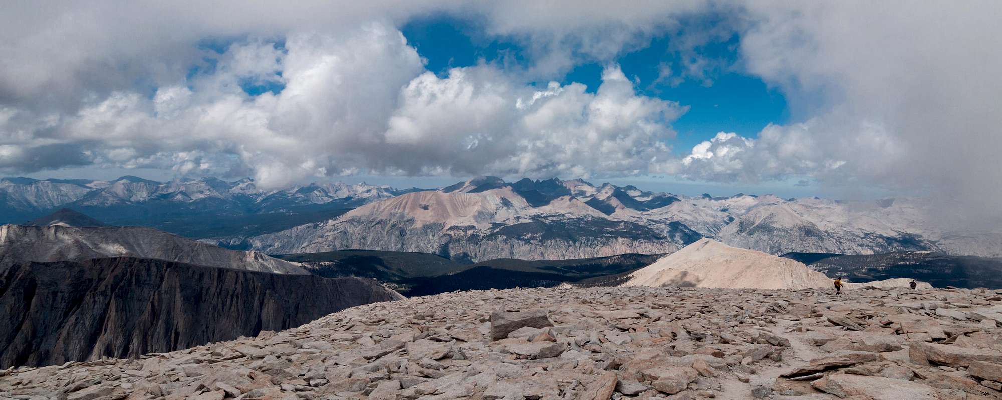
The 1.9-mile spur trail to summit is familiar territory. During 2009, I ascended Mt. Whitney to gain my 28th state highpoint. I have 4 remaining if I want to stand on the highest parcel of real estate in all fifty states. Denali, Alaska; Mount Rainier, Washington; Mount Hood, Oregon; and Mount Katahdin, Maine. Realistically, I have three left. “The High One” in Alaska is above my skill set. Mt. Whitney has ‘grown’ since my last visit. During 2009, Whitney’s summit was 14,494’ above sea level. Due to refined measuring and changing of the vertical coordinate system, Mount Whitney is now 14,505’ above sea level. Clouds engulfed the summit as I reached the stone Smithsonian hut. Visibility was nearly zero. Guitar Lake and the town of Lone Pine vanished. Periodically, an opening in the clouds permitted limited views; but 360-degree panoramic views from the summit weren’t happening this morning. I signed the summit register and enjoyed my mid-morning snack.
The Tahoe to Whitney hike and John Muir Trail were officially complete. The lowest elevation along the JMT is 4,000’ at the northern terminus, Happy Isles in Yosemite Valley. The highest elevation is 14,505’ at the southern terminus, Mount Whitney’s summit. The JMT is entirely above 7,000’ except for the first 7 miles climbing out of Yosemite Valley and doesn’t cross a road during its entire length of 211 miles.
![Mt. Whitney's summit]() Mt. Whitney's summit
Mt. Whitney's summit![Shelter atop Mt. Whitney]() Shelter atop Mt. Whitney
Shelter atop Mt. Whitney
Back at Trail Crest, my wilderness withdrawal was intensifying. Reluctantly, I donned my pack for the last time and began walking the 10 miles downhill to Whitney Portal. The views of Owens Valley were bittersweet. Glad to be going home to friends and family, yet sad to be leaving the “Range of Light”, a term John Muir coined describing the Sierra Nevada Mountains. Many colorful tents dotted the lunar landscape at Trail Camp, an alpine community located at 12,000’. Climbers ascending from Owens Valley normally spend the night at Trail Camp acclimating to the higher altitude. Starting at the northern terminus provides ample time for the human body to acclimate to the thinner air at higher altitudes. As the altitude increases, the atmospheric pressure and available oxygen decreases. The lungs’ ability to absorb precious oxygen molecules at higher altitudes also decreases. Its essential mountaineers know preventive measures, symptoms, and treatment of Acute Mountain Sickness and pulmonary (HAPE) and cerebral (HACE) edemas. Symptoms include headaches, dizziness, fatigue, nausea, and loss of appetite. When in doubt, descend to a lower elevation. Your life or your partners’ lives may depend on it.
![Outpost Camp along the Whitney Trail]() Outpost Camp along the Whitney Trail
Outpost Camp along the Whitney Trail![Owens Valley]() Owens Valley
Owens Valley
Tourists cheered as I walked into the portal. I felt special as I proudly strolled over to the café. They knew this smelly, unshaven, riff-raff backpacker just completed America’s favorite long distance hike, the John Muir Trail.
![Time for a burger and fries at the Whitney Portal]()
Hike completed
“Climb the mountains and get their good tidings. Nature’s peace will flow into you like sunshine flows
into the trees. The winds will blow their own freshness into you and the storms their energy while cares will drop off like autumn leaves.”
John Muir


Comments
Post a Comment