Toggle navigation
Mountains
Routes
Images
Trip Reports
Forum
What's New
People
Areas & Ranges
Articles
Trailheads
Canyons
Huts & Campgrounds
Albums
Logistical Centers
Fact Sheets
Lists
Custom Objects
Gear
Plans & Partners
WELCOME TO SUMMITPOST
SIGN IN
REGISTER
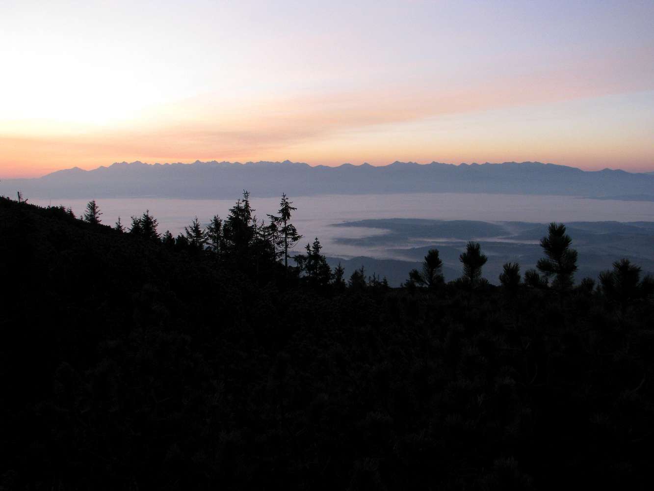
Tatras from near highest shelter
View High-Resolution Image
Tatras from near highest shelter
The whole range of the
Tatras
(High Tatras left, Western Tatras right) viewed from near the
shelter at 1643m
on the Slaná voda – Babia Hora trail.
Photo taken at 7am on 17th October 2017.
« PREV
NEXT »
yatsek
on
Oct 30, 2017 12:26 pm
Comments & voting
Other parents
Lat/Lon:
49.56950°N / 19.52930°E
Image Type(s):
Hiking
Image ID:
1009667
1064 Hits
78.27
% Score
9
Votes
Log in to vote
Comments
No comments posted yet.
to post!
Don't have an account?
Babia Góra / Babia hora
(Mountain/Rock)
You are at
the First
Image
Viewing
#1 of 1
GALLERY
You are at
the Last
Image
yatsek's Image Gallery
« PREV
Viewing
#417 of 1265
GALLERY
NEXT »
Babia Góra / Babia hora
(Mountain/Rock)
Loading....
21hrs on Babia Mtn
(Album)
Loading....
×
You need to login in order to vote!
User Name
Password
Remember me
Forgot your password?
Log me out when I close my browser.
Keep me logged in all the time.
sign in as a user
Don't have an account?
Register now for FREE
Rating available
Suggested routes for you
People who climb the same things as you
Comments Available
Create Albums
Register Here


