
-
 72927 Hits
-
 91.14% Score
-
 34 Votes
|
|
Mountain/Rock |
|---|---|
|
|
49.54903°N / 125.36828°W |
|
|
Hiking, Mountaineering, Skiing |
|
|
Spring, Summer, Fall |
|
|
6457 ft / 1968 m |
|
|
Overview & History
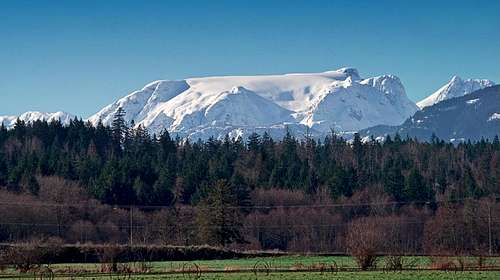 The Comox Glacier The Comox Glacier |
It comes as a surprise to some people to learn that there are mountains on Vancouver Island. These folks might be even more surprised to learn that there are extensive glaciers here as well. Given the northern latitude and proximity to the Pacific Ocean, this shouldn’t really be that much of a surprise.
Many Island summits support pocket glaciers, particularly on their northern and western slopes. However, on this page I describe one of the three extensive ice sheets on the Island that have formed over eons as huge snowfalls from countless winter storms blowing in from the ocean accumulated and compressed into glacial nevé. The dimensions of the Comox Glacier are even more impressive when one takes into account the fact that it lies to the east and the south of its rivals for Island glacier bragging rights; namely the Rugged and Mariner glaciers.
Normally a glacier is named after its parent mountain. The Comox Glacier, however, is such a distinct and impressive sight that the mountain has taken on the name of its dominant feature. The glacier fills the skyline when looking west from the towns of Courtenay and Comox and has long been an icon of the two communities. You can’t get your car serviced, have a game of golf, get your plumbing repaired etc anywhere in the Comox Valley without at least considering a company called “Glacier View” this or “Comox Glacier” that as a source of supply.

Early climbers in 1929

1922 First ascent
The first ascent of the Glacier took place in August 1922. The Reverend George Kinney, minister of the Grace Methodist Church in Cumberland joined local men Alfred McNevin, James Tremlett and Harold Banks on the first recorded attempt to scale the Comox Glacier. There was very limited means of access in those days so their route from Courtenay took them up the Puntledge River to Comox Lake and then to the head of the lake by boat. They then continued on the Puntledge River to modern-day Willemar and Forbush Lakes and hiked up Kookjai Mountain. Their route then took them up and over Black Cat Mountain, down to Lone Tree Pass and finally up to the glacier. A route only a little displaced from the modern day Comox Gap/Kookjai route (see below).
Not content with a single objective, the men continued down to Mirren Lake and then up onto the Aureole Icefield. Finally they descended into the Shepherd Creek drainage and followed it down to Buttle Lake. From this point it was a combination of a raft built on the spot and a chance meeting with a group of tourists that got them back to civilization at Campbell River after an absence of 10 days. They were tough hombres those old timers!
If the name Rev. George Kinney sounds familiar – it should. This was the same George Kinney who claimed (and whose family still claim) the first ascent of Mt Robson in 1909 with Donald “Curly” Phillips. Their claim was eventually discredited as we all know. Nevertheless, it’s nice to know that the Reverend gent made at least one real first ascent in his lifetime.
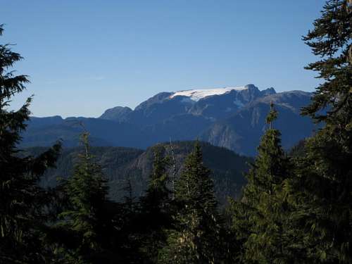 The Comox Glacier
Getting There
Vancouver Island can be reached directly by air from Toronto, Vancouver, Seattle, Calgary, Edmonton and recently from San Francisco to either Victoria, Nanaimo, Comox or Campbell River and by ferry from Port Angeles to Victoria on The Coho and on BC Ferries from Vancouver to Victoria or Nanaimo. Public transport on the Island is notoriously poor and anyone arriving by air would be advised to rent a car.Most visitors will reach the area from the Inland Island Highway 19. Approaching on Highway 19 from north or south take the Comox Valley Parkway/Cumberland exit (#117) and turn west towards the latter. After ~ 1.5 km turn right at the Save-on-Gas station onto Bevan Road. Drive 5.5 km on gravel to the junction of Bevan and Comox Lake Main (CLM) and turn left. Note the location of this junction for your return journey. It isn’t signed at the Comox Lake end. CLM is paved for the first km or so but soon reverts to gravel.
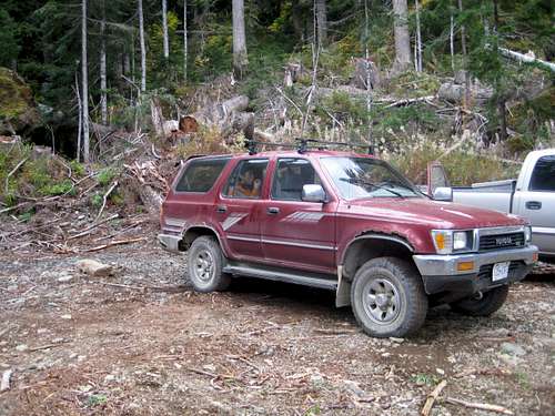
Comox Lake Main is the main arterial feeder for active logging in the area by Timberwest Ltd and is closed to the public 7 days a week during the hours 6 am to 6 pm UNLESS you are carrying a licensed VHF radio to communicate with the logging traffic. In fact, in recent years and as a result of vandalism, the road is often closed period. If it's open a gatekeeper stationed on the road shortly after it becomes gravel will check your credentials in this respect. In the window 6 pm-6 am there are no restrictions. Travel towards the Glacier therefore requires an evening approach and, likely, a camp at the trailhead or knowledge of the use of VHF radios.
 Comox Glacier Trailhead Comox Glacier Trailhead |
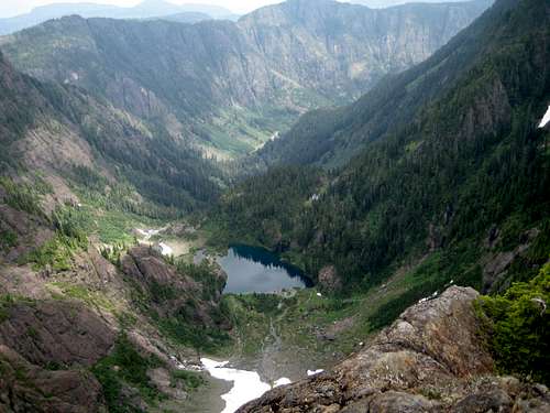 Century Sam Lake & Start Point from above Century Sam Lake & Start Point from above |
For the Kookjai Mountain route, continue on South Main past the junction noted above for ~ 2 km, past Cougar Lake and into Comox Gap where the route begins.
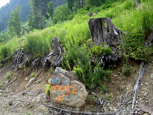
Frog Ponds Approach and Route
For many years this was – and perhaps still is – the standard route to the Comox Glacier. It was built in the early 1960’s by the Comox and District Mountaineering Club (CDMC) and is still well maintained by that august body.From the trailhead the well-marked trail descends briefly to Comox Creek and crosses it on a log. Almost immediately thereafter a signed route to Century Sam Lake heads off to the right.
After a few minutes of relatively gentle uphill, the route begins to head up a series of switchbacks in a generally southwesterly direction until the hiker is above a small unnamed lake (just visible below through the trees). After traversing east above the pond, the route then resumes its SW course and steepens considerably. With a full pack, it’s a steady 2-3 hours up through the forest before one breaks out abruptly into the open alpine on the ridge top. The switchbacks cease about halfway up about where you pass the Strathcona Park boundary sign. A couple of fixed hand-lines are in place where the route goes up some greasy, eroded ground.
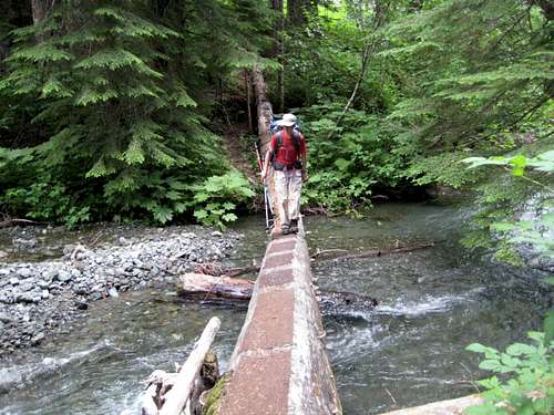 Crossing Comox Creek Crossing Comox Creek |
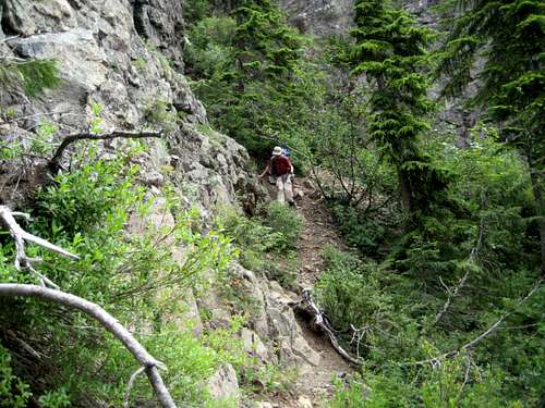 Approach ridge gully crossing Approach ridge gully crossing |
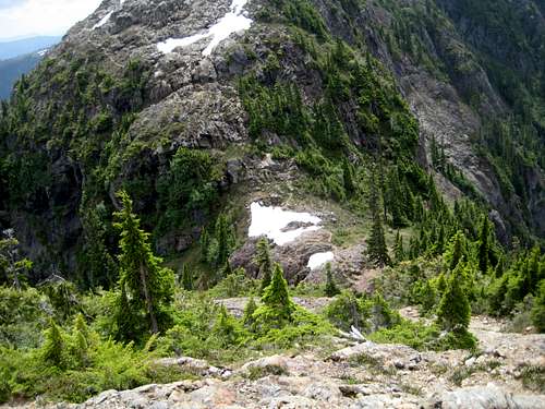
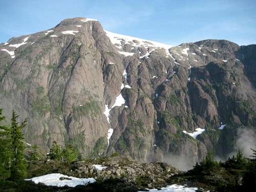 Lower Glacier SE Aspect from frog ponds Lower Glacier SE Aspect from frog ponds |
The path diverges on a number of occasions but all choices head the way you want to go. At N49 32.369 W125 19.029 take the left fork to avoid unnecessarily going right up, over and down a bump in the ridge. At N49 32.274 W125 19.298 find a steep gully with hand-line that takes you down 40-50 vertical metres to a low point before a last pull up to the Frog Ponds camping area. All told it’s about an hour along the ridge to Frog Ponds. Most people camp here although, be warned, in season it’s very buggy!
From Frog Ponds the route immediately descends steeply 80-90 vertical metres to a tight saddle. The last part of this descent is very steep and somewhat exposed. Lots use the fixed rope installed here.
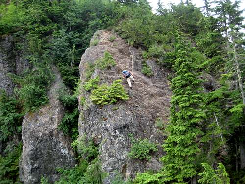 Steep downclimb Steep downclimb |
 Approach and connecting ridges Approach and connecting ridges |
 Climbing up to Lone Tree Pass Climbing up to Lone Tree Pass |
 Lone Tree Pass Lone Tree Pass |
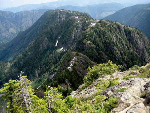
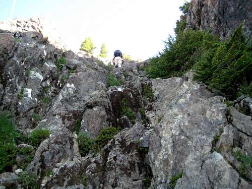
From Lone Tree Pass, follow cairns north and then northwest up to the SE summit of the Glacier. One or two scrambling phases are involved, one of them through a rather tight krumholtz choked gully.
  |
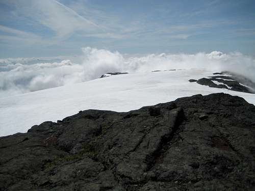
Even before the SE summit is reached the main summit comes into view looking every bit as far away as the 2 km distance involved. Between the two summits is ~ 3 square kilometres of snow covered ice that is the glacier itself.
Drop down from the SE summit and walk northwest across the almost flat glacier to the true summit in 30-45 minutes. Crevasse hazard is minimal but I have seen open slots, so be careful. It goes without saying that a large ‘schrund just to the NE of the SE summit is to be avoided at all costs. Beware also of sudden changes in the weather. A brilliantly clear day can change to a white-out in minutes and a wide featureless glacier is no place to be wandering on if, like me, you have no sense of direction. Make sure you have a good track stored on your GPS or, if you don’t have one and the weather looks like turning iffy, mark the route with wands.
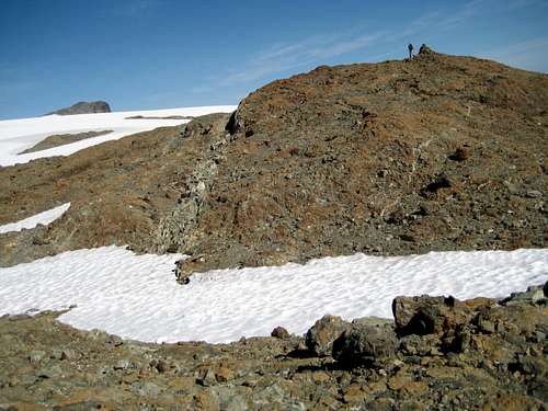 Comox Glacier SE Summit Comox Glacier SE Summit |
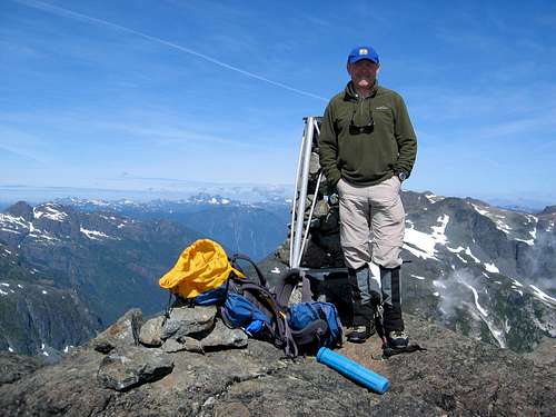 Comox Glacier Summit Comox Glacier Summit |
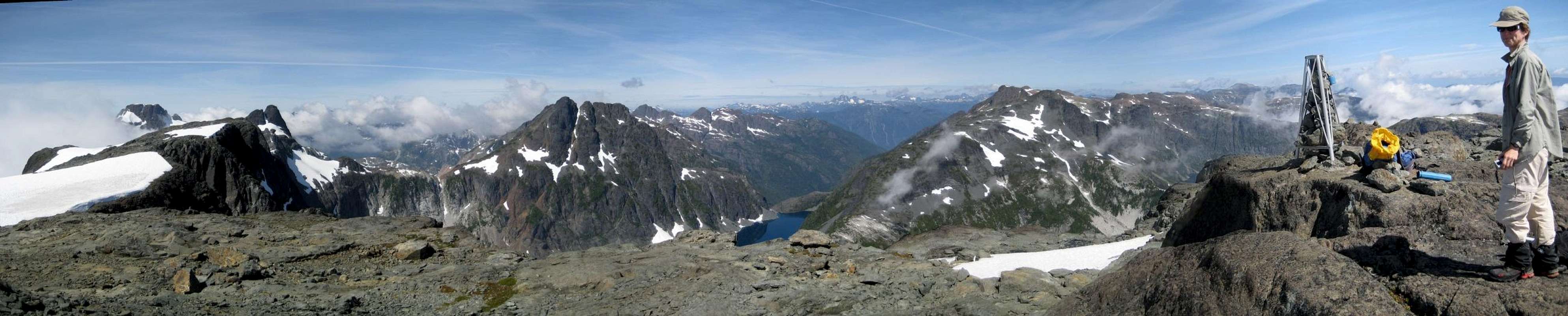
 Comox Glacier Summit View SW Comox Glacier Summit View SW |
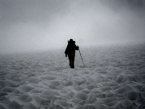 A Rude Awakening A Rude Awakening |
Views from the summit are simply stunning particularly from south to north and encompass The Red Pillar, Argus Mountain, Mt Harmston – with Milla Lake at its foot – Rees Ridge and the chain of peaks right down to Mt George V, Mt Frink and Mt Albert Edward and all their neighbours. Off in the distance to the northwest The Golden Hinde, Mt McBride, Rambler Peak, Mt Colonel Foster and Elkhorn are in plain and uninterrupted view.
Descend by reversing the route. If you’re not carrying a VHF radio don’t forget to wait, if necessary, to leave the trailhead after 6 pm.
Approximate route data.
Total distance: ~ 20 km
Net elevation: ~1,400 metres
Total elevation: ~1,850 metres
Ascent Times: TH to Frog Ponds ~ 3.5-4 hours, Frog Ponds to summit ~ 3.5-4 hours
Descent Times: Summit to TH 5.5-6.5 hours
 |
Kookjai Mountain Approach and Route
I have not done this route and, therefore, will only describe it in general terms. Readers who have done the route are encouraged to add details and photos using the “add route” facility.The trailhead can be found roughly 500 metres past Cougar Lake in the Comox Gap. Look for flagging marking an old logging road. Walk to the end of the road and look for more tape heading west and up onto the ridge above. Continue roughly NW on the main ridge up to the summit of Kookjai Mountain. From the vantage point of Kookjai the route can be seen running down to Tatsno Lakes and then continuing up the ridge SW and then NW to the top of Black Cat Mountain. Descend the north slopes of Black Cat into Lone Tree Pass and join the Frog Pond route there.
Kweishun Creek/Mirren Lake Route
Updated information provided by walkingtrashcanRelatively recently Timberwest have pushed roads up Rees and Kweishun Creeks to the north of the Comox Glacier. From the end of these roads it’s only about 3 hours travel to Mirren Lake – although the route is avalanche prone in early season.
Approach as for the Frog Ponds TH but at the junction of Cruikshank and South Main Roads turn right, not left. This is the continuation of Cruikshank Road. From the junction drive the Cruikshank road for 3.5 km to a junction on the left. Turn here and lock in 4WD.
This road, formerly known as "CK 75", is now marked as West Main. The old CK 75 sign has multiple shotgun wounds. The West Main sign is easier to spot.
3.6 Km from the start of West Main (formerly CK 75) the road forks. Going higher takes you up Rees creek. Instead bear left for Kweishun Creek. A few km later you will skirt around a meadow. There are several stones and logs scattered on the road along with a large cross-ditch which requires a good 4x4 and driving skills. The rest of the drive is fairly easy in comparison.
 Kweishun Creek Route TH Kweishun Creek Route TH |
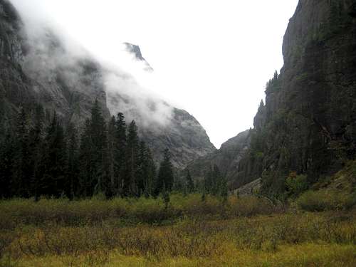 Kweishun Creek Canyon Kweishun Creek Canyon |
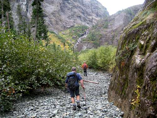 Hiking the lower canyon Hiking the lower canyon |
From the end of the road enter old growth almost immediately and hike southwest up through the forest on a good, well-flagged boot path. After about 30 minutes climbing the route levels out and suddenly emerges onto a flat meadow in what can only be described as a canyon with the sheer cliffs of the Comox Glacier to the south and those of an unnamed ~1,780 metres peak to the north.
 First waterfall First waterfall |
 Second waterfall Second waterfall |
 Second waterfall bypass Second waterfall bypass |
Walk up the valley on continuing good trail bypassing the first waterfall on the left and the second via slabs on the right (north). There is a fixed (bolted) handline on the upper slabs. Above the slabs turn southwest and walk up easy angled ground the last few hundred metres to Mirren Lake.
From Mirren Lake the Glacier can be accessed via a north facing gully. A tricky bergschrund at the base of the gully may, however, pose a problem if you are hikers rather than mountaineers.
I have only done part of this route. Readers who have done the whole route to the Glacier are encouraged to post details.
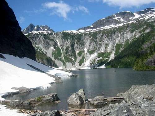 Mirren Lake © Lindsay Elms
Other Routes
If none of the above appeal, there is always the option to undertake the 4-6 day traverse north along the high ridges from Mt Washington and Mt Albert Edward via the Aureole Icefield and Rees Ridge. At least there are no road closure issues involved in this choice.Red Tape and Safety Considerations
There are no formalities to complete. You are not in any of the “core” areas of Strathcona where camping fees are due.There is line-of-sight from the summit of the Glacier to the cellular repeater tower on the summit of Mt Washington 23 km to the northeast and full service (Rogers) from there. I was also able to see Mt Washington from the top of the descent route off the Frog Ponds high point and was able to get service from there too. I did not try to obtain a signal from any lower points on the mountain.
Camping
If you’ve made a post 6 pm approach because of road closure during the day, there is reasonable camping on the road about 200 metres before the trailhead. Comox Creek is not too far away as a source of water but it would be more convenient if you brought a barrel with you.Some people undertake both Frog Pond and Kookjai routes as day trips. Most, however, camp at least one night en route.
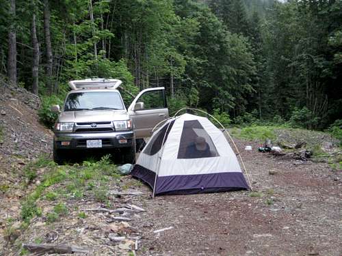 Car Camp at The Frog Ponds Trailhead Car Camp at The Frog Ponds Trailhead |
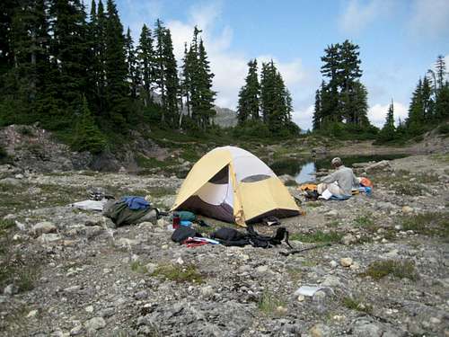 Camp at Frog Ponds Camp at Frog Ponds |
I’m informed that the Tatsno Lakes area provides the best camping spots on the Kookjai route.
There is excellent camping anywhere on the Mirren Lake approach - particularly at the lake itself.
If you do camp, there are no restrictions or fees. Just remember to practise your best no-trace methods, boil or otherwise treat your water and definitely light no fires.
Useful Links
For more information refer to Island Alpine – A Guide to The Mountains of Strathcona Park and Vancouver Island, Philip Stone, Wild Isle Publications, 2003, ISBN 0-9680766-5-3Don’t go on any trip on the Island without having a look for the right page on Lindsay Elms’ excellent Beyond Nootka website. The Comox Glacier page is especially good.
For precise directions get hold of a copy of Backroad Mapbook. Volume III: Vancouver Island
If you are considering a winter trip, consult Vancouver Island Avalanche Conditions
Weather
Nearest point current conditions and forecast.OR
Check the weather at altitude right from Mt Washington’s webcam
walkingtrashcan - Sep 26, 2012 3:38 am - Voted 10/10
I suggest revising the Mirren Lake routeI recently attempted to hike to Mirren Lake following your directions. This, combined with ignoring my map, led me up Rees Creek and eventually up to Duncan Lake through endless Devil's club. Although it wasn't a total loss (since now I know a potential route to Memory Lake) I suggest revising your directions to Mirren. Firstly, The road formerly known as "CK 75" is now marked as West Main. The old CK 75 sign has multiple shotgun wounds. The West Main sign is easier to spot. Second. The sentence "Follow the main line as high as you can drive always choosing the branch heading higher when faced with a choice." was what led me up Rees creek. 3.6km from the start of West Main (formerly CK 75) the road forks. Going "higher" takes you up Rees creek. Bearing left will take you up Kweishun Creek (the correct way). A few Km later you will skirt around a meadow. There are several stones and logs scattered on the road along with a large cross-ditch which requires a good 4x4 and driving skills. The rest of the drive is fairly easy in comparison. Lastly, there is also a route up the right side of the first waterfall. Where you would normally cross the creek and head up the left side, you instead, scramble up the slab on the right. While it is more technical and potentially dangerous, it is faster and easier in the long run.
lettingtonm - Sep 21, 2016 1:47 am - Hasn't voted
Frog Ponds Route in a dayThis past August me and 3 friends hiked the Frog Ponds Route to the Comox Glacier. I've read many trip reports, most people take two or three days to do this route but we gave it a shot as a day hike! We had ideal conditions and perfect weather. here is my trip report: http://explorington.com/2016/09/comox-glacier-day-hike/
vancouver islander - Sep 21, 2016 2:27 pm - Hasn't voted
Re: Frog Ponds Route in a dayI agree Matthew. With no foreknowledge of times we carried a camp up to Frog Ponds and were there for lunch. Spent the afternoon there hiding from the bugs since we didn't know how far it was to the summit. In fact we were there and back again for lunch the next day and back down at the TH by 4-ish. With light packs and an early start it's a very do-able day trip. Of course Frog Pond is a great place to camp and enjoy IF the bugs are reasonable.