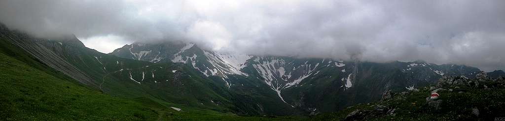
The southeastern corner of Liechtenstein in the clouds
I was hoping for a better day, but early in the morning, the clouds were even lower. Therefore I adjusted my plans, and started late.
With the summits hidden in the clouds, this is a sizable part of the length of the southeastern border region of Liechtenstein, seen from the north.
On the far left are the slopes of the Augstenberg. Next comes the Bettlerjoch, a saddle on the border with Austria. Then the Naafkopf, the summit of which is shared by Liechtenstein, Austria and Switzerland, but here it's in the clouds.
Continuing west, just to the right of the big snow field, would be the Hinter Grauspitz, also known as Schwarzkopf, then the Vorder Grauspitz, the highpoint of Liechtenstein, and then Falknis, beyond which the ridge to the west gets lower and disappears from view behind another ridge that branches off to the north from the Hinter Grauspitz. But with these clouds, all that is virtually invisible, so you'll just have to take my word for it ;-).
23 June 2012.


