Toggle navigation
Mountains
Routes
Images
Trip Reports
Forum
What's New
People
Areas & Ranges
Articles
Trailheads
Canyons
Huts & Campgrounds
Albums
Logistical Centers
Fact Sheets
Lists
Custom Objects
Gear
Plans & Partners
WELCOME TO SUMMITPOST
SIGN IN
REGISTER
The steep scree and cliffs...
View High-Resolution Image
The steep scree and cliffs...
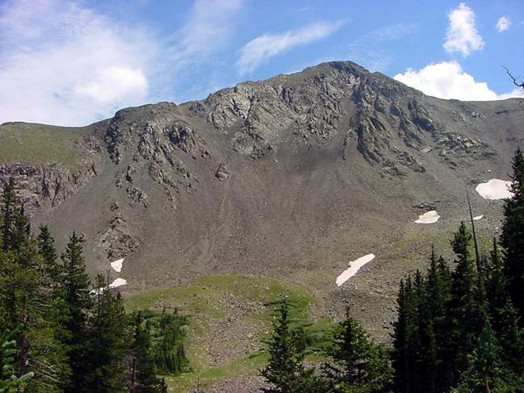
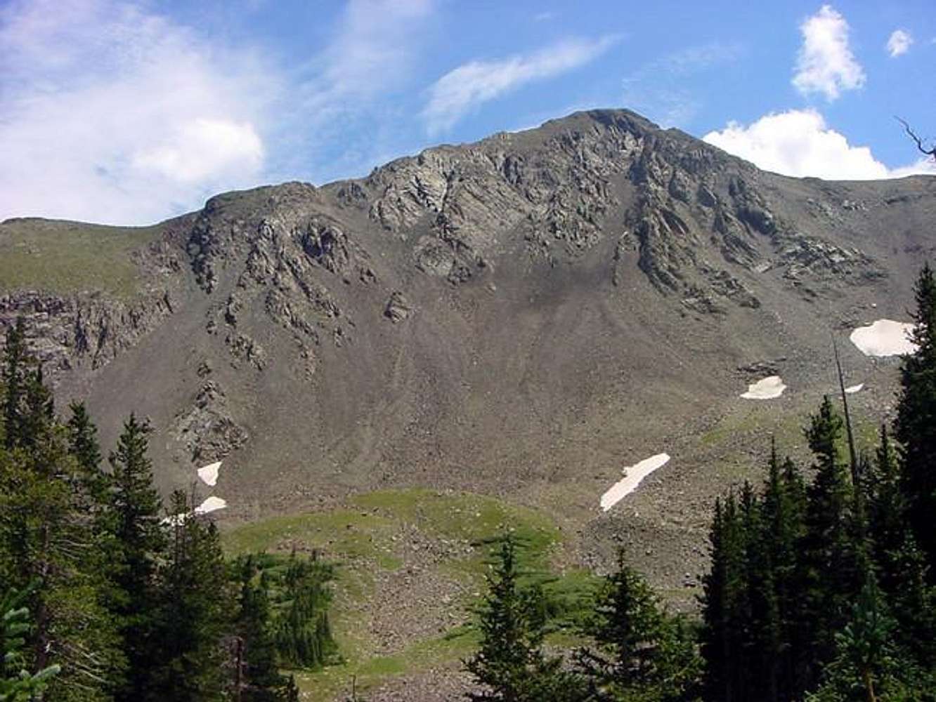
The steep scree and cliffs protecting the northwest side of Spread Eagle Peak from between the lower and middle Lakes of the Clouds. Early August, 2005.
« PREV
NEXT »
csmcgranahan
on
Aug 8, 2005 11:20 pm
Comments & voting
Other parents
Lat/Lon:
38.12510°N / 105.6436°W
Image ID:
119202
4095 Hits
73.59
% Score
4
Votes
Log in to vote
Comments
No comments posted yet.
to post!
Don't have an account?
Spread Eagle Peak
(Mountain/Rock)
You are at
the First
Image
Viewing
#1 of 1
GALLERY
You are at
the Last
Image
csmcgranahan's Image Gallery
« PREV
Viewing
#258 of 660
GALLERY
NEXT »
Spread Eagle Peak
(Mountain/Rock)
Loading....
Gibson Creek Trailhead
(Trailhead)
Loading....
×
You need to login in order to vote!
User Name
Password
Remember me
Forgot your password?
Log me out when I close my browser.
Keep me logged in all the time.
sign in as a user
Don't have an account?
Register now for FREE
Rating available
Suggested routes for you
People who climb the same things as you
Comments Available
Create Albums
Register Here


