
pluto's gulch - Feb 28, 2006 8:48 pm - Hasn't voted
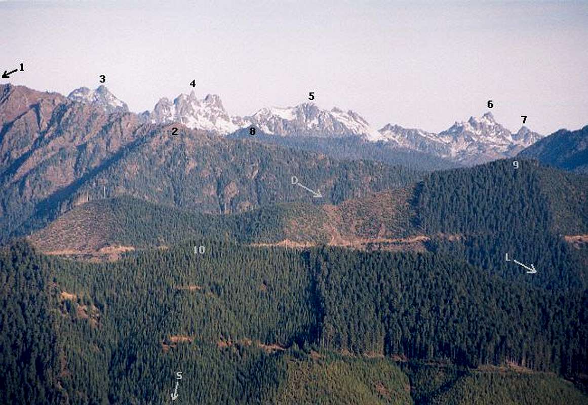
Fine Effort but . . .I doubt that #3 is Lincoln. Examine the S end of Sawtooth Ridge as it intervenes just above the Lightning ridge. The intervener is N Lincoln and your #3 is probably Hopper or even Deception. Also, you canted the horizon line due the foreground roads. Stone's "relative distance" wouldn't have so remarkable a shortening effect with respect to Sawtooth elevations at your range.

Klenke - Mar 1, 2006 5:59 am - Hasn't voted
Re: Fine Effort but ...You can doubt. But I am right. #3 is Mt. Lincoln. Photo was taken from here on a short spur up a knoll (this is the same place I took this photo of Rock Peak, interestingly, the only "Rock Peak" in the state). You are free to shoot rays from this point using your topo software.
I'm not sure what you're getting at regarding canting the photo. All points in the horizontal middle of the photo are higher (in elevation) than where the photo was taken so there is a slight upward tilt. #10 (Pk 3011) is at about the same elevation as the camera location. But at those distances we're talking only a degree or two of "cant." I'm not sure why you use "cant." Tilt would be more appropriate. Cant usually refers to objects, as in buildings.
It makes sense why Stone appears shorter: it's 4 miles farther away from the camera than Cruiser. Note also that Lincoln is about two miles closer to the camera than Cruiser. By the way, from this angle (camera location), Mt. Deception, Mt. Hopper, and Mt. Cruiser are in a straight line (i.e., Cruiser obscures the other two). Hopper and Cruiser are the same height so Cruiser won't show and Deception is too far away.


Comments
Post a Comment