Toggle navigation
Mountains
Routes
Images
Trip Reports
Forum
What's New
People
Areas & Ranges
Articles
Trailheads
Canyons
Huts & Campgrounds
Albums
Logistical Centers
Fact Sheets
Lists
Custom Objects
Gear
Plans & Partners
WELCOME TO SUMMITPOST
SIGN IN
REGISTER
Slesse Mountain
Additional Parents
Image
This is the aprox line for...
View High-Resolution Image
This is the aprox line for...
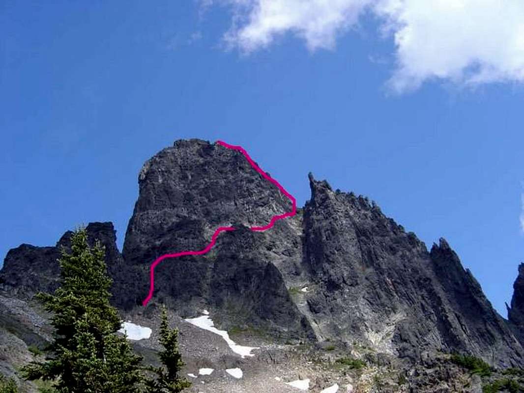
This is the aprox line for the SW Butress route. The easiest route up Slesse yet a 5.7. The picture is taken from the point at which the approach trail leaves the woods after a whooper 3300ft ascent over about 1.3 miles.
« PREV
NEXT »
Alpine72
on
Jan 5, 2006 5:35 pm
Comments & voting
Other parents
Lat/Lon:
49.02500°N / 121.593°W
Image ID:
144014
7487 Hits
79.04
% Score
10
Votes
Log in to vote
Comments
No comments posted yet.
to post!
Don't have an account?
Slesse Mountain
(Mountain/Rock)
« PREV
Viewing
#17 of 61
GALLERY
NEXT »
Alpine72's Image Gallery
« PREV
Viewing
#14 of 41
GALLERY
NEXT »
×
You need to login in order to vote!
User Name
Password
Remember me
Forgot your password?
Log me out when I close my browser.
Keep me logged in all the time.
sign in as a user
Don't have an account?
Register now for FREE
Rating available
Suggested routes for you
People who climb the same things as you
Comments Available
Create Albums
Register Here


