Toggle navigation
Mountains
Routes
Images
Trip Reports
Forum
What's New
People
Areas & Ranges
Articles
Trailheads
Canyons
Huts & Campgrounds
Albums
Logistical Centers
Fact Sheets
Lists
Custom Objects
Gear
Plans & Partners
WELCOME TO SUMMITPOST
SIGN IN
REGISTER
Big Sam
Additional Parents
Image
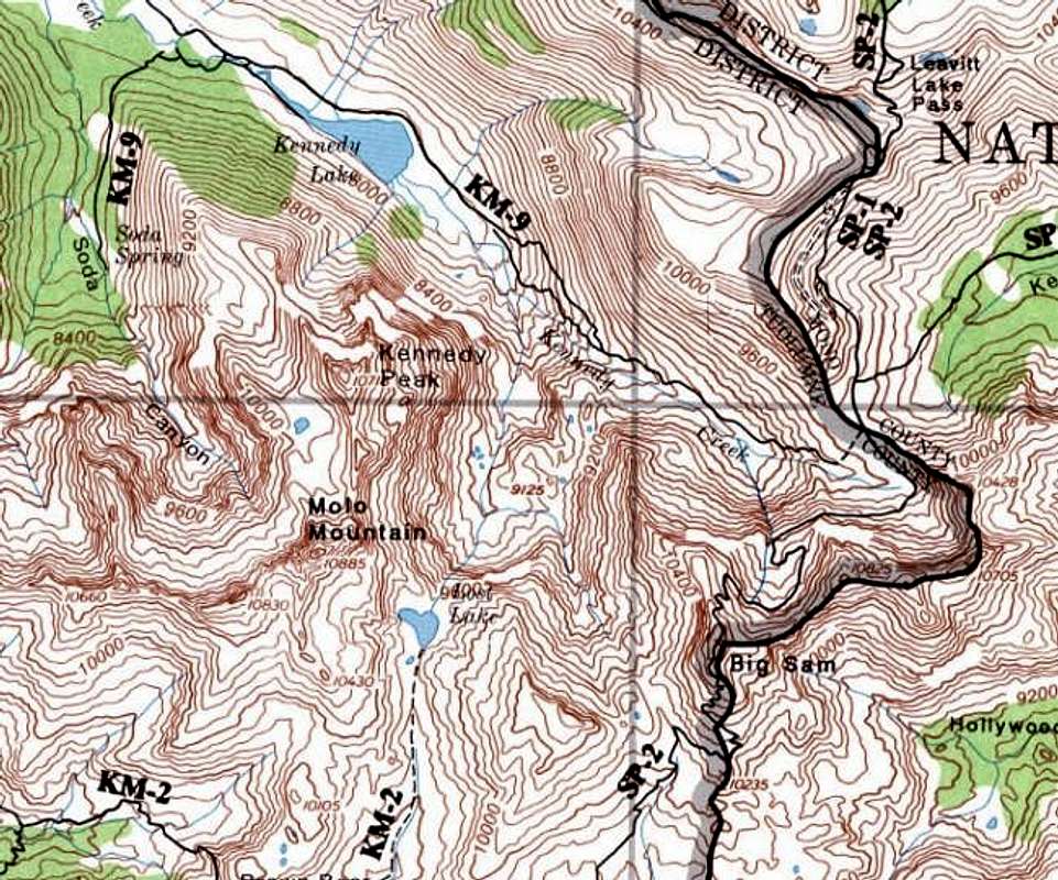
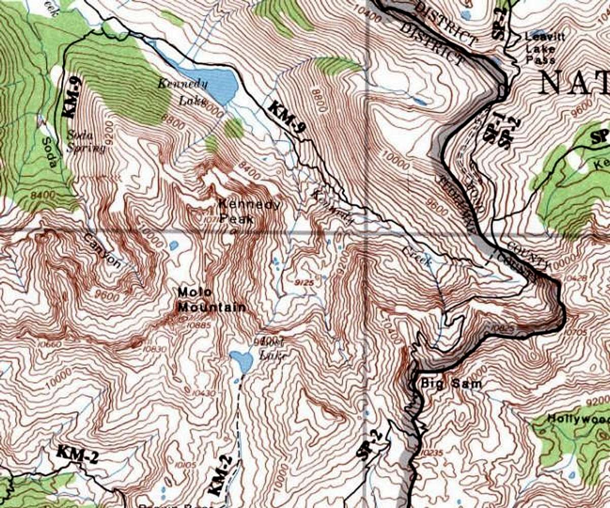
Topo map of Big Sam
View High-Resolution Image
Topo map of Big Sam
Topo map of Big Sam shows the following routes.
From Kennedy Lake
From Leavitt Lake
From Kennedy Canyon
Southern Route
« PREV
NEXT »
Alpinist
on
Nov 9, 2003 8:45 pm
Comments & voting
Other parents
Lat/Lon:
38.22910°N / 119.6253°W
Image ID:
32742
4955 Hits
0
% Score
0
Votes
Log in to vote
Comments
No comments posted yet.
to post!
Don't have an account?
Big Sam
(Mountain/Rock)
« PREV
Viewing
#16 of 16
GALLERY
You are at
the Last
Image
Alpinist's Image Gallery
« PREV
Viewing
#619 of 662
GALLERY
NEXT »
Snowfield Crossing on Big Sam
(Trip Report)
Loading....
×
You need to login in order to vote!
User Name
Password
Remember me
Forgot your password?
Log me out when I close my browser.
Keep me logged in all the time.
sign in as a user
Don't have an account?
Register now for FREE
Rating available
Suggested routes for you
People who climb the same things as you
Comments Available
Create Albums
Register Here


