Toggle navigation
Mountains
Routes
Images
Trip Reports
Forum
What's New
People
Areas & Ranges
Articles
Trailheads
Canyons
Huts & Campgrounds
Albums
Logistical Centers
Fact Sheets
Lists
Custom Objects
Gear
Plans & Partners
WELCOME TO SUMMITPOST
SIGN IN
REGISTER
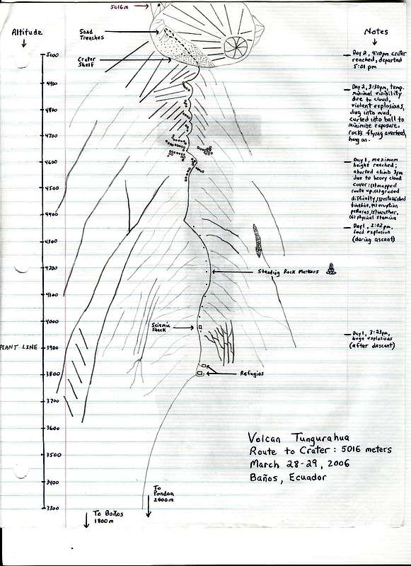
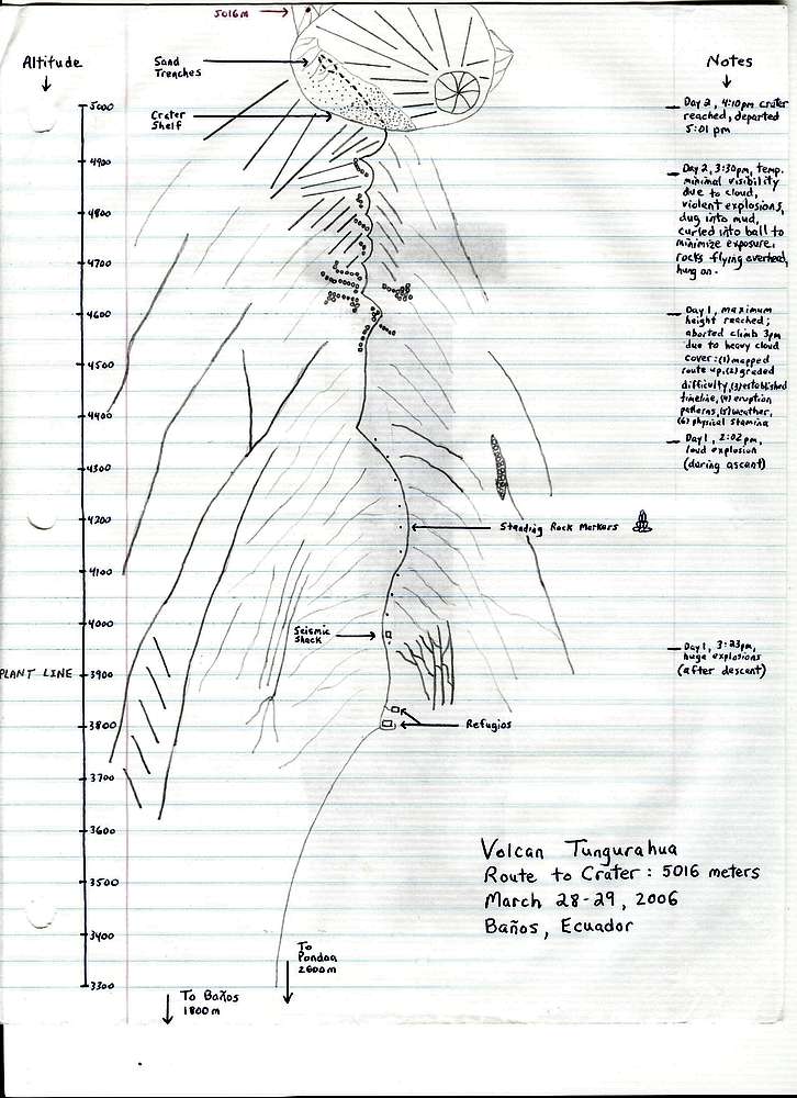
Tungurahua: Route to Crater
View High-Resolution Image
Tungurahua: Route to Crater
My route up and a crater diagram penciled the day after descending Volcano Tungurahua. (March 31, 2006)
« PREV
NEXT »
vTungurahua
on
Sep 1, 2009 5:49 pm
Comments & voting
Other parents
Lat/Lon:
1.467°S / 78.424°W
Image Type(s):
Hiking
Image ID:
548238
3215 Hits
72.08
% Score
2
Votes
Log in to vote
Comments
No comments posted yet.
to post!
Don't have an account?
Tungurahua
(Mountain/Rock)
You are at
the First
Image
Viewing
#1 of 1
GALLERY
You are at
the Last
Image
vTungurahua's Image Gallery
« PREV
Viewing
#8 of 8
GALLERY
You are at
the Last
Image
Tungurahua
(Mountain/Rock)
Loading....
Chasing The Dragon: Tungurahua
(Trip Report)
Loading....
×
You need to login in order to vote!
User Name
Password
Remember me
Forgot your password?
Log me out when I close my browser.
Keep me logged in all the time.
sign in as a user
Don't have an account?
Register now for FREE
Rating available
Suggested routes for you
People who climb the same things as you
Comments Available
Create Albums
Register Here

