Toggle navigation
Mountains
Routes
Images
Trip Reports
Forum
What's New
People
Areas & Ranges
Articles
Trailheads
Canyons
Huts & Campgrounds
Albums
Logistical Centers
Fact Sheets
Lists
Custom Objects
Gear
Plans & Partners
WELCOME TO SUMMITPOST
SIGN IN
REGISTER
Lochs, NE ridge
Additional Parents
Image
TwinPeaksGPSTrack
View High-Resolution Image
TwinPeaksGPSTrack
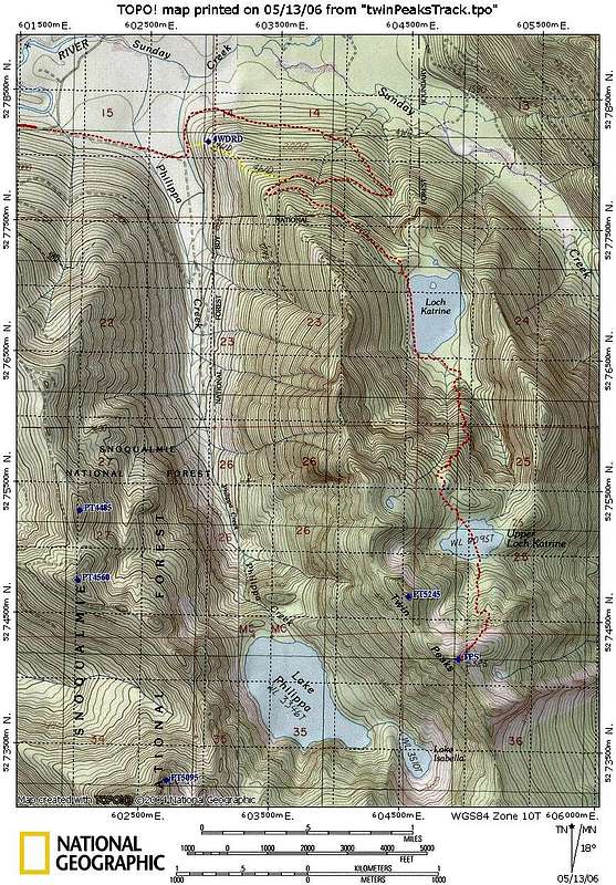
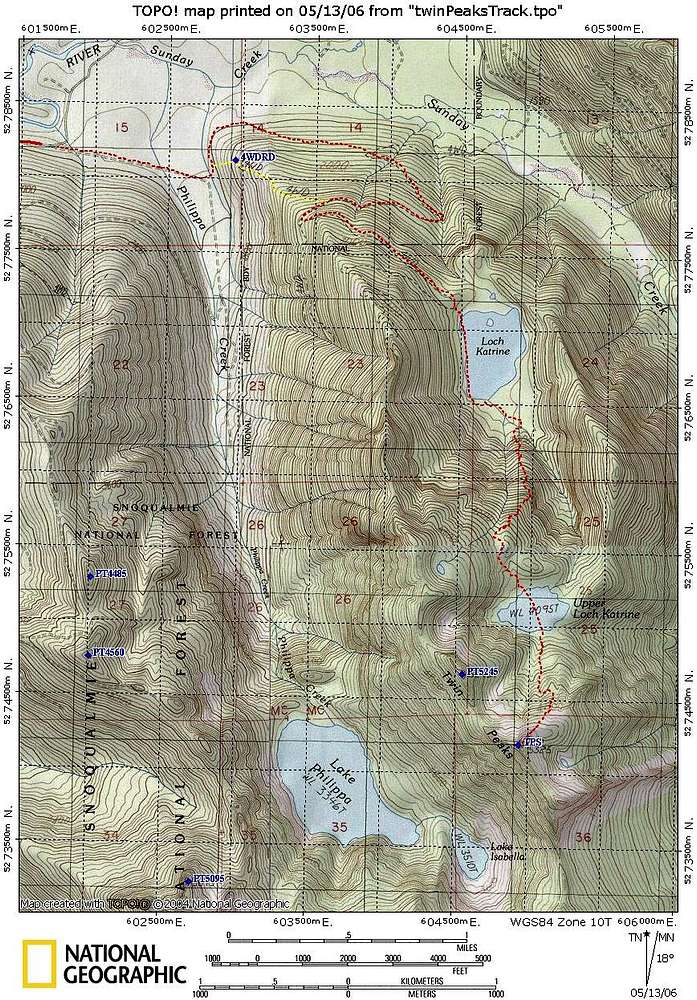
The dotted red route is our GPS track. The yellow route is a possible shortcut that will cut off almost three miles RT. Assuming the 4WD road is decent, you only need to do 500' (200' vertical) off trail. Feb 18, 2006
« PREV
NEXT »
larryN
on
May 14, 2006 4:32 am
Comments & voting
Other parents
Image Type(s):
Topo/Diagram
Image ID:
193793
2828 Hits
0
% Score
0
Votes
Log in to vote
Comments
No comments posted yet.
to post!
Don't have an account?
Lochs, NE ridge
(Route)
You are at
the First
Image
Viewing
#1 of 1
GALLERY
You are at
the Last
Image
larryN's Image Gallery
« PREV
Viewing
#214 of 267
GALLERY
NEXT »
×
You need to login in order to vote!
User Name
Password
Remember me
Forgot your password?
Log me out when I close my browser.
Keep me logged in all the time.
sign in as a user
Don't have an account?
Register now for FREE
Rating available
Suggested routes for you
People who climb the same things as you
Comments Available
Create Albums
Register Here


