Toggle navigation
Mountains
Routes
Images
Trip Reports
Forum
What's New
People
Areas & Ranges
Articles
Trailheads
Canyons
Huts & Campgrounds
Albums
Logistical Centers
Fact Sheets
Lists
Custom Objects
Gear
Plans & Partners
WELCOME TO SUMMITPOST
SIGN IN
REGISTER
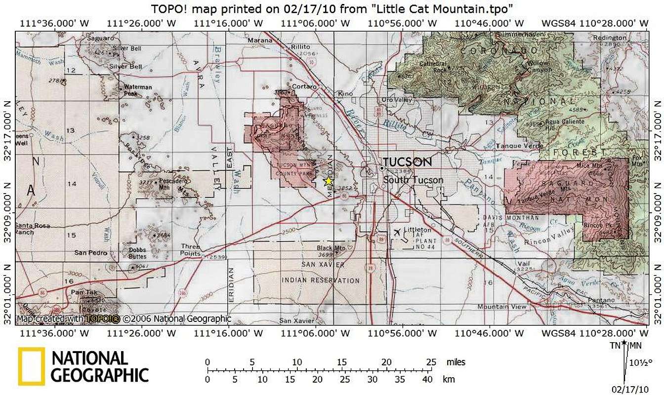
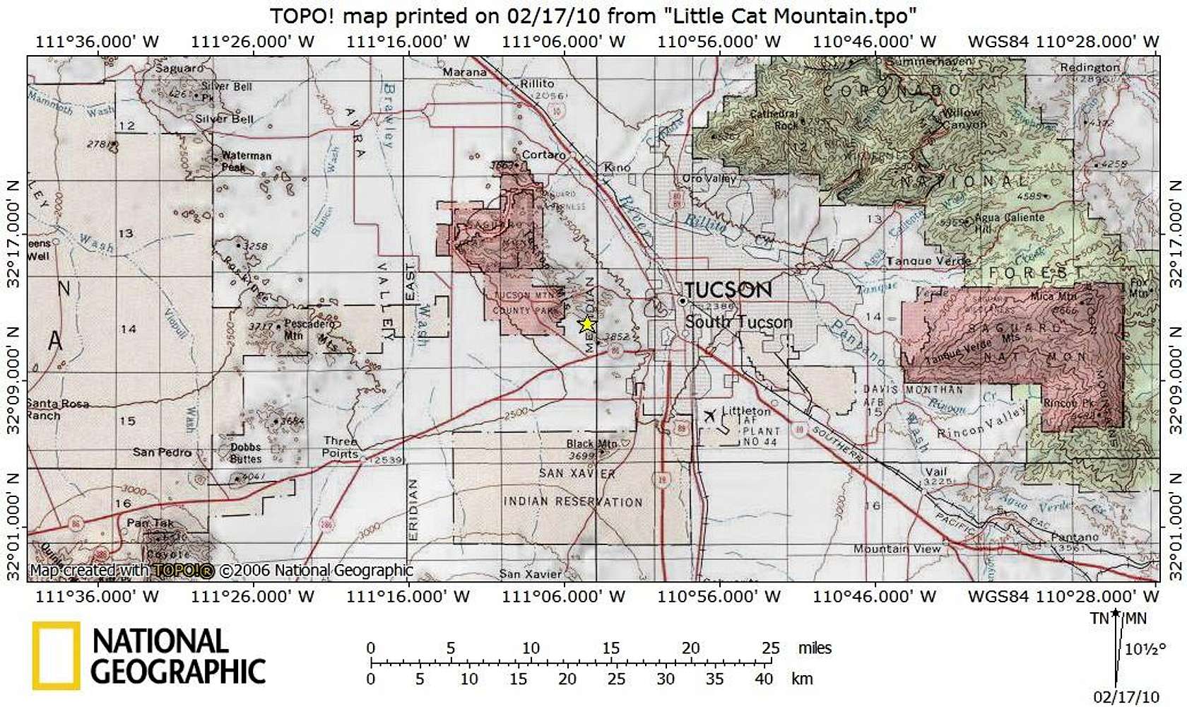
Bobcat Ridge
Additional Parents
Image
UN 3380_Getting There Map
View High-Resolution Image
UN 3380_Getting There Map
Tucson Mountain Park resides 13 miles to the west of Tucson, Arizona in Pima County. The park can be reached via Gates Pass Road or by taking Ajo Road to Kinney Way.
Feb 2010
« PREV
NEXT »
Sarah Simon
on
Mar 6, 2010 7:34 pm
Comments & voting
Other parents
Lat/Lon:
32.20040°N / 111.0749°W
Image Type(s):
Topo/Diagram
Image ID:
602209
1696 Hits
75.81
% Score
6
Votes
Log in to vote
Comments
No comments posted yet.
to post!
Don't have an account?
Bobcat Ridge
(Mountain/Rock)
You are at
the First
Image
Viewing
#1 of 1
GALLERY
You are at
the Last
Image
Sarah Simon's Image Gallery
« PREV
Viewing
#819 of 5480
GALLERY
NEXT »
×
You need to login in order to vote!
User Name
Password
Remember me
Forgot your password?
Log me out when I close my browser.
Keep me logged in all the time.
sign in as a user
Don't have an account?
Register now for FREE
Rating available
Suggested routes for you
People who climb the same things as you
Comments Available
Create Albums
Register Here


