Toggle navigation
Mountains
Routes
Images
Trip Reports
Forum
What's New
People
Areas & Ranges
Articles
Trailheads
Canyons
Huts & Campgrounds
Albums
Logistical Centers
Fact Sheets
Lists
Custom Objects
Gear
Plans & Partners
WELCOME TO SUMMITPOST
SIGN IN
REGISTER
Lost River Peak
Additional Parents
South Face Super Gully
Image
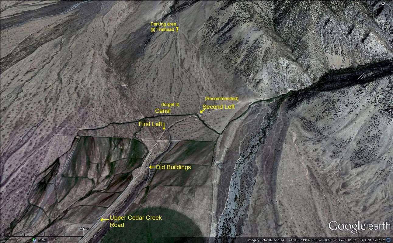
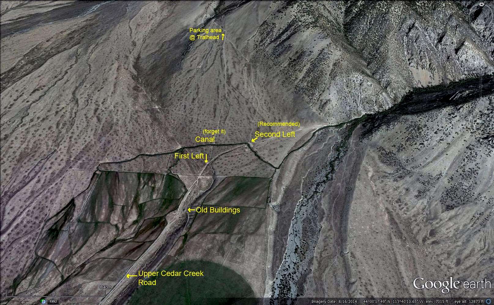
Upper Cedar Creek Map
View High-Resolution Image
Upper Cedar Creek Map
Google Earth image of the road to the west side of Lost River peak (12,078') and the Super Gully approach. Bob Boyles
« PREV
NEXT »
reboyles
on
May 9, 2016 2:41 pm
Comments & voting
Other parents
Lat/Lon:
44.03821°N / 113.65603°W
Image Type(s):
Alpine Climbing
,
Hiking
,
Skiing
Image ID:
971649
1563 Hits
74.92
% Score
5
Votes
Log in to vote
Comments
No comments posted yet.
to post!
Don't have an account?
Lost River Peak
(Mountain/Rock)
« PREV
Viewing
#57 of 73
GALLERY
NEXT »
reboyles's Image Gallery
« PREV
Viewing
#257 of 712
GALLERY
NEXT »
South Face Super Gully
(Route)
Loading....
×
You need to login in order to vote!
User Name
Password
Remember me
Forgot your password?
Log me out when I close my browser.
Keep me logged in all the time.
sign in as a user
Don't have an account?
Register now for FREE
Rating available
Suggested routes for you
People who climb the same things as you
Comments Available
Create Albums
Register Here


