
-
 11085 Hits
-
 78.27% Score
-
 9 Votes
|
|
Mountain/Rock |
|---|---|
|
|
47.00414°N / 10.80432°E |
|
|
Hiking |
|
|
Summer, Fall |
|
|
11237 ft / 3425 m |
|
|
Overview
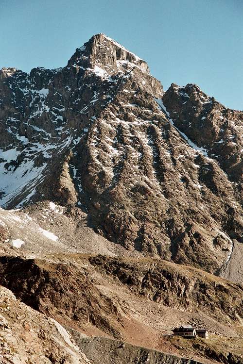 Verpeilspitze and Kaunergrathütte (30-08-2005)
Verpeilspitze is one of the major summits in the Kaunergrat Range, which makes part of the northern Ötztal Alps.
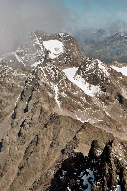
It is the second highest peak in Kaunergrat Range after neighbouring Watzespitze. Its huge summit block stands out above some glaciers: Plangerossferner, Verpeilferner and Neururer Ferner.
Verpeilspitze was first summited by Th. Petersen, Anna Voigt, St. Kirschner, J. Penz and J. Praxmarer on september 4th, 1886. They used the below described normal route to the summit.
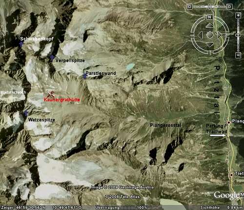
The north - south running Kaunergrat Range starts above Inntal valley and passes after about 25 km into the Weißkugel area. It is defined by Pitztal valley to the east and by Kaunertal valley to the west.
Verpeilspitze summit sits in the main ridge of Kaunergrat Range in the vicinity of Watzespitze (3533 m), Schwabenkopf (3379 m) and Rofelewand (3354 m) thus forming the highest elevations of the range.
There are three ridges joining at the summit: the north ridge goes to Verpeiljoch and Sonnenkögel, the west ridge goes to Schwabenjoch and Schwabenkopf and the south ridge drops down steeply into Plangeross valley. An eastern subridge with Parstleswand (3091 m) as main summit diverges from the south ridge and runs down to Pitztal valley.
There is only one easy route up to the summit via the southwest face of the mountain. All other routes and ridges are much more difficult.
Getting There
Pitztal / Plangeross
From Salzburg, Rosenheim, Kufstein and Innsbruck follow the Inntal highway A 12 until you reach the exit Imst.
From Rhine valley, Bregenz and Swizzerland follow the highway A 12 direction Innsbruck until you reach Imst. Exit there likewise.
 Overview
From Munich take the highway A 95 and the B 2 to Garmisch Partenkirchen. Follow the signs to Ehrwald / Lermoos (B 187).
From Füssen follow B 179 to Ehrwald / Lermoos.
B 179 continues across Fernpass and - numbered as B 189 - to Imst.
At Imst follow the signs leading to Pitztal. You pass Jerzens and Sankt Leonhard and you reach the little village of Plangeross. About 200 m south of Plangeross you reach a road exiting to the right and leading back into the village alongside the creek Pitze. After this intersection there is a place to park on the right side of the road.
Kaunertal / Feichten
Do as above but do not exit the Inntal highway at Imst but at Landeck. This is west of Imst. At Landeck follow B 180 to Reschenpass and Switzerland / Sankt Moritz.
At the village of Prutz there is an intersection: turn left at the traffic light, the road takes you into Kaunertal. Go on until you reach Feichten. You can park your car somewhere north of Feichten center.
Routes Overview
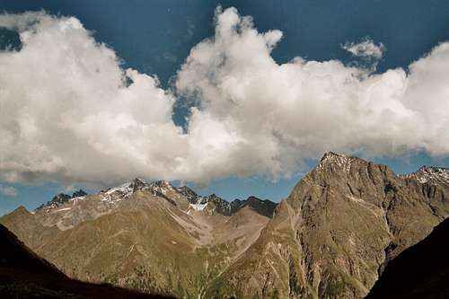 Geigenkamm (30-08-2005)
Ascent from Pitztal
From the Parking area south of Plangeross take the road alongside the creek Pitze and cross the creek on a good bridge. At the trailhead there are signposts to Kaunergrathütte. There is a forest road leading up the steep slope. Soon a trail (number 927) leaves this road and zigzags steep up through the forest to the timberline. The trail goes on through meadows and crosses the creek, running down the Plangeross valley, called Lußbach.
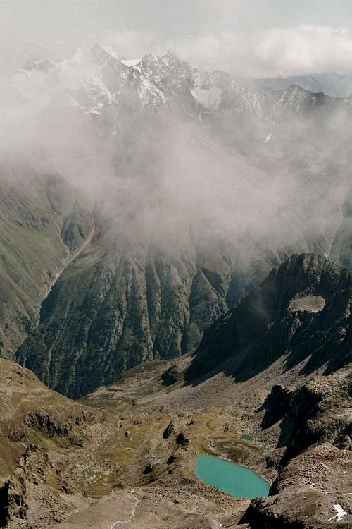
The steep slope is the lower of two escarpments of the Plangeross valley, made by glaciers of the ice age. Between the two escarpments stretches the meadow of Plangeross Alm. At the end of the valley you have a breathtaking view of Watzespitze and its hanging glaciers.
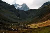 Watzspitze from huts ascent (30-08-2005)
After the second escarpment you reach at Karlesegg a trail junction. Straight on that´s the trail to Kaunergrathütte, now numbered 926. Trail 926 goes on to the south in the direction of Riffelseehütte. To the north there is another marked, though unnumbered trail which leads up the south slopes of the Plangeross valley, reaches a high notch and descends to Mittelberglessee and the village of Trenkwald in the Pitztal valley.
From below this notch there is a badly maintained and scarcely marked trail high on the south slopes of Plangeross valley to Kaunergrathütte with the possibility to climb Parstleswand (3091 m). This trail is recommended more as a descent than as an ascent trail.
For Kaunergrathütte follow the trail into the valley. At the end of the valley the trail ascends on the south slopes through talus and moraine scree, reaches the old moraine crest of the 19th century Plangeross glaciers (those where the days ...) and finally arrives at Kaunergrathütte.
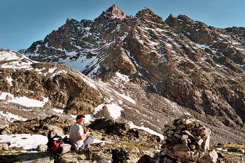
 Watzespitze from Kaunergrat hut (29-08-2005)
Kaunergrathütte can be highly recommended, the tenants are very nice and the food is very good. Normally you will stay a night at the hut before continuing to the summit.
West of Kaunergrathütte a marked trail continues up to the sad rests of Plangerossferner. There is the trail junction with the Kaunertal ascent.
Ascent from Kaunertal
At Feichten trailhead follow the trail number 926 up the steep escarpment to gain Verpeiltal. You reach Verpeilalm and, at the timberline, Verpeilhütte which also can be highly recommended for an overnight stay. As the complete ascent to the summit takes more than 2200 m of altitude difference, I strongly advise to stay a night at Verpeilhütte and go on the next morning.
Follow the trail number 926 up the north slopes of Madatschkopf but don´t go for this summit. Follow the trail into Hinteres Kühkarle and to the Madatschferner, which has to be climbed on its north side.
There are two possibilities to traverse the Kaunergrat Range main ridge and to descend some 50 to 100 m to Plangeross glacier. It depends on the glacier and snow conditions.
Schneeiges Madatschjoch is the lower notch but may be more difficult to traverse in late summer and autumn.
Aperes Madatschjoch is north of Schneeiges Madatschjoch and offers a better though higher traverse to Plangeross glacier and the trail junction.
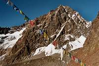
 Verpeilspitze with summit route (29-08-2005)
Summit Route
From the trail junction of the Pitztal and Kaunertal ascent follow the marked trail through moraine scree and talus to the highest point of a moraine crest, nowadays called Mainzer Kopf (3053 m). This one is made as a sort of summit for those who cannot climb the high Kaunergrat peaks but like to have their 3000 meters altitude experience. Funny though....
According to ForcanReg there is also a cairned route round the east side of Mainzer Kopf so you don´t have to climb this part.
After Mainzer Kopf the trail continues unmarked to the north. Due to snow conditions there will be snow or moraine scree to pass. Soon you will enter the northern rests of Plangeross glacier. Do not continue to Schwabenjoch (the col between Verpeilspitze and Schwabenkopf) but start to ascend the southwest slopes of Verpeilspitze up to a series of scree - covered ledges. There are several possibilities to gain these ledges.
Arriving the ledges, turn around and follow those easy ledges to the south up to the beginning of a rock and scree - maybe early in the summer snowfilled chute. There are big red marks on blocks, indicating the chutes entrance.
 Watzespitze from summit ascent (29-08-2005)
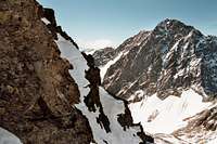
 On the summit route (29-08-2005
Follow the chute up to a little notch in its left margin, traverse this notch, gain a steep ledge which leads up to a snow or scree filled little cirque and onto the south ridge of Verpeilspitze. There are parts of UIAA grade I scramble but mostly easier though exposed.
Follow the easy south ridge up to the summit block. To the left there is a notch and a nice spire, ascend the notch through a short chute and gain the ledges, traversing the southwest rockface of Verpeilspitze, passing some chutes until you arrive a broad steep chute which leads up to the west ridge near the summit. This part is very exposed, too, but not so difficult to climb.
Follow the west ridge up to the likewise exposed summit and its summit cross.
 Geigenkamm (29-08-2005)
The view are breathtaking: you will see the whole Ötztal Alps, the Lechtal ranges, Wetterstein and Mieming ranges and the Engadin mountains to the west.
Return on the same route.
Red Tape
 Weißkugel from Verpeilspitze summit (29-08-2005
As far as I know there are no restrictions, fees or any kind of regulations to be considered.
Mountain Conditions, Gear, Maps and Guides
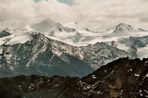 Ötztaler Wildspitze from summit (29-08-2005)
Montain conditions
Verpeilspitze should be hiked through summer and early autumn.
In spring there may be too much snow though you can reach Kaunergrathütte and Plangeross glacier with skies and go on by foot.
After the first snowfalls in autumn, conditions will turn icy and tricky.
Gear
Full glacier hiking gear with crampons and ice axe, rope. What you really will need depends on the conditions. If they are good enough you can leave some of the gear at the Kaunergrathütte.
Webcam
Kaunertal provides some webcams which can be used to check on the local weather
Weather forecast
The Austrian television provides a good weather forecast.
For weather freaks there is Wetterzentrale with its accurate meteorological maps.
Topo maps
Alpenvereinskarte 1 : 25.000
Blatt Nr. 30/3; Ötztaler Alpen
Kaunergrat - Geigenkamm
Guide
Walter Klier
Alpenvereinsführer Ötztaler Alpen
Bergverlag Rudolf Rother
Huts, Hotels and Camping
 Summit view (29-08-2005)
Mountain huts
Kaunergrathütte
Verpeilhütte
Riffelseehütte
Hotels and Camping
In the surrounding valleys there are many possibilities to stay overnight:
Pitztal
Kaunertal
What Else To Do ?
 Rofelewand seen from summit (29-08-2005)
There are some more interesting hikes and mountain adventures in the vicinity of Verpeilspitze / Kaunergrathütte.
- Try Watzespitze via east ridge (UIAA III- / IV in some parts) or via old glacier route (only recommended in early summer).
- Schwabenkopf (3379 m; hike and UIAA II)
- Seekarlesschneid (3208 m; UIAA II, northeast ridge)
Go on to Riffelseehütte
(trail number 926), from where you can climb some interesting glacier and rock summits:
- Seekarlesschneid (3208 m; UIAA II and III-)
- Rostizkogel (3392 m; glacier hike)
- Wurmtaler Kopf (3228 m; mostly a glacier hike)
Or you traverse to Verpeilhütte
and tackle Rofelewand (3354 m; glacier hike and steep snow or rock chute).