
-
 2383 Hits
-
 74.01% Score
-
 4 Votes
|
|
Route |
|---|---|
|
|
38.92100°N / 104.9467°W |
|
|
Hiking |
|
|
Spring, Summer, Fall, Winter |
|
|
Less than two hours |
|
|
Short Class 2+ walk-up |
|
|
Overview
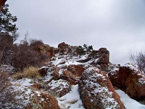
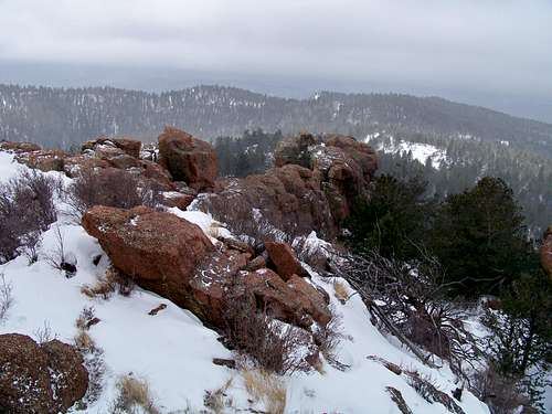
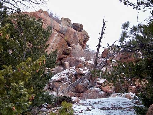
This route is very short with minimal elevation gain and requires only a small amount of easy off-trail navigation. The route follows a short, rugged dirt road near the base of UN 9620. A brief off-trail hike through timber is topped off by a pleasant scramble over and around large boulders and slabs of Pikes Peak Granite.Roundtrip Mileage: Less than 1 mile
Elevation Gain: 125 feet
Getting There
From with Garden of the Gods ParkIn dry conditions, high clearance is recommended for this dirt road, but a passenger car with be sufficient. In wet or snowy conditions, do not attempt Rampart Range Road without 4-wheel-drive and good tires.
 Rampart Range Road driving conditions Rampart Range Road driving conditions04 Apr 2009 |
| 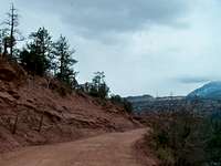 Rampart Range Road is narrow and wash-boarded with heavy traffic Rampart Range Road is narrow and wash-boarded with heavy traffic04 Apr 2009 |
 | Click here for a PDF Map from Garden of the Gods for instructions on getting to the park. |  |
Route Description
 UN 9620 via FS 300Q
- Begin heading northeast on FS 300Q.
- UN 9620 will come into view eventually as a granite outcropping to the northeast.
- Follow the road until it begins heading downhill, then leave the road and begin heading up through the trees and rocks.
- After some initial easy scrambling around and over granite boulders, you will reach a relatively level area with a rustic campsite.
- At this point the summit will loom almost directly to the north.
- Climb your way up some grippy granite slabs and look for the weakness to gain the final summit boulders.
Essential Gear
- Trail map (Trails Illustrated #137 (Pikes Peak, Cañon City) would meet most needs)
- Compass
- Trekking pole(s)
- Sturdy hiking boots with grippy soles and stiff ankle support
- Snowshoes after a heavy snowfall
- Water and snacks
- A camera to save memories of the high country views
- First aid kit
- Other standard backcountry essentials