|
|
Route |
|---|---|
|
|
44.91328°N / 6.35834°E |
|
|
Mountaineering, Mixed |
|
|
Spring, Summer, Fall, Winter |
|
|
Most of a day |
|
|
5.2 (YDS) |
|
|
PD |
|
|
II |
|
|
Overview
Pic Coolidge is a mountain very central to the Oisans (viz. Ecrins) range. Although the normal ascent appears to be from the west, i.e. from the mountaineering center of La Berarde via the Refuge Temple Ecrins, there is an equally fascinating access from the east, i.e. from the equally important mountaineering center of Ailefroide / Pre de Madame Carle. This ascent will be described here. It comprises a longer section of glacier walk over Glacier Noir, up to about 3000m, and then mixed terrain through the southern flank of Pic Coolidge to Col de la Temple, were the east and west ascents meet, and further-on to the top.The main seasons are late spring time to fall, but - avalanche situation permitting - the ascent should be possible all the year round.
Getting There
The mountain range Oisans, which comprises the southernmost 4000m peak of the Alps (Barre des Ecrins, 4101m) is situated east of Grenoble, and the starting point of the route is accessed from national route N.91 east of the Oisans.Leave the N.91 at Argentiere-la-Bessee, about 10 km south of the scenic medieval village of Briancon, and head west in the valley of Vallouise. Passing by the small village of Ailefroide, follow the road to its end at Pré (=meadow) de Madame Carle, 1874m, where you find a big parking place and a private hut with food and accommodation.
Route Description
From the Pre de Madame Carle to the summit you have to move your body up by exactly 1900 m of altitude gain.The first part of about 700m follows the side moraine of the lower Glacier Noir - see primary image. At about 2500m the tongue of the glacier is crossed southward to follow the southern branch of Glacier Noir.
The 2nd part is a 2.5 km hike along this branch, with a moderate altitude gain of only about 500m. Note that the name of this glacier (noir meaning black) indicates that it is largely covered by scree. Although this part is not very demanding alpinistically, it proceeds in a fascinating scenery, with the impressive and alpinistically important north faces of Pelvoux, Pic Sans Nom et Ailefroide to the left.
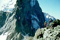
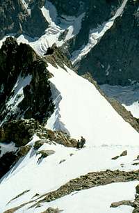
For the 3rd part, you leave the glacier at about 3000m to the right and scramble up mixed terrain of snow fields and interspersed rock belts, passing by Col de la Temple where you may meet people coming up from the (other) normal route. In the vicinity of the col also some bivy places exist, so in perfect weather you may want to enjoy an overnight stay here.
The last steps lead over a breathtaking snowfield
and finally over a short steep ridge
Now you will be stunned by the incredible gorgeous views you have to all sides, being surrounded by big walls of around 4000ers.
The upper part of the ascent is well visible on this photo taken from Mont Pelvoux:


