Fine climb, difficult descent
Open Source map of the Cadini Group, centered on Torre Wundt.
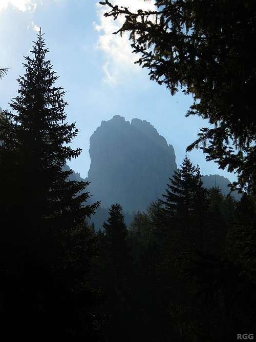
![Just wondering if this is Torre Wundt...]() Close to the trailhead we see this tower.
Close to the trailhead we see this tower.
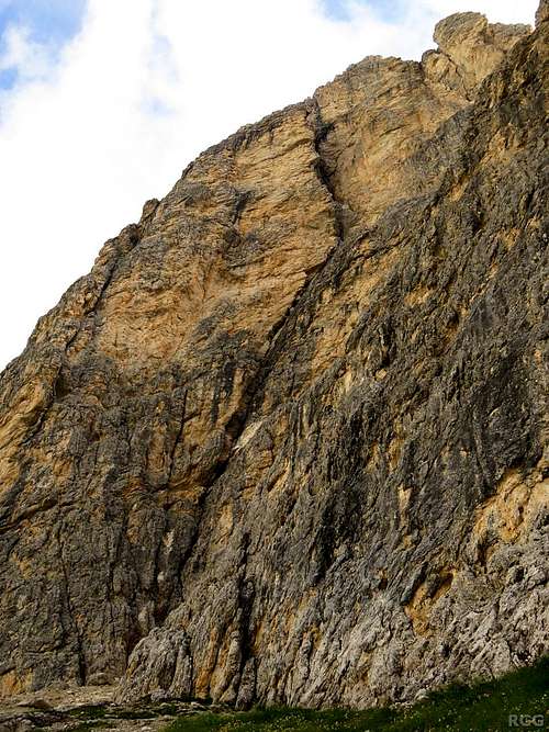
Is this perhaps Torre Wundt?![Via Mazzorana, the normal route on Torre Wundt, follows the obvious crack]() Via Mazzorana, the normal route on Torre Wundt, follows the obvious crack
Via Mazzorana, the normal route on Torre Wundt, follows the obvious crackThe days before, the weather had not been particularly settled, but this morning it looked fine, and so it was with almost clear skies that Jan and I set out to climb
Via Mazzorana on Torre Wundt.
It was a fine climb and we reached the summit in good time, without any real problems. We had a bite to eat, and admired the jagged peaks around us. Only then did we see that the skies were getting clouded. Time to get moving again.
On the descent, the first problem was to locate the abseil rings that our guidebook said could be found by following the west ridge from the summit, and descending. Going west wasn't difficult, but we saw no rings before it got real steep again. After a while we found them, though a bit lower than where we would expect them so we weren't sure we were at the right spot.
From there, we tried making sense of the descent directions, but failed. There was a subsidiary summit just a bit further west, so we figured, perhaps the real descent starts from there? We climbed it and looked around for more rings, but there was nothing. We reluctantly had to admit that we didn't understand the descent directions. The description just didn't seem to match the terrain that we saw below us. We went back to the abseil rings to have another look down from there, but didn't see anything we hadn't seen before.
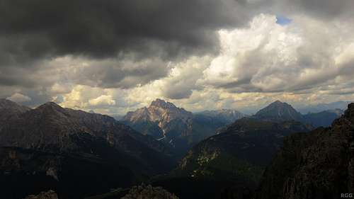
![A storm is brewing...]() A storm is brewing...
A storm is brewing...
Now, if the weather had been fine, there would have been no reason to be worried, for we knew that we could always go back to the summit and rappel the route. But while we had been searching, the skies had become darker and darker, and we heard thunder not far away. It was still dry, but we knew we had to get off the mountain, and soon, if possible.
We gave up on the directions and looked for a way down ourselves. As it happened, right below the abseil rings was a gully that descended towards the southeast, traversing the upper face of the mountain. It clearly wasn't what the book described, but it should lead us back in the direction of our ascent route, and it might be shorter than going back up to the summit and descending from there.
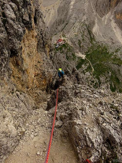
![Jan on an easy section on Torre Wundt]() I'm belaying Jan as he scrambles up an easy section not far above the big crack - hours later, this is where we would rejoin the ascent route!
I'm belaying Jan as he scrambles up an easy section not far above the big crack - hours later, this is where we would rejoin the ascent route!The gully started steeply, but soon after the grade slackened and from there on down descending was surprisingly easy (no harder than UIAA grade III near the top, still easier below that), and it kept continuing for what seemed like a long time. In fact, it lead us right back to the penultimate belay point on the route we had climbed earlier! I waited for Jan to catch up and share the good news. Sure, we weren't out of the woods just yet as we still had a lot of rappels to go, with bad weather brewing all around us, but it was comforting to know where we were.
We rappelled one length after another. Having two ropes meant that we could rappel up to 60 m in one go, provided that we had a decent place for our next rappel. The drawback was that it was hard work to drag down the ropes afterwards. They got twisted all the time, and sometimes got snagged somewhere. Still, with some pulling and yanking we always got them released.
Relieved we got to the base of the climb, just when the first drops started falling. But the mountain wasn't ready to let us go just yet. As Jan pulled down the ropes, one of them got caught once again. No matter what he tried, he could get it unstuck this time. In the end I had to climb back up to release it. All said and done, our descent had taken a whole lot longer than our climb.
![Tired]() Jan is tired (and soaked)
Jan is tired (and soaked)After quickly gathering our gear, we started the hike back to the trailhead. If it had been pouring with rain, perhaps we would have headed for shelter in the nearby Rifugio Fonda Savio, but it wasn't serious, at least not at first. And with much higher peaks so close by, we weren't concerned with the now regular thunder either. And indeed, it never felt as if we were in danger - but the rain intensified, and by the time we were back at the car we were soaked.
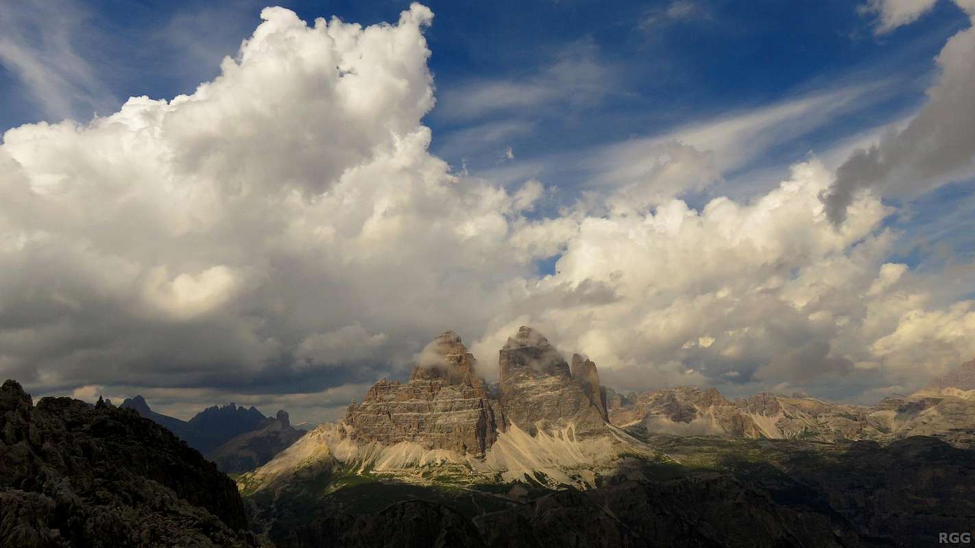
![Tre Cime di Lavaredo from Torre Wundt]() The magnificent summit panorama from Torre Wundt to Tre Cime di Lavaredo
The magnificent summit panorama from Torre Wundt to Tre Cime di Lavaredo
Comments
No comments posted yet.