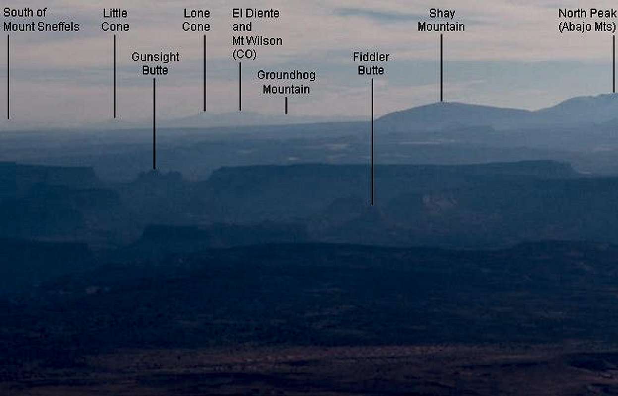
Here is a labeled version of
this image to identify some named features that are visible in the photo. The image on this page is reduced from its original image width of 650, so to see more legible text in the image, click on it.
These points were identified using a program I wrote in Visual Basic that can generate an image from any perspective on or above Earth. The elevation data the program uses are from USGS.
The elevations and approximate distances from Mount Ellen's summit of the points shown in the image are as follows:
Little Cone (11981 ft): 148.7 mi.
Gunsight Butte (6721 ft): 34.2 mi.
Lone Cone (12614 ft): 140.1 mi.
El Diente (14159 ft): 154.1 mi.
Mount Wilson (14250 ft): 154.8 mi.
Groundhog Mountain (12165 ft): 142.6 mi.
Fiddler Butte (6027 ft): 27.6 mi.
Shay Mountain (9989 ft): 69.9 mi.
North Peak (10824 ft): 73.7 mi.


Comments
Post a Comment