
-
 11120 Hits
-
 81.84% Score
-
 14 Votes
|
|
Route |
|---|---|
|
|
62.32043°N / 9.26681°E |
|
|
Mountaineering, Scrambling, Skiing |
|
|
Spring, Summer, Fall |
|
|
Most of a day |
|
|
Alpine F |
|
|
Overview
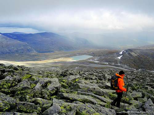
Geographical classification: The Scandes > Dovrefjell – Sunndalsfjella > Snøhetta Snøhetta Normal route from Snøheim
Snøhetta Normal route from Snøheim
Snøhetta 2286 m - whose name means the Snow Cap - is a superb mountain located in the county of Innlandet, Dovre Kommune, and included inside the Dovrefjell-Sunndalsfjella National Park, a mountain area shared amongst the counties of Møre og Romsdald, Oppland and Sør-Trøndelag. There are 291 peaks in Norway with the magic elevation over sea level of 2,000 metres and Snøhetta is one of these, a landmark which cannot easily be forgotten. To be precise, it's the 24th mountain in order of height in Norway and the highest one outside the Jotunheimen range. Snohetta includes somes small glaciers and four different tops are lined up on the summit crest: Stortoppen, the highest one, 2286 m, Midttoppen, 2278 m, Hettpiggen 2261 m, Vesttoppen 2253 m.
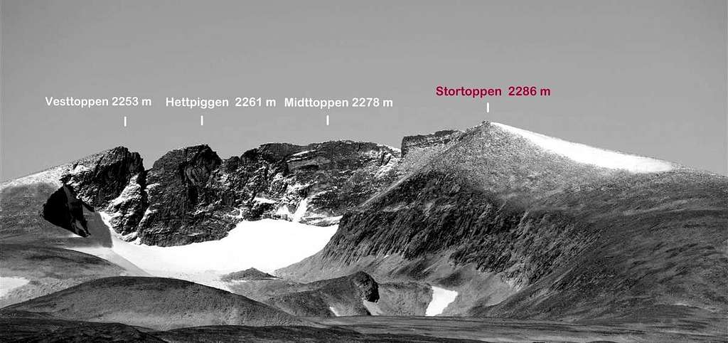
Midttoppen, Hettpiggen and Vesttoppen, even if not the highest summits, are the finest ones, because of - unfortunately - on Stortoppen there is a military building, a radio link station, originally installed by the Norwegian Army, which can initially disappoint those who reach the top. Anyhow, this particular is soon forgotten in comparison with the broadness of the panorama offered by the summit. Anyhow the Norwegian Defence Estates Agency is conducting the program to restore the original condition within the year 2020.

|

|
The route starting from the Snøheim Mountain Lodge and running along the Eastern slope directly to the highest point, even with the drawback previously told, is the most convenient for those who simply wish to reach the highest peak, especially with unstable weather. This route is the easiest and also the shortest way to climb Snøhetta amongst the various itineraries getting the summit and has the advantage to climb directly to the highest point, the Stortoppen. Moreover this itinerary doesn't involve the use of mountaineering gear, apart eventually an ice-axe, and doesn't require any climbing.
History
In times gone by, when the Jotunheimen range had not yet been fully explored, Snøhetta was thought to be the highest peak in Norway. The summit was reached for the first time in the year 1798 with scientific motivation by Jens Esmark, a Danish-Norwegian teacher of mineralogy.
Getting There
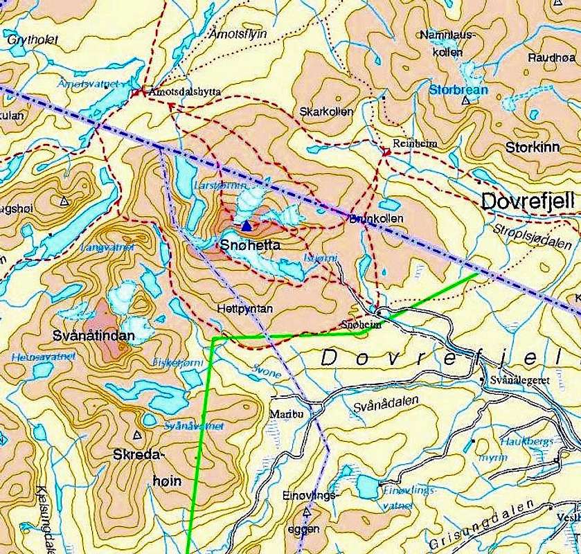
The nearest town is Dombås, located South of Dovrefjell, just at the junction of E6 and E136 Highways (about 330 km. from Oslo).

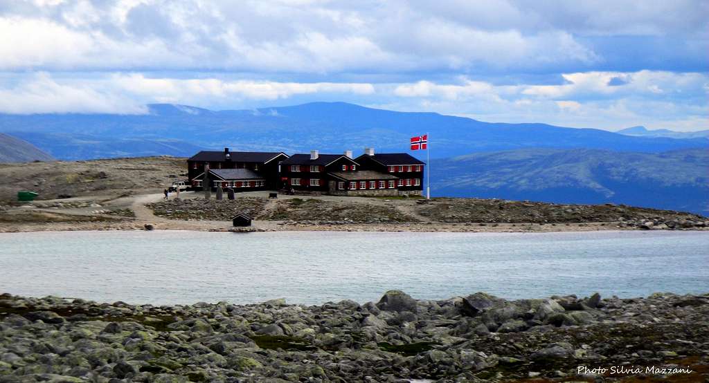
The starting point to climb is Hjerkinn, a locality situated at about 30 km. from Dombås, along the E6 Highway, just at the junction E6/RV29. Here it starts the Snøheim road, a gravel road about 12,5 km. long; once opened to private cars, now it's accessible only by the shuttlebus starting from the bus stop located in Hjerkinn, in front of the Hjerkinnhus Mountain lodge. Ticket price: Adult 60 NOK (july 2016), free for kids under 6 years, Dog 30 NOK. Parking is available at the bus stop.
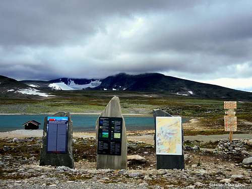
Snøhetta and info panels at Snøheim |
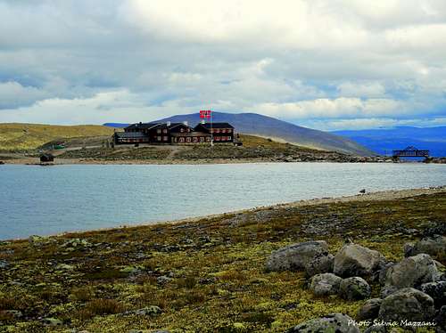
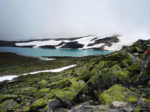
The lake near Snøheim Mountain Lodge Hut |
Public transportation You can take the Oslo-Trondheim train and stop at Kongsvoll station at about 900 m (ask for the stop to the train's crew before). From Oslo about 5 hours, from Trondheim 2 hours by train.
Route Description
Snøhetta Normal route from Snøheim report
Summit altitude: 2286 m
Difficulty: walk, then easy scramble up granite boulders and snowfields
Vertical gain: 820 m
Exposure: East
Starting point: Snøheim Mountain Lodge 1474 m
Ascent without technical difficulty and with excellent T marks and signposts, so it doesn't present any particular problems even in the case of poor visibility. With bad weather temperatures can drop considerably even in summer.

Ford at the start |

The Gamle Reinheim cabin |
Route report
The starting point to Snøhetta is the Snøheim hut, situated nearby a lake in the middle of a broad plain, from which the mountain is well visible. From the lodge start skirting the lake; there are two possibilities: on the right shore (East) the route is direct, but there is a ford sometimes difficult at the end of the lake to cross the tributary. With plenty of water it's better to walk the lake on the left bank (West) after crossing a bridge near the shelter. Along the left itinerary you will meet a great cairn with a plate in memory of Johan Hjerkinn and the visitor's book. At the end of the plain - at about 1500 meters of height - the two routes converge and head towards the small Gamle Reinheim cabin. The itinerary up to the cabin is essentially flat and here it starts to climb decisively along the large east crest of the mountain. The climb takes place along the ground consisting of boulders, rock slabs and snow fields and is well marked with T signs.

|

|
Shortly before the top, the Stortoppen or East summit, the highest, a large military building was positioned, near which there is an orientation table. The summit is reached in just a few minutes by skirting the building and climbing to the top on easy rocks. If you want to climb also Midttoppen, which is easily climbed from Stortoppen, continue for about 400 m on the ridge, then descend to the col between Midttoppen and Stortoppen and from here climb up to Midttoppen.
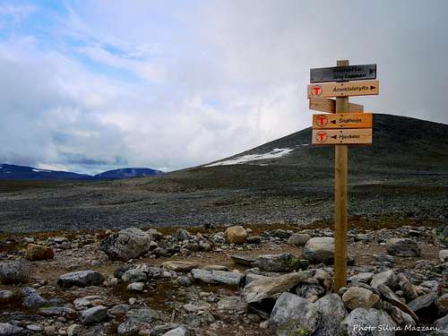
Signpost along the route> |
Granite stones along the route |
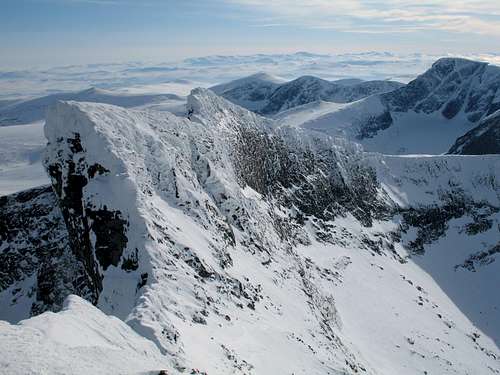
View of Snohetta summit |
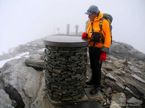
Snøhetta orientation table |
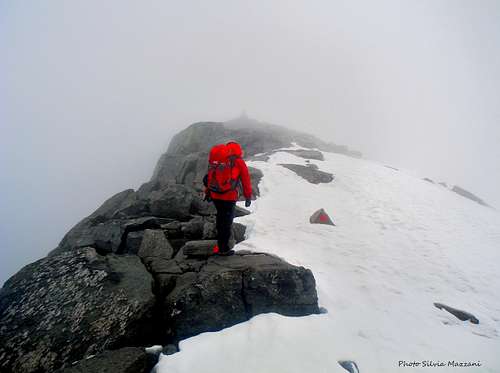
Last steps to Stortoppen |
Snøhetta landscape |
Descent - reversing the same route
Essential Gear
Warm mountain clothing and boots, rope and glacier equipment are not required, but an ice-axe may be useful
Red Tape
No fees no permits required. Private cars are not allowed on the Snøheimveien road. Snøhetta is located inside the Dovrefjell-Sunndalsfjella National Park. You should take care of nature as usual within the boundaries of all the natural parks. The whole fauna and flora are protected. Don’t disturb the fauna in the area. The Reindeer are very easily disturbed, so do never try get close to them, while the Musk might become aggressive and attack in self-defence. Please keep the correct distance (at least 200 meters) from the animals.
Nature and climate
This area is the natural habitat for many rare animals and plants. The landscape is unique and rich in various animal species such as wild reindeer, glitter, arctic fox, as well as the famous musk ox. Dovrefjell also has a stock of musk oxen, imported from Greenland in 1932, and become symbols of Dovre Mountains. In 1974, parts of the range became a national park, extensively enlarged in 2002. Together with Rondane it has Norway and Europe's last stock of wild reindeer of Beringia origin.
Where to stay
Built in the year 1952 by the DNT - Norwegian Trekking Association - and subsequently became property of the Army, today Snøheim is owned again by the DNT. 80 places
Other possibilities of accomodation in Dombås and Hjerkinn.
Meteo
When to climb
Mountaineering: from July to September
Ski-mountaineering: from March to May
Guidebooks and maps
 |
 |
-Guidebooks
Walks and scrambles in Norway - Anthony Dyer, John Baddeley, Ian H. Robertson - Hiking, Scrambling and Mountaineering in Norway, an English guidebook covering Jotuheimen and several other areas in the Scandes -Ripping Yarns 2006 (ISBN 978-1904466253)
-Maps
1519-IV Snøhetta Statens Kartverk, Norge 1:50000