
Comments
No comments posted yet.
|
|
Trip Report |
|---|---|
|
|
48.85127°N / 113.71074°W |
|
|
Aug 6, 2019 |
|
|
Hiking |
|
|
Summer |
First off, thanks to Bob Sihler for the excellent page description. I brought a print out with me on the hike and it was very helpful. The trail is "there" the whole way, but in many places it is not obvious and takes careful route finding to stay on course. I would not do this in low visibility or if there is any chance of a storm rolling in. Once on the trail, there does not appear to be any bailout points (besides what Mr. Sihler already described). Anyway, this is a fantastic trail and am grateful we had good weather and clear views all day. It is quite unique to find such an exposed route that is simply a hike and requires no ropes or wires. Outstanding.
Our itinerary was Ptarmigan Tunnel -> Goat Trail North to South -> Iceberg Notch down to Iceberg Lake and return. We estimated it to be ~18 miles, but the 6 or so miles on the Goat Trail and Iceberg Notch are quite involved with route finding, exposure, and some scambling in the class 3-4 range.
A few helpful tips before I jump in to the trip report:
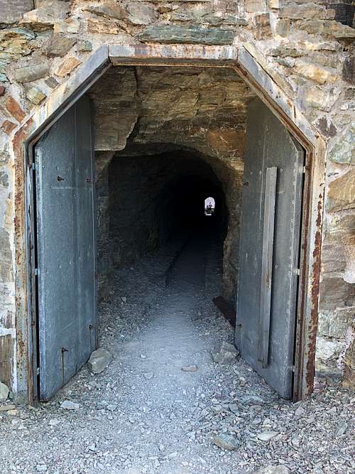
Based on Mr. Sihler's recommendation, my cousin and I set out for Ptarmigan Tunnel to do the route north to south. We got a bit of a late start as we drove in from Bigfork that morning, starting our adventure ~8:30am. The trail to Ptarmigan Tunnel is well established and well trafficked and this is where you will be able to quickly cover ground if you plan on making a day trip of it. It took us about 1hr45 to reach the tunnel.
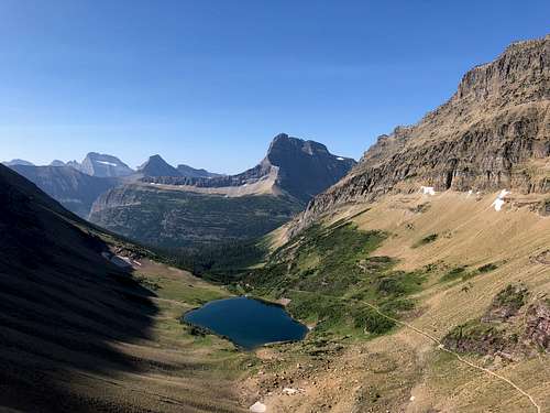
A few hundred feet before you reach the tunnel there is a pretty obvious climbers trail to gain the ridge. Stick to the ridge until you hit the headwall. The trail starts just to the right of it. Mr. Sihler's description of how to reach the saddle was right on. Nothing to add. We did take our time and review the description carefully and it probably took ~1.5hrs from the tunnel. The panoramic views of Ptarmigan Tunnel and Helen Lake from there are incredible. It's a good snack/rest spot before hitting the trail again.
We had some difficulty picking up the trail from the saddle. The route description said to catch the trail about "level with the saddle". Indeed it appeared a trail started there, but it fizzles quickly. We eventually found the trail ~30ft above where we entered. If you find yourself on crumbly sloped scree traversing this section, climb upward. The trail is obvious once you're on it.
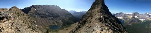
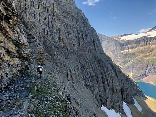
The highlight of the trail is the traverse of the cliff band on Ptarmigan Wall. You'll come in to view of this ~30mins past the saddle. It appears from a distance that there will be no way across. The trail gets narrow, but it is nothing more than class 2 hiking the whole way.
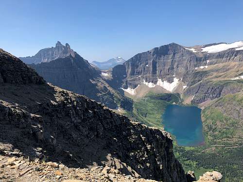
Eventually the snow field comes in to view. We climbed the rock before reaching the snow. It was not clear to me how you would use the snowfield to reach Ahern Pass. Perhaps earlier in the season the snow reaches to the top of the cliff band, but not when we were there in early August. Therefore, we lugged our crampons and iceaxes the whole day as dead weight. It took ~2hrs to reach the top of Ahern Pass from the saddle. Here we ran in to the first people we had seen since the tunnel, who had hiked up from the Granite Park Chalet off the Highline Trail. They were accompanied by a shaggy mountain goat, ironically the first we had seen all day.
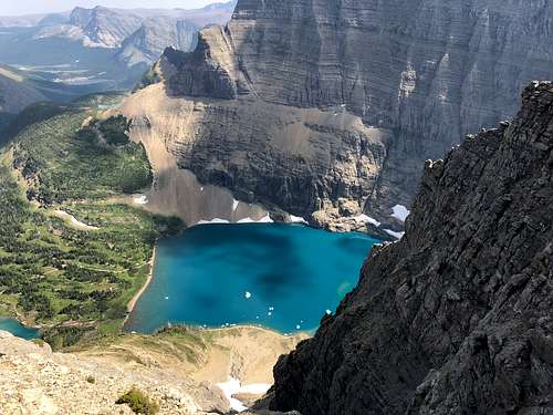
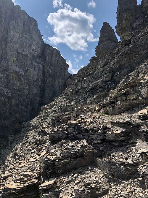
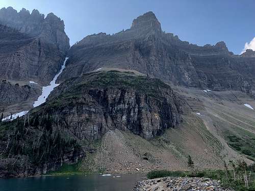
It was at this point that we realized that the SummitPost Goat Trail route description ended and the route back to Iceberg Lake was not clear to us. Fortunately, in the overview, Mr. Sihler mentions Iceberg Notch as a potential loop route. The notch is very obvious from Ahern Pass, but requires climbing a steep scree slope for ~750 vertical feet. From the notch, upon first glance a descent to Iceberg Lake does not appear passable without a rope, but there is a cairned route that keeps the downclimb to class 3/easy class 4. In places cairn trails split off in different directions, but it all looked passable. The goal is lose as much elevation toward the lake as possible without cliffing out.
Once you near the lake and reach the bottom of the main band of cliffs, a good looking trail continues to traverse back north (left) along the cliff line. Upon reviewing the Iceberg Notch description after we got back, we realized this was wrong. Apparently there is a route that gets you through the impeding cliff band just above the lake. We traversed the cliff band trail for about a quarter of a mile. By this point we were getting tired of traversing left and decided to b-line it to the lake. This was a horrendous descent but direct and got the job done. We arrived at Iceberg Lake ~5pm, or about 3hrs from Ahern Pass.
From the trail it's an easy downhill 5.5 miles back to the Swiftcurrent Hotel trailhead where beer and a dip in Lake McDonald awaited us. The whole loop took 10hrs, with plenty of route finding, snack and photo breaks. Hoping to be back next year to summit Iceberg Peak!