


-
 1108 Hits
-
 81.18% Score
-
 13 Votes
|
|
Route |
|---|---|
|
|
45.68346°N / 7.30878°E |
|
|
Hiking, Mountaineering, Scrambling, Via Ferrata |
|
|
Summer, Fall |
|
|
A long day |
|
|
From F to PD- |
|
|
II |
|
|
Note
|
La montagna chiama i suoi figli, ed essi rispondono fedelmente al suo appello… Osvaldo Cardellina, Diario alpinistico, 1964-65 Page texts: @ OsvaldoCardellina "Osva", passed away on May 2, 2022. Page owners: Christian Cardellina e Osvaldo Cardellina. Any updates from September 12, 2022: Antonio Giani, page administrator, friend and climbing companion. Testi della pagina: @ OsvaldoCardellina "Osva", scomparso il 2 maggio 2022. Proprietari pagina: Christian Cardellina e Osvaldo Cardellina. Eventuali aggiornamenti dal 12 settembre 2022: Antonio Giani, amministratore della pagina, amico e compagno di salite. |
Overview
This long spur takes beginning, after the Punta della Valletta (3.090m), from the Hill of Tsa Sétze or Chasèche (dry higher pasture; 2.820m), real input port between the Valley of Cogne (higher left branch or Western ramification of Vallon of Arpisson) and Pila 's Basin into the Municipality of Gressan. This enough long divide between the Central Valley of Baltea and Grand'Eyvia (Big Water Stream) forming on the street or mountain route, after the Colle or Col di Tsa Setze (2.815m), the Punta Tsa Sètze (2.824m), the Notch (in Giulio Berutto - Lino Fornelli "Monte Emilius Book Guide", page 69, "9. Colle di Mompers 2.750 meters", otherwise 2.745 meters) and the subsequent Punta di Monpers otherwise Mompers even Montpers (2.793m), the "Piatta" (Flat Plateform) of Grevon (2.752m), the Col de Couìs or Colle del Couìss and the next Punta del Couis also Couìss and even "Pic de la Tombe" (2.637 and 2.661 meters) to reach the Colle and Punta of Drinc, also known as Drink (2.565 meters and 2.663 meters with Cross +), and finally die out with the Col de la Pierre and Punta with the same name (2.584, 2.653 meters) above Gressan, Jovençan and Aymavilles Municipalities. Like nearby Punta del Couìs ("Top of the Blizzard") that was also known as Pic de la Tombe, from the name of the small and semi abandoned valley just South after the great overlying rocky cliffs drops the small Vieyes Village, last of Aymavilles Communality and before Cogne 's main Municipality. This last, hiking very busy in the years before the laying of some repeaters around Summit (1960?) of Drinc is today an intermediate transit point along "Pano Via" equipped by 2000 and then linked in 2003 with the "Via Ferrata" on the Crest Southwest of Punta della Valletta. All this buttress, which acts as a partition between the Central Valley of the Dora Baltea and the diagonal (From Southeast to Northwest) Cogne Valley, in summer can be covered during the day with a highly spectacular and panoramic semicircular route, which we will best describe with a small analysis / summary just below.
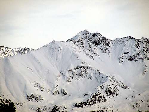
When the Southwest Ridge of Punta della Valletta was not yet a Via Ferrata ****** ![]()
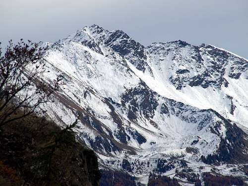
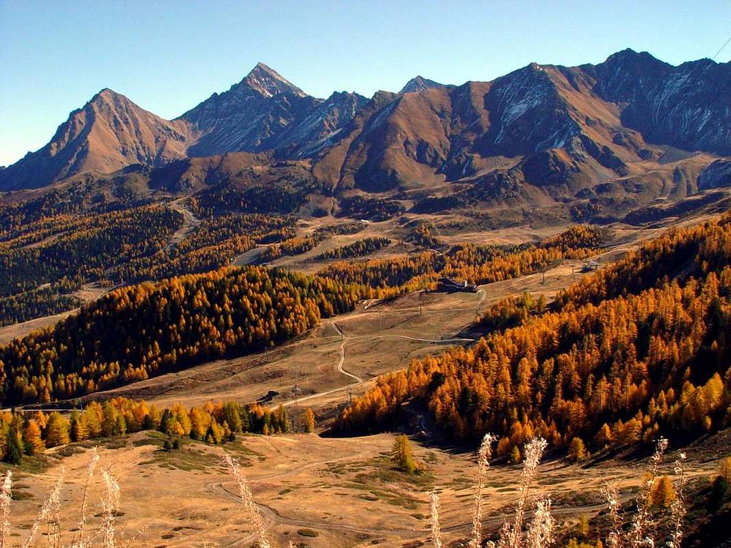
Pointe du Couìs, Piatta de Grevon & Punta di Montpers North-northeastern Slopes, with view on Pila Basin ****** ![]()
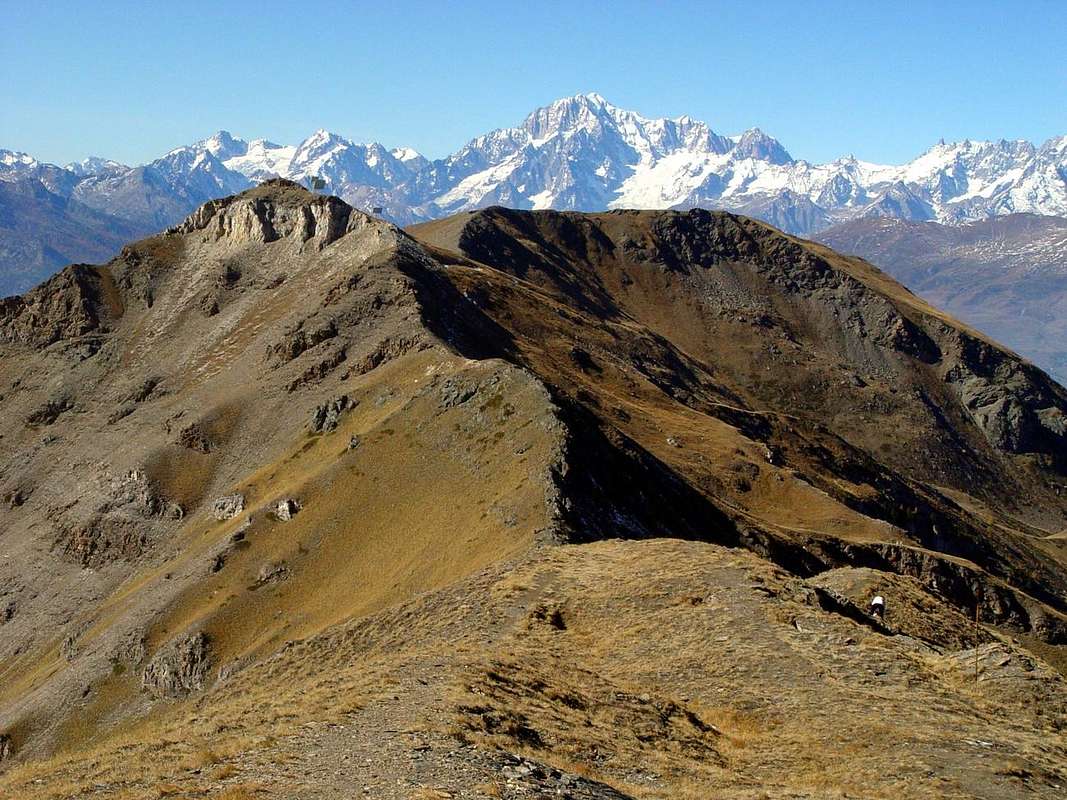
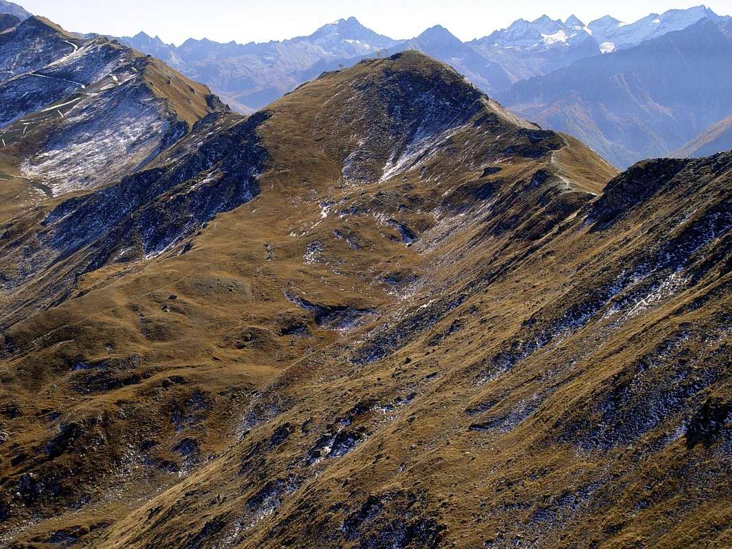
Punta della Valletta (3090m) Southwestern Ridge above South-southeastern Slope, from Arpisson Vallon ****** ![]() Long watershed from Pointe de la Pierre towards Piatta de Grevon, sited between Conca di Pila Cogne Valley
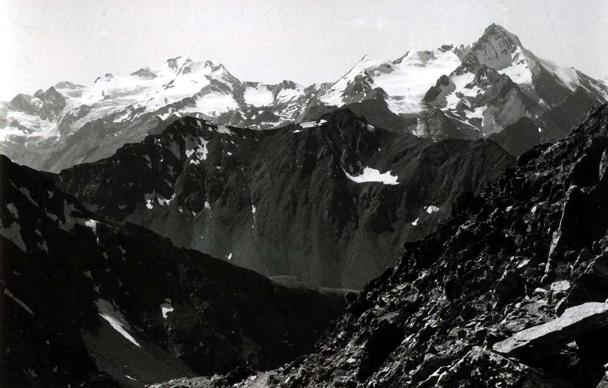
Long watershed from Pointe de la Pierre towards Piatta de Grevon, sited between Conca di Pila Cogne Valley ![]() M. Emilius (3559m) above Pila Basin from Western watershed bypassing Punta del Drinc to Piatta de Grevon
M. Emilius (3559m) above Pila Basin from Western watershed bypassing Punta del Drinc to Piatta de Grevon ******
In winter the ridge is always very dangerous ******
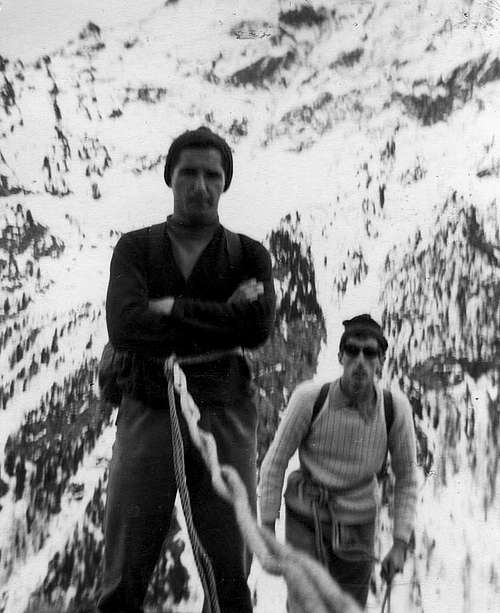
Old tours & youth crossings since 1965 until 1966 ******
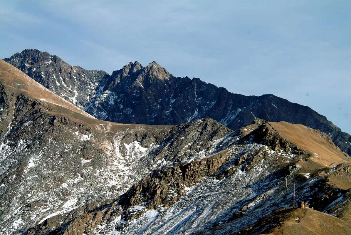
An intermediate main strecht of route from Great Shoulder 3.007 meters towards Punta della Valletta (3.090m), Mont Bellefaçe (2.970m) and Testa Nera (2.820m)
 |
 |
 |
The same, in fact, can be extended from the Punta della Valletta towards the North, reaching Mont Bellefaçe (2.970 meters and formerly even Bellefaça) and the subsequent Testa Nera (2.820 meters and in ancient times said as "Aouille Neira") just above the Chamolé Lake (2.325m). While the stretch between Pointe de la Pierre (2.653m) and Colle Tsa Sètze or Chasèche is defined as: "24. Cresta di Pila" (see in "EMILIUS - ROSA DEI BANCHI PARK OF M. AVIC" by Giulio Berutto - Lino Fornelli , pages 78/9; Edit. CAI / TCI, March 2005), in "Guide of Monte Emilius", pages 66/7, by Osvaldo Cardellina and Edit. from the same in collaboration with the Aosta Section of the C.A.I. December 1978, we find it as "GIRO DELLA CONCA DI PILA" also "TOUR OF THE PILA BASIN". In fact, completing the route, not only to the Black Head, but continuing along the ridge that from Colle di Chamolé (2.641m) reaches the altitude (2033m) called since just over half a century (1966) Punta del Dard (from the name of the waterfall, being above that of Ponteilles), or "Becca de Rien" (of little or no importance) and again "Becca du Rem" (of the copper). In this last case, after the descent from the Testa Nera (Black Head) on the hill, reach the altitudes of the Chamolé Coast (2.509m, 2.485m), the Col Gran Plan (2.437m), the Punta di Replan (2.451m), the Col Replan (2.366m), of the Signal Sismonda (2.356, 2.343 meters; old observatory dedicated to the geologist Angelo Sismonda), of the Colle Plan Fenêtre (2.221m); from this point, which establishes the entrance door between the Alpe di Chamolé and the Vallone del Comboé or Combuì, the watershed crest still has a "jolt" foming the Pointe de Ponteilles (2.263m), the Punta Valletta (2.164m) and that of the Dard, above the splendid and very wild Foresta Nera (Black Forest) of Combatissière) and the Alps of Les Pousses (1.601m), Les Leyzères (1.517m) and Les Gorres (1.385m), Saint Salò or La Pissine Salà (1.307/12 m), with this last nearby the Regional Road toward Pila Resort. A tour that at first glance may appear to be "oceanic", but which can actually be done in one day. A path that requires a total of 5 to 7 hours,, in addition to another 2 and a half hours to go from Pila to the watershed at an average height of about 2.650/2.750 meters (therefore from 8 to 10 hours in total), always depending on the level of training, which, however, requires 'to be qualitatively good and truly complete. Always depending on the degree of training, which, however, needs to be qualitatively good and very complete. Furthermore, the overall views range over the entire Alpine arc from the Rutor-Paramont Chain to Mont Blanc in the West and from the latter to Mont Dolent-Tour Noire in the North-northeast; then on the entire Pennine Alps that unfold from the Grand Golliaz or Golliat towards the East reaching the Matterhorn and the Monte Rosa Group, not before having climbed over the Mont Velan, the various Grand Combins, the Gelé / Morions / Punta Fiorio Chain and there at the bottom the pyramid of Dent d'Hérens in Valpelline. But with splendid glances on the pyramids of the Gran Paradiso Mountain Chain; ranging from the very close pyramids of the Gran Nomenon and the La Grivola that suddenly emerge like two mushrooms above the Pila Basin / Vieyes small Hamlet partition, from the Herbetet which emerges in the South to the Lavina Tower at the end of the Cogne Valley, while in the Levant the pyramids of Pic Garin, Punta Rossa dell'Emilius, Monte Emilius and Becca di Nona rise "proud". With the latter two dominating the underlying Città d'Aosta.
 Long watershed from Pointe de la Pierre towards Piatta de Grevon, sited between Conca di Pila Cogne Valley
Getting There
By car:
- From TORINO, MILANO, etc: Motorway A5. Exit at IVREA or Quincinetto (PIEDMONT) AOSTA West/Aymavilles, Cogne Municipalities.
- From Gressan (alternaive Regional Road by the small square Chez-le Ru 610m) towards Leysettaz Dèsott, Tivet Villages and Pila-Resort up to Les Fleurs Fraction (1.414m). But in this case, then you must descend to the Regional Road from Charvensod to the junction 951 meters for Reverier du Tzat and Dessous Alpages. From Aymavilles (646m) towards Cogne Valley: reaching Vieyes (1.132m), Epinel, Crétaz Hamlets to Cogne (1.534m); through Main Road. Or from this by Regional Road towards Montroz and Gimillan (1.785m) Villages; from the last in Northwest towards the above Arpisson/Tsa Sètze Vallons.
- From FRANCE: through the Mont Blanc Tunnel to Entrèves-crossroads to Vény/Ferret Valleys - Mountain Guides of Courmayeur - La Saxe Rock Gym - Courmayeur. By Little Saint Bernard Hill, closed since November until half May to La Thuile Valley - Pré Saint Didier - Courmayeur.
It is not necessary to take Motorway A5: you can drive on SS.26, in the direction of AOSTA - IVREA - TURIN.
- Aeroporto "Corrado Gex" Saint Christophe (Aosta).
Routes Description
Various route hypotheses with diversifications of departure and distance on the four watersheds that surround the Tourist Center of Domaine Skiable of Pila 's Basin. In this great and wideTOUR of PILA BASIN, which covers the entire Pila Resort, we want to propose, in addition to the integral route starting from the North-Northwest from the Pointe de la Pierre (2.653 meters and above the three Municipalities of Aymavilles, Jovençan and Gressan) and arrival at the end of the opposite, or Eastern, watershed which ends with the Pointe du Dard or "Becca de Rien" and even "Becca du Rem" (of copper) (2.033 meters above the Municipality of Charvensod) a series of alternative itineraries which in practice correspond to the splitting of the entire TOUR of the CONCA di PILA. It is possible, in fact, to divide the entire route into four parts which correspond to the deployment of the four different watersheds which contain this large and extensive basin and which correspond to the municipal division just carried out. But bearing in mind that on the opposite or Southern side, the border between the Municipalities of Aymavilles and Cogne takes place at Pointe du Couìs (2.661 meters and above the two small Valleys of Tomba and Drinc); while that of Cogne runs out in the Punta della Valletta (+; 3.090m). From the latter, which is the highest peak of this small subgroup,a long buttress extends towards the North which in the first section, that is, up to the Testa Nera (Black Head, 2.820 m), acts as a divider between the Valley of the Plan de l'Eyvie (in the highest part of the Conca di Pila) and the adjacent Vallone di Arbole or Arbolle which goes up to Mont Emilius (3.559m); from the Colle di Chamolé (2.641m) below it divides the Eastern part of the Pila basin to the West from the Comboé Valley or Combuì 's Vallon, immediately to the East. A further division is recorded in the final part, in which the Conca di Pila, now decidedly in the territory of Charvensod, first separates from the Gorgia del Dard and then, between the Pointe du Dard and the Alpe Les Pousses, goes to merge with the same.Varie ipotesi di via con diversificazioni di partenza e percorrenza sui quattro spartiacque che cingono il Centro Turistico del Domaine Skiable della Conca di Pila. In questo grande TOUR of the PILA BASIN, che percorre semicircolarmente l'intero Comprensorio di Pila, vogliamo proporre, oltre al percorso integrale con partenza da Nord-nordovest dalla Pointe de la Pierre (2.653 metri ed al di sopra dei tre Comuni di Aymavilles, Jovençan e Gressan) ed arrivo al termine dello spartiacque opposto, od Orientale, che si conclude con la Pointe du Dard o "Becca de Rien" (nella definizione locale di una sommità di scarsa importanza) ed anche "Becca du Rem", ovvero del rame, con locale interpretazione che par derivi da una vicina miniera in un valloncello subito ad Occidente, (2.033 metri al di sopra del Comune di Charvensod) una serie di itinerari alternativi che in pratica corrispondono al frazionamento dell'intero GIRO della CONCA di PILA. Risulta possibile, infatti, dividere l'intero percorso in quattro parti che corrispondono al dispiego dei quattro diversi spartiacque contenenti questo ampio ed esteso bacino e che corrispondono alla divisione comunale testé effettuata. Ma tenendo presente che sul versante opposto, o Meridionale, il confine tra i Comuni di Aymavilles e Cogne avviene presso la Pointe du Couìs (2661 metri ed al di sopra dei due Valloncelli di Tomba e del Drinc); mentre quello di Cogne s'esaurisce nella Punta della Valletta (+; 3.090 m). Da ques'ultima, risultante quale sommità maggiormente elevata del piccolo sottogruppo, si dilunga verso Settentrione un lungo contrafforte che dapprincipio, cioé fino alla Testa Nera (2.820 m), funge da divisorio tra Vallone del Plan de l'Eyvie (nella parte più elevata della Conca di Pila) ed adiacente Vallone d'Arbole od Arbolle che risale fino al Monte Emilius (3.559 m); dal sottostante Colle di Chamolé (2.641 m) separa invece la parte più Orientale del Bacino di Pila ad Occidente dal Vallone del Comboé o Combuì, subito ad Oriente. Un'ulteriore divisione si registra nella parte finale dal Col Plan Fenêtre, nella quale la Conca di Pila, ormai decisamente sul territorio di Charvensod, dapprima si separa dalla Gorgia del Dard per poi, tra la Pointe du Dard e l'Alpe Les Pousses, andare a fondersi con la medesima.
So summing up we will have these four sectors with the possibility of as many diversified itineraries: 1) - "Via Panorama": from the Pointe de la Pierre to the Colle di Tsa Sètze or Chasèche (2h'30 at the first and as many on the crossing; from F to F +). 2) - "Via Ferrata": from Colle di Tsa Sètze or Chasèche to Punta della Valletta and crossing the Mont Bellefaçe up to the Testa Nera (1h'30 for the first and the same crossing over an hour for the descent to the lake of Chamolé; from F to F + / D- / D for the Ferrata and from F to F + for the entire crossing). 3) - "Not equipped route": from Colle di Chamolé to the homonymous Coastline or Costa, Colle di Gran Plan, Punta and Colle di Replan, Signal Sismona and to Colle di Plan Fenetre (1h'15 at the first from the chairlift station and as many in traverse; from PD- to F + / F). 4) - "Not equipped route" but with a small path: from Colle di Plan Fenetre to Pointe de Ponteilles, Punta Valletta and Pointe du Dard (1h'30 crossing to the North and just as long on the way back, as it is not convenient to go down the steep and intricate Northwestern slopes of the three summits; from F to F + / F / F + / F).
Dunque sintetizzando avremo questi quattro settori con possibilità di altrettanti itinerari diversificati: 1) - "Via Panorama": dalla Pointe de la Pierre al Colle di Tsa Sètze o Chasèche (2h'30 alla prima ed altrettante in traversata; da F a F+). 2) - "Via Ferrata": dal Colle di Tsa Sètze o Chasèche alla Punta della Valletta e traversata del Mont Bellefaç fino alla Testa Nera (1h'30 per la prima ed altrettante in traversata oltre ad un'ora per la discesa verso il Lago di Chamolé; da F a F+/D-/D per la Ferrata e da F a F+ per l'intera traversata). 3) - "Via non attrezzata": dal Colle di Chamolé alla omonima Costa, Colle di Gran Plan, Punta e Colle di Replan, Signal Sismona e fino al Colle di Plan Fenetre (1h'15 al primo dalla Stazione della seggiovia ed altrettante in traversata; da PD- a F+/F). 4) - "Via non attrezzata" ma con piccolo sentiero: dal Colle di Plan Fenetre alla Pointe de Ponteilles, Punta Valletta e Pointe du Dard (1h.30 in traversata verso Nord ed altrettanto tempo al ritorno, poiché non conviene scendere i ripidi ed intricati versanti Nordoccidentali delle tre sommità; da F a F+/F/F+/F).
Pointe de la Pierre towards Punta della Valletta & from this to Chamolé Coast-Punta del Dard with semicircular route on two parallel watersheds that surround Pila
Basic way or approach road & route towards and from Touristic Center Pila Resort in Gressan Municipality. From the Center Touristic of Pila (attainable from the City of Aosta through the Regional Road that from the Bridge Suaz (567m) above the River Dora Baltea climbs to the inhabited area of Charvensod (746m) for then to continue, through a whole small series of fractions of this Municipality, reaching at first Péroulaz renowned Hamlet (1.359m) to the border with Gressan and then Les Fleurs Village (1.414m), already inside this last. Touching in progression the Villages of the Petite and the Grande Cerise, Eaux-Froides, Charémoz, Bettères and Perchu the same one reaches the center of Pila (1.800m about). Also, always pivot of reference the Pont Suaz to climb up to Les Fleurs with the road that, long the same stream, it reaches the Commune of Gressan (600m about). From the rotunda really in front of the Commune, between the inhabited areas of Taxel and Chez the Rus, to go up again at first toward Southeast among a series of small scattered fractions, but adjacent; then to a first winding road to form of elbow the same one clearly changes direction in East and, doubling the characteristic Hill of the Gargantua (toponym derived from Legend of Giant "Gargantua et Pantagruel", by François Rabelais), just above Gressan. The same one reaches the Village of Plan David (745m) and subsequently with a series of wide windings road those of Perriail, Champlan Dessous, Leysettaz, Champlan Dessus, Barrier, Tivet and Gerdaz (1.340m; intermediary station of the Cableway Aosta/Pila) that it discards as soon as on the left. With other two windings the same reaches Les Fleurs to the conjunction with preceding Regional Road, from where whence towards Pila. Interesting and fun approach that should be done with one and go down with the other in asphalt road and viceversa.
Sometimes we are troubled, sometimes we meditate ******
Here it is better to pass from winter to summer ******
 |
 |
 |
Basic way or approach road & route towards and from Touristic Center Pila Resort in Gressan Municipality. From the Center Touristic of Pila (attainable from the City of Aosta through the Regional Road that from the Bridge Suaz (567m) above the River Dora Baltea climbs to the inhabited area of Charvensod (746m) for then to continue, through a whole small series of fractions of this Municipality, reaching at first Péroulaz renowned Hamlet (1.359m) to the border with Gressan and then Les Fleurs Village (1.414m), already inside this last. Touching in progression the Villages of the Petite and the Grande Cerise, Eaux-Froides, Charémoz, Bettères and Perchu the same one reaches the center of Pila (1.800m about). Also, always pivot of reference the Pont Suaz to climb up to Les Fleurs with the road that, long the same stream, it reaches the Commune of Gressan (600m about). From the rotunda really in front of the Commune, between the inhabited areas of Taxel and Chez the Rus, to go up again at first toward Southeast among a series of small scattered fractions, but adjacent; then to a first winding road to form of elbow the same one clearly changes direction in East and, doubling the characteristic Hill of the Gargantua (toponym derived from Legend of Giant "Gargantua et Pantagruel", by François Rabelais), just above Gressan. The same one reaches the Village of Plan David (745m) and subsequently with a series of wide windings road those of Perriail, Champlan Dessous, Leysettaz, Champlan Dessus, Barrier, Tivet and Gerdaz (1.340m; intermediary station of the Cableway Aosta/Pila) that it discards as soon as on the left. With other two windings the same reaches Les Fleurs to the conjunction with preceding Regional Road, from where whence towards Pila. Interesting and fun approach that should be done with one and go down with the other in asphalt road and viceversa.
 |
 |
 |
 |
 |
 |
 |
 |
 M. Emilius (3559m) above Pila Basin from Western watershed bypassing Punta del Drinc to Piatta de Grevon
 |
 |
 |
 |
 |
 |
 |
 |
 |
 |
 |
 |
 |
Essential Gear
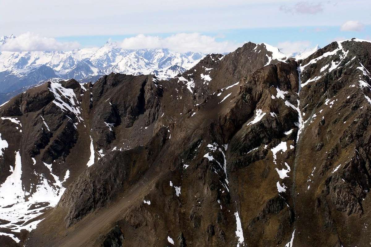
Difficulty This route can be considered EE/F for both the crests watershed (Northwest from Arno Bivouac or East-southeast by Col Tsa Sètse).L'itinerario è da classificare in EE/F per entrambe le creste spartiacque (Nordovest dal Bivacco Arno oppure Est-sudest dal Col Tsa Sètse).![]() Pointe de la Valletta toward Chamolé Pass on watershed Plan de l'Eyve/Arbolle Vallon above Pila 's Conca
Pointe de la Valletta toward Chamolé Pass on watershed Plan de l'Eyve/Arbolle Vallon above Pila 's Conca******
 Pointe de la Valletta toward Chamolé Pass on watershed Plan de l'Eyve/Arbolle Vallon above Pila 's Conca
Da Escursionismo. Calcolare che al Bivacco Simone Facchinello "Arno" (sempre aperto e gratuito) si può bivaccare, ma lo stesso non é attrezzato in merito.
Campings
Remember that free camping is forbidden (except for emergency reasons, over 2.500m, from darkness until dawn).Mountain Condition
- Meteo: you can find all the needed informations at the official site of the Valle d'Aosta Region:
- Valle d'Aosta Meteo
Important Information
- REGIONE AUTONOMA VALLE D'AOSTA the official site.
- FONDAZIONE MONTAGNA SICURA Villa Cameron, località Villard de la Palud n° 1 Courmayeur (AO) Tel: 39 0165 897602 - Fax: 39 0165 897647.
- A.I.NE.VA. (Associazione Interregionale Neve e Valanghe).
Useful numbers
- Protezione Civile Valdostana località Aeroporto n° 7/A Saint Christophe (Ao) Tel. 0165-238222.
- Bollettino Meteo (weather info) Tel. 0165-44113.
- Unità Operativa di Soccorso Sanitario Tel. 118.