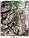
Approach
Starting at the Glacier Gorge TH (9,240-ft) hike about .2 miles to the Glacier Gorge Junction, it is signed. You want the “Mills Lake” option, which is to the right. Of course I went to the left for about quarter mile thinking I wanted the “Glacier Basin” option. I soon realized that Mills Lake was in my route. Back on the correct trail, hike 1.1 miles to another signed trail junction. This is the “North Longs Peak Trail” junction. You want the “Lock Vale” or the “Glacier Gorge” option, which is to the right. Go another .04 miles to another signed trail junction, this is the “Lock Vale/Glacier Gorge” junction, and you obviously want Glacier Gorge. From here, there are no more junctions to worry about and the route becomes obvious. Continue about a half-mile to the beautiful Mills Lake. From here you get your first full view of the gorge area. You can also see Pagoda Mountain from here. Mills Lake is a good half-mile in length and the trail here is easy. Continue hiking past Mills Lake, the next objective is the spectacular Black Lake at 11,100-ft. It is about a mile and a half from Mills Lake to Black Lake. Once you are at Black Lake you will notice 300-ft walls of rock surround the lake. If you look sharp to the left (east) you can pick up the route as it hugs a minor wall of rock that enters the lake. There is a nice ledge here that will take you back to the trail. This trail ascends to the left about .03 miles and will deliver you up to the high basin above Black Lake. Once in the basin you are pretty much on your own. Not that many people go past Black Lake so there are only bits and pieces of trail to look for. From here The Spearhead towers above you, as well as Pagoda & Chiefs Head and the Keyboard of the Winds. This is a special place.
Route Description
Locate the steep rubble filled trough that separates Pagoda and the Keyboard of the Winds. This gully will get you to the small saddle that separates Longs Peak and Pagoda Mountain. From the bench above Black Lake there is some minor route finding issues if you want to avoid the willows on the way to the gully. Angle slightly east up through a tedious boulderfield about .75 miles to the base of the 1,500-ft gully.
Now for the fun part, this gully is very loose. It is so loose that there are only remnants of trails, for the scree and talus keeps sliding down over any trails that may have been started. Your best bet is to take the line of least resistance and suffer the slog directly up the gully. I didn’t find it even worth the time to keep looking for some type a trail. The route up this mess is very strenuous class 2+.
After you finally arrive at the saddle, you get amazing views of the entire Keyhole Route on Longs Peak. Turn right and ascend semi-loose large talus to Pagoda’s summit. This 300-ft of vertical is easy class 3, if that. He views from Pagoda’s summit will blow you away, enjoy.
Essential Gear
I would recommend a climbing helmet for this hike, especially on the weekend or if your hiking with others.
Miscellaneous Info
If you have information about this route that doesn't pertain to any of the other sections, please add it here.