
|
|
Route |
|---|---|
|
|
42.69570°N / 71.8927°W |
|
|
Hike |
|
|
Less than two hours |
|
|
Class 1 |
|
|
Approach
TO WAPACK TRAIL TRAILHEAD: Take Route 119 through the hill country of northern Massachusetts. If coming from the east go past the town of Ashby and stay on the road past the summit of Mt. Watatic (a round and bald summit on your right). The trailhead with be on your right with marking to both the Midstate Trail and the Wapack Trail.Route Description
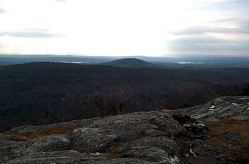
The Class 1 Wapack Trail is the preferred way up to the summit of Mt. Watatic. For the first quarter of a mile the both the Mid-State and the Wapack Trail combine. The trail itself start out alternating moderate and gradual grades. The Wapack Trail then goes right and passes a through two large boulders. About a mile past those boulder the trail begins it's climb. The trail then climb at a moderate pace with some steeper sections but nothing on the trail comes close to approaching Class 2. On top of the steepest area is an outlook west and southwest. The trail then continues up it's climb up the mountain at a moderate clip until it reaches the summit of Mt. Watatic.
Toward the top the trail eases and the panorama awaits. To the north, the rest of the Wapack Range rises with the trail highpoint of North Pack Monadnock and Pack Monadnock rises in the background. To the easy most of Massachusetts hilly countryside rises. On clear day the skyscrapers of Boston can be seen. To the south lies Mt. Watchusett and it's ski run.
